The best walks and hikes around Titicaca
4.3
(90)
521
hikers
4
hikes
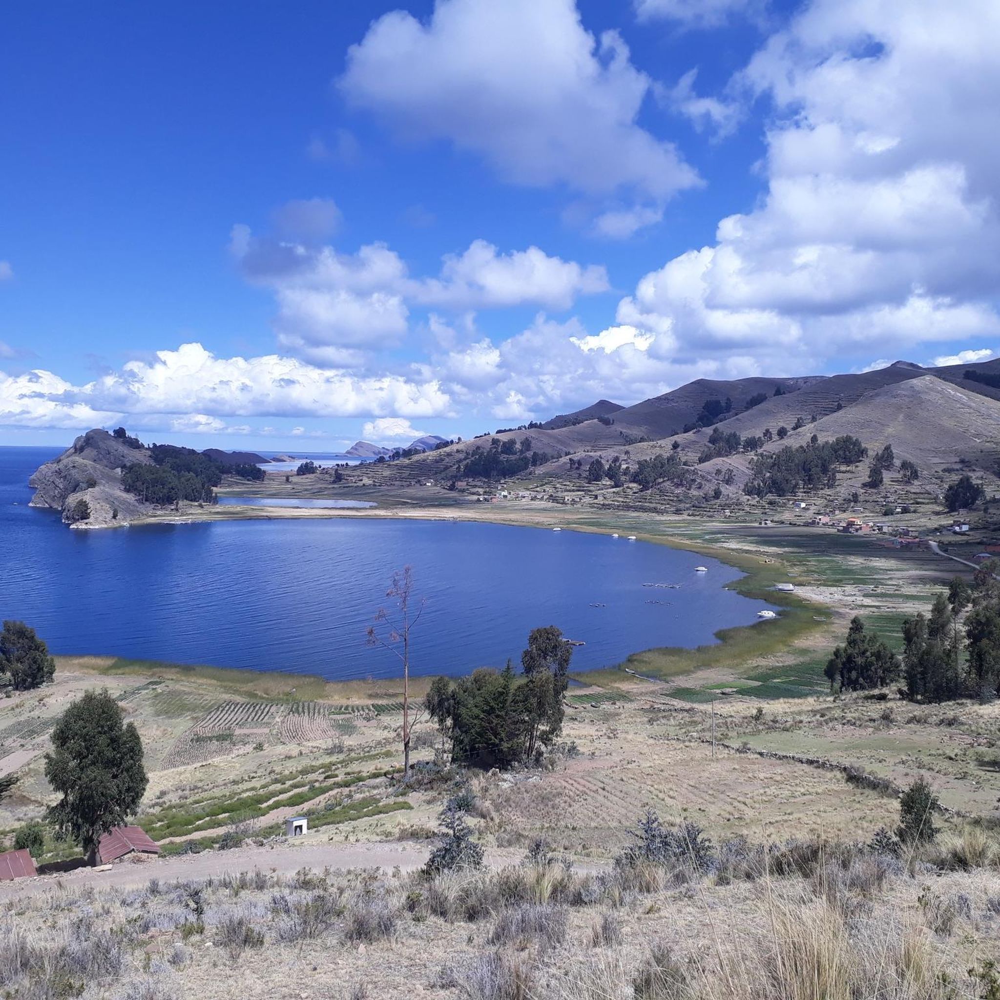
Hiking around Titicaca offers diverse terrain at high altitudes, situated over 3,800 meters above sea level. The region is characterized by the vast, shimmering lake, numerous islands, and the dramatic backdrop of the Andes mountains. Trails often traverse varied landscapes, including hills, valleys, and rural communities, providing a unique experience with every route. The area features a mix of ancient ruins, sacred sites, and traditional Andean life along its shores and islands.
Best hiking trails around Titicaca
- The most popular…
Last updated: July 10, 2026
4.9
(81)
474
hikers
Hard hike. Very good fitness required. Easily-accessible paths. Suitable for all skill levels.
4.4
(7)
28
hikers
9.30km
02:45
270m
270m
Moderate hike. Good fitness required. Easily-accessible paths. Suitable for all skill levels.

Sign up for free
3.0
(1)
9
hikers
Moderate hike. Good fitness required. Easily-accessible paths. Suitable for all skill levels.
5.0
(1)
10
hikers
5.81km
01:51
230m
230m
Easy hike. Great for any fitness level. Easily-accessible paths. Suitable for all skill levels.
Our route recommendations are based on thousands of hikes, rides, and runs completed by other people on komoot.
Start today with a free account
Your next adventure awaits.
Login or Signup
Popular around Titicaca
Tips from the Community


Even though the climb is quite arduous due to the unusual altitude, it's worth it. A magnificent panorama of Lake Titicaca opens up.
0
0

A beautiful path has been created on the ridge, and the turnoff with a kiosk towers over the island.
1
0
If you don't know that you are almost 4000m above sea level, you feel like you are in the Caribbean.
1
0
The Basilica of Our Lady of Copacabana is a 17th-century Spanish colonial shrine that houses the statue of the Virgen de Copacabana. The statue can be rotated; on weekends, it faces the church, and during the week, it can be seen in the Virgin's house on the first floor.
3
0
Copacabana beach is located on a crescent-shaped bay that opens to the northwest and has its own flair. The jetties that extend into the lake look anything but stable, and numerous small boats rock in the cool waters of Lake Titicaca.
3
0
The Way of the Cross was built on this hill in the 1950s when the government decided that Copacabana should have more to offer its thousands of pilgrims than just the Basilica of the Virgin Mary.
2
0

It is better not to go in rainy weather, as the slippery steps of the steep stairs can be dangerous, especially when going down.
0
0
Frequently Asked Questions
How many hiking trails are available around Titicaca?
There are several hiking routes around Titicaca, with komoot featuring 4 distinct trails. These routes are highly rated by the komoot community, with an average score of 4.6 stars from over 70 reviews, and have been explored by more than 400 hikers.
Are there easy hiking options for beginners around Lake Titicaca?
Yes, there are options suitable for beginners. For instance, the Cerro Calvario – Plaza 2 de Febrero, Copacabana loop from Copacabana is an easy 3.6-mile (5.7 km) trail that takes about 1 hour 50 minutes. This route leads through hills overlooking Copacabana, offering stunning views of the town and Lake Titicaca, especially beautiful at sunset.
What kind of landscapes and views can I expect on hikes around Lake Titicaca?
Hiking around Lake Titicaca offers a unique blend of stunning natural landscapes and cultural heritage. You can expect dramatic Andean scenery with shimmering azure waters contrasting against rugged peaks. Trails often wind through diverse terrain, including mountains, valleys, and rural communities. Many routes, especially on islands like Isla del Sol and Taquile, provide spectacular panoramic views of the lake and surrounding mountains.
How long do hikes on Isla del Sol typically take?
Hikes on Isla del Sol can vary in length and difficulty. A significant trail that crosses the island, such as the Playa de las Sirenas – Cerro Santa Barbara Junction loop from Isla del Sol, is a challenging 14.2-mile (22.8 km) route that typically takes around 6 hours 40 minutes to complete. This trail allows hikers to explore ancestral ruins and enjoy extensive lake views.
Are there any circular hiking routes available in the Titicaca area?
Yes, several circular routes are available. The Playa de las Sirenas – Cerro Santa Barbara Junction loop from Isla del Sol is a challenging 14.2-mile (22.8 km) loop. For a moderate option, consider the Traditional Rural Houses – Cerro Santa Barbara Junction loop from Yumani, which is 5.8 miles (9.3 km). An easier loop is the Cerro Calvario – Plaza 2 de Febrero, Copacabana loop from Copacabana, spanning 3.6 miles (5.7 km).
What cultural or historical sites can I explore while hiking around Lake Titicaca?
Many hiking routes integrate cultural exploration. On Isla del Sol, you can find numerous Inca ruins, such as the Chincana Ruins and the Sacred Rock (Titikala), connecting hikers with the region's historical significance. The Taquile Island is renowned for its tranquil environment and vibrant textile traditions recognized by UNESCO, offering cultural immersion alongside splendid lake views.
What are the best times of year to go hiking in Lake Titicaca?
The dry season, typically from May to October, is generally considered the best time for hiking around Lake Titicaca. During these months, you can expect clearer skies, less rain, and more stable weather conditions, which are ideal for enjoying the panoramic views and exploring the trails. However, even during the dry season, temperatures can vary significantly between day and night, and the high altitude means cooler temperatures are common.
What should I consider regarding altitude when planning a hike around Lake Titicaca?
Lake Titicaca is situated at over 3,800 meters (12,500 ft) above sea level, so acclimatization is crucial for hikers. It's recommended to spend a day or two at a lower altitude or take it easy on your first day to allow your body to adjust. Stay hydrated, avoid strenuous activity initially, and be aware of symptoms of altitude sickness. The high altitude can make even moderate hikes feel more challenging.
Are there options for public transport or parking near the trailheads?
Public transport options, primarily buses and shared taxis (colectivos), are available to reach towns like Copacabana and Puno, which serve as common starting points for hikes. From these towns, local transport or boats can take you to island trailheads like Isla del Sol or Taquile. Parking availability varies; in larger towns, you might find paid parking lots, while in more rural areas, options might be limited to roadside parking or designated areas near tourist facilities.
What are some notable attractions or landmarks near the hiking trails?
Beyond the trails themselves, the region offers several notable attractions. On Isla del Sol, you can visit the Chincana Ruins and the Sacred Rock (Titikala). The Taquile Island is a cultural highlight. In Puno, you can explore the Puno Main Square and the Puno Lighthouse. A unique experience is visiting the Uros Floating Islands, which are man-made reed islands.
What do other hikers say about the trails around Titicaca?
The hiking trails around Titicaca are highly rated by the komoot community, with an average score of 4.6 stars. Reviewers often praise the breathtaking panoramic views of the lake and the Andes, the opportunity to explore ancient ruins, and the unique cultural immersion offered by walking through traditional Andean communities. Many highlight the diverse terrain and the sense of tranquility found on the island trails.
Are there any multi-day trekking opportunities around Lake Titicaca?
While the guide data primarily lists day hikes, the extensive trail network, particularly on Isla del Sol, allows for longer, more immersive experiences. The trail crossing Isla del Sol, for example, can take 4 to 6 hours, and combining it with overnight stays in local communities on the island or nearby Taquile Island can create a multi-day trekking adventure. This allows for deeper cultural immersion and more extensive exploration of the islands and their historical sites.
Most popular routes around Titicaca
Most popular attractions around Titicaca

Get inspired with the komoot mobile app


Explore more
Browse the best Hikes in other regions.
