The best road cycling routes around Lac De La Palisse
4.8
(17)
393
riders
39
rides
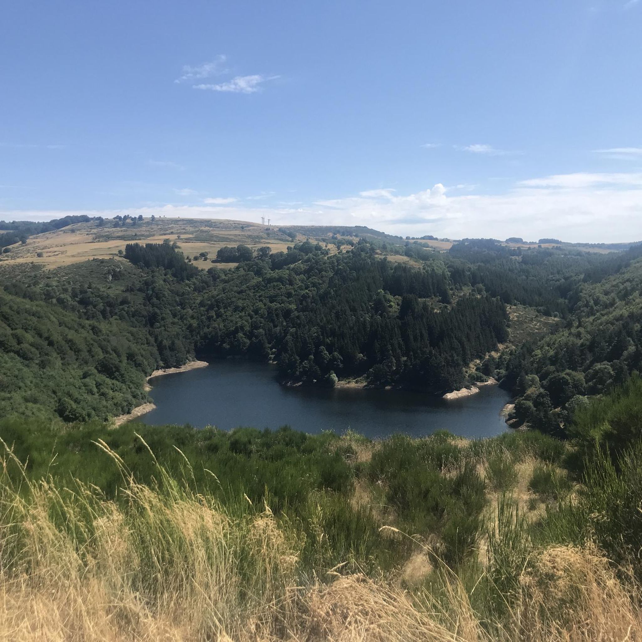
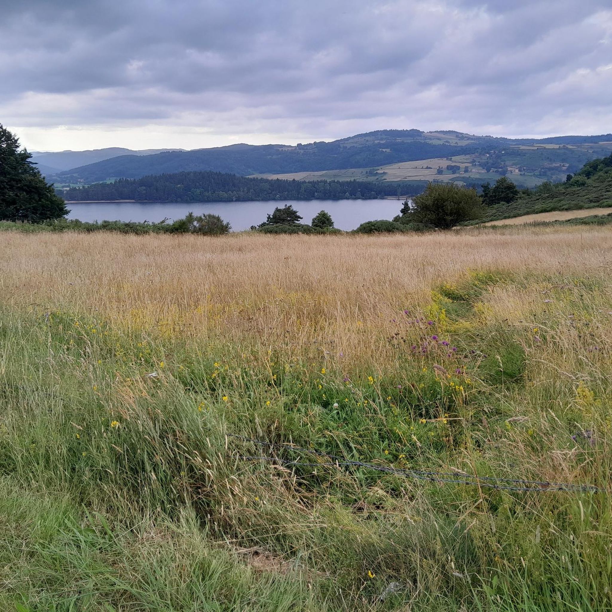
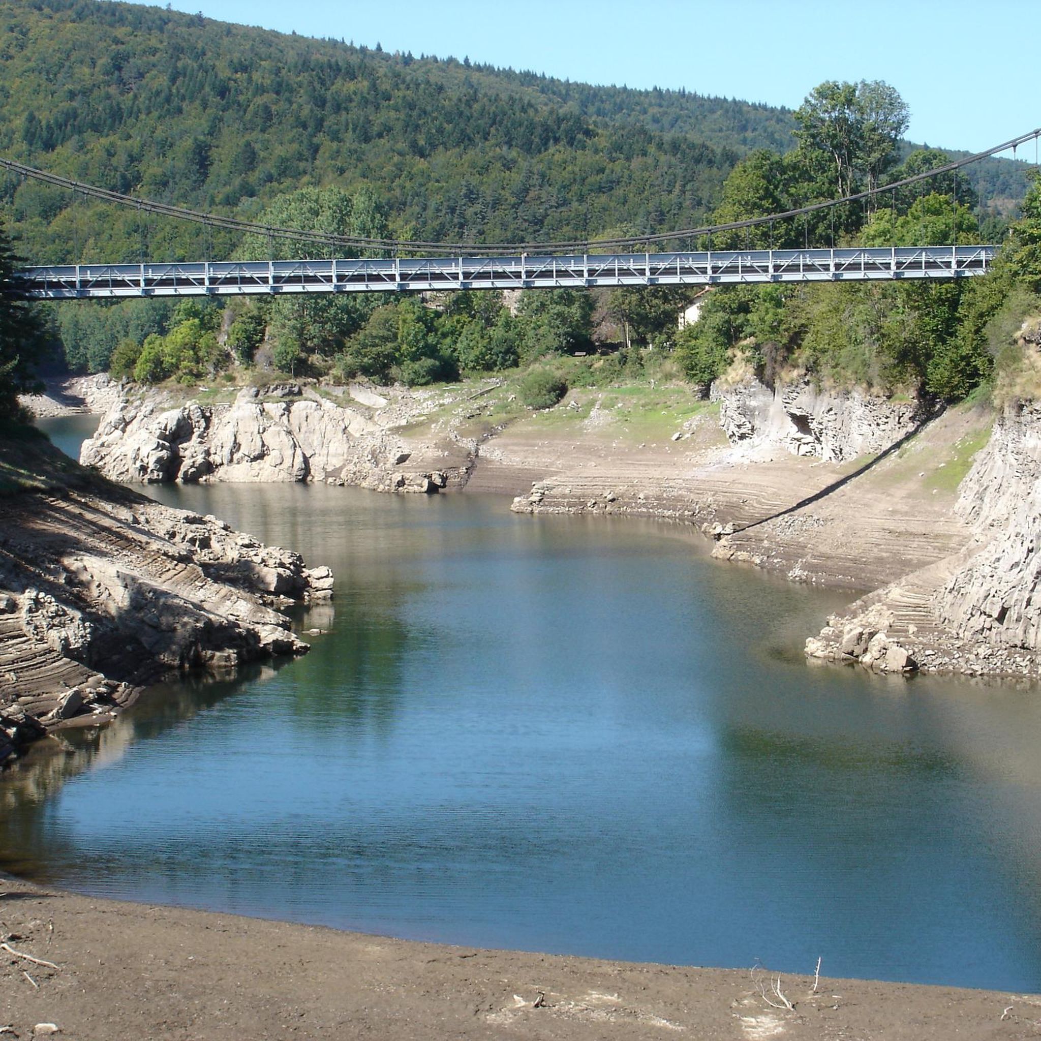
Road cycling around Lac De La Palisse offers diverse terrain across the wider Pays de Lapalisse region. The area features a mix of plains, river valleys like the Besbre, and the highlands of the Bourbonnaise Mountain, providing varied elevation profiles. Cyclists encounter numerous small lakes, woodlands, and verdant hills, with some routes revealing impressive basalt cliffs when water levels are low. The region's natural environment supports a network of road cycling routes suitable for different fitness levels.
Best road cycling routes around Lac De La Palisse
- The most popular road cycling route is Lac d’Issarlès – Lake Issarlès loop from Saint-Cirgues-en-Montagne, a 21.5 miles (34.6 km) moderate trail that takes 1 hour 48 minutes to complete. This route offers views of Lake Issarlès and the surrounding landscape.
- Another top favourite among local road cyclists is Cros de Georant – Eulalie loop from Cros-de-Géorand, a difficult 46.0 miles (74.1 km) path. This route features significant elevation gain through varied terrain.
- Local road cyclists also love the Col de la Clède (1,385 m) – Lake Issarlès loop from Cros-de-Géorand, a 49.1 miles (79.0 km) trail leading through mountainous landscapes, often completed in about 4 hours 21 minutes.
- Road cycling around Lac De La Palisse is defined by small lakes, woodlands, and river valleys. The network offers options for various ability levels, from moderate rides to more challenging routes with significant elevation gains.
- The routes in Lac De La Palisse are highly rated by the komoot community with an average score of 4.7 stars from more than 10 reviews. More than 400 road cyclists have used komoot to explore Lac De La Palisse's varied terrain.
Last updated: July 13, 2026
28
riders
92.5km
04:55
1,700m
1,700m
Hard road ride. Very good fitness required. Some segments of this route may be unpaved and difficult to ride.
14
riders
34.6km
01:47
610m
610m
Moderate road ride. Good fitness required. Mostly well-paved surfaces and easy to ride.

Sign up for free
21
riders
73.7km
03:42
1,080m
1,080m
Hard road ride. Very good fitness required. Mostly well-paved surfaces and easy to ride.
8
riders
79.1km
04:22
1,490m
1,490m
Hard road ride. Very good fitness required. Mostly well-paved surfaces and easy to ride.
3
riders
Moderate road ride. Good fitness required. Mostly well-paved surfaces and easy to ride.
Get access to more routes and recommendations from other explorers.
Sign up for free
Already have an account?
Our route recommendations are based on thousands of hikes, rides, and runs completed by other people on komoot.
Start today with a free account
Your next adventure awaits.
Login or Signup
Tips from the Community

The Ferme de Clastre is part of the last 15 thatched cottages still "standing" on the Mezenc-Gerbier massif and it is the last one located in the heart of the village. It has the particularity of having a double roof: mineral, made of phonolite slabs, for the two living quarters, and vegetal, dotted with broom, for the stable and hayloft part. The oldest writings found concerning the Ferme de Clastre indicate that its foundation dates back to the 11th century. Clastre, from the Latin "claustrum", was a non-conventual priory attached to the Abbey of Saint Chaffre du Monastier sur Gazeile. However, following two archaeological excavation campaigns carried out by the CNRS in Rennes in 2014 and 2016, charcoal dating has made it possible to prove human presence on this site dating back to 880-970, i.e. about 100 years earlier than the foundation of the priory. https://www.fondation-patrimoine.org/les-projets/ferme-de-clastre-a-sainte-eulalie/30888
0
0
Located at an altitude of 1,330 meters, Lachamp-Raphaël is the highest village in the Ardèche. Dominated by the Montivernoux peak, the village offers exceptional panoramic views of the Alps and the Ardèche mountains. https://lachamp-raphael.fr/
0
0
Eight million years old, Mont Gerbier-de-Jonc owes its conical shape to a viscous, cold lava that was unable to flow away. It is at its foot that the Loire River originates, in three places respectively designated as the geographical, authentic, and true sources. What if the Loire, in addition to its long journey to the Atlantic, also flowed into the Mediterranean? This is the intriguing hypothesis formulated by Gilles Clément after climbing the mountain following a period of drought, during which he nevertheless perceived a regular seepage in the rock. He imagines that Mont Gerbier-de-Jonc functions, in part, as a "water tower": a water trap based on the condensation of water vapor from clouds in desert regions. The collected water would flow at the foot of Mont Gerbier, towards the Atlantic Ocean and the Mediterranean Sea. https://www.lepartagedeseaux.fr/le-parcours-artistique/les-oeuvres-in-situ/la-tour-a-eau/
0
0

South gate of the fortified town of Pradelles, an unmissable vestige during your visit
0
0
In the eastern foothills of the Massif Central, in a harsh climate, at an altitude of 1,380 meters, this former 17th-century farmhouse, built like a fortress in the heart of a windswept plateau, is now a must-see attraction located 3 kilometers from Mont Gerbier-de-Jonc. You'll admire its typical architecture, its 900 m² of phonolite slate roof (local volcanic slabs), its upside-down ship-shaped framework, and its impressive volumes (50 meters long and 10 meters wide). https://www.bourlatier.fr/FR/home.html
1
0

Cemetery of St-Cirgue-en-Montage. Outside, to the left of the entrance.
0
0
Frequently Asked Questions
How many road cycling routes are available around Lac De La Palisse?
The wider Pays de Lapalisse region offers a comprehensive network of over 40 road cycling routes. These routes cater to various skill levels, from easy rides to very challenging ones with significant elevation gains.
What kind of terrain can I expect when road cycling around Lac De La Palisse?
You can expect a diverse range of terrain. The region features a mix of plains, river valleys like the Besbre, and the highlands of the Bourbonnaise Mountain. Cyclists will encounter numerous small lakes, woodlands, and verdant hills. Some routes may even reveal impressive basalt cliffs when water levels are low.
Are there easy road cycling routes suitable for beginners around Lac De La Palisse?
Yes, there are routes suitable for beginners. The region offers 2 easy road cycling routes, providing a gentle introduction to the area's scenic beauty. These routes are generally on mostly paved surfaces, ideal for all skill levels.
Are there challenging road cycling routes for experienced cyclists?
Absolutely. For experienced cyclists seeking a challenge, there are 24 difficult road cycling routes available. These routes often feature significant elevation gains and traverse mountainous landscapes, such as the View from Col de Meyrand – Col de Meyrand Viewpoint loop from Saint-Cirgues-en-Montagne, which covers nearly 100 km with substantial climbing.
Are there circular road cycling routes around Lac De La Palisse?
Many of the road cycling routes in the region are designed as loops, allowing you to start and finish in the same location. For example, the Barrage de Coucouron – col de Fioulebise loop from Saint-Cirgues-en-Montagne is a moderate circular route offering diverse scenery.
What are some scenic viewpoints or natural features I can see while road cycling?
The Pays de Lapalisse is rich in natural beauty. You can enjoy views of small lakes, woodlands, and rivers like the Besbre. Keep an eye out for the impressive basalt cliffs near the La Palisse Dam when water levels are low. The region also features the Suc de Cherchemuse, an ancient volcano offering pleasant views of the Mézenc massif, and an interesting 'watershed line' where waters flow to either the Mediterranean or the Atlantic.
What cultural or historical attractions can I explore near the road cycling routes?
The town of Lapalisse itself is home to the magnificent Château de la Palice, a 12th-century castle with stunning Renaissance modifications and public gardens. You can also find the 19th-century Church of Saint John the Baptist, ancient mills, and 15th-century half-timbered houses. The wider region is dotted with charming villages and heritage sites like the Pourçain tower and Roman bridges.
What do other road cyclists enjoy the most about road cycling in Lac De La Palisse?
The road cycling routes around Lac De La Palisse are highly rated by the komoot community, with an average score of 4.7 stars from over 10 reviews. Cyclists often praise the diverse terrain, ranging from river valleys to mountain highlands, and the unspoiled natural environment featuring numerous small lakes and woodlands.
What is the best time of year for road cycling in the Pays de Lapalisse region?
The region's diverse landscapes, including woodlands and river valleys, make it enjoyable for road cycling across multiple seasons. Spring and autumn offer pleasant temperatures and vibrant scenery. Summer is also suitable, but it's advisable to start early to avoid the midday heat, especially on routes with significant elevation.
Are there family-friendly road cycling options near Lac De La Palisse?
While the immediate Lac de la Palisse area is more focused on leisure activities like walking and picnicking, the broader Pays de Lapalisse region does offer easier road cycling routes that can be suitable for families. These routes typically feature mostly paved surfaces and less challenging elevation profiles, allowing for a more relaxed cycling experience.
Where are good starting points for road cycling routes in the area?
Many routes conveniently start from towns and villages within the Pays de Lapalisse. For example, several routes, including challenging ones, begin in Saint-Cirgues-en-Montagne or Cros-de-Géorand. The town of Lapalisse itself is also a common starting point for circuits like the 'Au Pays des "Vérités"'.
Most popular routes around Lac De La Palisse

Get inspired with the komoot mobile app


Explore more
Browse the best Road cycling routes in other regions.
