The best running trails around Gravière De Munchhausen
4.4
(282)
4,650
runners
389
runs
Jogging routes around Gravière De Munchhausen traverse the Delta de la Sauer National Nature Reserve, an area shaped by the Sauer and Rhine rivers. The landscape is characterized by alluvial forests, including white willow and hardwood groves, alongside expansive wet meadows and reed beds. Runners will find mostly flat terrain, with minimal elevation changes, making it suitable for various fitness levels.
Best jogging routes around Gravière De Munchhausen
- The most popular jogging route is Plittersdorf–Seltz Rhine Ferry – The Sauer…
Last updated: July 5, 2026
4.0
(1)
24
runners
Moderate run. Good fitness required. Mostly paved surfaces. Suitable for all skill levels.
5.0
(3)
5
runners
Moderate run. Good fitness required. Mostly paved surfaces. Suitable for all skill levels.

Sign up for free
8
runners
Moderate run. Good fitness required. Mostly paved surfaces. Suitable for all skill levels.
12
runners
Moderate run. Good fitness required. Mostly paved surfaces. Suitable for all skill levels.
4.0
(2)
22
runners
Moderate run. Good fitness required. Mostly paved surfaces. Suitable for all skill levels.
Get access to more routes and recommendations from other explorers.
Sign up for free
Already have an account?
Our route recommendations are based on thousands of hikes, rides, and runs completed by other people on komoot.
Start today with a free account
Your next adventure awaits.
Login or Signup
Tips from the Community

The Rhine is one of Europe's most important rivers and is approximately 1,233 km long. Its source lies in the Swiss Alps, where it originates from several mountain streams. From there, it first flows through Switzerland and then partly forms the border between Germany and France, before continuing through Germany and finally the Netherlands. At Rotterdam, the Rhine divides into several distributaries and finally reaches the North Sea. Its catchment area is very large (approx. 185,000 km²) and includes many tributaries such as the Moselle, Main, or Neckar. The Rhine is of great importance to Europe: Shipping: One of the world's most important waterways for trade and transport Economy: Connection of many industrial and port cities Nature: Habitat for numerous animal and plant species Energy: Utilization through hydropower in the Alpine regions Due to its location and use, the Rhine is considered one of Central Europe's most important lifelines.
0
0
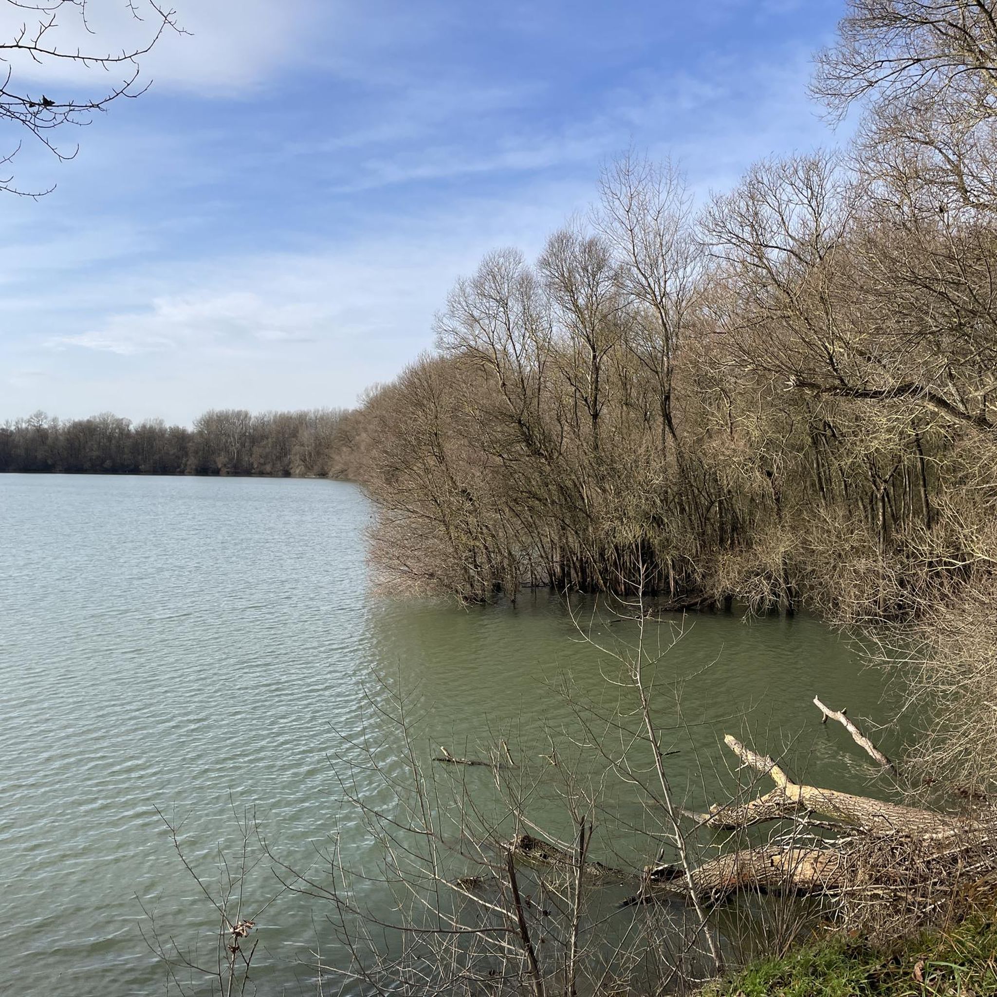
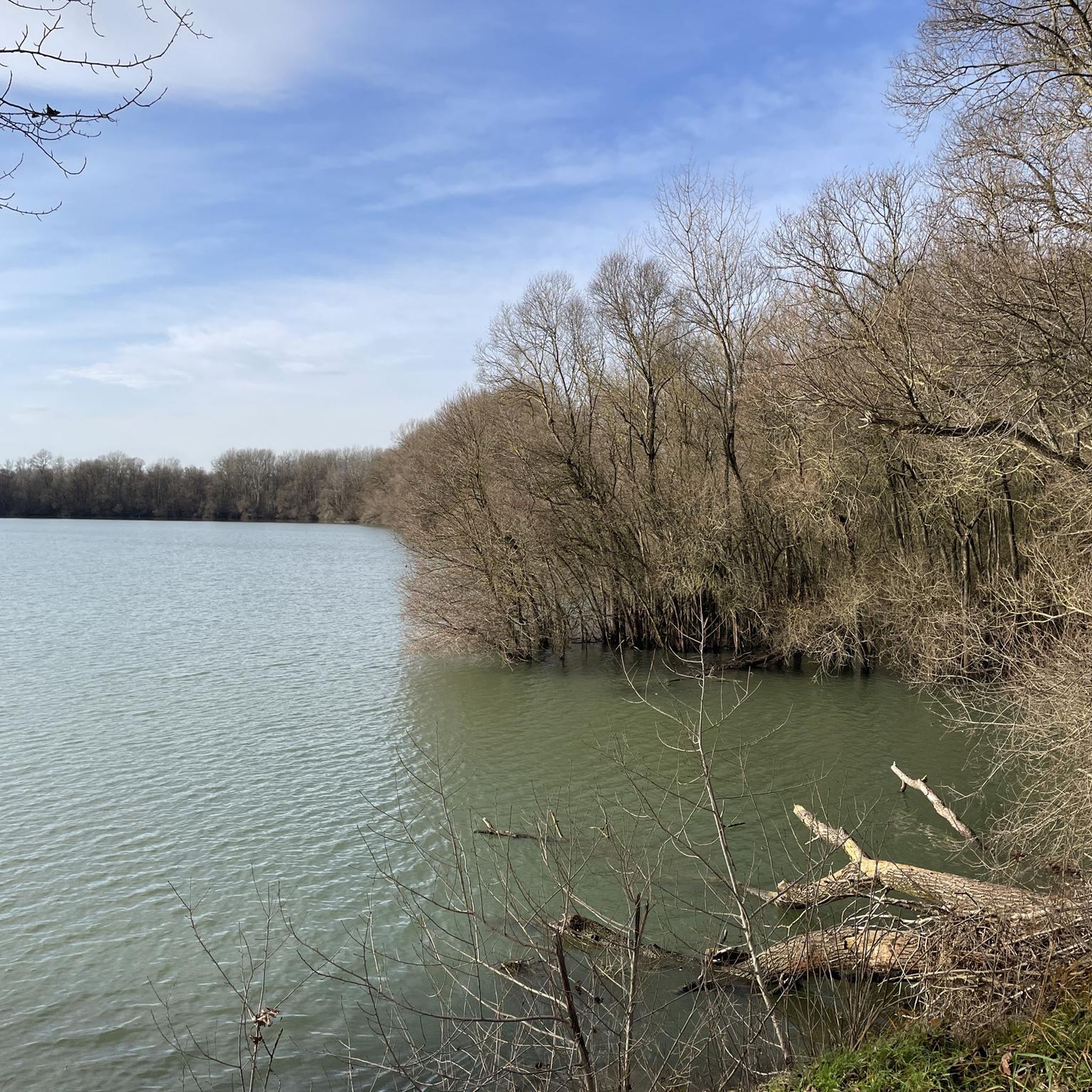
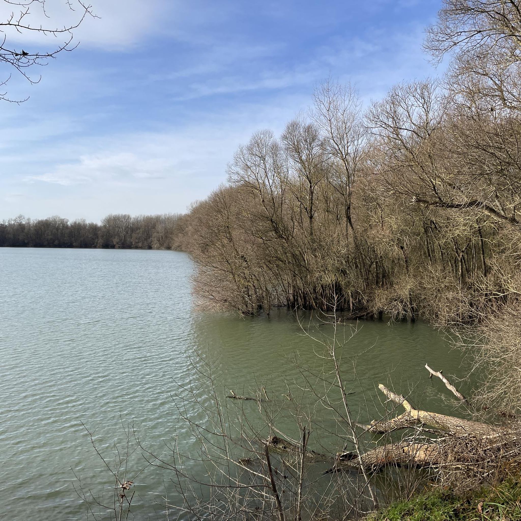
The Altrhein near Plittersdorf is a former arm of the Rhine, which was separated from the main current by the Rhine regulation in the 19th century (also called Rhine straightening). Today, the Altrhein is a calm, mostly slow-flowing or stagnant body of water in the Rhine floodplain near Plittersdorf. It is surrounded by floodplain forests, meadows, and small bodies of water. This natural landscape offers many animal and plant species an important habitat, for example birds such as herons and swans, as well as various fish species. In the past, the Rhine flowed directly past Plittersdorf and often led to floods. The course of the river was changed by the straightening, and the Altrhein was preserved as a "remnant" of the old Rhine. Today, it has above all ecological significance and also serves as a recreational area for people.
0
0
The Altrhein near Plittersdorf is a former arm of the Rhine river, which was separated from the main stream by the Rhine regulation in the 19th century (also called Rhine straightening). Today, the Altrhein is a calm, mostly slow-flowing or standing body of water in the Rhine floodplain near Plittersdorf. It is surrounded by riparian forests, meadows, and small water areas. This natural landscape offers an important habitat for many animal and plant species, such as birds like herons and swans, as well as various fish species. In the past, the Rhine flowed directly past Plittersdorf and often caused floods. The regulation changed the course of the river, and the Altrhein remained as a "remnant" of the old Rhine. Today, it has primarily ecological significance and also serves as a recreational area for people.
0
0
The Altrhein near Plittersdorf is a former arm of the Rhine, which was separated from the main stream by the Rhine regulation in the 19th century (also called Rhine straightening). Today, the Altrhein is a quiet, mostly slow-flowing or standing body of water in the Rhine floodplain near Plittersdorf. It is surrounded by floodplain forests, meadows, and small bodies of water. This natural landscape offers an important habitat for many animal and plant species, for example birds such as herons and swans, as well as various fish species. In the past, the Rhine flowed directly past Plittersdorf and frequently caused floods. The course of the river was changed by the straightening, and the Altrhein was preserved as a "remnant" of the old Rhine. Today it has primarily ecological significance and also serves as a recreational area for people.
0
0
The Sauer is an approximately 70 km long tributary of the Rhine. It originates in the Palatinate Forest near the German-French border. On its way, it flows through the Northern Vosges and partly forms the border between Germany and France. It then crosses Alsace before flowing into the Rhine at Munchhausen. The Sauer has a catchment area of about 800 km² and an average discharge of around 6 m³ per second.
0
0
The Sauer is a tributary of the Rhine, approximately 70 km long. It originates in the Palatinate Forest near the Franco-German border. On its course, it flows through the Northern Vosges and partly forms the border between Germany and France. It then crosses Alsace before flowing into the Rhine near Munchhausen. The Sauer has a catchment area of about 800 km² and an average discharge of around 6 m³ per second.
0
0
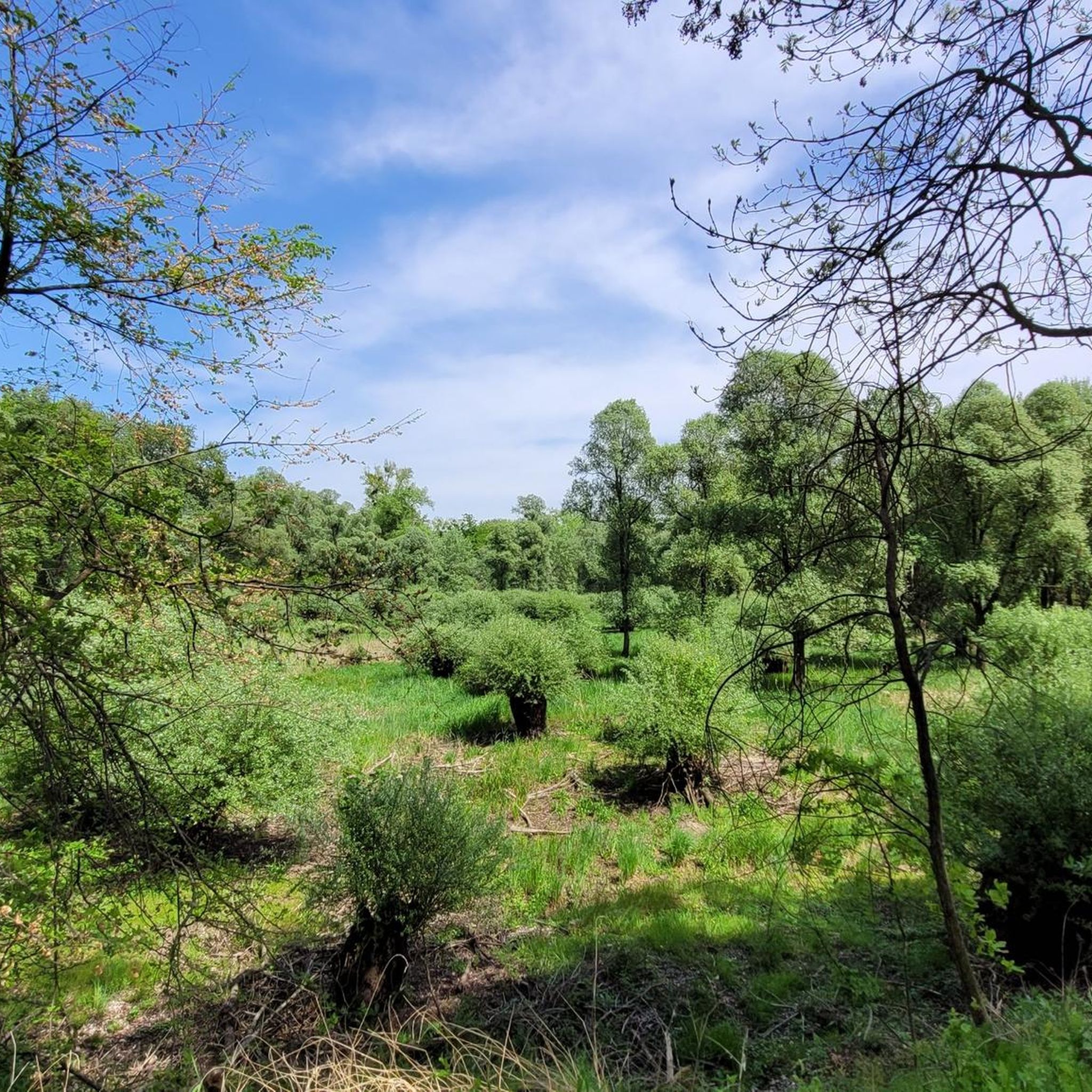
Willow bushes, marshy areas and reeds - the Sauer Delta nature reserve is an unusual landscape! It was declared a nature reserve by ministerial decree in 1997 and 486 ha were protected. From an ornithological, botanical and landscape perspective, it is a truly exceptional area and one of the last regions in France where the Rhine floodwaters can still spread out.
0
0
The cable ferry "Saletio" is unique in its kind. A cable system whose principle consists in using the sole force of the current to move. It connects the two banks Seltz (FR) with Plittersdorf (DE). It can transport 70 passengers, 28 bicycles and 6 vehicles. Motorhomes and caravans are not allowed on the ferry. The ferry is free.
0
0
Frequently Asked Questions
How many running routes are available around Gravière De Munchhausen, and what are their difficulty levels?
The Gravière De Munchhausen area features over 370 running routes. You'll find a good variety, with approximately 47 easy routes, 295 moderate routes, and 34 more challenging options, catering to various fitness levels.
Are there any easy or beginner-friendly running paths in Gravière De Munchhausen?
Yes, Gravière De Munchhausen is well-suited for beginners and those looking for an easier run. The terrain is mostly flat with minimal elevation changes. There are around 47 easy routes available, perfect for a relaxed jog through the natural landscapes.
What kind of landscapes and natural features can I expect to see while jogging in this region?
Jogging routes in Gravière De Munchhausen traverse the unique Delta de la Sauer National Nature Reserve. You'll experience a mosaic of Rhineland natural environments, including extensive alluvial forests (like white willow and hardwood groves), vast wet meadows, and reed beds. The influence of the Sauer and Rhine rivers is prominent, shaping a dynamic and biodiverse landscape.
What do other runners enjoy most about the trails in Gravière De Munchhausen?
The running routes in Gravière De Munchhausen are highly rated by the komoot community, with an average score of 4.4 stars from over 200 reviews. Runners frequently praise the immersive natural experience, the diverse ecosystems, and the well-maintained trails that make for an enjoyable outing.
Are there any circular running routes available?
Yes, many routes in the area are circular, offering convenient starting and ending points. For example, the Bridge over the Sauer – Sauer Delta Nature Reserve loop from Munchhausen is a moderate 7.4 km circular route that takes you through the heart of the nature reserve.
Are there any specific landmarks or points of interest along the running routes?
While jogging, you can encounter several points of interest. The area is known for the Rhine and its flood plains, offering scenic views. You might also pass by the Ornithologische Station, a key attraction for birdwatching enthusiasts given the region's rich bird diversity. The Willersinn Gravel Pit is another notable feature.
Are the running trails in Gravière De Munchhausen suitable for families?
Yes, many trails are suitable for families. The generally flat terrain and easy accessibility make it ideal for all fitness levels. The region also features an interpretation trail, "Sentier de découverte du Delta de la Sauer," which is a 2.5 km loop with wooden walkways, perfect for a family outing combining a light jog with nature exploration.
Can I bring my dog on the running routes?
The Delta de la Sauer National Nature Reserve is a natural area, and generally, dogs are permitted on trails, often requiring them to be on a leash to protect wildlife. It's always best to check local signage or the Maison de la Nature for specific regulations regarding pets within the reserve to ensure a pleasant experience for everyone.
What are the typical trail surfaces like for jogging in this area?
The running routes around Gravière De Munchhausen are often on mostly paved or easily accessible paths. You can expect a mix of surfaces, including well-maintained dirt paths through alluvial forests, gravel sections, and possibly some paved stretches, all designed to provide a comfortable running experience through the natural surroundings.
Is there public transport access to the running trails in Gravière De Munchhausen?
While specific public transport details for trailheads might vary, the village of Munchhausen serves as a central point for accessing the Delta de la Sauer National Nature Reserve. It's advisable to check local bus schedules or regional transport options that connect to Munchhausen or nearby towns like Seltz, which can provide access to various starting points for your run.
Where can I find parking for the running routes?
Parking is generally available at key access points to the nature reserve and near popular trailheads. For instance, if you're starting a route like the Plittersdorf–Seltz Rhine Ferry – The Sauer loop from Rastatter Rheinaue, you would typically find parking facilities in or around Rastatter Rheinaue or near the ferry crossings. Look for designated parking areas near visitor centers or trail entrances.
Are there any visitor centers or facilities nearby to learn more about the area?
Yes, the "Maison de la Nature du Delta de la Sauer et d'Alsace du nord" in Munchhausen acts as a visitor center. It offers guided tours, maps, and tourist guides, providing valuable information to enhance your exploration of the reserve and its diverse ecosystems.
Most popular routes around Gravière De Munchhausen
Most popular attractions around Gravière De Munchhausen

Get inspired with the komoot mobile app


Explore more
Browse the best Running Trails & Routes in other regions.
