The best mountain hikes around Lac des Vaux
3.3
(3)
19
hikers
5
hikes
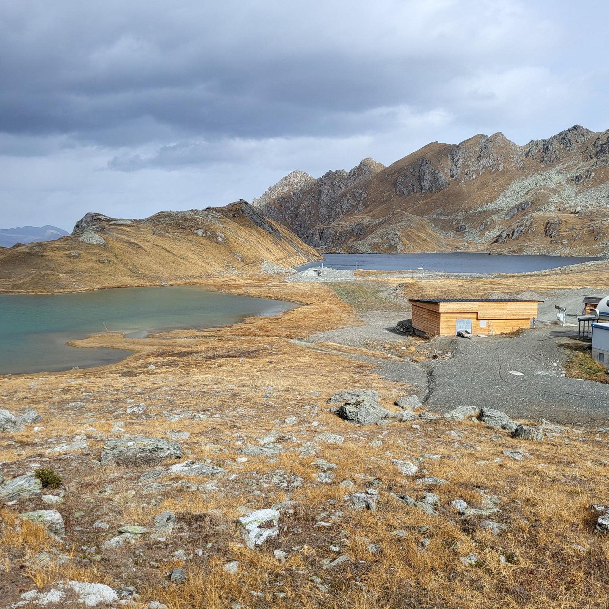
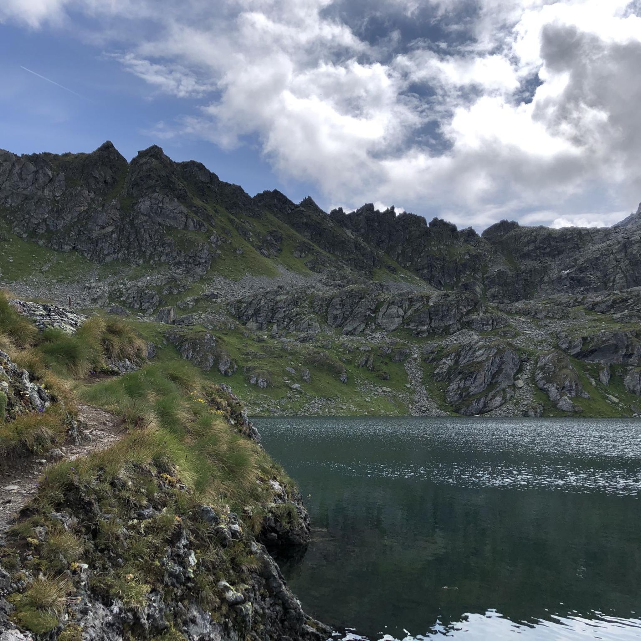
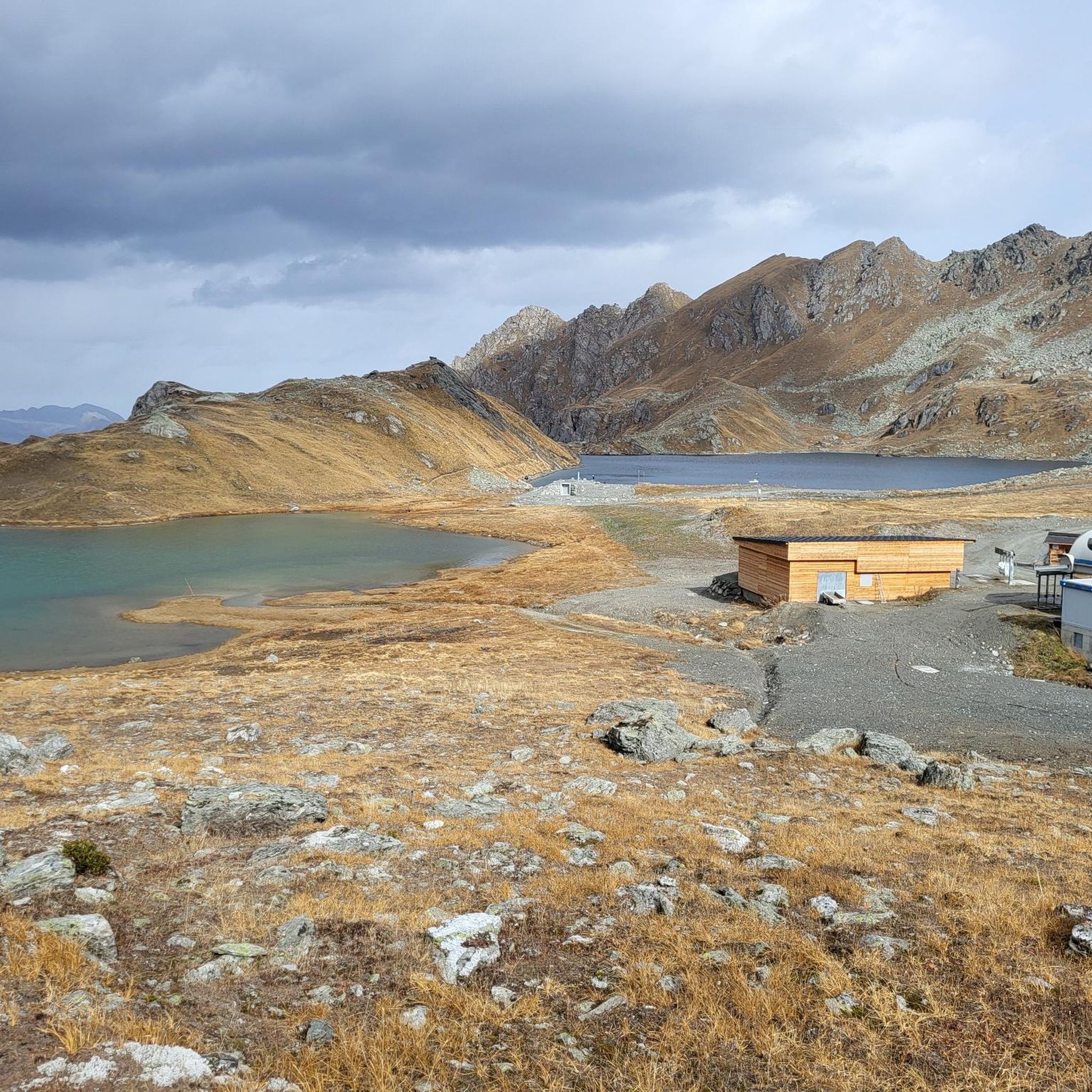
Mountaineering routes around Lac des Vaux are set within a high-altitude alpine environment in the Valais Canton of Switzerland. The region is characterized by jagged rocky peaks, including Mont Gelé and Mont Rogneux, and features the pristine Lac des Vaux itself, often reflecting the surrounding mountains. Key passes like Col des Mines and Col du Creblet offer challenging ascents and expansive views across the Rhône Valley, Grand Combin, and Mont Blanc massifs. This terrain provides diverse opportunities for experienced mountaineers.
…Last updated: July 11, 2026
3.0
(1)
5
hikers
7.61km
03:07
470m
470m
Moderate mountaineering route. Good fitness required. Mostly accessible paths. Sure-footedness required.
3.0
(1)
6
hikers
15.9km
05:52
840m
840m
Hard mountaineering route. Very good fitness required. Mostly accessible paths. Sure-footedness required.

Sign up for free
3
hikers
15.2km
05:50
810m
810m
Hard mountaineering route. Very good fitness required. Mostly accessible paths. Sure-footedness required.
2
hikers
9.21km
03:55
600m
610m
Hard mountaineering route. Good fitness required. Sure-footedness, sturdy shoes and alpine experience required.
4.0
(1)
3
hikers
17.8km
06:55
1,050m
1,050m
Hard mountaineering route. Very good fitness required. Mostly accessible paths. Sure-footedness required.
Our route recommendations are based on thousands of hikes, rides, and runs completed by other people on komoot.
Start today with a free account
Your next adventure awaits.
Login or Signup
Tips from the Community

The Vieux water channel runs alongside a stone staircase. This ingenious section of the water channel allowed the water to continue flowing down to the valley. Here you will find a hand-shaped sculpture, signed Raphaël Pache. This hand receives the water and lets it flow between its fingers to return it to the stream. The sculpture thus suggests that water is only borrowed from the mountain and that we must therefore respect it.
0
0
This picnic area offers spaces with benches and tables as well as two covered shelters. If you stop, take the time to observe the wheel mechanism that regulates the flow of water from the bisse.
0
0

The Ruinettes (approx. 2,200 m above sea level) are an important starting point for hikers, mountain bikers and skiers in the 4 Vallées region.
0
0

From Les Ruinettes, steep and rocky, at least the 'direct' path is.
0
0

Casual but not too difficult trail.
0
0

easy, beautiful walking path
0
0
Frequently Asked Questions
How many mountaineering routes are available in Lac des Vaux?
There are 8 distinct mountaineering routes available in the Lac des Vaux region, offering a range of experiences for different skill levels.
What is the best time of year for mountaineering in Lac des Vaux?
The best time for mountaineering in Lac des Vaux is typically during summer and early fall. While the area is known for winter sports, the high-altitude environment and snowmelt-fed lakes mean that trails are most accessible and enjoyable from July through September, when the alpine flora is also in bloom.
Are there any circular mountaineering routes around Lac des Vaux?
Yes, several circular routes allow you to experience the diverse landscapes of Lac des Vaux. For example, the Lac Rogneux – Creblet loop from Verbier is a moderate option that takes you through scenic alpine terrain.
Are there options for less experienced mountaineers in Lac des Vaux?
While many routes in Lac des Vaux are challenging, there are moderate options suitable for those with some mountaineering experience. The region features 3 moderate routes, such as the Mont Gond loop from Dent de Nendaz, which offers a rewarding experience without the extreme demands of the most difficult trails.
What kind of views can I expect on mountaineering routes in Lac des Vaux?
Mountaineering routes in Lac des Vaux offer spectacular panoramic views. You can expect to see the pristine Lac des Vaux itself, often reflecting the surrounding peaks, as well as expansive vistas of the Rhône Valley, the Grand Combin massif, and the Mont Blanc massif. Trails also provide stunning outlooks over Verbier and the Val de Bagnes below.
Are there any specific attractions or natural features to look out for on these routes?
Beyond the stunning lake, the region is rich in natural beauty. You'll encounter jagged rocky peaks like Mont Gelé and Mont Rogneux, and traverse key passes such as Col des Mines and Col du Creblet. The nearby Vallon d'Arbi is a protected natural area, adding to the ecological diversity. In summer, look for fields of beautiful white cottongrass flowers around the lake.
Can I bring my dog on mountaineering routes in Lac des Vaux?
Generally, dogs are welcome on many hiking and mountaineering trails in the Valais region. However, it's always advisable to keep them on a leash, especially in protected areas like the Vallon d'Arbi, and to be mindful of local regulations and livestock. Ensure your dog is fit for high-altitude terrain and carry enough water for both of you.
Are there any family-friendly mountaineering options in the area?
While many routes are geared towards experienced mountaineers, some of the moderate trails might be suitable for families with older, experienced children who are accustomed to significant elevation changes and longer distances. Always check the specific route details for elevation gain and distance to ensure it matches your family's capabilities.
How can I get to the starting points of these mountaineering routes using public transport?
Many starting points for routes around Lac des Vaux, such as Verbier, La Tzoumaz, or Siviez, are accessible by public transport, typically involving a train to a main valley station (like Le Châble) followed by a bus or cable car connection. It's recommended to check the local public transport schedules (e.g., SBB website for Switzerland) for the most up-to-date information on connections to your chosen trailhead.
Where can I park my car when planning a mountaineering trip to Lac des Vaux?
Parking is generally available in the villages and resorts that serve as trailheads, such as Verbier, La Tzoumaz, or Siviez. These areas often have designated parking lots, though some may require a fee. It's advisable to research specific parking options for your chosen starting point in advance, especially during peak season.
What gear should I consider bringing for mountaineering in Lac des Vaux?
Given the high-altitude and challenging terrain, essential gear includes sturdy mountaineering boots, appropriate layered clothing for varying weather conditions, rain gear, a map and compass or GPS device, sufficient water and food, sun protection (hat, sunglasses, sunscreen), and a first-aid kit. Trekking poles can also be very helpful on steep ascents and descents.
Are there places to eat or stay near the mountaineering routes?
Yes, the surrounding towns and villages like Verbier and La Tzoumaz offer a range of accommodation options, from hotels to chalets and apartments. You'll also find various cafes, restaurants, and shops to resupply. Some routes might pass by mountain huts or refuges where you can find refreshments or even overnight stays, but it's best to check their operating seasons and make reservations if needed.
What is the overall difficulty level of mountaineering in Lac des Vaux?
Mountaineering in Lac des Vaux is characterized by routes ranging from moderate to difficult. The region features 3 moderate routes and 5 difficult routes, often involving significant elevation changes and rugged terrain. For instance, the Attelas loop from Verbier is a challenging 12.9 km path with substantial elevation gain, while the Lac de Tracouet – Pointe de Balavaux loop from Siviez is another difficult option.
Are there any less crowded mountaineering routes near Lac des Vaux?
While popular routes can see more traffic, exploring trails that start from slightly less central locations or opting for longer, more challenging routes can often lead to a quieter experience. The #Verbier Photo Spot – Col de la Croix de Cœur loop from La Tzoumaz, for example, is a longer, difficult route that might offer more solitude compared to some of the more frequently accessed trails directly from Verbier.
Most popular routes around Lac des Vaux

Get inspired with the komoot mobile app


Explore more
Browse the best Mountain Hikes & Routes in other regions.
