The best road cycling routes around Lai da Marmorera
5.0
(14)
639
riders
6
rides
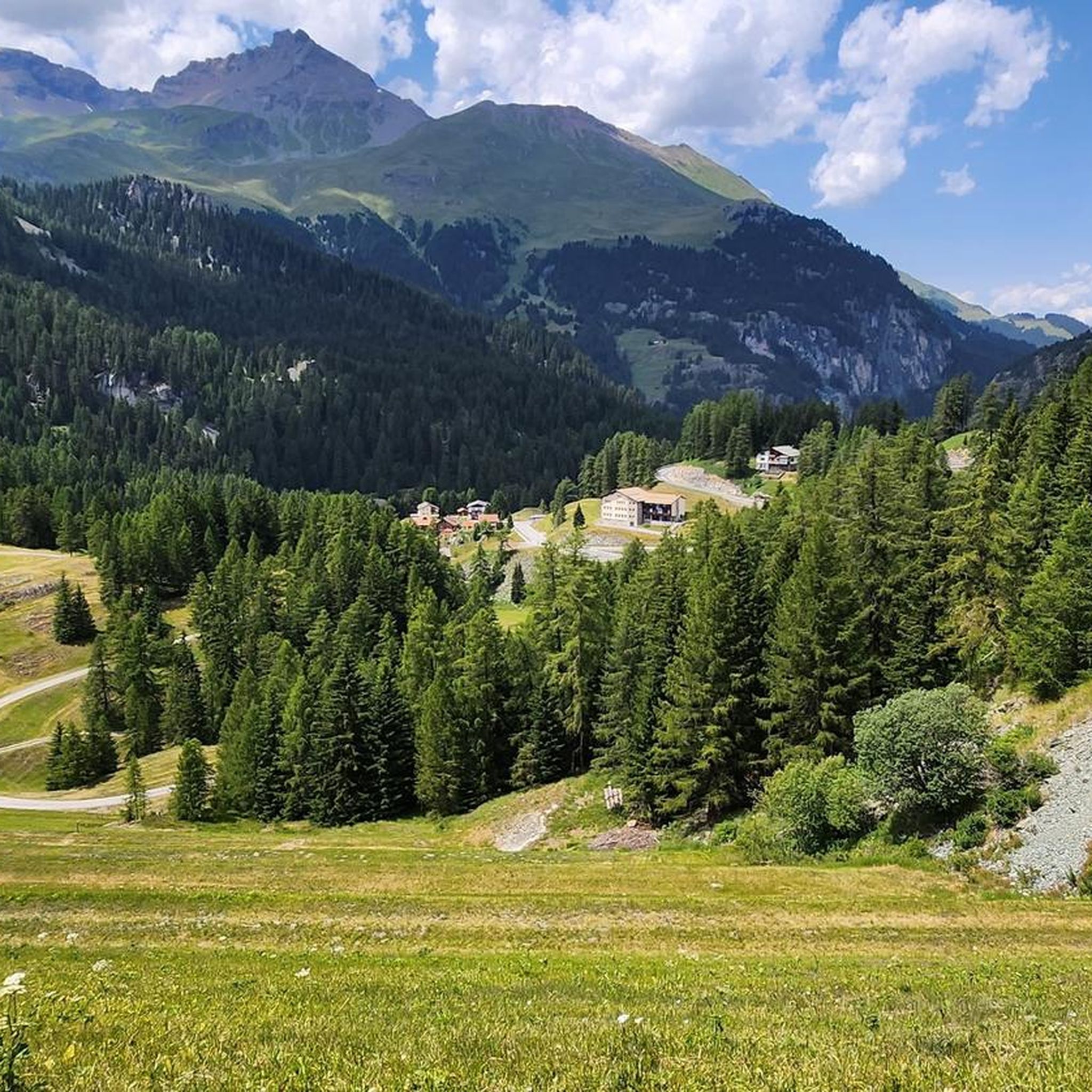
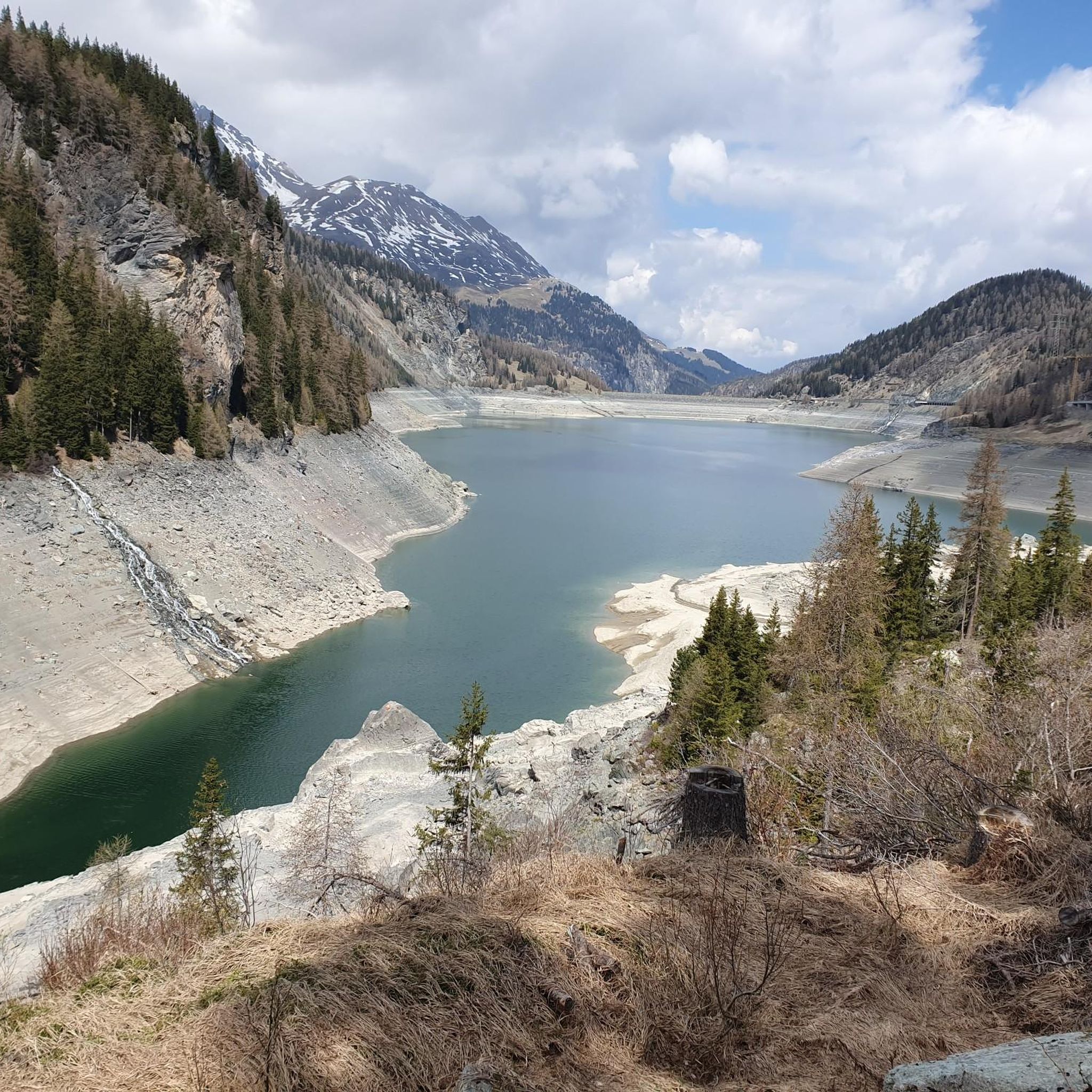
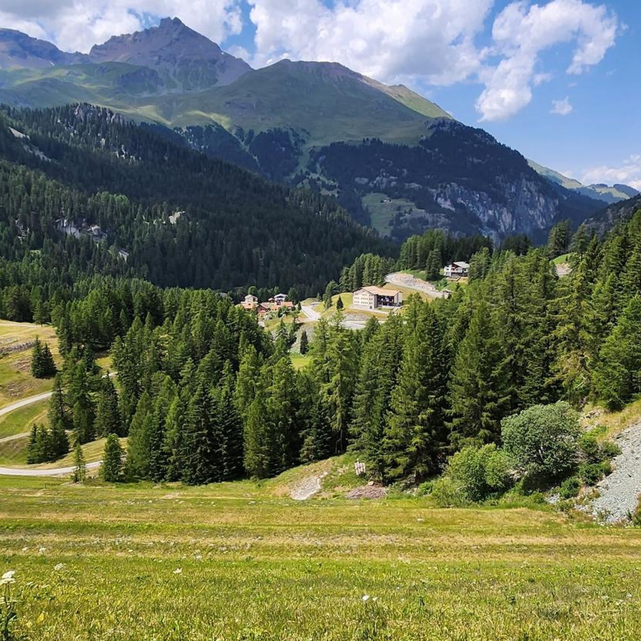
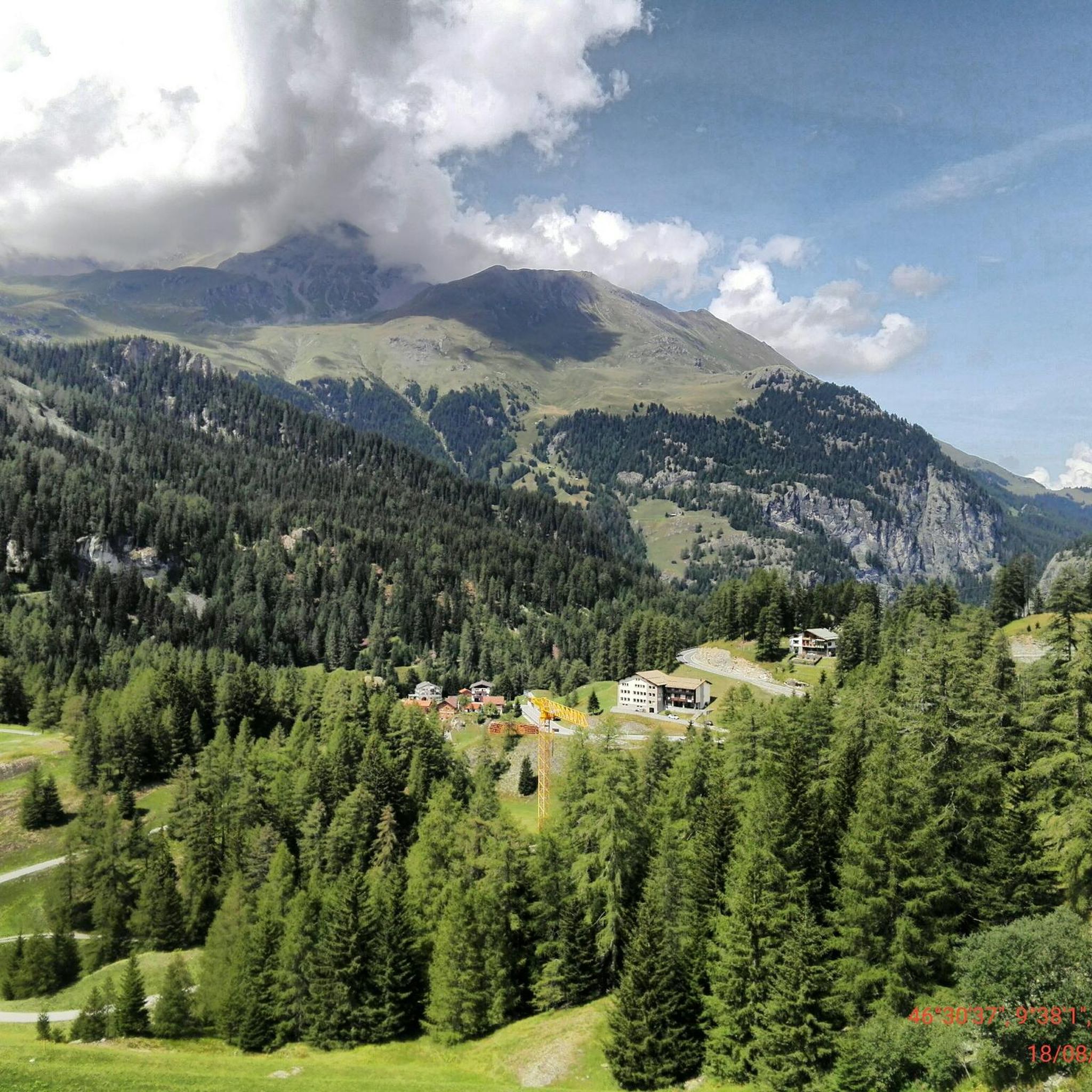
Road cycling around Lai da Marmorera, located in the Grisons canton of Switzerland, offers routes through alpine landscapes within the Parc Ela nature park. The region is characterized by the reservoir's clear waters, surrounding mountains, and significant elevation changes due to its proximity to major alpine passes. Road cyclists encounter well-maintained roads and varied terrain, including ascents to passes like the Julier Pass.
Best road cycling routes around Lai da Marmorera
- The most popular road cycling route is Julier Pass…
Last updated: October 22, 2026
5.0
(2)
138
riders
48.6km
02:49
1,120m
1,120m
Hard road ride. Very good fitness required. Mostly well-paved surfaces and easy to ride.
187
riders
54.4km
03:00
1,100m
1,100m
Hard road ride. Very good fitness required. Mostly well-paved surfaces and easy to ride.

5.0
(1)
23
riders
19.0km
01:12
510m
510m
Moderate road ride. Good fitness required. Mostly well-paved surfaces and easy to ride.
12
riders
20.3km
01:03
350m
350m
Moderate road ride. Good fitness required. Mostly well-paved surfaces and easy to ride.
49
riders
134km
09:11
3,350m
3,350m
Hard road ride. Very good fitness required. Some segments of this route may be unpaved and difficult to ride.
Our route recommendations are based on thousands of hikes, rides, and runs completed by other people on komoot.
Start today with a free account
Your next adventure awaits.
Tips from the Community

Beautiful, cool hike almost entirely in the forest.
0
0

Bivio - Access to the Septimer and Julier Alpine Passes Bivio (German, and officially Stalla until 1902, Romansh Beiva). It lies at the foot of the Julier and Septimer Alpine Passes. Bivio is, along with Tarvisio and Luwin, the only officially Italian-speaking village north of the Alpine watershed and is considered the one in Switzerland with the greatest linguistic diversity. Bivio is located in the middle of one of Switzerland's most beautiful holiday regions: at 1,769 metres, with direct access to the Septimer and Julier Alpine Passes. Historic paths lead through the highest village in Surses – here the Romans already transported their goods. Today, holidaymakers enjoy the Alpine landscape in summer with its magnificent views, healthy climate and the play of colours of rich green and colourful flora. In addition, there are diverse opportunities for families and other guests. After all, Bivio is located in the middle of Parc Ela, Switzerland's largest nature park. This is appreciated by children eager for experiences and bike holidaymakers just as much as by all those who find relaxation on extensive hikes in the Alps. Text / Source: Graubünden Ferien, Alexanderstrasse 24, Chur https://www.graubuenden.ch/de/ausflugsziele/bivio
13
0
Bivio at 1769 m above sea level. The name Bivio means “fork in the road” and is inextricably linked with the two Roman passes, Septimer and Julier. The village of 260 inhabitants probably has the strangest linguistic situation in all of Europe, so judges a prominent scholar about Bivio, the highest village in Surses. Text / Source: Switzerland Tourism https://www.myswitzerland.com/de-ch/reiseziele/bivio/
13
0
Julier Pass, History (Pass height 2284 m above sea level) The column remnants exactly at the summit of the Julier Pass and the finds of Roman coins nearby point to a very early use of this Alpine crossing. The Septimer Pass, a few kilometers to the west, which was however steeper and more avalanche-prone, can certainly be considered a competitor. What is certain is that both were used intensively in Roman times. The Julier even with two-wheeled carts. In the age of packhorse trains, the Julier increasingly lost importance because the topography at the Septimer Pass was hardly a factor and, moreover, the detour via the Engadin was not necessary. With the construction of a cart track over the Septimer (1387), the Julier was definitively left behind. The Julier remained important for access to the Upper Engadin and the Bernina Pass. The actual road construction over the Julier took place between 1820 and 1826. In this phase of history, the Julier retained "the upper hand" over the Septimer. On the one hand, topographical reasons were decisive, and on the other hand, the canton could not afford to ignore the Engadin. This was the first road construction project in which the canton acted as the client. In the second half of the 19th century, various route adjustments followed, which became necessary due to the increasing feeder traffic for the Upper Engadin health resorts. The opening of the Albula Line of the Rhaetian Railway in 1903 caused car traffic over the Julier to collapse again. When the Federal Council put pressure on the Graubünden government in 1923 for a car-suitable transit route, the canton opted for the Julier route. Between 1935 and 1940, the pass road was renovated and was the first Alpine crossing to receive an asphalt surface. Today, the Julier is the most important, year-round open, northern access to the Engadin. Text / Source: Interessengemeinschaft Alpenpässe IAP, Postfach 11, Realp https://www.alpen-paesse.ch/de/alpenpaesse/julierpass/
13
0
Already in the Roman Empire around 2,000 years ago Already in the Roman Empire around 2,000 years ago, the Julier Pass was of great importance. At the pass summit, two columns of a Roman sanctuary still stand today. Today, the pass road over the Julier is the most important road connection to the Engadin and is passable all year round. In the vicinity of the Julier, you will find numerous hiking and biking routes on which the landscape can be ideally explored. From the Julierhospitz (pass summit 2284 m above sea level), the exploration tour or hike to the clear mountain lake Leg Grevasalvas begins. Text / Source: Graubünden Ferien, Alexanderstrasse 24, Chur https://www.graubuenden.ch/de/ausflugsziele/julierpass
13
0
Julier Pass - Already in the Roman Empire around 2,000 years ago Already in the Roman Empire around 2,000 years ago, the Julier Pass was of great importance. Two columns of a Roman sanctuary still stand on the pass summit today. Today, the Julier pass road is the most important road connection to the Engadin and is passable all year round. In the vicinity of the Julier, you will find numerous hiking and biking routes on which the landscape can be ideally explored. From the Julier Hospiz (pass summit 2284 m a.s.l.), the exploration tour or hike to the clear mountain lake Leg Grevasalvas begins. Text / Source: Graubünden Ferien, Alexanderstrasse 24, Chur https://www.graubuenden.ch/de/ausflugsziele/julierpass
13
0
Julierpass, History (Pass height 2284 m above sea level) The column remnants exactly at the summit of the Julier Pass and, next to them, the finds of Roman coins point to a very early use of this Alpine crossing. The Septimer Pass, located a few kilometers to the west, which was however steeper and more avalanche-prone, can probably be considered a competitor. What is certain is that both were intensively used in Roman times. The Julier even with two-wheeled carts. In the age of packhorse trains, the Julier lost more and more importance because the topography at the Septimer Pass hardly mattered and, moreover, the detour via the Engadin was not necessary. With the construction of a small road at the Septimer (1387), the Julier finally fell behind. The Julier remained important for access to the Oberengadin and the Bernina Pass. The actual road construction at the Julier took place between 1820 and 1826. In this phase of history, the Julier retained "the upper hand" over the Septimer. On the one hand, topographical reasons were decisive, and on the other hand, the canton could not afford to ignore the Engadin. This was the first road construction project in which the canton acted as the client. In the second half of the 19th century, various route adjustments followed, which became necessary due to the increasing feeder traffic for the Oberengadin health resorts. The opening of the Albula line of the Rhaetian Railway in 1903 caused car traffic over the Julier to collapse again. When the Federal Council put pressure on the Graubünden government in 1923 for a car-suitable transit route, the canton opted for the Julier route. Between 1935 and 1940, the pass road was renovated and was the first Alpine crossing to receive an asphalt surface. Today, the Julier is the most important, year-round open, northern access to the Engadin. Text / Source: Interessengemeinschaft Alpenpässe IAP, Postfach 11, Realp https://www.alpen-paesse.ch/de/alpenpaesse/julierpass/
13
0
Ospizio La Veduta, Julier Pass Discover the diversity and beauty of the Julier Pass. The gateway to an imposing world! La Veduta means beautiful view, good visibility or foresight. Step inside and let yourself be pampered by the Bündner hospitality with a refined, regional cuisine and a select wine cellar. A historic hospice, hospitality with tradition and contemporary infrastructure: welcome to Ospizio La Veduta - the gateway to an imposing world. Eat + Sleep at over 2233 meters above sea level. Text / Source: Tourismus Val Surses, Savognin Bivio AG, Stradung 42, Savognin https://www.valsurses.ch/de/ospizio-la-veduta
3
0
Frequently Asked Questions
How many road cycling routes are available around Lai da Marmorera?
There are 8 road cycling routes around Lai da Marmorera, offering a range of experiences within the Parc Ela nature park. These routes cater to various skill levels, with 5 moderate and 3 difficult options.
What kind of terrain and scenery can I expect on road cycling routes around Lai da Marmorera?
The region offers diverse alpine landscapes with well-maintained roads. You can expect significant elevation changes due to its proximity to major alpine passes like the Julier Pass. Routes feature sweeping vistas of the clear turquoise waters of Lai da Marmorera, surrounding mountains, and forests. The area is known for its challenging yet rewarding rides.
Are there routes suitable for different skill levels, including beginners?
The road cycling routes around Lai da Marmorera are generally suited for moderate to difficult ability levels. There are 5 moderate and 3 difficult routes available. While there are no routes specifically classified as 'easy' in this selection, moderate routes like the Bivio – Julier Pass loop from Bivio offer a good introduction to the alpine scenery without the most extreme elevation gains.
What are some particularly challenging road cycling routes for experienced cyclists?
Experienced cyclists will find several challenging options. The Julier Pass – Lake St. Moritz loop from Bivio is a difficult 50.3 km trail with substantial elevation gain and panoramic views. Another demanding route is the Julier Pass – Silvaplana Market Square loop from Bivio, a 53.4 km path offering sweeping vistas and significant climbs.
What natural features or landmarks can I see while cycling around Lai da Marmorera?
While cycling, you'll be treated to views of the stunning Lai da Marmorera itself, known for its crystal-clear, often turquoise waters. The routes also offer panoramic views of the surrounding Bündner mountains and lead through larch forests, especially beautiful in autumn. The Julier Pass, a significant alpine crossing, is a prominent feature on many routes, providing historical context and breathtaking high alpine scenery.
What do other road cyclists enjoy the most about road cycling in Lai da Marmorera?
The area is highly rated by the komoot community, with an average score of 5.0 stars from 2 reviews. Road cyclists often praise the challenging alpine passes, the clear lake views, and the overall breathtaking natural scenery that combines the exhilaration of cycling with stunning vistas.
When is the best time of year for road cycling around Lai da Marmorera?
The best time for road cycling around Lai da Marmorera is typically during the warmer months when alpine passes are clear of snow. Autumn is particularly scenic, as the surrounding forests turn golden, enhancing the natural beauty of the area. Always check local weather and road conditions before heading out, especially for high-altitude passes.
Can I reach the road cycling routes around Lai da Marmorera by public transport?
Yes, the region is accessible by public transport. Villages like Bivio, which serve as starting points for several routes, are connected by bus services. This allows cyclists to reach the area without a car and start their tours directly from these locations.
Are there any circular road cycling routes available?
Yes, many of the routes around Lai da Marmorera are designed as loops, allowing you to start and finish in the same location. Examples include the Lake Marmorera – Julier Pass loop from Bivio and the Stone Fountain Water Refill – Savognin Stone Bridge loop from Surses, providing convenient options for round trips.
Do I need any special permits for road cycling in the Lai da Marmorera area?
Generally, no special permits are required for road cycling on public roads in the Lai da Marmorera area or within the Parc Ela nature park. However, it's always advisable to respect local regulations and signage, especially when passing through protected areas or private land.
What is the average elevation gain on the road cycling routes?
The road cycling routes around Lai da Marmorera feature significant elevation gains, reflecting the alpine terrain. For instance, difficult routes like the Julier Pass – Lake St. Moritz loop from Bivio can involve over 1100 meters of ascent, while moderate routes such as the Bivio – Julier Pass loop from Bivio still present over 500 meters of climbing.
Are there any other outdoor activities besides road cycling in the Lai da Marmorera region?
Absolutely! The Lai da Marmorera region, part of Parc Ela, offers a wide array of outdoor activities. These include hiking on numerous trails, fishing in the lake for trout and pike, and even diving to explore the remnants of the old flooded village of Marmorera. The area is also popular for scenic appreciation, especially in autumn.
Most popular routes around Lai da Marmorera
Most popular attractions around Lai da Marmorera

Get inspired with the komoot mobile app


Explore more
Browse the best Road cycling routes in other regions.
