The best road cycling routes around Embalse de la Tajera
4.5
(2)
106
riders
14
rides
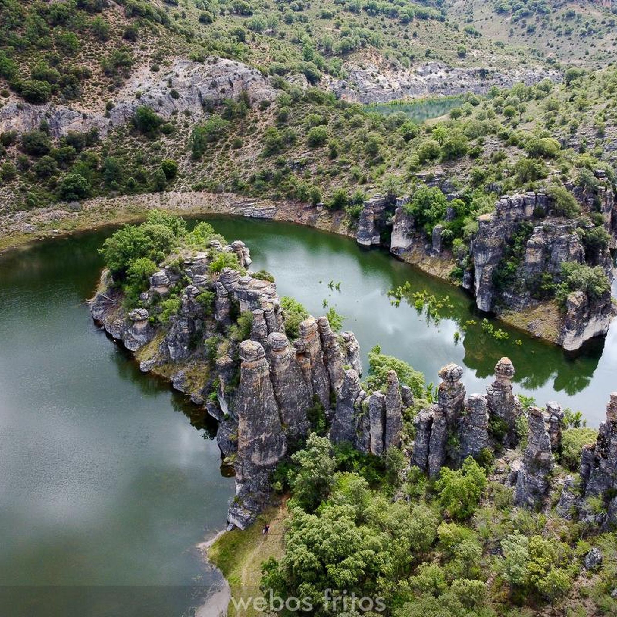
Road cycling around Embalse de la Tajera offers routes through the scenic province of Guadalajara, Castilla-La Mancha. The region is characterized by the clear waters of the reservoir, the Tajuña River basin, and the mountainous terrain of the Sierra Norte de Guadalajara. Cyclists can expect winding roads with varied elevation gains, providing both challenging climbs and enjoyable descents. The landscape features diverse natural elements, including riverine valleys and views towards higher elevations.
Best road cycling routes around Embalse de la…
Last updated: July 11, 2026
5.0
(1)
29
riders
110km
05:18
1,550m
1,550m
This difficult 68.6-mile road cycling route through the Alto Tajo ZEPA area features Trillo Waterfalls and stunning Alcarria landscapes.
22
riders
83.7km
03:53
1,020m
1,020m
Cycle 52.0 miles (83.7 km) through the difficult terrain of La Alcarria's lavender fields, starting from Cifuentes.

Sign up for free
Moderate road ride. Good fitness required. Some segments of this route may be unpaved and difficult to ride.
4.0
(1)
12
riders
58.1km
02:36
580m
570m
Moderate road ride. Good fitness required. Mostly well-paved surfaces and easy to ride.
8
riders
62.9km
02:58
770m
770m
Moderate road ride. Good fitness required. Some segments of this route may be unpaved and difficult to ride.
Get access to more routes and recommendations from other explorers.
Sign up for free
Already have an account?
Our route recommendations are based on thousands of hikes, rides, and runs completed by other people on komoot.
Start today with a free account
Your next adventure awaits.
Login or Signup
Popular around Embalse de la Tajera

Tips from the Community

First checkpoint on the route from Madrid to Barcelona. In the main square we find places to get supplies and rest.
0
0
Fresh water source in the village of Solanillos del Extremo, in the first kms of the route from Madrid to Barcelona.
0
0

Muslim castle built on a firm rock. Impregnable. for the defense of the Tagus River.
0
0

Cívica is a fascinating village in the province of Guadalajara, known for its rock-cut structures, which have earned it the nickname of the "Cappadocia of Alcarria". Cívica is a perfect place for lovers of history and nature.
5
0

The Torresaviñán castle, from the 12th century, is located on a hill very close to Torremocha del Campo and is visible from the Barcelona highway itself. It is of Muslim origin and due to the absence of amenities in its structure, it is assumed that it was a defensive post, rather than a permanent settlement. Its current state is due to the blowing up of its walls by the Austrian army during the war of succession in the 18th century.
0
0

The Valtablado del Río bridge crosses the waters of the Tagus in an area full of poplars. The great width and shallowness of the river, added to the shade provided by the trees, creates a privileged bathing area on hot days.
2
0
Moranchel is a small hamlet in the Alcarreña town of Cifuentes. It is located on the route of the Ruta de la Lana and has a curious historic center that is currently decorated with murals on the houses.
0
0

Walk around the 14th century fortress, built by Don Juan Manuel. The castle has five towers, dominates the landscape and dominates the village below.
2
0
Frequently Asked Questions
What kind of terrain can I expect when road cycling around Embalse de la Tajera?
The region around Embalse de la Tajera offers diverse terrain, characterized by winding roads through the Tajuña River basin and the mountainous Sierra Norte de Guadalajara. Cyclists can expect varied elevation gains, including both challenging climbs and enjoyable descents, set against a backdrop of clear reservoir waters and riverine valleys.
Are there road cycling routes suitable for beginners or those looking for an easier ride?
While many routes in the area feature significant elevation, there are options for varying skill levels. For instance, the Solanillos del Extremo – Cifuentes loop from Cifuentes is a moderate 44.0 km route with 484 meters of elevation gain, offering a less demanding experience compared to the more difficult trails.
What are some notable natural features or landmarks I might see while cycling in the area?
Cyclists will enjoy the striking clear, blue waters of the Embalse de la Tajera itself. The wider region is part of the Tajuña River basin and borders the Sierra Norte de Guadalajara, offering panoramic views and diverse natural elements. Although not directly on cycling routes, the nearby Tejera Negra Beech Forest is a UNESCO World Heritage site known for its ancient trees and vibrant autumn colors, contributing to the overall natural beauty of the area.
Are there any circular road cycling routes around Embalse de la Tajera?
Yes, several routes are circular. A popular option is the Embalse de la Tejera and Castillo de Torresaviñán — circular from Cifuentes, a moderate 71.6 km trail that takes you through the reservoir area and past the historic Castillo de Torresaviñán.
What is the best time of year to go road cycling around Embalse de la Tajera?
The region's climate suggests that spring and autumn would be ideal for road cycling. Spring offers pleasant temperatures and blooming landscapes, while autumn provides cooler weather and the stunning vibrant colors of the nearby Tejera Negra Beech Forest, making for a picturesque ride.
What do other road cyclists say about their experience in Embalse de la Tajera?
The area is highly rated by the komoot community, with an average score of 4.5 stars. Cyclists often praise the scenic beauty of the reservoir and the varied challenges presented by the mountainous terrain, making for rewarding rides.
Are there any routes that pass through or near lavender fields?
Yes, the La Alcarria Lavender Fields Trail from Cifuentes is a difficult 83.7 km route specifically designed to wind through the notable lavender fields of La Alcarria, offering a unique visual experience during the blooming season.
How many road cycling routes are available in the Embalse de la Tajera area?
There are over 10 dedicated road cycling routes available around Embalse de la Tajera, offering a range of distances and difficulty levels for cyclists to explore.
Can I find routes with significant elevation gain for a challenging ride?
Absolutely. The region is known for its mountainous terrain. For a challenging experience, consider the Alto Tajo Natural Park Loop, a difficult 110.4 km route with over 1550 meters of elevation gain, taking you through the natural park.
Are there any routes that start from Cifuentes?
Cifuentes serves as a common starting point for several routes. Besides the lavender fields trail, the Cifuentes – Brihuega lavender fields loop from Cifuentes is another moderate 59.3 km option that begins and ends in Cifuentes.
What is the general difficulty level of road cycling routes in this region?
The road cycling routes around Embalse de la Tajera are generally categorized as moderate to difficult. There are 7 moderate routes and 3 difficult routes, indicating that most rides will involve some significant climbs and descents, making it suitable for cyclists with a good level of fitness.
Most popular routes around Embalse de la Tajera

Get inspired with the komoot mobile app


Explore more
Browse the best Road cycling routes in other regions.
