The best cycling routes around Embalse de El Villar
4.7
(23)
838
riders
64
rides
Touring cycling routes around Embalse de El Villar traverse a region characterized by abrupt and contrasting landscapes, including the dramatic Lozoya River Gorge and lush pine forests. The area features varied rock formations and Mediterranean scrubland, offering diverse scenery for cyclists. The Embalse de El Villar itself is home to the oldest functioning reservoir in the Community of Madrid, an emblematic historical dam. Cyclists can expect routes with significant track sections, some technical segments, and challenging climbs, providing a comprehensive…
Last updated: June 28, 2026
5
riders
Moderate bike ride. Good fitness required. Mostly paved surfaces. Suitable for all skill levels.
5.0
(3)
124
riders
55.2km
04:00
1,150m
1,160m
Hard bike ride. Very good fitness required. Mostly paved surfaces. Suitable for all skill levels.

Sign up for free
34
riders
58.8km
04:09
1,150m
1,150m
Hard bike ride. Very good fitness required. Mostly paved surfaces. Suitable for all skill levels.
11
riders
21.6km
02:00
250m
250m
Moderate bike ride. Good fitness required. Mostly paved surfaces. Suitable for all skill levels.
9
riders
25.9km
02:05
340m
330m
Moderate bike ride. Good fitness required. Mostly paved surfaces. Suitable for all skill levels.
Get access to more routes and recommendations from other explorers.
Sign up for free
Already have an account?
Our route recommendations are based on thousands of hikes, rides, and runs completed by other people on komoot.
Start today with a free account
Your next adventure awaits.
Login or Signup

Tips from the Community

Prádena del Rincón is a charming village located in the Sierra Norte of Madrid, founded between the 11th and 12th centuries and historically linked to livestock farming. Strolling through its streets reveals traditional architecture surrounded by nature. Its monuments include the Romanesque-Mudejar church of Santo Domingo de Silos. The tranquility of the area and its rural trails invite you to a peaceful and contemplative getaway in the heart of the Sierra del Rincón. This is ideal for those seeking a genuine connection with nature and rural history, far from the hustle and bustle, with routes that allow you to explore ancient transhumance trails and enjoy the area's biodiversity.
0
0
The landscape of the El Cardoso Pass is very typical of the Central Mountain System. Its pass separates the oak forest that thrives on one side and the pine trees that spread across the other. It also has extensive alpine meadows from which the rest of the mountain range can be seen.
0
0

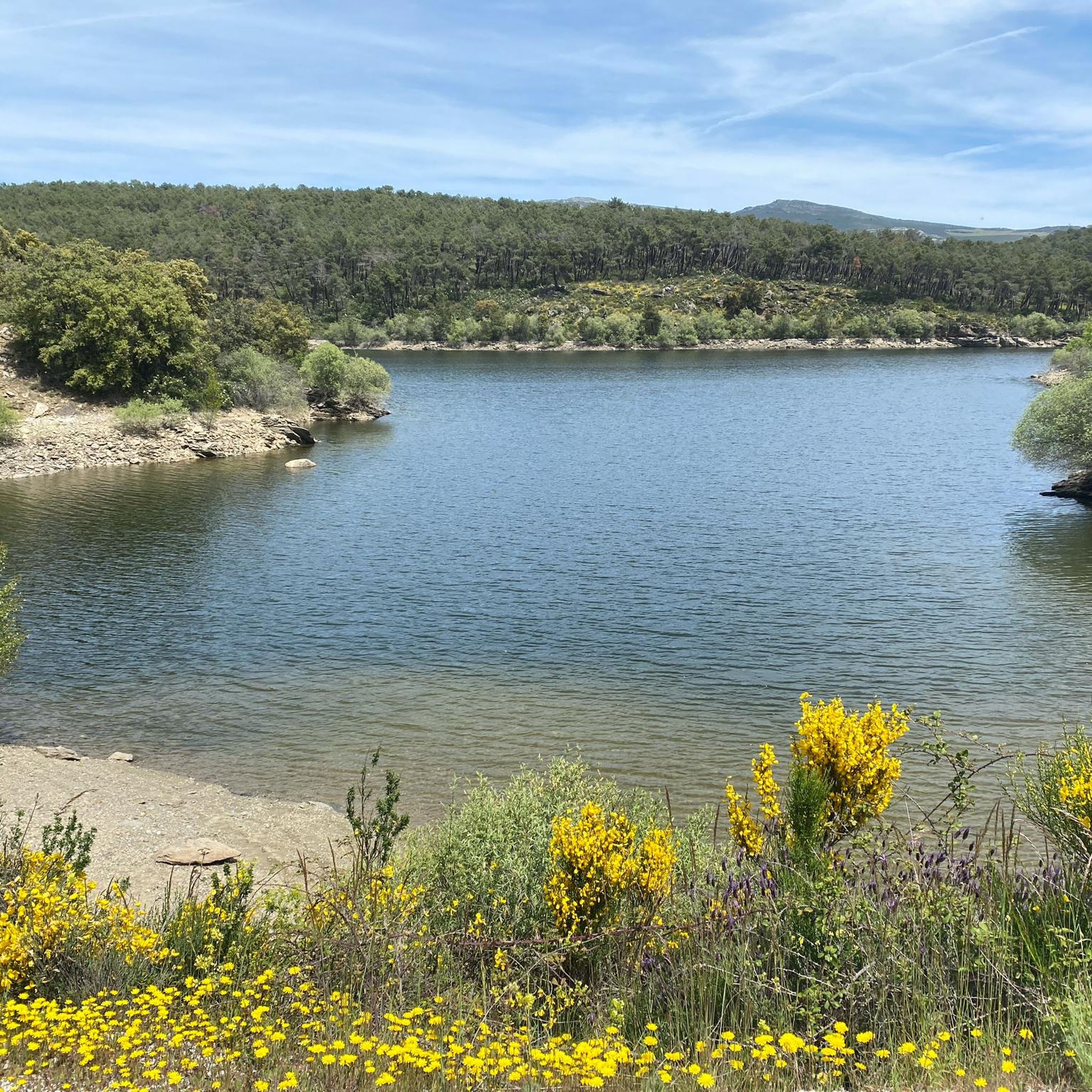
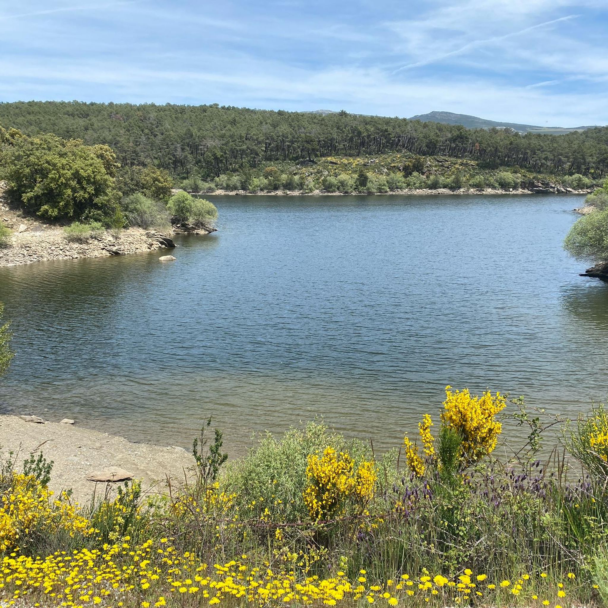
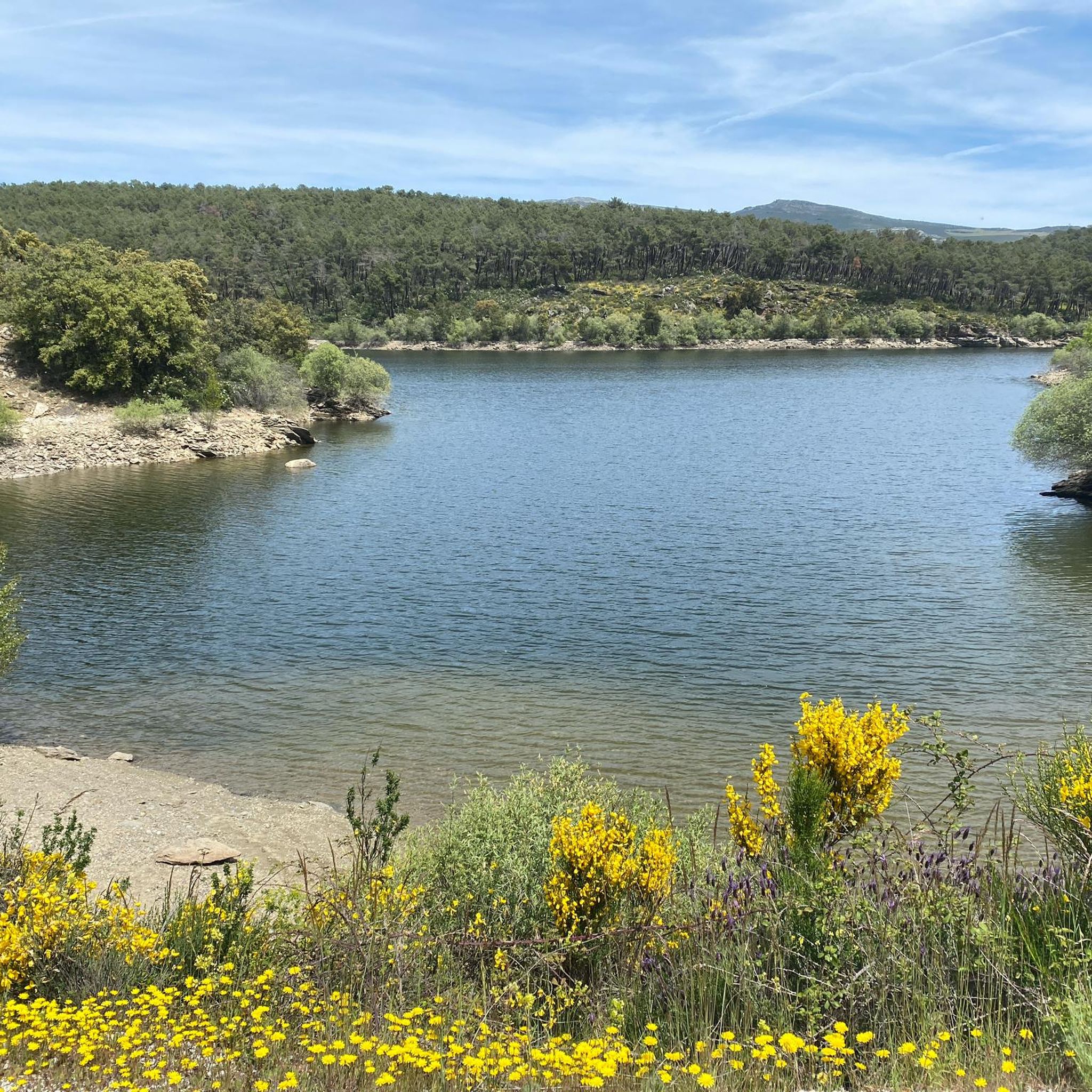
Beautiful views of the Lozoya reservoir
0
0


Beautiful town in La Sierra de Madrid with extraordinary landscapes. We recommend this town and its surroundings to isolate yourself from the world.
0
1
The Puentes Viejas reservoir is located in the middle course of the Lozoya River, in the Sierra Norte (Madrid). It belongs to the Canal de Isabel II reservoir network and is the third reservoir in the direction of the current that the river passes through.
0
0
The Puerto de La Hiruela through La Hiruela is a climb in the Castilla-La Mancha region. It has a length of 6.5 kilometers and a climb of 351 vertical meters with a slope of 5.4% on average, which implies a difficulty level of 224. The top of the climb is located at 1482 meters.
0
0
This port serves as an ideal baptism for those who begin to climb ports: easy, without traffic and with charm. But it also serves as an aperitif before other ports such as La Hiruela or La Puebla, with which you can easily connect to do much harder routes. Although it only reaches 1,358 meters, it is a natural border of very different landscapes, with oak trees on one side and pine trees on the other, and a fantastic gateway to the cycling paradise that exists on the Madrid-Guadalajara border. It serves as an indication that it is the necessary previous step to reach the famous Hayedo de Montejo. El Puerto del Cardoso via El Cardoso de la Sierra is a climb in the Castilla-La Mancha region. It has a length of 10.2 kilometers and a climb of 277 vertical meters with a slope of 2.7% on average, which implies a difficulty level of 134. The top of the climb is located at 1353 meters
0
0
Frequently Asked Questions
How many touring cycling routes are available around Embalse de El Villar?
There are over 60 touring cycling routes around Embalse de El Villar. These routes offer a diverse range of experiences, from moderate paths to more challenging trails with significant climbs, catering to various skill levels.
What kind of terrain and difficulty can I expect on touring cycling routes around Embalse de El Villar?
The terrain around Embalse de El Villar is characterized by abrupt and contrasting landscapes, including the dramatic Lozoya River Gorge and lush pine forests. Cyclists will encounter varied rock formations, Mediterranean scrubland, and significant sections of dirt track or gravel roads. While there are some moderate routes, many feature challenging climbs and technical segments, requiring good physical condition. For example, the Sierra del Rincón – circular by Puebla de la Sierra desde Manjirón is a difficult 55.2 km path with over 1150 meters of elevation gain.
What natural features and historical landmarks can I see while cycling around Embalse de El Villar?
The region offers a wealth of natural beauty and historical significance. You can cycle through the impressive Lozoya River Gorge, explore the beautiful Pinar de Casasola pine forest, and enjoy panoramic views from villages like Berzosa del Lozoya, known as the 'Balcón de la Sierra Norte'. A key historical landmark is the Embalse de El Villar Dam itself, the oldest functioning reservoir in the Community of Madrid and a significant engineering feat.
Are there many circular touring cycling routes in the Embalse de El Villar area?
Yes, the area is well-suited for circular touring cycling routes. A prominent example is the Senda del Genaro (GR-300), a 70-kilometer circular route that forms part of the Green Ways network. Other circular options include the El Atazar Reservoir – Views of the Lozoya River loop from Puentes Viejas, which is a moderate 21.6 km trail, and the Embalse del Atazar – Lozoyuela Crossing Point loop from Manjirón, a 25.7 km moderate route.
What is the best time of year for touring cycling around Embalse de El Villar?
The best times to cycle around Embalse de El Villar are generally spring and autumn. During these seasons, you can enjoy the vibrant colors of the landscape and more moderate temperatures, making for a more comfortable and scenic touring experience. Summers can be hot, and winters may present colder conditions.
Are there family-friendly touring cycling options around Embalse de El Villar?
While many routes in the area feature challenging climbs and technical sections, there are options suitable for families or those seeking an easier ride. The region offers a variety of paths, and it's advisable to look for routes designated as 'easy' or 'moderate' on komoot, which typically have less elevation gain and smoother surfaces. Always check the route details for distance and elevation before heading out with family.
Where can I find parking for my touring cycling trip to Embalse de El Villar?
Parking is generally available in the villages surrounding Embalse de El Villar, such as Manjirón, Robledillo de la Jara, or near popular starting points for routes. It's recommended to check local signage for designated parking areas and any restrictions, especially during peak seasons.
Can I reach Embalse de El Villar by public transport with my bike?
Public transport options to the Sierra Norte de Madrid, including areas near Embalse de El Villar, are available, primarily by bus from Madrid. However, policies regarding transporting bicycles on public buses can vary. It's always best to check with the specific bus operator beforehand to confirm their regulations on carrying bikes, especially for touring bicycles which can be larger.
What do other touring cyclists enjoy the most about touring cycling in Embalse de El Villar?
The area is highly rated by the komoot community, with an average score of 4.8 stars from over 10 reviews. Reviewers often praise the dramatic gorges, lush pine forests, and panoramic viewpoints that define the region. The comprehensive experience of diverse landscapes and the opportunity for multi-day adventures, particularly along routes like the Senda del Genaro, are frequently highlighted.
Are there opportunities for multi-day touring cycling around Embalse de El Villar?
Yes, the region is excellent for multi-day touring. The Senda del Genaro (GR-300), a 70 km circular route, is officially divided into seven stages. This allows cyclists to complete the tour at a relaxed pace, catering to different fitness levels and providing opportunities to explore traditional villages like Mangirón, Robledillo de la Jara, and El Atazar along the way.
What kind of bikes are best suited for touring cycling in this region?
Given the diverse terrain, which includes significant sections of dirt track/gravel road and some technical segments, robust touring bikes, gravel bikes, or mountain bikes equipped for longer rides are ideal. While some routes are moderate, the more challenging sections, including 'cortafuegos' (firebreaks) and steep descents, are best tackled with a bike that can handle varied surfaces and provide good stability.
Are there any easy touring cycling routes for beginners around Embalse de El Villar?
While many routes present a challenge, there are easier options. For instance, the Access arch to the city wall – Alcazaba de Buitrago loop from Manjirón is a moderate 14.9 km trail that takes about 1 hour to complete, offering views of historical architecture without excessive difficulty. It's always recommended to check the route's elevation profile and surface type on komoot to ensure it matches your skill level.
Most popular routes around Embalse de El Villar

Get inspired with the komoot mobile app


Explore more
Browse the best Cycling routes in other regions.
