The best MTB trails around Embalse de Bachimaña Alto
4.7
(66)
1,176
riders
2
rides
Mountain biking around Embalse de Bachimaña Alto offers routes through the high-mountain scenery of the Aragonese Pyrenees. The region features glacial lakes, towering peaks, and varied terrain suitable for mountain biking. Riders can expect a mix of alpine pastures, forests, and technical sections, with elevations reaching over 2,200 meters. The landscape is characterized by rocky terrain and dramatic ascents and descents, providing diverse challenges for mountain bikers.
Best mountain bike trails around Embalse de Bachimaña Alto
- The most popular mountain…
Last updated: July 4, 2026
4.5
(2)
80
riders
38.6km
04:35
1,620m
1,620m
Hard mountain bike ride. Very good fitness required. Advanced riding skills necessary. Some portions of the route may require you to push your bike.
12
riders
21.0km
01:44
590m
590m
Moderate mountain bike ride. Good fitness required. Suitable for all skill levels.

Sign up for free
4.0
(4)
81
riders
24.1km
03:13
1,100m
1,100m
Hard mountain bike ride. Very good fitness required. Advanced riding skills necessary. Some portions of the route may require you to push your bike.
5.0
(2)
45
riders
28.5km
02:26
620m
620m
Moderate mountain bike ride. Good fitness required. Suitable for all skill levels.
38
riders
13.2km
01:28
490m
490m
Moderate mountain bike ride. Good fitness required. Advanced riding skills necessary.
Our route recommendations are based on thousands of hikes, rides, and runs completed by other people on komoot.
Start today with a free account
Your next adventure awaits.
Login or Signup
Popular around Embalse de Bachimaña Alto

Tips from the Community

Simple route, ideal for a walk.
0
0

On this road all the views are beautiful.
0
0
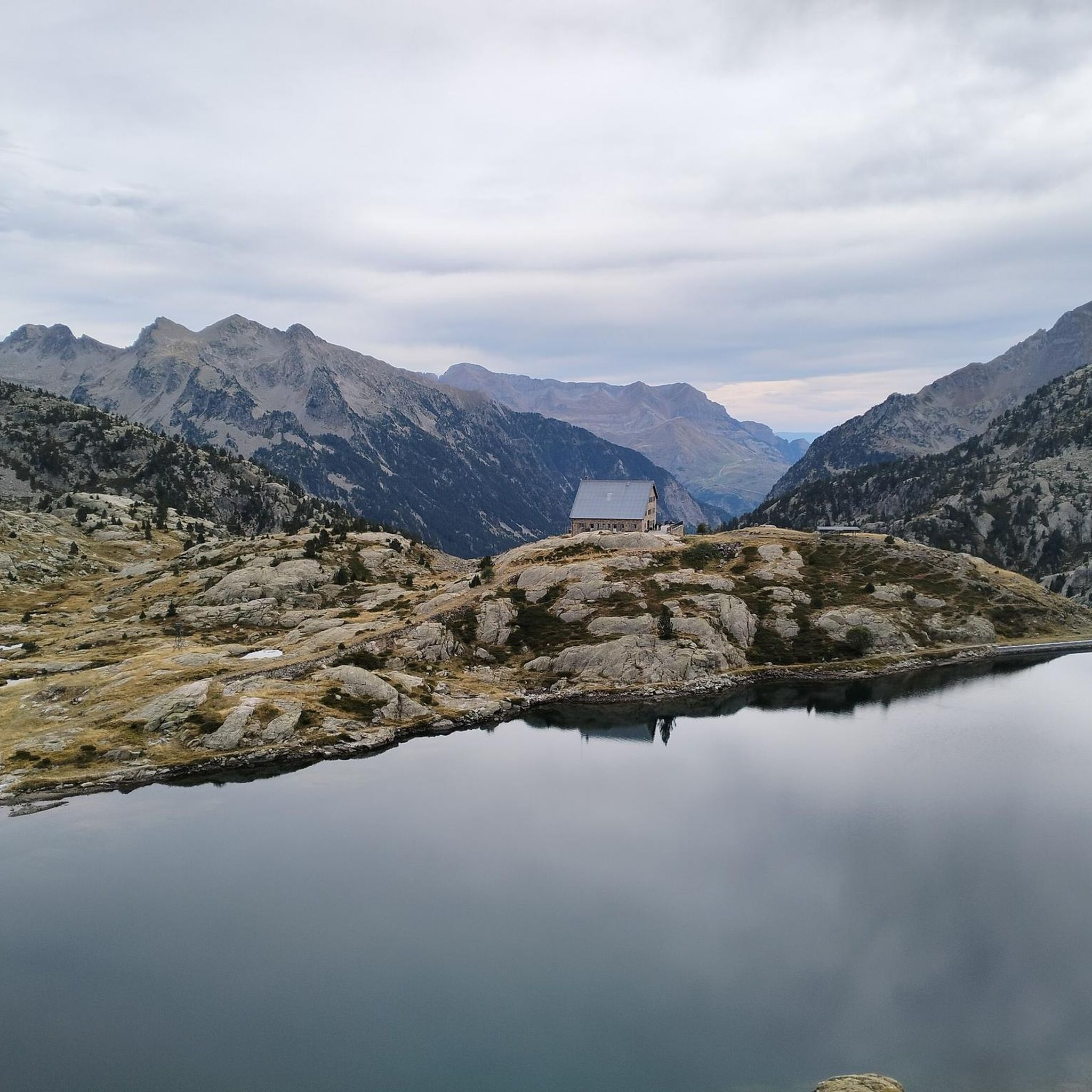
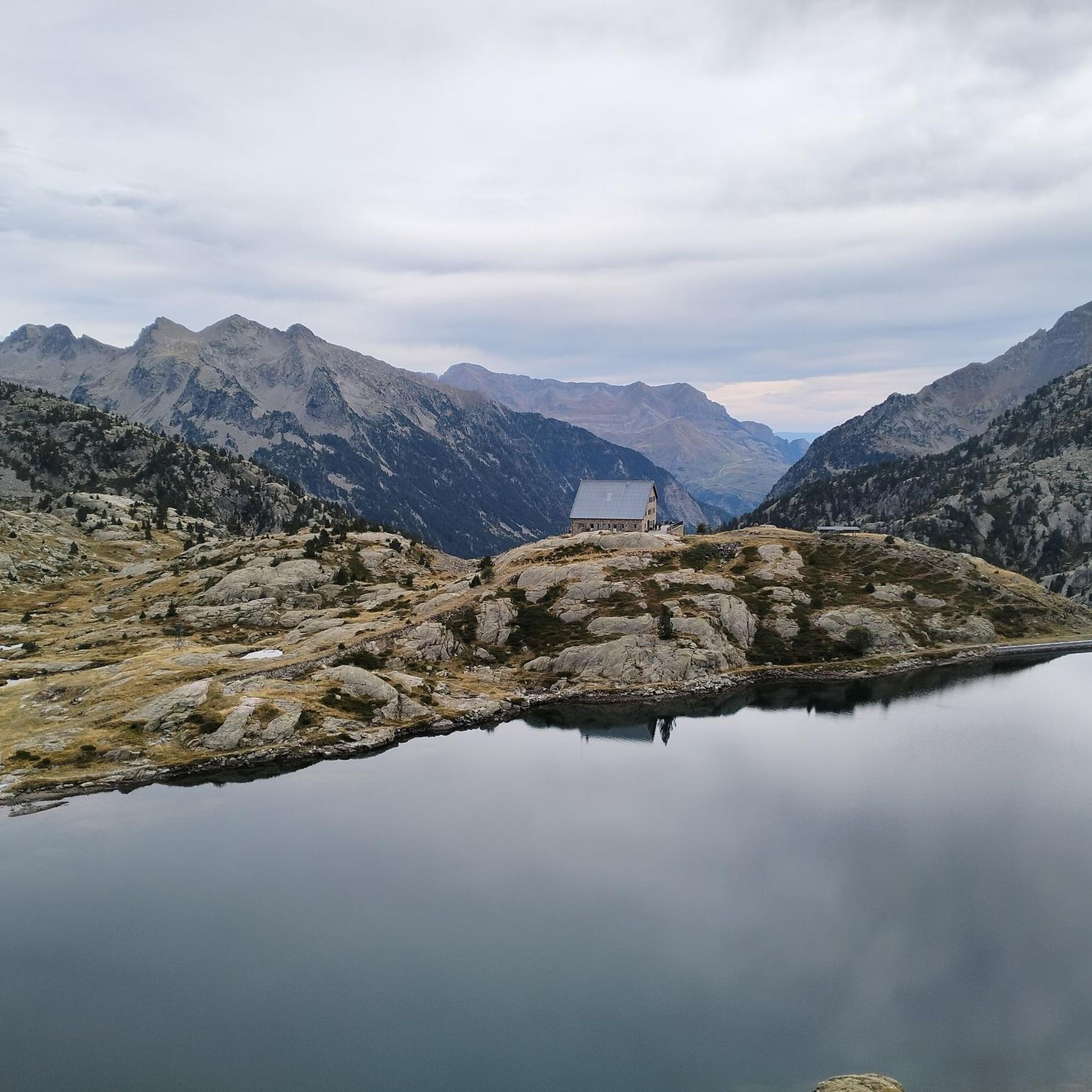
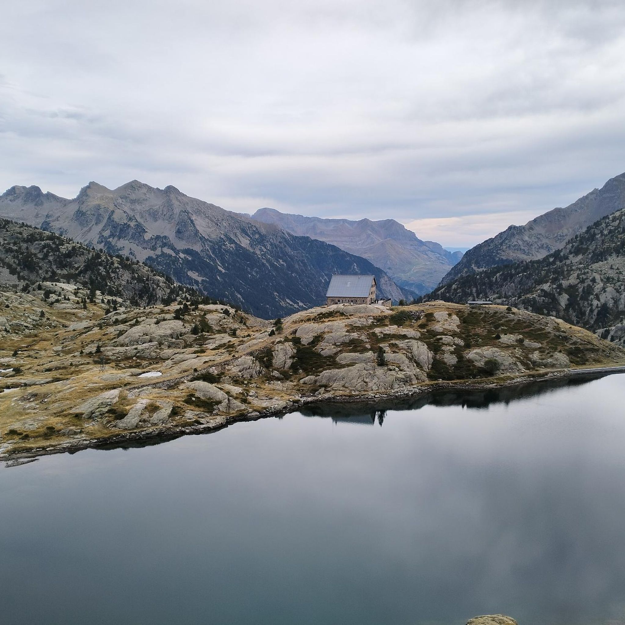
A shelter in very good condition located in an exceptional setting beneath the cirque that forms part of the Tendeñera mountain range and the peak of the same name, the Pico dero Verde.
0
0
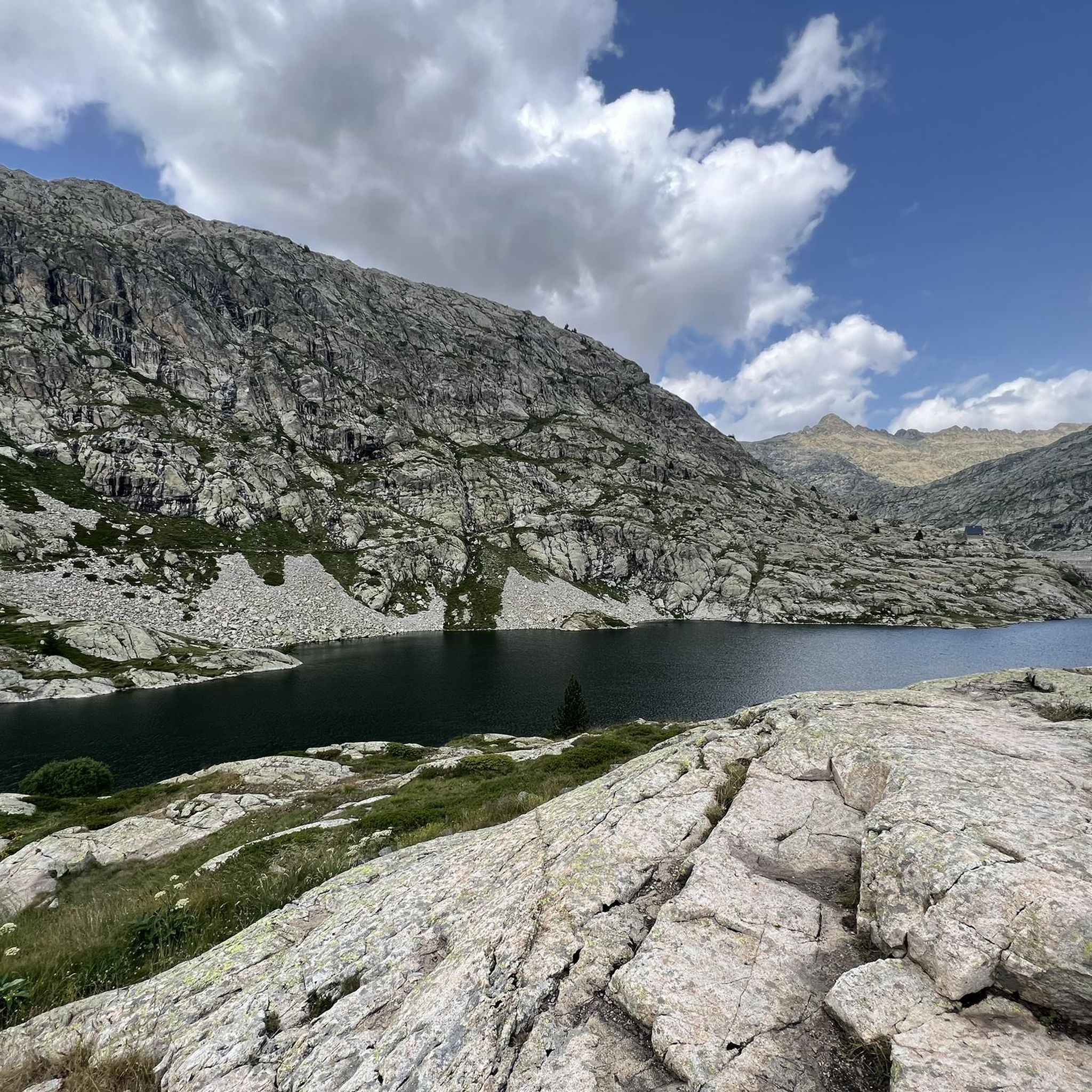
A beautiful lake located at 1,905 m in a glacial cirque surrounded by Pico del Verde (2,295 m) and Peña Sabocos (2,757 m). It has a maximum depth of 25 m and is close to the Asnos Lake.
0
0


Small, newly renovated shelter near the Tendenera waterfall.
1
0

A very good spot in the Tena Valley with magnificent views and very good technical passages. Advice to avoid in summer with the insolence of tourists 😉
0
0

Don't miss the stop to take beautiful photos
0
1
Frequently Asked Questions
What kind of terrain can I expect on mountain bike trails around Embalse de Bachimaña Alto?
The mountain bike trails in the Embalse de Bachimaña Alto region offer a diverse range of terrain. You'll encounter high-mountain scenery, including rocky sections, alpine pastures, and lush forests. Expect significant ascents and descents, characteristic of the Aragonese Pyrenees, with elevations reaching over 2,200 meters. The broader Tena Valley provides a mix of tracks, paths, and old routes, suitable for various skill levels.
Are there any loop mountain bike trails in the area?
Yes, several excellent loop trails are available. For a challenging ride, consider the Ibón de Sabocos – Ibón de Sabocos loop from Río Caldarés, which is 24.0 miles (38.6 km) long and features significant elevation gain. Another popular option is the Baños de Panticosa – Panticosa loop from Río Caldarés, a moderate 13.0 miles (21.0 km) path with forest sections and open views.
What are some natural features or landmarks I might see while mountain biking here?
The region is rich in stunning natural features. You'll encounter glacial lakes, such as Embalse de Bachimaña Alto itself and the smaller Embalse de Bachimaña Bajo, along with others like the Ibones Azules. Towering peaks like Picos del Infierno and Pico de Argualás provide a dramatic backdrop. Keep an eye out for cascading waterfalls, such as the Cascada del Fraile, and verdant meadows that add to the scenic beauty.
What is the best time of year for mountain biking around Embalse de Bachimaña Alto?
The best time to visit for mountain biking is generally during the warmer months, from late spring to early autumn, when the high-mountain trails are free of snow and weather conditions are more stable. The high-altitude setting means that winter can bring snow and challenging conditions, making many trails inaccessible or requiring specialized equipment.
Are there any family-friendly mountain bike trails in the vicinity?
While the immediate area around Embalse de Bachimaña Alto features more challenging high-mountain routes, the broader Tena Valley offers an extensive network of trails with varying difficulty levels, including options suitable for families. These routes often traverse alpine pastures and forests, providing a less technical experience. It's advisable to check individual route descriptions for specific family-friendly recommendations.
Can I bring my dog on the mountain bike trails?
Many trails in the Aragonese Pyrenees are accessible for dogs, especially those that are not within strict national park zones where regulations might be tighter. However, given the high-mountain terrain and potential for wildlife, it's always recommended to keep dogs under control, preferably on a leash, and to ensure they are fit enough for the strenuous activity. Always check local signage for any specific restrictions.
How long do mountain bike trails typically take to complete in this region?
Trail durations vary significantly based on difficulty and distance. For example, a difficult route like the Ibón de Sabocos – Ibón de Sabocos loop from Río Caldarés, which is 24.0 miles (38.6 km), typically takes around 4 hours 35 minutes. A moderate trail such as the View of the Tena Valley – Tena Valley loop from Panticosa, at 8.2 miles (13.2 km), might take about 1 hour 28 minutes. Always check the estimated duration for each specific route.
What are the options for parking when accessing mountain bike trails?
Parking options are generally available in the towns and villages surrounding the Embalse de Bachimaña Alto area, such as Panticosa or Baños de Panticosa, which serve as common starting points for many trails in the Tena Valley. From these points, trails often lead into the higher mountains. Specific parking details can usually be found in the descriptions of individual routes or at local tourist information centers.
Are there any places to eat or stay near the mountain bike trails?
Yes, the broader Tena Valley offers various amenities. Towns like Panticosa provide options for accommodation, cafes, and restaurants. Additionally, for those on longer excursions into the high mountains, the Refugio de los Ibones de Bachimaña is a mountain hut situated near the lakes, offering a crucial resting point and a place to refuel amidst the alpine environment.
What is the overall difficulty level of mountain biking around Embalse de Bachimaña Alto?
The mountain biking in this region ranges from moderate to difficult. You'll find challenging routes with significant elevation gains and technical sections, suitable for experienced riders. For instance, the Ibón de Sabocos – Panticosa loop from Panticosa is rated as difficult. However, the wider Tena Valley also includes moderate paths that are less demanding, offering options for different skill levels.
What do other mountain bikers enjoy most about the trails here?
The area is highly rated by the komoot community, with an average score of 4.7 stars from over 60 reviews. Mountain bikers frequently praise the breathtaking high-mountain scenery, the challenge of the varied terrain, and the sense of adventure offered by the glacial lakes and towering peaks. The diverse network of trails allows riders to experience everything from alpine pastures to technical descents.
Are there opportunities for wild swimming near the mountain bike trails?
The region is known for its numerous glacial lakes, including Embalse de Bachimaña Alto itself, the Ibones Azules, and others. While these high-altitude lakes are incredibly scenic, their waters are typically very cold. Wild swimming might be possible in some areas, but it's important to exercise caution due to the cold temperatures and remote locations. Always prioritize safety and be aware of local regulations regarding swimming in natural bodies of water.
What kind of wildlife might I encounter on the mountain bike trails?
The Aragonese Pyrenees are home to diverse wildlife. While mountain biking, you might spot various bird species, including raptors soaring overhead. Mammals such as chamois and marmots are also present in the higher alpine areas. Keep a respectful distance and avoid disturbing any animals you encounter, especially during breeding seasons.
Most popular routes around Embalse de Bachimaña Alto

Get inspired with the komoot mobile app


Explore more
Browse the best MTB trails in other regions.
