The best walks and hikes around Estany de Travessany
4.6
(884)
8,639
hikers
113
hikes
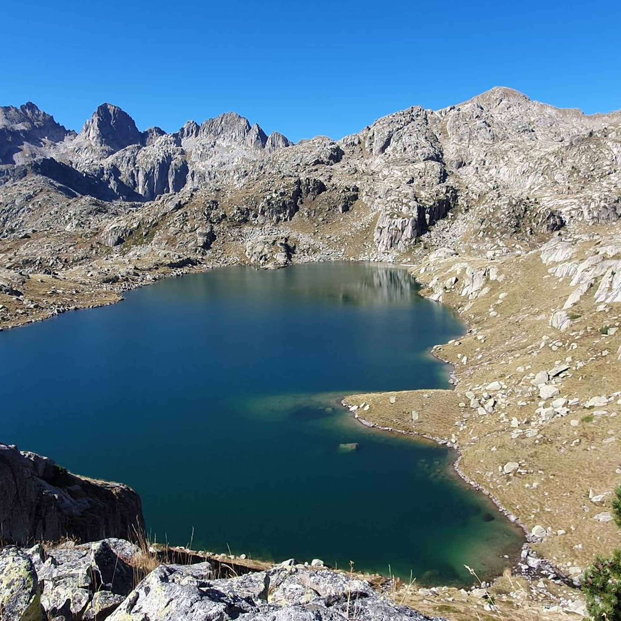
Hiking around Estany de Travessany offers trails through the glacial landscapes of the Catalan Pyrenees, within Aigüestortes i Estany de Sant Maurici National Park. The region is characterized by a prominent glacial lake, dramatic mountainous cirques, and a network of interconnected lakes and waterfalls. Towering peaks like Agulles and Pic de Travessani define the rugged terrain, providing varied elevation gains for hikers.
Best hiking trails around Estany de Travessany
- The most popular hiking route is Refugi Ventosa i Calvell to…
Last updated: October 7, 2026
1
hikers
Moderate hike. Great for any fitness level. Mostly accessible paths. Sure-footedness required.
13
hikers
Moderate hike. Good fitness required. Mostly accessible paths. Sure-footedness required.

9
hikers
Hard hike. Good fitness required. Sure-footedness, sturdy shoes and alpine experience required.
5.0
(1)
4
hikers
Moderate hike. Great for any fitness level. Mostly accessible paths. Sure-footedness required.
5.0
(1)
43
hikers
18.5km
09:57
1,550m
1,550m
Hard hike. Very good fitness required. Sure-footedness, sturdy shoes and alpine experience required.
Get access to more routes and recommendations from other explorers.
Already have an account?
Our route recommendations are based on thousands of hikes, rides, and runs completed by other people on komoot.
Start today with a free account
Your next adventure awaits.
Popular around Estany de Travessany


Tips from the Community

Beautiful plateau just above the Estany de Cavallers, a very bucolic place
0
0

This refuge is named after the Restanca lake, next to which it is located. It is located at an altitude of 2010 metres in the Alto Arán. It has capacity for 80 guests, divided into six rooms. It also has hot water showers, food service and a bar.
1
0

views just as impressive as from Montardo
1
0

The Lakes of Tumeneia are two lakes of glacial origin. They are located at an altitude of 2,320 meters.
1
0

We come across the shepherd and his 3,000 sheep. A show
0
0
Fantastic place with great views of the Valley. It is a starting point for many ascents.
1
0

Spectacular views from the top
1
0

Located in the Valle de Arán region and with an altitude of 2833 m, it is the best known mountain in the Valley. Once we reach the top, we will have magnificent 360º views
2
0
Frequently Asked Questions
What kind of terrain can I expect when hiking around Estany de Travessany?
The terrain around Estany de Travessany is characterized by dramatic glacial landscapes within the Catalan Pyrenees. You'll encounter rugged mountainous cirques, pristine glacial lakes, and a network of interconnected smaller lakes and cascading waterfalls. The trails often feature varied elevation gains, leading through valleys, alpine pastures, and past towering peaks like Agulles and Pic de Travessani.
How many hiking trails are available in the Estany de Travessany area?
There are over 90 hiking trails available around Estany de Travessany. These routes cater to various skill levels, with 5 easy, 38 moderate, and 53 difficult options to explore the diverse glacial landscape.
Are there any circular hiking routes around Estany de Travessany?
Yes, there are several circular routes. For example, the Refugi Ventosa i Calvell – Estany Negre loop from Refugi Ventosa i Calvell is a moderate 3.9-mile path. Another option is the more challenging Refugi Ventosa i Calvell – Port de Caldes loop from Refugi Ventosa i Calvell, which covers 5.4 miles through high mountain passes.
What is the best time of year to hike in Estany de Travessany?
The best time to hike around Estany de Travessany is generally during the warmer months, from late spring to early autumn, when the trails are clear of snow and the weather is more stable. The national park's elevation ranges from 1,200 to 3,000 meters, so conditions can vary. Always check local weather forecasts before heading out.
What are some notable natural features or attractions to see while hiking?
Beyond the stunning Estany de Travessany itself, you'll find a rich network of other glacial lakes, such as Estany de Monges, Estany de Mangades, and Estany Clot, all contributing to the area's vibrant aquatic landscape. The dramatic mountainous cirque, dominated by Agulles and Pic de Travessani, offers breathtaking views, and you can often spot cascading waterfalls along the routes.
Is there a mountain hut or refuge available for hikers near Estany de Travessany?
Yes, the Refugi Joan Ventosa i Calvell is located very close to Estany de Travessany. It serves as an excellent base or stopover point for hikers exploring the area, including those on multi-day treks like the 'Carros de Foc' route.
What is the difficulty level of hikes around Estany de Travessany?
The hiking trails around Estany de Travessany offer a range of difficulties. While some routes are moderate, such as the Refugi Ventosa i Calvell to Estany de Tumeneia de Dalt, many are classified as difficult due to significant elevation gains and rugged terrain. There are 5 easy, 38 moderate, and 53 difficult routes in total.
What do other hikers say about the trails in Estany de Travessany?
The area is highly rated by the komoot community, with an average score of 4.6 stars from nearly 700 reviews. Hikers frequently praise the stunning glacial scenery, the pristine lakes, and the challenging yet rewarding nature of the trails. Over 7,000 hikers have used komoot to explore this region.
Are there any specific regulations for hiking in Aigüestortes i Estany de Sant Maurici National Park?
As Estany de Travessany is located within Aigüestortes i Estany de Sant Maurici National Park, it's important to be aware of park regulations. These typically include rules regarding waste disposal, staying on marked trails, and protecting wildlife. For detailed information on permits or specific rules, it's advisable to consult the official park website or visitor centers. You can find general information about the park on Spain.info.
Where can I park to access the hiking trails for Estany de Travessany?
A common starting point for trails leading to Estany de Travessany is the car park at the base of the Cavallers dam. From there, well-marked trails ascend towards the lake and other points of interest in the area.
Are there any long-distance routes that pass through Estany de Travessany?
Yes, Estany de Travessany is part of the larger network of trails within Aigüestortes i Estany de Sant Maurici National Park, making it a prime location for multi-day treks. Notably, it is a segment of the renowned 'Carros de Foc' route, a challenging high-mountain circuit connecting several refuges in the Pyrenees.
What kind of wildlife might I encounter while hiking?
The Aigüestortes i Estany de Sant Maurici National Park, where Estany de Travessany is located, is home to diverse flora and fauna. While specific wildlife sightings can vary, the meltwater ecosystem supports a variety of species. You might encounter grazing animals like cows in alpine pastures, and the park is known for its rich biodiversity, thriving in the high-mountain environment.
Most popular routes around Estany de Travessany

Get inspired with the komoot mobile app


Explore more
Browse the best Hikes in other regions.
