The best walks and hikes around Embalse de Ordunte
4.7
(125)
774
hikers
54
hikes
Hiking around Embalse de Ordunte offers routes through scenic landscapes centered around the reservoir, which is fed by the Cerneja and Ordunte rivers. The area features diverse forest scenery and is known for its aquatic birdlife. While the immediate surroundings are characterized by the reservoir's tranquil setting, the broader region includes hills and higher summits, providing varied terrain for hikers.
Best hiking trails around Embalse de Ordunte
- The most popular hiking route is Forgotten Way and Ordunte Reservoir Loop, a 5.4 miles (8.7 km) trail that takes 2 hours 28 minutes to complete, offering views of the reservoir and surrounding forests.
- Another top favourite among local hikers is Ilso de las Estacas Summit – Bicergi Summit (1160 m) loop from Embalse de Ordunte, a difficult 11.2 miles (18.1 km) path that ascends to two prominent summits, providing expansive views.
- Local hikers also love the Ordunte Reservoir – Hornes loop from Embalse de Ordunte, a 4.0 miles (6.5 km) trail leading through forested areas and along the reservoir's edge, often completed in about 1 hour 47 minutes.
- Hiking around Embalse de Ordunte is defined by its picturesque reservoir, diverse forest scenery, and opportunities to observe aquatic birdlife. The network of routes offers options for various ability levels, from easy loops to more challenging summit ascents.
- The routes in Embalse de Ordunte are highly rated by the komoot community with an average score of 4.6 stars from over 120 reviews. More than 700 hikers have used komoot to explore Embalse de Ordunte's varied terrain.
Last updated: July 3, 2026
8.74km
02:28
190m
190m
Hike the moderate 5.4-mile Embalse de Ordunte circular route from Ribota de Ordunte, enjoying reservoir views and diverse forest scenery.
5.0
(1)
12
hikers
Hard hike. Very good fitness required. Easily-accessible paths. Suitable for all skill levels.

Sign up for free
5.0
(1)
6
hikers
Moderate hike. Good fitness required. Easily-accessible paths. Suitable for all skill levels.
1
hikers
6.51km
01:47
100m
100m
Easy hike. Great for any fitness level. Easily-accessible paths. Suitable for all skill levels.
1
hikers
6.48km
01:46
100m
100m
Easy hike. Great for any fitness level. Easily-accessible paths. Suitable for all skill levels.
Get access to more routes and recommendations from other explorers.
Sign up for free
Already have an account?
Our route recommendations are based on thousands of hikes, rides, and runs completed by other people on komoot.
Start today with a free account
Your next adventure awaits.
Login or Signup
Tips from the Community

Ilso de las Estacas is a mountain 1037 meters high. The top is marked with a curious coffee pot on a pole and a booth. It offers magnificent views of the surrounding mountains and green valleys.
1
0

Hornes is a small town that is located near the Ordunte Reservoir, just above the same swamp and on its west side.
1
0
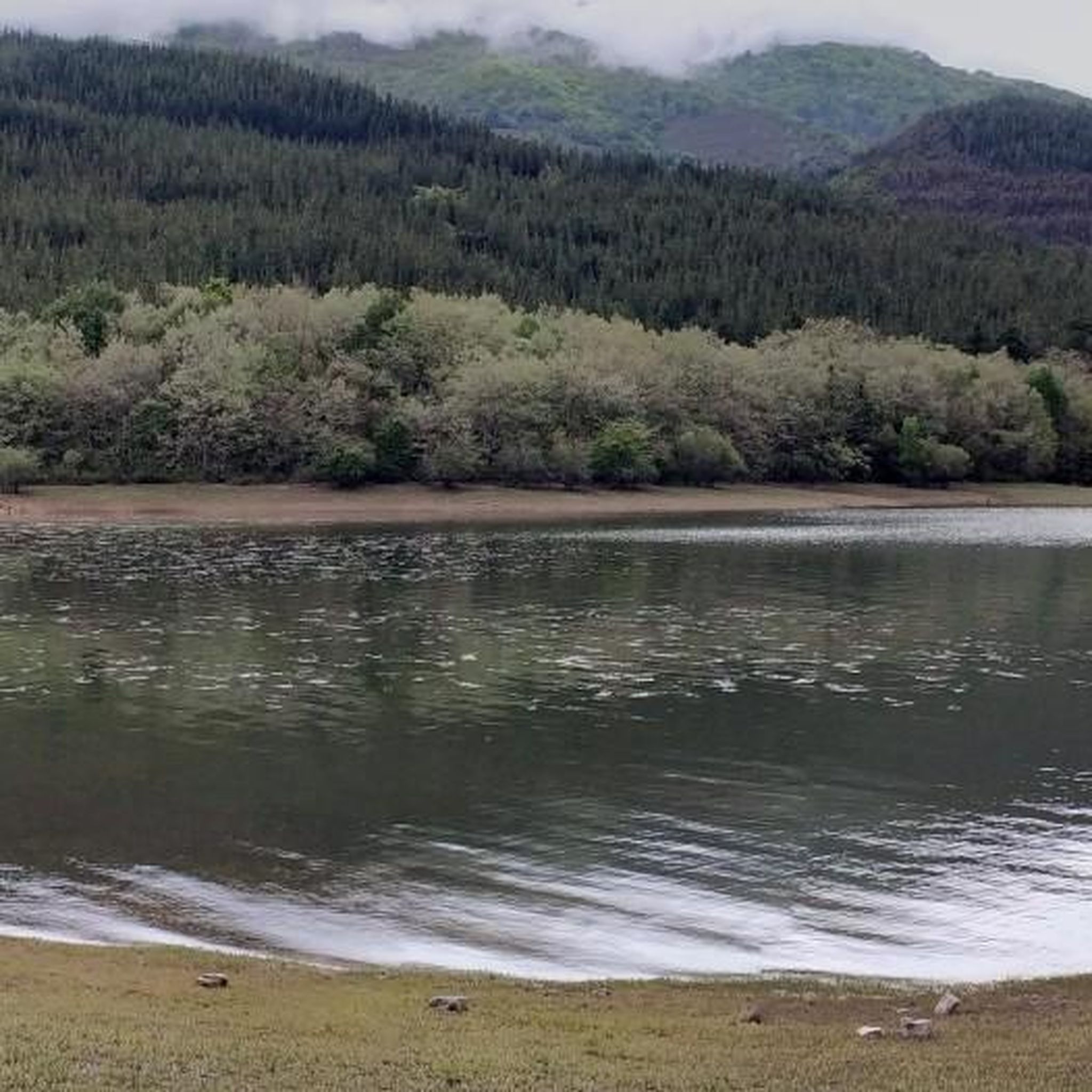
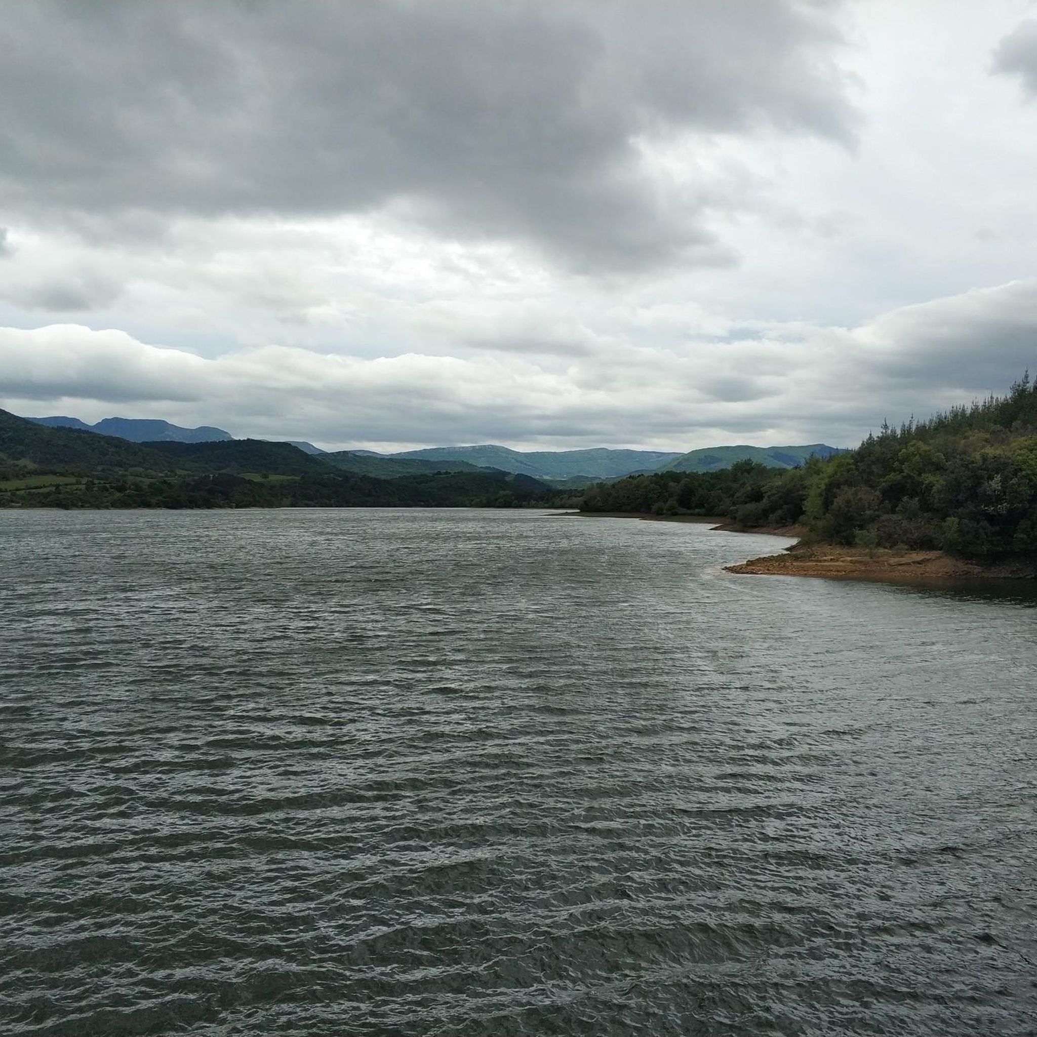
Beautiful reservoir in a very beautiful area. You can take a walk around the 10km reservoir. It has an area with tables and benches to relax and enjoy the views of the reservoir.
1
0

beautiful beech forest on the way up to La Maza
0
0
The most visited peak in the Karranza part of the Sierra de Ordunte.
0
0
Frequently Asked Questions
How many hiking trails are available around Embalse de Ordunte?
There are over 50 hiking routes around Embalse de Ordunte, offering a variety of experiences from easy strolls along the reservoir to more challenging ascents into the surrounding hills. You'll find 19 easy, 25 moderate, and 11 difficult trails to explore.
Are there any easy, family-friendly hikes in the area?
Yes, Embalse de Ordunte offers several easy trails suitable for families. A great option is the Ordunte Reservoir – Hornes loop from Embalse de Ordunte, which is 6.5 km long and takes about 1 hour 47 minutes, leading through forested areas and along the reservoir's edge. Another similar easy route is the Hornes – Ordunte Reservoir loop from Río Ordunte.
Can I hike a circular route around the Embalse de Ordunte reservoir?
Absolutely. A prominent feature of the area is a well-defined circular hiking route that completely encircles the reservoir. This route is approximately 10 km long and typically takes about 2 hours and 30 minutes to complete, offering beautiful views and a tranquil setting. The Forgotten Way and Ordunte Reservoir Loop is a popular moderate option that covers a significant portion of the reservoir's edge.
What kind of natural features can I expect to see while hiking?
Hikers around Embalse de Ordunte will encounter picturesque reservoir views, diverse forest scenery, and opportunities to observe aquatic birdlife. The reservoir is fed by the Cerneja and Ordunte rivers, creating a tranquil environment. Keep an eye out for species like the mallard, common coot, northern shoveler, and great crested grebe.
Are there any historical or archaeological sites to discover?
Beyond its natural beauty, the area around Embalse de Ordunte holds historical and archaeological value. Hikers can encounter concentrations of Copper Age (Calcolithic, 2,900-2,000 B.C.) hearths and burial mounds in the vicinity, adding a cultural dimension to your outdoor experience.
Where are the main starting points for hikes, and is parking available?
The hiking trails are generally easily accessible. Potential starting points include the dam's parking area or the nearby town of Ribota de Ordunte. These locations typically offer convenient parking for hikers.
What do other hikers say about the trails in Embalse de Ordunte?
The routes in Embalse de Ordunte are highly rated by the komoot community, with an average score of 4.6 stars from over 120 reviews. Hikers often praise the picturesque reservoir, diverse forest scenery, and the opportunities to observe aquatic birdlife, noting the variety of terrain available for different ability levels.
Are there any challenging hikes with expansive views?
Yes, for those seeking a challenge and panoramic vistas, the area offers more difficult routes. The Ilso de las Estacas Summit – Bicergi Summit (1160 m) loop from Embalse de Ordunte is a difficult 18.1 km path that ascends to two prominent summits, providing expansive views of the surrounding landscape.
Is the circular route around the reservoir suitable for cycling as well?
Yes, the circular route around Embalse de Ordunte is 100% cyclable, making it a great option for mountain biking enthusiasts in addition to hikers. It offers a scenic and accessible path for both activities.
What is the best time of year to go hiking in Embalse de Ordunte?
Embalse de Ordunte is enjoyable throughout much of the year. Spring and autumn offer pleasant temperatures and vibrant natural colors, while summer provides longer daylight hours. The tranquil setting of the reservoir and diverse forest scenery make it a beautiful destination in various seasons, though checking local weather conditions before your visit is always recommended.
Are dogs allowed on the hiking trails around Embalse de Ordunte?
While specific regulations for every trail can vary, generally, dogs are welcome on many outdoor trails in the region, especially if kept on a leash. The natural setting of Embalse de Ordunte, with its forests and open paths, is often suitable for walks with canine companions. Always ensure to clean up after your dog and respect any local signage regarding pet access.
Most popular routes around Embalse de Ordunte

Get inspired with the komoot mobile app


Explore more
Browse the best Hikes in other regions.
