The best walks and hikes around Pantà dels Guiamets
4.4
(221)
917
hikers
76
hikes
Hiking around Pantà dels Guiamets features a natural setting in the southern Priorat region, characterized by the central reservoir and surrounding Mediterranean landscapes. The area offers a mix of tranquil paths, some paved sections, and trails that wind through ravines and past small dams. Hikers can expect varied terrain, connecting nearby villages and offering opportunities for birdwatching.
Best hiking trails around Pantà dels Guiamets
- The most popular hiking route is Museu de la imprenta antiga – Main Street of Marçà…
Last updated: October 18, 2026
4.5
(4)
15
hikers
11.2km
03:11
240m
240m
Moderate hike. Good fitness required. Easily-accessible paths. Suitable for all skill levels.
8
hikers
17.5km
05:20
550m
550m
Hard hike. Very good fitness required. Easily-accessible paths. Suitable for all skill levels.

6
hikers
8.44km
02:20
150m
150m
Moderate hike. Good fitness required. Easily-accessible paths. Suitable for all skill levels.
4.0
(2)
10
hikers
4.88km
01:22
100m
100m
Easy hike. Great for any fitness level. Easily-accessible paths. Suitable for all skill levels.
4.0
(1)
3
hikers
12.3km
03:34
320m
320m
Moderate hike. Good fitness required. Easily-accessible paths. Suitable for all skill levels.
Get access to more routes and recommendations from other explorers.
Already have an account?
Our route recommendations are based on thousands of hikes, rides, and runs completed by other people on komoot.
Start today with a free account
Your next adventure awaits.
Tips from the Community

Within the municipality of Marçà, there is a socio-cultural gem still unknown to many. It is the museum of the old printing press of this small town in Priorat. A space that can not only be visited, but also allows documents to be printed in various techniques such as lead or wood. In this way, it makes everything more intuitive and didactic. The collection of machines at the Museum of the Old Printing Press covers a whole range of years. From 1300 to 1900, including various ideologists such as Laurens Janszoon Coster or Johannes Gutenberg. A visit is essential!
0
0


Llaberia is an old medieval settlement that belongs to the municipality of Tivisa. It is worth walking through its cobbled streets and admiring the ancient facades. One of the houses, called Cal Riba, dates from 1640. The Romanesque church of San Juan Bautista also stands out.
2
0

At the end of the 19th century, all of Catalonia suffered an economic downturn that coincided with an attack by the phylloxera insect, which killed the vineyards. This led to the depopulation of many towns. However, in this area, the decline was not as severe as in others thanks to the railway line, which played a fundamental role in the wine trade, as it quickly connected the consuming and producing areas, ensuring that the wine arrived at its destination in better condition.
2
0

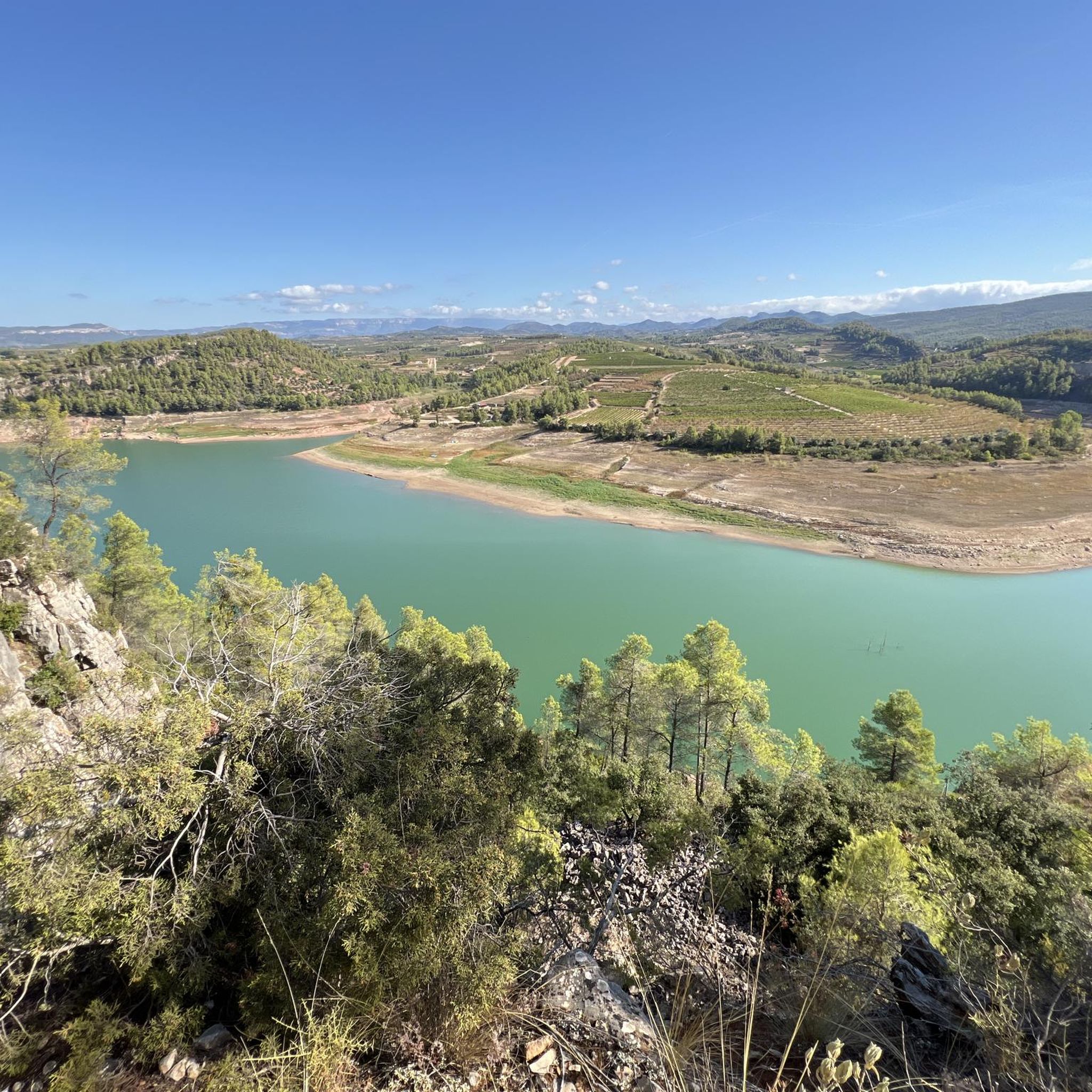
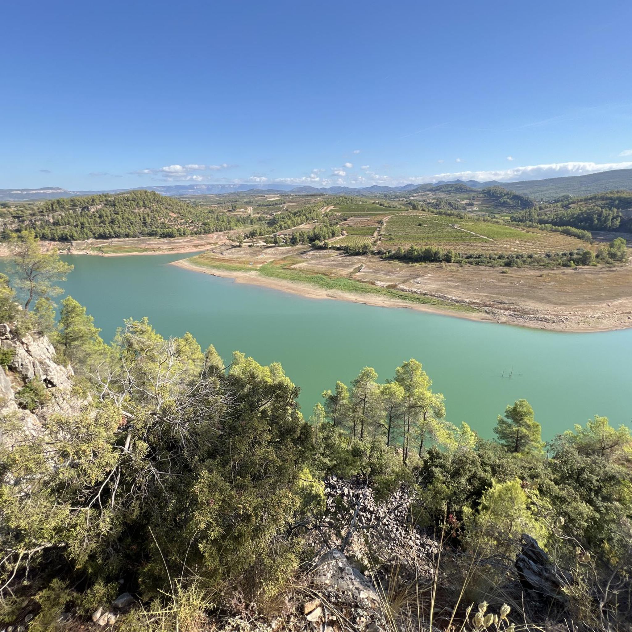
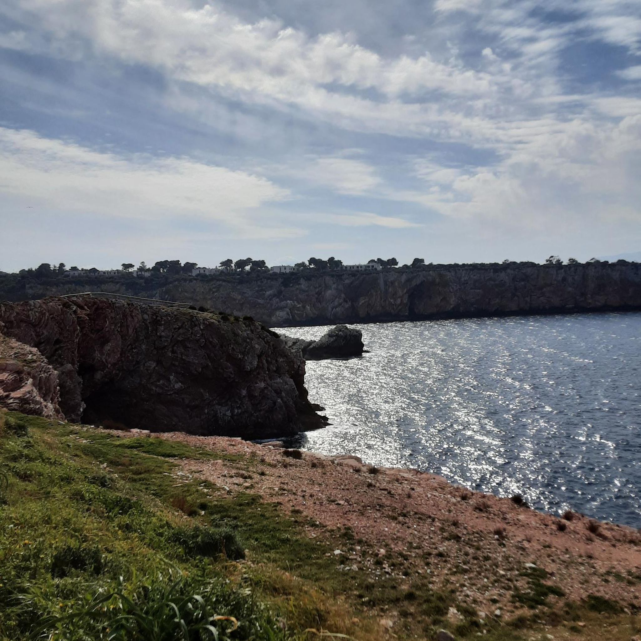
There are lovely views of the reservoir from the road that crosses the village of Els Guiamets. Following the road down to the reservoir leads to the viewpoint.
2
0
Drinking water source in the town of El Masroig.
2
0
The reservoir was built between 1951 and 1971 on the Capçanes stream, in the Ebro River basin. Located in the municipality of Els Guiamets, the dam is used to generate hydroelectric power and to irrigate the surrounding farmland.
3
1

The charm of Llaberia lies in its medieval physiognomy that remains intact. It is the smallest and highest town in the municipality of Tivissa, located at 680 m. above sea level. The beautiful town, an aggregate of Tivissa, was practically abandoned but is currently well recovered. Walking through the town we pass the "Museu del Bast", by Emili Boada and dedicated to Benvinguda Riba Pallejà. Unfortunately, the museum was closed a few years ago and its pieces given to the "La Masia de Castelló" Foundation, despite the fact that many were donations from the people of Llaberia. The alley next to it, called "El Pontet", which descends in an arcade beyond, leads to the Font de la Verge with the washing machines of the villa. This name is due to the fact that in the past there was a chapel with an image of the Virgin. We continue to contemplate beautiful texts that decorate the walls of some houses, like this one: "... Llaveria sucks the spirit of the mountain that beats alive in the sour charm of its streets..." by Josep Iglésies and we pass to near the Romanesque church of Sant Joan Degollat, from the 12th or 13th century. The church was transformed into a place of defense and among many details, inside there is a silo to store grain, it has a double roof with a wall with loopholes and matacán covered over the door. Today the church is one of the most emblematic late Romanesque elements of southern Catalonia. For your visit you must contact the Fundació Esforç de Tivissa (tel: 977 41 73 18). To finish this short review, let me tell you that the name of the place probably comes from the Arabic "Al-Abbarî", which we would translate as "De la Travessa", being the point that had to be "crossed" to go from Camp de Tarragona to the Ebro.
2
1
Frequently Asked Questions
How many hiking trails are available around Pantà dels Guiamets?
There are over 80 hiking trails in the Pantà dels Guiamets area, offering a wide range of options for different skill levels and preferences. You'll find everything from easy strolls to more challenging routes.
What kind of terrain can I expect on hikes around Pantà dels Guiamets?
The terrain around Pantà dels Guiamets is quite varied. You can expect a mix of tranquil paths, some paved sections, and trails that wind through ravines and past small dams. The region is known for its Mediterranean landscape, so you might encounter diverse flora, and potentially vineyards or olive groves on longer routes.
Are there any easy hiking trails suitable for beginners or families?
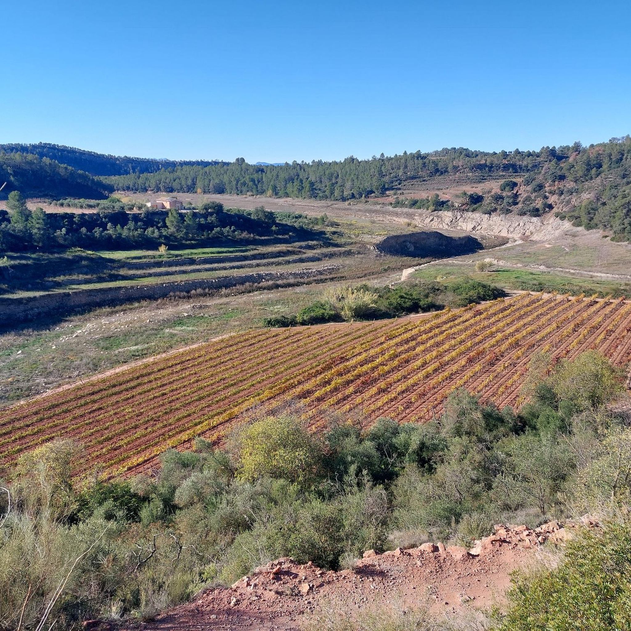
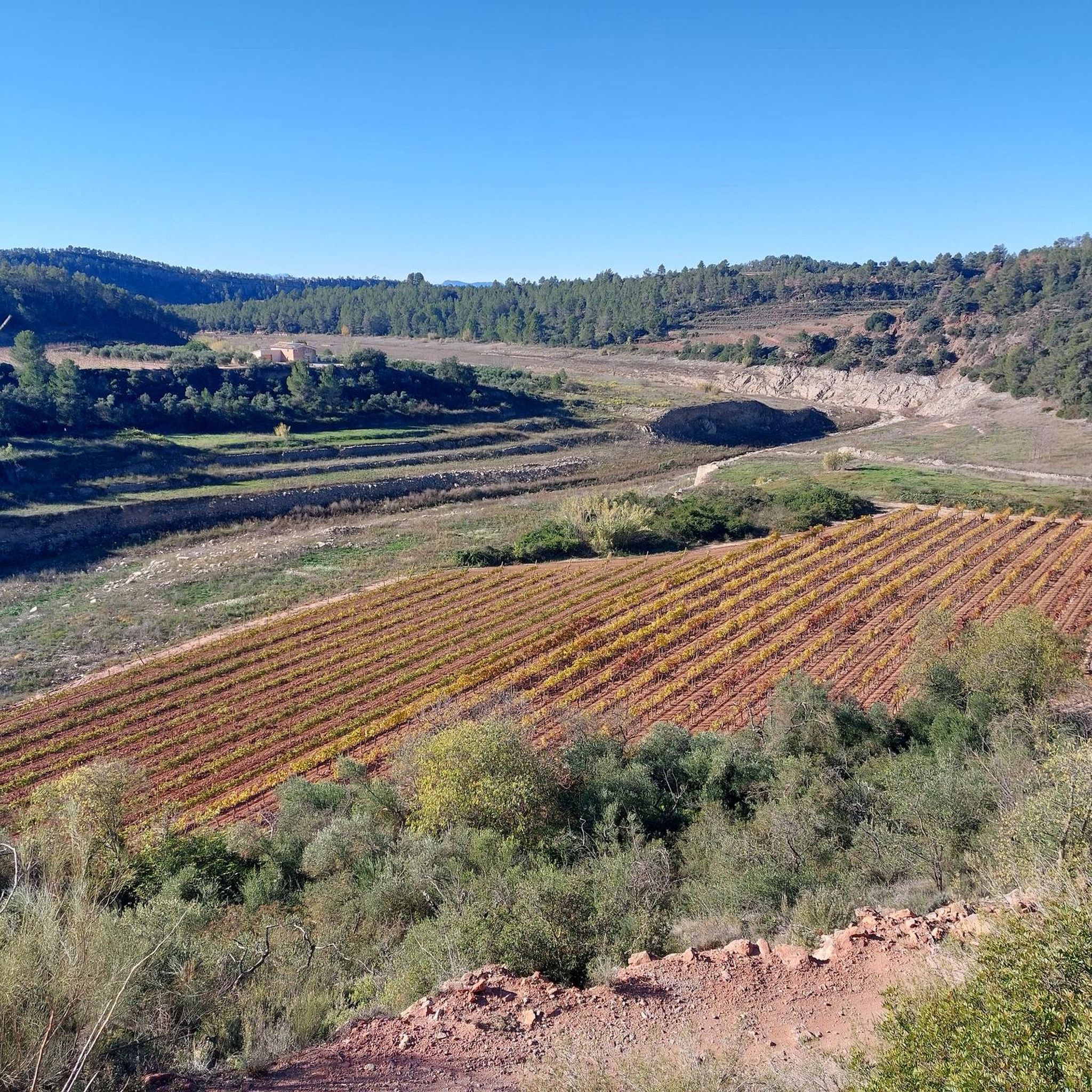
Yes, Pantà dels Guiamets offers several easy hiking trails. For example, the View of the Vineyards – Masroig Spring loop from el Masroig is an easy 3.0-mile (4.9 km) trail that takes about 1 hour 22 minutes to complete, leading through scenic vineyard views and natural springs.
What natural features or landmarks can I see while hiking?
The Pantà dels Guiamets reservoir itself is a central scenic feature, providing picturesque waterscapes. The area is also excellent for birdwatching, with species like grey herons, egrets, cormorants, and mallards often observed. Trails often connect nearby villages like Capçanes, La Serra d´Almós, and Els Guiamets, offering cultural points of interest alongside natural beauty.
Are there any circular hiking routes in the area?
Yes, many routes around Pantà dels Guiamets are designed as loops. An example is the Masroig Spring – View of the Vineyards loop from el Masroig, which is a moderate 13.5 km (8.4 miles) trail that offers a circular experience through the landscape.
What is the best time of year to go hiking in Pantà dels Guiamets?
The Mediterranean climate of the Priorat region generally makes hiking enjoyable for much of the year. Spring and autumn are often ideal, offering milder temperatures and vibrant natural colors. Summers can be hot, so early morning or late afternoon hikes are recommended, while winters are generally mild.
Is there parking available near the hiking trails?
While specific parking details for every trailhead are best checked on individual route pages, the area around Pantà dels Guiamets is generally accessible. There is an equipped recreational area near the reservoir which often provides amenities, including parking, making it a convenient starting point for many hikes.
What do other hikers say about the trails in Pantà dels Guiamets?
The routes in Pantà dels Guiamets are highly rated by the komoot community, with an average score of 4.4 stars from over 180 reviews. Hikers often praise the serene reservoir views, the diverse Mediterranean scenery, and the tranquil paths that traverse varied terrain.
Are there any challenging hikes for experienced hikers?
Yes, for experienced hikers seeking a challenge, the Font de Llaberia – Llaberia Village loop from Capçanes is a difficult 10.8-mile (17.5 km) path. This challenging trail includes significant elevation changes, ascending over 540 meters.
Are there any amenities or places to rest near the trails?
Yes, near the reservoir, there is an equipped recreational area. This spot offers amenities such as tables, shaded areas under pine trees, barbecues, and restrooms, making it a suitable place for breaks, picnics, or family outings before or after a hike.
Can I combine hiking with other activities at Pantà dels Guiamets?
Absolutely! For those looking to combine hiking with other activities, kayaking is also available at the reservoir. Services like Servikayak offer rentals, allowing you to enjoy the waterscapes from a different perspective.
How long do hikes around Pantà dels Guiamets typically take?
Hike durations vary significantly depending on the route's length and difficulty. For instance, an easy trail like the View of the Vineyards – Masroig Spring loop from el Masroig can be completed in about 1 hour 22 minutes, while a moderate route like Museu de la imprenta antiga – Main Street of Marçà loop from Capçanes takes around 3 hours 10 minutes.
Most popular routes around Pantà dels Guiamets

Get inspired with the komoot mobile app


Explore more
Browse the best Hikes in other regions.
