The best walks and hikes around Tullyogallaghan
4.4
(68)
559
hikers
18
hikes
Hiking around Tullyogallaghan offers access to a diverse landscape within County Armagh, Northern Ireland. The region is characterized by rolling countryside, drumlin hills, and tranquil loughs, providing a serene setting for outdoor activities. While the townland itself is small, its proximity to significant natural features like the Ring of Gullion and Slieve Gullion expands the hiking opportunities. This area features a mix of gentle paths and more challenging ascents through varied terrain.
Best hiking trails around Tullyogallaghan
- The most popular…
Last updated: June 27, 2026
2
hikers
9.79km
03:02
340m
340m
Hike the moderate 6.1-mile Camlough Mountain & Lake loop for panoramic views and diverse terrain in the Ring of Gullion AONB.
4
hikers
8.64km
02:44
330m
330m
Hike Camlough Mountain from Camlough for moderate terrain, panoramic views, and a unique geological experience in the Ring of Gullion.

Sign up for free
13.0km
03:30
160m
160m
Moderate hike. Good fitness required. Easily-accessible paths. Suitable for all skill levels.
5.0
(1)
45
hikers
2.76km
01:03
190m
190m
Easy hike. Great for any fitness level. Easily-accessible paths. Suitable for all skill levels.
3.0
(2)
11
hikers
Easy hike. Great for any fitness level. Easily-accessible paths. Suitable for all skill levels.
Get access to more routes and recommendations from other explorers.
Sign up for free
Already have an account?
Our route recommendations are based on thousands of hikes, rides, and runs completed by other people on komoot.
Start today with a free account
Your next adventure awaits.
Login or Signup
Popular around Tullyogallaghan

Tips from the Community

Cycling through the Ring of Gullion, you'll always come across places where you just have to stop. The views up here are special - not spectacular in the usual sense, but rather calming and expansive. I took a short break and let my gaze wander over the wide valley. From the heights you can see the green landscape of Northern Ireland stretching gently into the distance. The quiet hills and scattered farms seem peaceful and remind you that sometimes it's the simple things that make a place special. With the trailer for the kids, it was nice to take a quick breather and enjoy the little break. The routes here offer enough variety so that you can really pedal and then roll comfortably again. Sometimes the wind is a bit stronger, but that's part of it if you want to experience nature to the fullest. A little tip: the viewpoints aren't always immediately visible, but if you have a good feeling for beautiful places, you'll find them all by yourself. A short stop and the moment is yours – and of course the vast landscape that lies at your feet
2
0
As you walk along the road, the vast landscape of the Ring of Gullion opens up before you. On both sides stretches the Cloverhill Golf Course, nestled in the rolling hills at the foot of Mullaghbane Mountain. The well-kept fairways and greens contrast beautifully with the wild nature around them, and you always have clear views of the green expanses framed by the mountain in the distance. It is an interesting sight how the landscaped lawns of the golf course merge with the surrounding nature. The path leads you further through this peaceful scenery, while the backdrop changes with every bend. Here you feel the peace that the golf course radiates, while the surrounding fields and forests give you the feeling of being deep in nature. A relaxing moment on your hike through this varied landscape.
1
0
The Ballykeel Dolmen, also known as the "Witch's Chair", stands alone on the edge of a green river terrace and invites you to take a look back into the past. With its three supporting stones and the imposing capstone, over three metres long, the dolmen looks like a stone sculpture left behind by a long-forgotten culture. The simple but distinctive tripod shape is a testament to the archaic construction that attracted people to this place over 4000 years ago. Excavations around the dolmen have uncovered the remains of a stone mound and Neolithic pottery that tell of the rites and customs of this early community. When you stand among the stones, you feel the mystique of the place - a place that inspires the imagination then and now. Nearby you will find other megalithic structures such as the Portal Tomb of Aughadanove, which together reflect the rich archaeological heritage of the region.
1
0
Camlough Lake is a peaceful place where time seems to pass more slowly. As you stroll along the path, the sparkling water stretches out before you, framed by rolling hills and the shade of the surrounding forests. A few curious goats watch you from a meadow, their gaze almost as interested as yours as you enjoy the view. There is not only nature to experience here, but also small amenities - a car park and a picnic area invite you to take a break. The view of the lake, which once served as a reservoir, is a wonderful way to relax. The lake is also a popular destination for anglers who wait patiently for their catch here. A walk around Camlough Lake is a welcome break that simply does you good.
1
0
Gordon's Lane, just a stone's throw south of Camlough, invites you to a quiet journey of discovery. The narrow lane winds gently through the hills and takes you right into the green of the fields. Old stone walls and thorny hedges line the path on either side, while behind every bend you catch a new view of the valley. From up here, Camlough seems almost like a silent model, spreading out in the distance while nature maintains its own rhythm. The path leads you past pastures and you notice how the noise of everyday life quietly fades away. Especially after a rain shower, the asphalt sparkles and the fresh scent of grass is in the air - a little adventure off the beaten track.
1
0
As soon as you cross the gentle ridge of Slieve Gullion, the North Cairn stretches out before you - a slightly smaller hill than its southern neighbour, but no less impressive. The stones that gather here seem like silent sentinels, witnesses of the distant Bronze Age. Two ancient stone boxes were once found here during excavations, which lay hidden in the depths of history. The North Cairn, with its diameter of around 18 metres, invites you to pause for a moment and enjoy the peace. But it is not just the Cairn that is fascinating. Right next to it lies "Calliagh Beara's Lough", a quiet mountain lake that, according to legend, is the home of the witch Beara. On a clear day, the sky is reflected in the calm waters and you can almost feel the ancient magic of this place coming to life. The road here may be rocky, but the landscape rewards with sweeping views and a touch of mysticism that makes Slieve Gullion something special.
1
0

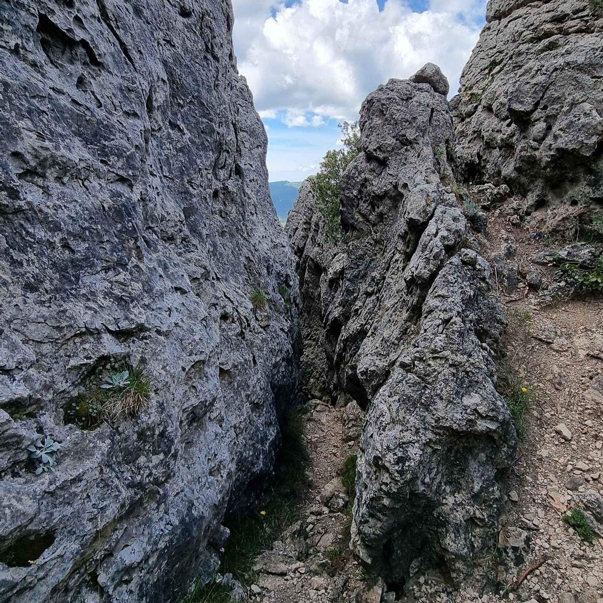
Enjoy the many view points to stop and take in the landscape
2
0

Frequently Asked Questions
What types of hiking trails can I expect around Tullyogallaghan?
The hiking trails around Tullyogallaghan, situated within County Armagh, offer a diverse landscape. You'll find a mix of rolling countryside, drumlin hills, and unique volcanic terrain, particularly within the nearby Ring of Gullion. There are options for both gentle strolls and more challenging moderate ascents, with a total of 18 routes available, including 10 easy and 8 moderate trails.
Are there any easy, family-friendly walks near Tullyogallaghan?
Yes, County Armagh offers several family-friendly options. While specific trails within Tullyogallaghan itself might be more moderate, nearby Gosford Forest Park provides multiple trails, including a 3-mile circular route suitable for all skill levels. The Craigavon Lakes Circular Walk is another flat and accessible 3.3-mile loop, ideal for leisurely strolls with family.
Can I bring my dog on the hiking trails around Tullyogallaghan?
Many outdoor areas in County Armagh are dog-friendly, but it's always best to check specific park or trail regulations. Generally, dogs are welcome on trails if kept on a leash, especially in nature-sensitive areas or where livestock may be present. For example, Gosford Forest Park is a popular spot where dogs are permitted.
Are there any circular hiking routes in the area?
Yes, there are several circular routes. A notable one is the Camlough Mountain & Lake loop, which is 6.1 miles (9.8 km) long and offers views of Camlough Lake. Another option is the Slieve Gullion Summit loop from Ring of Gullion AONB, an easy 2.7 km route.
What are some notable natural features or viewpoints I can see while hiking?
The region is rich in natural beauty. You can experience the tranquil Camlough Lake, or explore the unique volcanic landscape of the Ring of Gullion. For panoramic views, consider a hike up Slieve Gullion Summit, which offers sweeping vistas of the surrounding hills and distant Mourne Mountains on clear days. The North Cairn of Slieve Gullion and Calliagh Beara's Lough is another significant natural landmark.
What is the best time of year to go hiking in Tullyogallaghan?
Hiking around Tullyogallaghan and County Armagh is enjoyable throughout much of the year. Spring (April-May) is particularly beautiful, especially in places like Clare Glen, when bluebells carpet the forest floor. Summer (June-August) offers longer daylight hours and generally warmer weather. Autumn (September-October) brings vibrant fall colors to the woodlands. Winter hiking is possible but requires appropriate gear for potentially colder and wetter conditions.
Are there any challenging hikes for experienced hikers?
While there are no 'difficult' graded routes directly listed, several moderate trails offer a good challenge. The Camlough Mountain from Camlough trail involves a direct ascent to the mountain, providing significant elevation gain and expansive views. The Ring of Gullion also features more rugged terrain for those seeking a more invigorating experience.
What do other hikers enjoy most about hiking in Tullyogallaghan?
The area is highly rated by the komoot community, with an average score of 4.4 stars from over 60 reviews. Hikers often praise the serene setting, the diverse landscapes ranging from rolling hills to volcanic terrain, and the rewarding views from higher elevations, particularly around Camlough Mountain and Slieve Gullion.
Are there any historical or cultural landmarks to explore near the trails?
Yes, the region has a rich history. The Ring of Gullion, for instance, is not only a unique geological landform but also steeped in mythology. You can also find sites linked to St. Patrick along segments of the Saint Patrick's Way, a long-distance trail that passes through County Armagh. The Giant's Lair and The Witch Sculpture are also points of interest.
Is public transport available to reach hiking areas around Tullyogallaghan?
While Tullyogallaghan itself is a small townland, public transport options in County Armagh can connect you to larger towns and some trailheads. However, for direct access to many of the more remote hiking areas and natural parks, having a car is often more convenient. It's advisable to check local bus schedules for specific routes to areas like Gosford Forest Park or towns near the Ring of Gullion.
Where can I find parking for hiking trails?
Parking is generally available at popular trailheads and visitor centers for larger parks like Gosford Forest Park and within the Ring of Gullion Area of Outstanding Natural Beauty. For specific routes, it's recommended to check the route details on komoot, as many tours include information about starting points and available parking facilities.
Are there any places to eat or get refreshments near the hiking routes?
While Tullyogallaghan is rural, you'll find cafes, pubs, and other amenities in nearby towns and villages within County Armagh. Larger visitor centers, such as those at Gosford Forest Park or within the Ring of Gullion, may also offer refreshment options. Planning your hike to start or end near these towns is a good way to ensure access to food and drink.
Most popular routes around Tullyogallaghan
Most popular attractions around Tullyogallaghan

Get inspired with the komoot mobile app


Explore more
Browse the best Hikes in other regions.
