The best cycling routes around Magheralamfield
17
riders
8
rides
Touring cycling around Magheralamfield, a townland in County Tyrone, Northern Ireland, offers routes through a landscape characterized by rolling countryside and views towards Lough Neagh. The area features historic sites such as Mountjoy Castle, perched on a hill, providing points of interest for cyclists. While specific dedicated cycling infrastructure within the townland is limited, its location within County Tyrone provides access to a broader network of trails, including forest parks and river paths. The terrain generally consists of gentle ascents…
Last updated: November 11, 2026
2
riders
55.5km
03:13
250m
250m
Moderate bike ride. Good fitness required. Mostly paved surfaces.
3
riders
51.4km
03:01
310m
310m
Moderate bike ride. Good fitness required. Mostly paved surfaces.

2
riders
13.7km
00:48
70m
70m
Easy bike ride. Mostly paved surfaces.
2
riders
14.0km
00:52
130m
130m
Easy bike ride. Mostly paved surfaces.
2
riders
58.3km
03:28
370m
370m
Moderate bike ride. Good fitness required. Mostly paved surfaces.
Get access to more routes and recommendations from other explorers.
Already have an account?
Our route recommendations are based on thousands of hikes, rides, and runs completed by other people on komoot.
Start today with a free account
Your next adventure awaits.
Popular around Magheralamfield
Tips from the Community

For cyclists following the 'Lough Neagh Cycle Way' (National Cycle Route 94), the Maghery footbridge is an iconic resting point and an essential link. This elegant, modern bridge spans the mouth of the Upper Bann as it enters the lough.
8
0
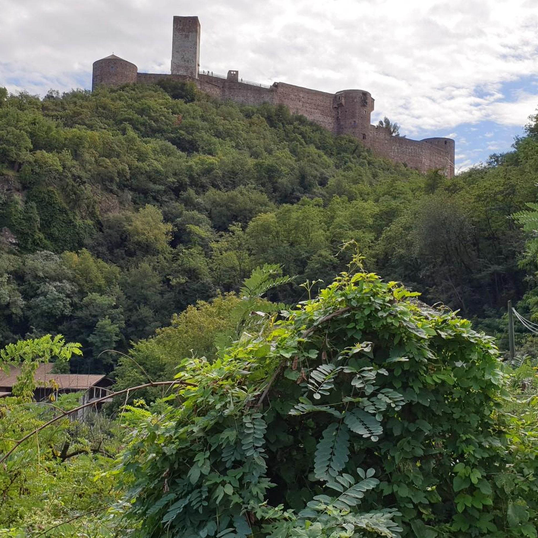
On the banks of Lough Neagh, near the village of Brockagh, you will find the impressive ruin of Mountjoy Castle. This castle was built between 1602 and 1605 by Lord Mountjoy and served at the time as a crucial military stronghold during the turbulent years of the Nine Years' War. Unique is the special combination of building materials: the lower floor is constructed from rough natural stone, while the upper floor consists of locally fired red brick. Although the castle has been a ruin since 1648, the central block and the characteristic arrow-shaped corner towers are still clearly recognizable in the landscape.
8
0

The Maghery Footbridge on the edge of Lough Neagh offers a small moment of peace in the midst of the expansive landscape. As you cross the bridge, your gaze glides over the gentle waters of the largest lake in the British Isles. In good weather, the clouds are impressively reflected on the surface of the water, making the scene look almost like a painting. Even when the sky is cloudy, the lake has a special atmosphere that invites you to linger rather than to quickly pass by. The paths around the bridge are mostly flat, but you should be prepared for occasional sections with unpaved surfaces. This could be a bit slippery, especially in wet weather, but this is not a problem. The connection to the National Cycle Network, Route 94, also offers you many other opportunities to explore the area. A little tip: Maghery itself does not have much to offer apart from the bridge, but a short detour to the nearby Oxford Island nature reserve is definitely worth it. This means you can easily combine a visit to the bridge with a larger circular tour.
4
0
From the shore at Maghery, the view falls directly on Coney Island, which lies quietly in Lough Neagh. The rough waters of the lake, which are constantly in motion, create a special atmosphere that alternates between calm and turmoil. The cool breeze carries the scent of the wild vegetation on the shore, while the sound of the waves sets the tone for the moment. Coney Island itself seems almost untouched, a small spot in the vastness of the lake that seems to tell stories of times gone by. It may be tempting to imagine what it would be like to row there and explore the island. But from here it remains a place of longing in the distance - close enough to arouse curiosity, but far enough to keep a certain mystery. The view is impressive, but on stormy days you realize that nature can be rough here. Perhaps not the ideal place for a long rest, but a place that is worth a moment's pause before continuing on the path.
1
0
In the shadow of Northern Ireland's vast skies, the mysterious Mountjoy Castle rises on a hill above Lough Neagh. This ruined castle, whose Irish name "Caisleán Mhuinseo" whispers into the wind, stands like a proud sentinel in the village of Mountjoy, County Tyrone. The castle was built in 1602 by order of Charles Blount, 1st Earl of Devonshire and 8th Baron Mountjoy. But times have not always been kind to this building: as early as 1643, a devastating fire left scars on the walls of the castle. What remained is a two-story brick building with the ground floor clad in stone. The architecture speaks of a time of defense and vigilance - a central rectangular block protected by four spear-shaped towers, crisscrossed by embrasures. The north-western tower testifies to the fragility of time - partially collapsed, while the western curtain wall has lost its presence. The entrance, once on the south side of the eastern curtain wall, seems to whisper stories of days gone by, while wide windows on the upper floor capture the eyes of visitors. Unfortunately, an extension at the back keeps some of the castle's secrets hidden, and the interior area is closed to visitors' eyes. But even in its ruined state, Mountjoy Castle embodies the soul and history of Northern Ireland. Not only is it a State Care Historic Monument in the townland of Magheralamfield in the Mid Ulster District, but it is also a silent testament to time, inviting every walker to pause for a moment and listen to the whispers of history.
4
0


Small bridge with great views of Lough Neagh - the largest body of freshwater in all Ireland and in the UK.
4
0

From here you have a view of Coney Island.
3
0
Frequently Asked Questions
How many touring cycling routes are available around Magheralamfield?
There are 9 touring cycling routes available around Magheralamfield on komoot. These routes cater to various skill levels, with 3 easy routes and 6 moderate routes, ensuring options for different touring cycling experiences.
What kind of terrain can I expect on touring cycling routes in Magheralamfield?
The terrain around Magheralamfield is characterized by rolling countryside with gentle ascents and descents. You'll find routes that offer views towards Lough Neagh and pass through historic sites. While dedicated cycling infrastructure within the townland is limited, the broader County Tyrone area provides access to a network of trails, including forest parks and river paths.
Are there any easy touring cycling routes suitable for beginners or families?
Yes, there are several easy touring cycling routes. For a relatively flat and shorter ride, consider the Coalisland Canal loop from Brackaville, which is 21.4 km long. Another easy option is the Bike loop from Clonmore, which is just under 14 km.
What historical sites or landmarks can I see while cycling in the area?
Magheralamfield is home to the ruins of Mountjoy Castle, a 17th-century fortification overlooking Lough Neagh, which you can explore. You can find more information about it here: Mountjoy Castle. Other notable historical sites nearby include the Ardboe High Cross.
Are there any routes that offer views of Lough Neagh?
Yes, many touring cycling routes in the Magheralamfield area offer views of Lough Neagh, the largest lake in the British Isles. The region's landscape is defined by its proximity to the Lough, providing expansive water views and serene scenery. You can also visit the Maghery Footbridge at Lough Neagh or enjoy the View of Coney Island from Maghery.
What are some of the longer or more challenging touring cycling routes?
For those seeking a longer ride with varied terrain, the Great Downhill – Long Climb loop from Brackaville is a moderate 60.2 km route featuring both downhill sections and sustained climbs. Another substantial option is the Long Climb – Great Downhill loop from Brackaville, which covers 51.4 km.
What do other touring cyclists enjoy about cycling in Magheralamfield?
Touring cyclists often appreciate the blend of natural beauty and historical intrigue in the Magheralamfield area. The routes offer a chance to explore the rolling countryside, enjoy views of Lough Neagh, and discover sites like Mountjoy Castle. The variety of routes, from easy canal paths to more challenging loops, is also a highlight for many.
Can I find circular touring cycling routes in Magheralamfield?
Yes, all the touring cycling routes listed for Magheralamfield are circular loops, allowing you to start and end your ride at the same point. Examples include the Killymoon Castle loop from Brackaville and the Coalisland Canal loop from Brackaville.
Are there any picnic spots or viewpoints along the routes?
Yes, you can find scenic spots to rest and enjoy the views. The Bannfoot Picnic Area is a great option for a break. Additionally, the Maghery Footbridge at Lough Neagh offers excellent viewpoints over the lake.
What is the best time of year for touring cycling in Magheralamfield?
The spring and summer months generally offer the most pleasant conditions for touring cycling in Magheralamfield, with milder weather and longer daylight hours. However, the atmosphere around Lough Neagh changes with the seasons, offering dynamic scenery year-round, from sparkling waters on clear days to mystical views under cloudy skies.
Is Magheralamfield well-connected by public transport for cyclists?
While Magheralamfield itself is a townland, its location within County Tyrone means that access to public transport for cyclists might require some planning. It's advisable to check local bus services or train connections to nearby larger towns in County Tyrone and plan your route accordingly, considering bike carriage policies.
Are there any specific routes that are particularly popular among local touring cyclists?
Among local touring cyclists, the Killymoon Castle loop from Brackaville is a popular choice. It's a moderate 47.8 km route that takes you through the local countryside and is frequently completed by the komoot community.
Most popular routes around Magheralamfield
Most popular attractions around Magheralamfield

Get inspired with the komoot mobile app


Explore more
Browse the best Cycling routes in other regions.
