The best walks and hikes around Lake Valvestino
4.5
(10437)
42,767
hikers
409
hikes
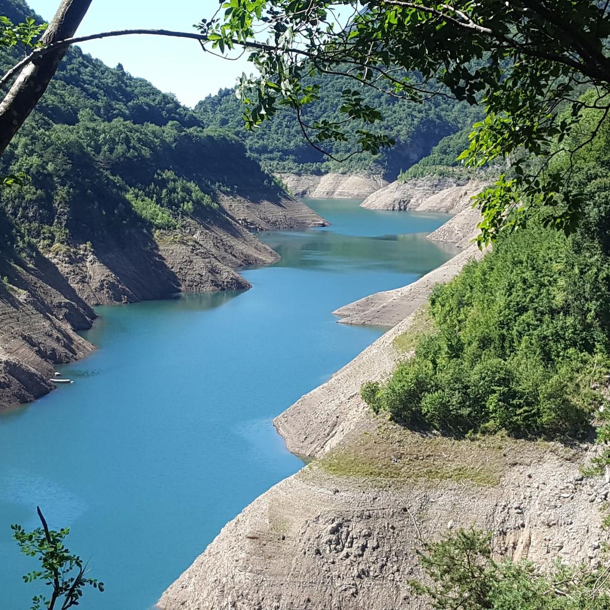
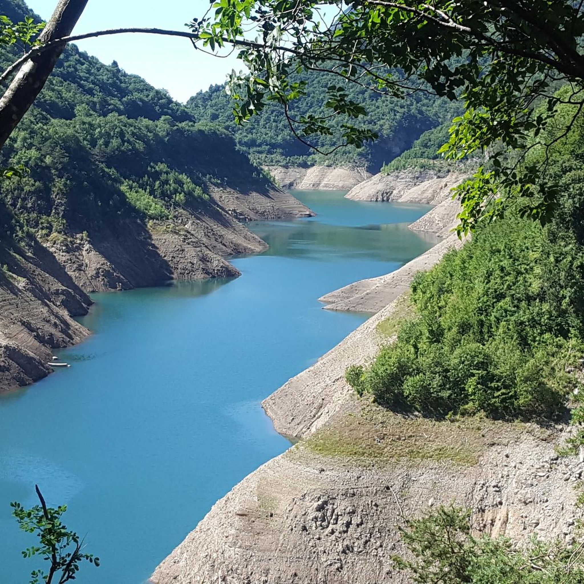
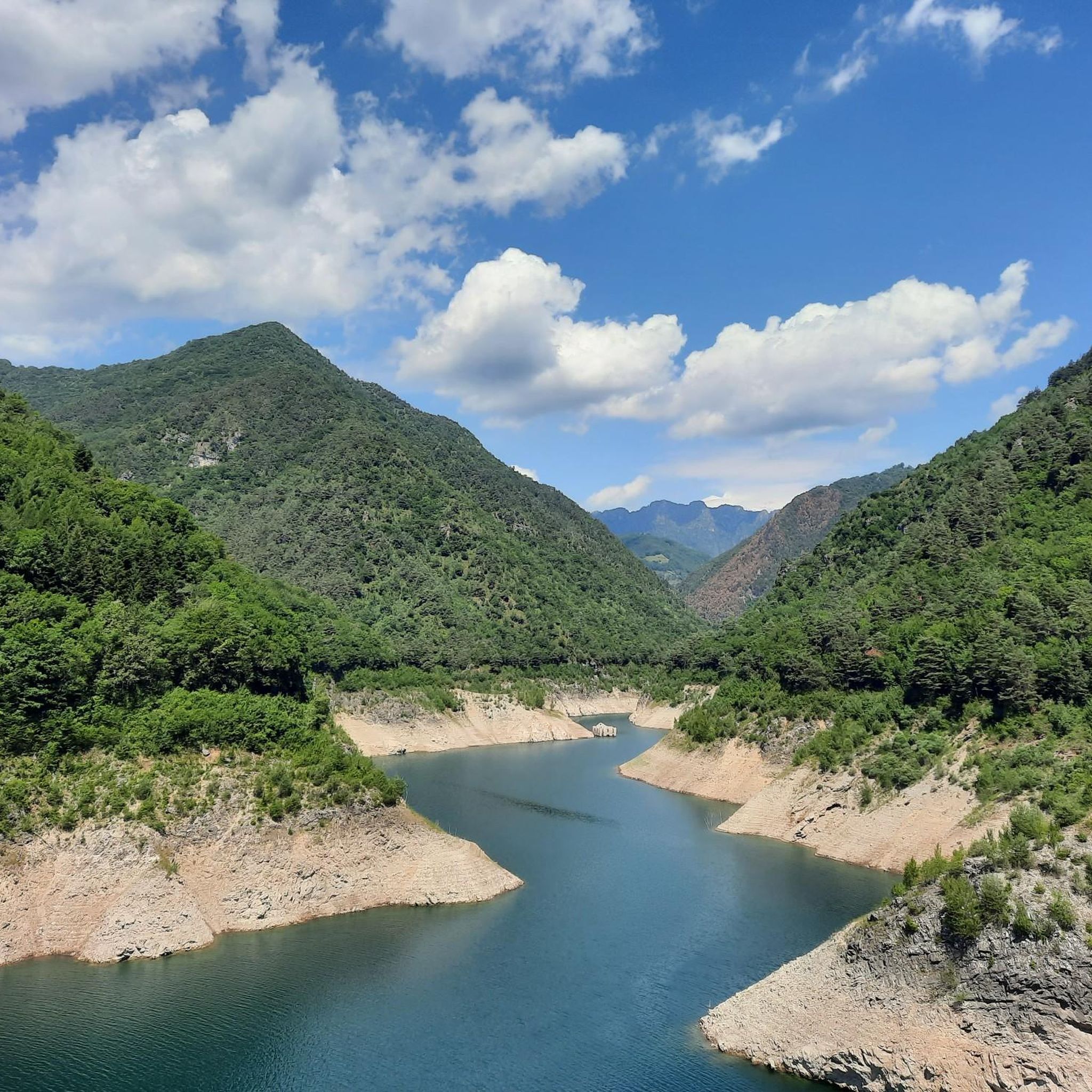
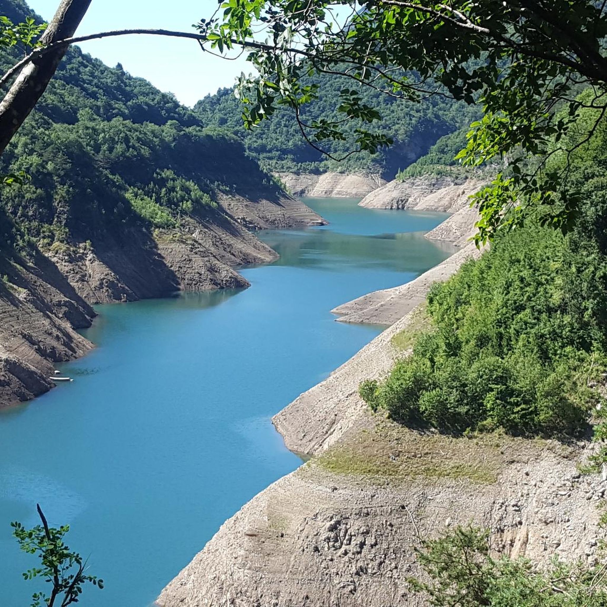
Hiking around Lake Valvestino, situated within the Alto Garda Bresciano natural park, offers diverse landscapes for outdoor enthusiasts. The region features a fjord-like lake surrounded by mountains, with the Val di Vesta wilderness area contributing ravines and waterfalls. Trails traverse woods, beech forests, and lush meadows, providing varied terrain for exploration. The area also includes historical villages and remnants of World War I fortifications.
Best hiking trails around Lake Valvestino
- The most popular hiking route is Lago di Valvestino to Bocca Paolone Trail, a 7.3 miles (11.7 km) trail that takes 3 hours 47 minutes to complete. This moderate path offers views of the lake and surrounding hills.
- Another top favourite among local hikers is Bocca Magno - Passo Fobbia Trail, a moderate 8.2 miles (13.2 km) path. This route navigates through forested areas and offers elevation changes.
- Local hikers also love the Pineta del Pavarì loop from Valvestino, a 8.7 miles (14.0 km) trail leading through dense pine forests, often completed in about 5 hours 18 minutes.
- Hiking around Lake Valvestino is defined by its fjord-like lake, wild Val di Vesta wilderness, and historical villages. The network offers options for various ability levels, from easy walks to more challenging ascents.
- The routes in Lake Valvestino are highly rated by the komoot community with an average score of 4.5 stars from over 8,700 reviews. More than 37,000 hikers have used komoot to explore Lake Valvestino's varied terrain.
Last updated: August 19, 2026
4.1
(17)
61
hikers
11.7km
03:47
480m
480m
Forest trail through Parco Alto Garda with turquoise lake glimpses and a rock-built church.
4.7
(10)
17
hikers
10.2km
03:24
370m
360m
Moderate hike. Good fitness required. Mostly accessible paths. Sure-footedness required.

Sign up for free
8
hikers
4.37km
01:13
80m
80m
Easy hike. Great for any fitness level. Easily-accessible paths. Suitable for all skill levels.
4.0
(1)
7
hikers
19.4km
06:11
680m
680m
Hard hike. Very good fitness required. Mostly accessible paths. Sure-footedness required.
13.2km
04:13
570m
570m
Hike the moderate Bocca Magno - Passo Fobbia Trail, covering 8.2 miles (13.2 km) with 1858 feet (566 metres) of elevation gain.
Get access to more routes and recommendations from other explorers.
Sign up for free
Already have an account?
Our route recommendations are based on thousands of hikes, rides, and runs completed by other people on komoot.
Start today with a free account
Your next adventure awaits.
Login or Signup

Tips from the Community


The Droanello is a semi-hidden side stream that flows into the incomparably beautiful Lake Valvestino.
0
0

A crossing point for racing bikes and a starting point for gravel and mountain bikes for the Droanello Valley. Worth a visit.
0
0

A dream in turquoise. You hardly have time to drive because an even more beautiful view keeps opening up.
0
0
Beautiful dirt road also feasible with Gravel.
0
0
Beautiful forest road that descends from Costa towards Lake Valvestino. From the road there are remarkable views of the fjords of the lake. The road is at the base of the famous Legnach forest.
0
0

Access to the stream from the path along the valley
0
0

Along the beautiful MTB trails you can enjoy the beautiful view of the reservoir. The trail is great to drive.
0
0
Frequently Asked Questions
How many hiking trails are available around Lake Valvestino?
There are over 400 hiking routes around Lake Valvestino, catering to various skill levels. This includes more than 110 easy trails, over 170 moderate paths, and around 120 difficult routes for experienced hikers.
What kind of terrain can I expect when hiking in the Lake Valvestino area?
The Lake Valvestino region, part of the Alto Garda Bresciano natural park, offers incredibly diverse terrain. You'll find trails winding through dense woods, serene beech forests, and lush meadows. The landscape is characterized by its fjord-like lake, surrounded by towering cliffs and mountains, with the wild Val di Vesta wilderness area featuring ravines and occasional waterfalls.
Are there any family-friendly hiking options around Lake Valvestino?
Yes, Lake Valvestino offers several family-friendly options. Many easy walks traverse forests and follow streams, providing gentle paths suitable for all ages. For example, the Droanello Stream – Small Spring loop from Bollone is an easy route that allows families to enjoy the natural beauty without significant elevation changes.
What historical sites or landmarks can I discover while hiking near Lake Valvestino?
The area is rich in history. Hiking routes often connect charming historic villages like Turano, Armo, Persone, and Moerna. You can also find remnants of World War I fortifications, including old military deposits carved into rock, trenches, and artillery pitches on mountains like Monte Tombea and Monte Caplone. A unique sight is the Submerged Ruins of Lake Valvestino, which are visible when lake levels are low, revealing the historical Lignago Customs House.
Are there any circular hiking routes around Lake Valvestino?
Yes, there are many circular routes available. These allow you to start and end your hike in the same location, often passing through diverse landscapes and villages. An example of a challenging circular route is the Pineta del Pavarì loop from Valvestino, which takes you through dense pine forests.
What do other hikers enjoy most about the trails in Lake Valvestino?
The trails around Lake Valvestino are highly rated by the komoot community, with an average score of 4.5 stars from over 8,700 reviews. Hikers often praise the region's unspoiled beauty, the stunning fjord-like views of the lake, and the variety of terrain that caters to different fitness levels. Many appreciate the blend of natural landscapes with historical elements.
Can I hike with my dog around Lake Valvestino?
While specific dog-friendly trails with water access rules are not explicitly detailed, the natural environment of Lake Valvestino and the Val di Vesta wilderness generally welcomes dogs. It's always advisable to keep dogs on a leash, especially in protected areas like the Alto Garda Bresciano natural park, and to respect local regulations regarding wildlife and livestock. Ensure your dog has access to water, particularly on longer routes.
Are there any notable natural features or viewpoints along the hiking trails?
Absolutely. The region is famous for its fjord-like lake, with deep inlets and towering cliffs. The Val di Vesta wilderness area offers ravines and occasional waterfalls. You can also find breathtaking views from various points, such as those along the Lago di Valvestino to Bocca Paolone Trail, which provides expansive vistas of the lake and surrounding hills. The Ponte Cola Dam itself is an impressive man-made structure offering unique perspectives of the lake.
What is the best time of year to go hiking in Lake Valvestino?
The diverse landscapes of Lake Valvestino make it suitable for hiking across multiple seasons. Spring and autumn offer pleasant temperatures and vibrant colors, with lush greenery in spring and stunning foliage in autumn. Summer is also popular, though trails can be busier. While winter hiking is possible, some higher-altitude trails may be affected by snow and ice, so checking local conditions is recommended.
Are there opportunities to explore charming villages or cultural sites during a hike?
Yes, many hiking routes are designed to pass through or near the region's charming historic villages. You can explore places like Turano, Armo, Persone, and Moerna, experiencing local culture and history. The village of Cima Rest is particularly notable for its characteristic barns with steep straw roofs, a unique example of Austro-Hungarian rural tradition, and is home to the Valvestino Ecomuseum. For more information on the villages, you can visit Valvestino and its villages.
Where can I find parking for hiking trails around Lake Valvestino?
Parking is generally available in or near the villages surrounding Lake Valvestino, such as Turano, Armo, Persone, Moerna, and Bollone, which serve as common starting points for many trails. Specific parking details for individual trailheads are often provided on komoot tour pages, so it's best to check the details for your chosen route.
Most popular routes around Lake Valvestino
Most popular attractions around Lake Valvestino

Get inspired with the komoot mobile app


Explore more
Browse the best Hikes in other regions.
