The best cycling routes around Creevagh Lower
34
riders
14
rides
Touring cycling routes around Creevagh Lower offer access to a diverse landscape in County Tyrone, Northern Ireland. The region features varied terrain, including well-paved roads and some unpaved segments, suitable for different cycling preferences. While Creevagh Lower itself is a small area, its surroundings include rolling hills and proximity to natural features like Lough Neagh and the Sperrins mountain range. This geographical placement provides a mix of easy road rides and more demanding routes with significant elevation gain.
Best touring…
Last updated: June 27, 2026
15.8km
00:59
140m
140m
Easy bike ride. Great for any fitness level. Mostly paved surfaces. Suitable for all skill levels.
4
riders
76.2km
04:30
510m
510m
Hard bike ride. Very good fitness required. Mostly paved surfaces. Suitable for all skill levels.

Sign up for free
4
riders
47.8km
02:54
380m
380m
Moderate bike ride. Good fitness required. Mostly paved surfaces. Suitable for all skill levels.
2
riders
58.5km
03:31
440m
440m
Moderate bike ride. Good fitness required. Mostly paved surfaces. Suitable for all skill levels.
3
riders
55.5km
03:13
250m
250m
Moderate bike ride. Good fitness required. Mostly paved surfaces. Suitable for all skill levels.
Get access to more routes and recommendations from other explorers.
Sign up for free
Already have an account?
Our route recommendations are based on thousands of hikes, rides, and runs completed by other people on komoot.
Start today with a free account
Your next adventure awaits.
Login or Signup
Popular around Creevagh Lower

Tips from the Community

For cyclists following the 'Lough Neagh Cycle Way' (National Cycle Route 94), the Maghery footbridge is an iconic resting point and an essential link. This elegant, modern bridge spans the mouth of the Upper Bann as it enters the lough.
8
0

The Maghery Footbridge on the edge of Lough Neagh offers a small moment of peace in the midst of the expansive landscape. As you cross the bridge, your gaze glides over the gentle waters of the largest lake in the British Isles. In good weather, the clouds are impressively reflected on the surface of the water, making the scene look almost like a painting. Even when the sky is cloudy, the lake has a special atmosphere that invites you to linger rather than to quickly pass by. The paths around the bridge are mostly flat, but you should be prepared for occasional sections with unpaved surfaces. This could be a bit slippery, especially in wet weather, but this is not a problem. The connection to the National Cycle Network, Route 94, also offers you many other opportunities to explore the area. A little tip: Maghery itself does not have much to offer apart from the bridge, but a short detour to the nearby Oxford Island nature reserve is definitely worth it. This means you can easily combine a visit to the bridge with a larger circular tour.
4
0
The Caledon Beam Engine is an exciting relic from another era that will accompany you on your tour through the Northern Ireland countryside. Nestled in the remains of an old wool mill, the beam engine tells of an era when the pounding and banging of machines shaped everyday life. Today it stands almost forgotten by the roadside and is a reminder of the region's industrial past. The ruin has its own charm - rusty gears, weathered walls and a feeling of time standing still. If you want to pause for a moment to take in the surroundings, this is an ideal place to dismount for a moment. This is not about perfectly restored monuments, but about the raw charm and stories that such places carry. Look out for the old inscriptions and the signs of decay that give the Beam Engine an almost sculptural appearance. This place is a silent witness to a time long gone and offers you a welcome change from the wide fields and winding roads of the region.
1
0
From the shore at Maghery, the view falls directly on Coney Island, which lies quietly in Lough Neagh. The rough waters of the lake, which are constantly in motion, create a special atmosphere that alternates between calm and turmoil. The cool breeze carries the scent of the wild vegetation on the shore, while the sound of the waves sets the tone for the moment. Coney Island itself seems almost untouched, a small spot in the vastness of the lake that seems to tell stories of times gone by. It may be tempting to imagine what it would be like to row there and explore the island. But from here it remains a place of longing in the distance - close enough to arouse curiosity, but far enough to keep a certain mystery. The view is impressive, but on stormy days you realize that nature can be rough here. Perhaps not the ideal place for a long rest, but a place that is worth a moment's pause before continuing on the path.
1
0

The church ruins date from the early 16th century but include stones from a much earlier pre 11th century church. After a new church was built, this one fell into disrepair, but the graveyard remains in use.
0
0
Built in 1802, Killymoon Castle was built to replace a 17th century castle which was destroyed by fire in 1801. James Nash was the designer, who also designed Buckingham Palace in London. Tours are available but must be pre-booked, as is afternoon tea in the castle tea rooms. See the website for more details https://killymooncastle.com/
0
0
Also known as Black Lough, it's unique habitat means it is a great place for bird watching with a number of rare species being seen. You're also likely to spot people course fishing for pike and perch. There are even eels in the water.
0
0
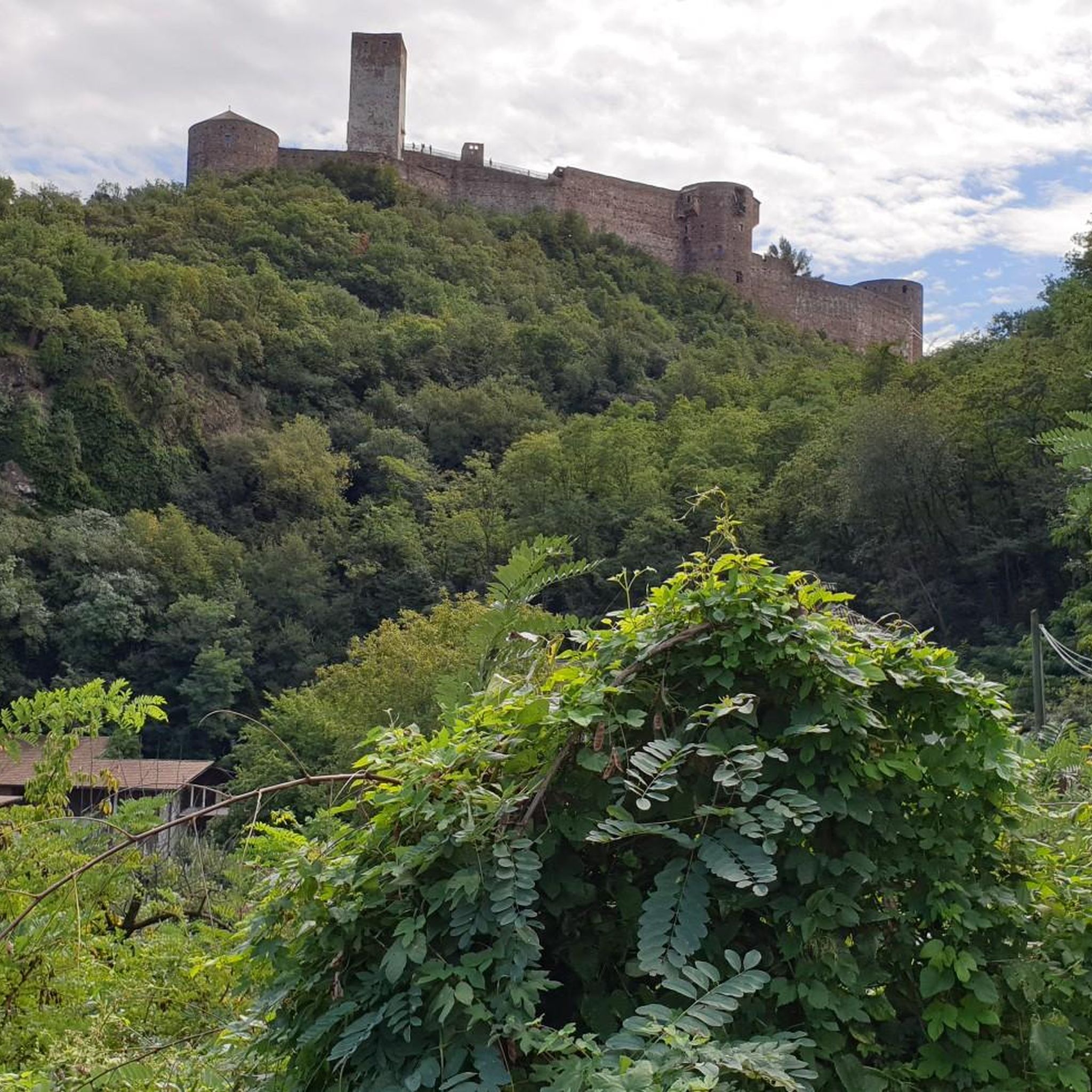
The O'Neills ruled the region for over 400 years and this was their seat of power for over 300. You can enjoy a guided tour and learn more about the history of Ulster and marvel at the views from the top, from where you can see all the way to the Sperrin Mountains, the Mournes and Lough Neagh. A fine view for the O'Neills over their land.
0
0
Frequently Asked Questions
How many touring cycling routes are available around Creevagh Lower?
There are over 15 touring cycling routes documented on komoot for the Creevagh Lower area. These routes cater to various skill levels, including 4 easy, 9 moderate, and 2 difficult options.
Are there any family-friendly touring cycling routes in Creevagh Lower?
Yes, Creevagh Lower offers several family-friendly touring cycling routes. An excellent option is the Castle Caulfield & Ballysaggart Lough loop from Dungannon. This easy 9.8-mile (15.8 km) route takes about an hour to complete and offers a scenic ride around historical ruins and a tranquil lough, perfect for a leisurely family outing.
What kind of landscapes and natural features can I expect to see while cycling in this region?
The region around Creevagh Lower offers a diverse landscape for touring cyclists. You can expect to encounter rolling hills, well-paved roads, and some unpaved segments. The area provides views towards natural features like Lough Neagh and the Sperrins mountain range. The wider region also features significant natural beauty, including the Slieve Gallion NE Top Summit, which offers sensational views.
Are there any circular touring cycling routes available?
Yes, many of the touring cycling routes around Creevagh Lower are designed as loops. For example, the Killymoon Castle loop from Brackaville is a moderate 29.7-mile (47.8 km) circular path that provides a varied cycling experience through the local countryside. Another option is The Mall, Armagh – Ballysaggart Lough loop from Dungannon, which is a 36.3-mile (58.5 km) loop.
What historical sites or landmarks can I explore along the cycling routes?
The touring cycling routes in the Creevagh Lower area offer access to several historical sites and landmarks. You can visit the Castle Caulfield Ruins, an 1800s estate, or the Tullyhogue Fort. The The Mall, Armagh – Ballysaggart Lough loop from Dungannon route, for instance, leads through historic Armagh. Further afield, the iconic Peace Bridge in Derry/Londonderry is a striking structure designed for pedestrians and cyclists.
Are there any viewpoints or scenic spots along the touring cycling routes?
Yes, the region offers several scenic spots and viewpoints. The Dungannon Park Lake is a notable viewpoint. Additionally, the broader area, including the Slieve Gallion NE Top Summit, provides sensational views across the Sperrins mountain range and Lough Neagh, which can be incorporated into more challenging rides.
What is the best time of year to go touring cycling in Creevagh Lower?
The best time to go touring cycling in Creevagh Lower generally aligns with the milder, drier months, typically from late spring through early autumn (May to September). During this period, you'll experience more favorable weather conditions for exploring the varied terrain, from well-paved roads to unpaved segments.
What are the trail conditions like for touring cyclists?
The touring cycling routes around Creevagh Lower feature varied terrain. You'll find a mix of well-paved surfaces suitable for road bikes, as well as some unpaved, more challenging segments. Conditions can vary with weather, so it's always advisable to check local forecasts and be prepared for potentially damp or muddy sections, especially on unpaved paths.
Is there public transport available to access the cycling routes?
While Creevagh Lower itself is a small area, the wider County Tyrone region has public transport options that may connect to towns near the starting points of some routes. For specific details on bus or train services to access particular trailheads, it's recommended to consult Translink's official website for Northern Ireland public transport.
Are there places to park near the touring cycling routes?
Parking availability will vary depending on the specific starting point of your chosen route. Many routes originate from towns like Dungannon or Brackaville, where public parking facilities are generally available. For routes starting in more rural areas, look for designated car parks or safe roadside parking, always respecting local regulations and private property.
Can I find cafes, pubs, or accommodation near the cycling routes?
Yes, the towns and villages surrounding Creevagh Lower, such as Dungannon and Armagh, offer various amenities including cafes, pubs, and accommodation options. While Creevagh Lower itself is small, planning your route to pass through these larger centers will provide opportunities for refreshments and overnight stays.
What do other touring cyclists enjoy most about cycling in Creevagh Lower?
Over 35 touring cyclists have used komoot to explore Creevagh Lower's varied terrain. They often appreciate the diverse landscapes, which include rolling hills and scenic lough views, as well as the mix of easy road rides and more demanding routes that cater to different ability levels.
Most popular routes around Creevagh Lower
Most popular attractions around Creevagh Lower

Get inspired with the komoot mobile app


Explore more
Browse the best Cycling routes in other regions.
