The best running trails around Stourpaine
4.3
(42)
2,443
runners
268
runs
Jogging routes around Stourpaine traverse the scenic Stour Valley, characterized by its river meadows and rolling hills. The landscape includes prominent features like Hod Hill and Hambledon Hill, offering varied terrain for runners. Trails often lead through open countryside and past historic sites, providing diverse running experiences. The region's topography allows for both flatter riverside paths and more challenging ascents.
Best jogging routes around Stourpaine
- The most popular jogging route is Stour Valley Way and Blandford Forum Loop, a…
Last updated: July 2, 2026
22
runners
11.9km
01:17
140m
140m
Moderate run. Good fitness required. Mostly paved surfaces. Suitable for all skill levels.
3
runners
9.29km
01:10
280m
280m
Moderate run. Good fitness required. Mostly accessible paths. Some sure footedness required.

Sign up for free
5.0
(2)
181
runners
17.4km
02:08
460m
460m
Hard run. Very good fitness required. Mostly paved surfaces. Suitable for all skill levels.
53
runners
Hard run. Very good fitness required. Mostly paved surfaces. Suitable for all skill levels.
8
runners
16.5km
01:51
240m
240m
Hard run. Very good fitness required. Mostly paved surfaces. Suitable for all skill levels.
Get access to more routes and recommendations from other explorers.
Sign up for free
Already have an account?
Our route recommendations are based on thousands of hikes, rides, and runs completed by other people on komoot.
Start today with a free account
Your next adventure awaits.
Login or Signup

Tips from the Community

All aboard for a massive hit of nostalgia! Shillingstone Station is like a beautifully preserved 1950s time capsule tucked away in the Dorset countryside. Once a vital stop on the legendary Somerset & Dorset Joint Railway (the "Slow and Dirty"), it’s now being lovingly restored by a team of dedicated volunteers. You can wander the original platforms, explore vintage signal boxes, and even have tea in a converted railway carriage. It’s the perfect spot to pretend you're an extra in Brief Encounter while the North Dorset Trailway hikers buzz past. No trains to Bath today, but the atmosphere is pure gold!
0
0
The structure you see today stands in isolation in the flood meadows and acts as a major landmark for the area. North Dorset Trailway: The former railway line's route, including the embankment leading up to the remaining arches, has been repurposed as the North Dorset Trailway. This popular multi-use path is enjoyed by walkers, cyclists, and horse riders, and stretches for miles along the former trackbed. Stour Meadows Park: The park itself is a beautiful area for recreation and nature walks, situated next to the River Stour, and the preserved arches are a key historic feature on the route. Essentially, the remaining spans of the railway bridge are a powerful, tangible reminder of a celebrated piece of British railway history that once played a vital role in the commercial and social life of Blandford Forum.
0
0
The former railway bridge in Stour Meadows (part of the wider flood meadows near the River Stour) is significant for several reasons: The Line: It carried the Somerset & Dorset Joint Railway line, which ran a crucial cross-country route connecting Bath to Bournemouth. The Town's Station: The bridge was essential for the railway to reach the final location of Blandford Forum Station, which opened north of the River Stour in 1863. This required the extension of the line from its original temporary terminus south of the river at Blandford St Mary. Closure: The entire S&DJR line, often referred to simply as the "S&D," was closed as a result of the infamous Beeching Cuts. The Blandford station closed to passengers in March 1966, with the track eventually lifted around 1969. Demolition & Preservation: Following the line's closure, the original railway bridge that crossed the River Stour was largely demolished. However, two of its arches/spans were saved and are still visible in the meadows today. This is thanks to the efforts of local groups, like the Blandford Railway Arches Trust, who recognized their historical importance.
1
0

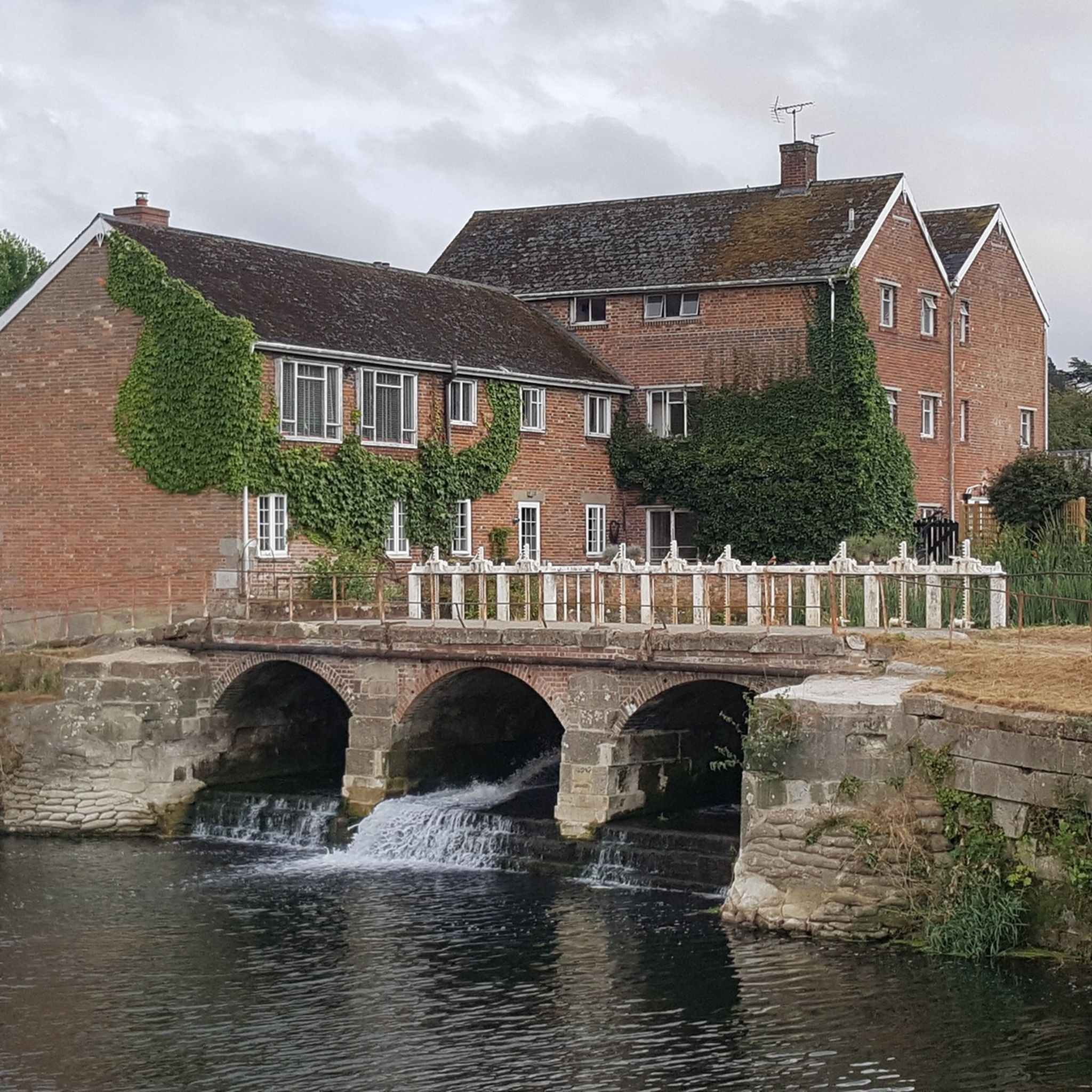
Durweston Mill is a Grade II listed building, that has been converted into a holiday accommodation with two apartments, Coopers and Riverside, overlooking the River Stour. It also features a separate 5-acre private island with glamping and camping facilities, which are open for bookings and offer activities like fishing, wild swimming, and dog walking.
0
0

Using the power of moving water to drive a mill wheel is an ancient invention of the human spirit of discovery, the origins of which can be traced back to times long past. Thanks to such a construction, a watercourse - natural or artificial - could simply replace human or animal muscle power with the power of the natural elements, for example to grind grain into corn or to press oil from fruit. There are essentially two different ways of driving watermills: * Either the flowing water simply hits the blades of the water wheel from below to set it in motion; or * the water is guided - usually through a so-called "mill channel" - above the wheel and falls onto the blades; this type of construction is more efficient due to natural gravity.
0
0

I imagine it to be a nice little cafe selling cakes, teas and coffees. unfortunately it only opens from 10am on a saturday
0
0
A very welcome stop to let your legs recover for a bit.
0
0
Frequently Asked Questions
How many running routes are available around Stourpaine?
There are over 270 running routes around Stourpaine, offering a wide range of options for different abilities and preferences. The komoot community has explored these trails over 2400 times.
Are there easy running routes suitable for beginners in Stourpaine?
Yes, Stourpaine offers several easier running paths, particularly along the River Stour. These routes often feature flatter terrain, ideal for beginners or those seeking a less strenuous run. For example, the Stour Valley Way and Blandford Forum Loop follows the river through pleasant countryside.
What kind of terrain can I expect on running trails in Stourpaine?
The running trails in Stourpaine are diverse, ranging from flat riverside paths along the Stour Valley to more challenging ascents up prominent features like Hod Hill and Hambledon Hill. You'll encounter a mix of river meadows, rolling hills, and open countryside.
Are there any circular running routes in the Stourpaine area?
Yes, many running routes around Stourpaine are circular, allowing you to start and finish at the same point. A popular option is the Hod Hill Iron Age Hill Fort – Hambledon Hill Trig Point loop from Durweston, which offers both historical interest and scenic views.
What are some scenic points of interest or landmarks I can see while running near Stourpaine?
The Stourpaine area is rich in natural and historical landmarks. Runners can enjoy views from Hambledon Hill Iron Age hill fort and Hod Hill. Other notable viewpoints include Fontmell Down and Melbury Beacon, offering expansive vistas of the surrounding landscape.
Are the running routes around Stourpaine suitable for families?
Many of the flatter, riverside paths are suitable for families, especially those with younger children or those looking for a more relaxed outing. Always check the route's distance and elevation profile to ensure it matches your family's ability.
Can I bring my dog on the running trails in Stourpaine?
Generally, many trails in the Stourpaine area are dog-friendly, especially those through open countryside and along public footpaths. However, it's always advisable to keep dogs on a lead, particularly near livestock or in nature conservation areas, and to check specific route guidelines for any restrictions.
What is the best season for running in Stourpaine?
Stourpaine offers enjoyable running conditions throughout the year. Spring and autumn provide pleasant temperatures and beautiful scenery with changing foliage. Summer is ideal for early morning or late evening runs to avoid the heat, while winter runs can be invigorating, though some paths may be muddy.
How can I find parking near the running trails in Stourpaine?
Parking availability varies by trailhead. Many routes starting from villages like Stourpaine or Durweston will have local parking options, such as village car parks or roadside parking. For routes accessing specific hills like Hod Hill, dedicated car parks are often available nearby.
What are the typical distances and durations for running routes in Stourpaine?
Running routes in Stourpaine vary significantly. You can find shorter loops of around 5-6 miles (8-10 km) that take about an hour, such as the Hod Hill and Hambledon Hill Loop. Longer, more challenging routes can extend to 10-12 miles (16-19 km) and take several hours, like the Stourpaine – Shillingstone Railway Station loop from Stourpaine.
Are there any running routes in Stourpaine that pass by cafes or refreshment stops?
While many routes are through natural landscapes, some longer loops might pass through nearby villages or towns like Blandford Forum, where you can find cafes and pubs for refreshments. It's a good idea to check the route map in advance to plan any stops.
What do other runners say about the trails in Stourpaine?
The running routes in Stourpaine are highly rated by the komoot community, with an average score of 4.1 stars from over 30 reviews. Runners often praise the diverse scenery, from tranquil river paths to challenging hill climbs, and the historical interest of sites like the Iron Age hill forts.
Most popular attractions around Stourpaine

Get inspired with the komoot mobile app


Explore more
Browse the best Running Trails & Routes in other regions.
