The best walks and hikes around Compton Valence
4.5
(544)
3,456
hikers
226
hikes
Hiking around Compton Valence offers diverse landscapes characterized by rolling chalk hills, deep valleys, and mature woodlands. The village is situated at the head of a narrow valley, providing varied terrain with both ascents and descents. The area features geological formations like the Compton Valence Dome and is fed by a tributary of the River Frome. This region provides a tranquil setting for outdoor exploration.
Best hiking trails around Compton Valence
- The most popular hiking route is The Valley of…
Last updated: August 20, 2026
4.1
(8)
32
hikers
5.58km
01:37
150m
150m
Easy hike. Great for any fitness level. Easily-accessible paths. Suitable for all skill levels.
4.9
(7)
28
hikers
11.2km
03:09
240m
240m
Moderate hike. Good fitness required. Easily-accessible paths. Suitable for all skill levels.

Sign up for free
1.0
(1)
18
hikers
11.8km
03:20
270m
270m
Moderate hike. Good fitness required. Easily-accessible paths. Suitable for all skill levels.
5.0
(2)
17
hikers
10.2km
02:46
150m
150m
Moderate hike. Good fitness required. Easily-accessible paths. Suitable for all skill levels.
4.4
(5)
19
hikers
Moderate hike. Good fitness required. Easily-accessible paths. Suitable for all skill levels.
Get access to more routes and recommendations from other explorers.
Sign up for free
Already have an account?
Our route recommendations are based on thousands of hikes, rides, and runs completed by other people on komoot.
Start today with a free account
Your next adventure awaits.
Login or Signup

Tips from the Community

The "Moot Stone" is a significant, if easily overlooked, historical landmark located on the ridge above the valley near Abbotsbury and Portesham. While the term "moot" refers to an ancient Anglo-Saxon assembly place used for political, administrative, and judicial meetings, the Moot Stone specifically serves as a geographical marker for the Uggescombe Hundred. Here are the key details about it:Historical Significance: In Anglo-Saxon Wessex, a "hundred" was an administrative unit comprising roughly 100 "hides" of land. The Moot Stone is believed to mark a point of high importance for this area, which once extended from the outskirts of Weymouth to Bridport and as far north as Compton Valence. Appearance: It is a large, unassuming stone. Because it is essentially a boundary marker, it is quite easy to miss unless you are specifically looking for it while walking the ridgeway trails. Purpose: The name suggests that this was the site where the people of the Uggescombe Hundred would gather to "moot"—or hammer out—local legal and administrative matters. Though it would have been a very exposed and "draughty" place for a meeting, its location was likely chosen for its prominence and centrality to the surrounding parishes.
0
0
Under the full moon’s silver glow, the Hampton Stones near Abbotsbury do not remain cold, silent granite. As the light reaches its peak, the boulders groan and stretch, shedding their stony shells. They emerge as towering, grey-skinned humans and prowling, heavy-limbed beasts, driven by an eternal, agonizing thirst. They wander the ridgeway, desperate to reach the cool waters of the Fleet. Yet, they are cursed; as the moon begins to fade and the first hint of dawn touches the sky, their forms stiffen. Fearful, they scramble toward their original positions, desperately trying to return to the safety of the earth. But if the moon fades too quickly, they are caught in the open—frozen mid-stride, trapped forever in stone, waiting for the next full moon to grant them another fleeting, thirsty night of life.
0
0
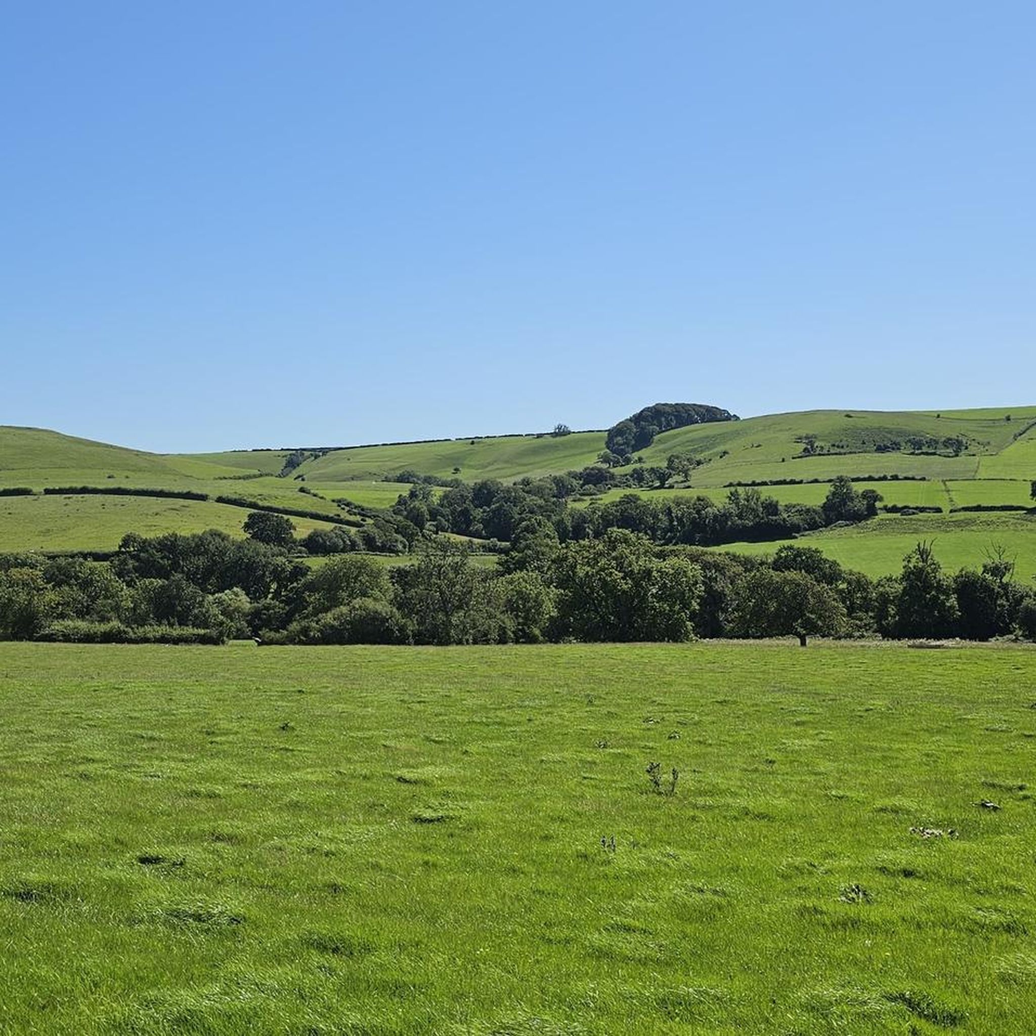
When you look out over Abbotsbury, the rolling hills present a striking landscape shaped by thousands of years of human hands. Instead of smooth, uniform hills, the slopes are dramatically stepped and contoured, telling the story of ancient and medieval survival. The Rolling Hills View The chalk and limestone hills of the South Dorset Ridgeway drop sharply into the Abbotsbury Vale. This creates a dramatic contrast: steep, stark ridges covered in wild gorse and grass that soften into a green, undulating basin before meeting the sea. The landscape is a quilt of ancient hedgerows, steep valleys, and dramatic mounds, the most prominent being Chapel Hill, which rises like a small wave right on the edge of the village.
0
0
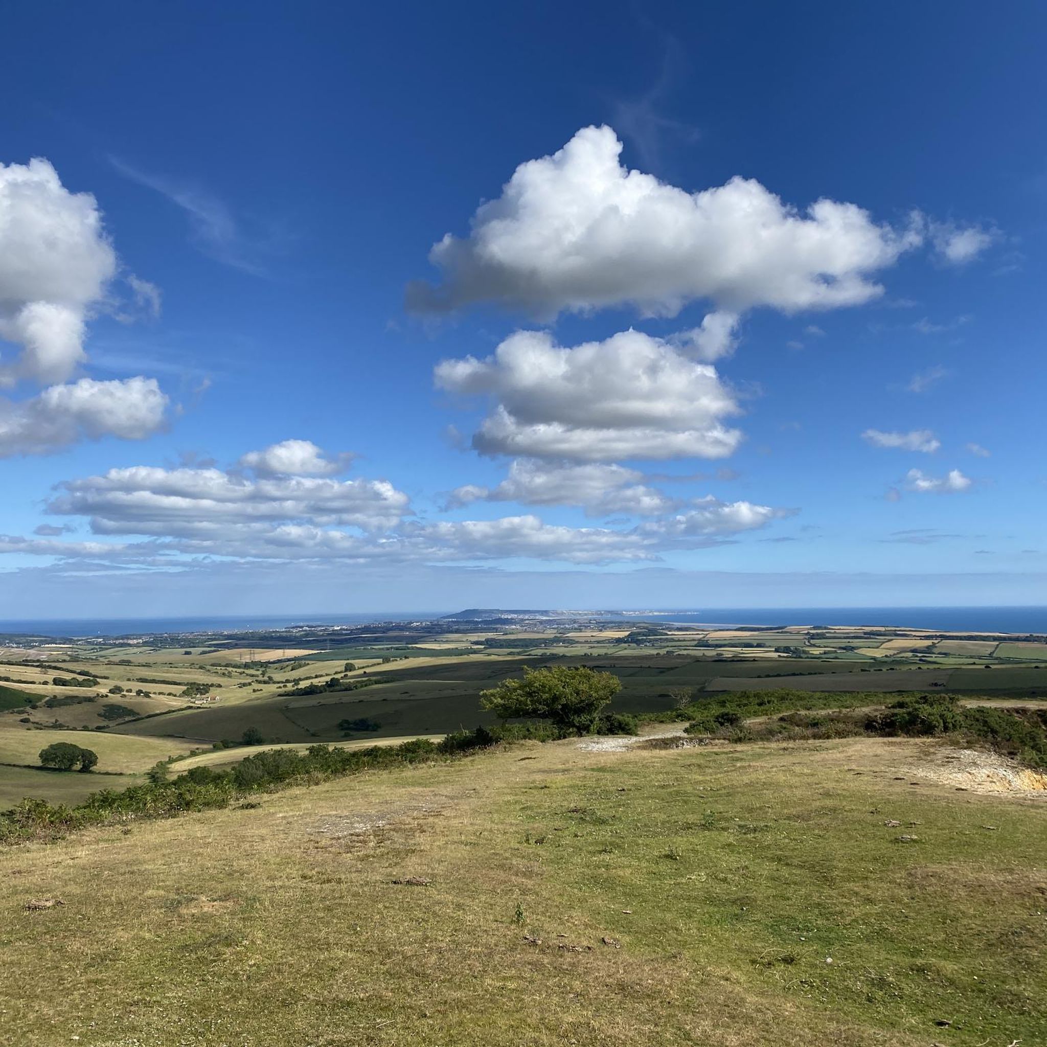
Standing at the crest of the South Dorset Ridgeway gives you one of the most striking coastal panoramas in the UK. Because the ridge rises sharply just inland from the coast, the landscape unfolds below you like a massive, living map. The Fleet Lagoon and Chesil Beach The most dominating feature from this height is the massive sweep of Chesil Beach, a 18-mile barrier of shingles stretching out toward the Isle of Portland in the distance. Trapped right behind it is The Fleet, a shallow, glassy lagoon. From the Ridgeway, you get a clear view of how this narrow strip of water mirrors the sky, contrasting sharply with the rougher English Channel waves breaking on the outer side of the bank. Abbotsbury Vale Looking directly down into the valley, the village of Abbotsbury looks nestled into the rolling green landscape. St Catherine’s Chapel: The 14th-century stone chapel sits entirely exposed on its own smaller hill down in the vale, looking like a tiny solitary sentinel against the backdrop of the sea. The Subtropical Gardens and Swannery: You can trace the dark, wooded canopy of the gardens and the open waterways of the swannery where the Fleet tapers off into the land. On a clear day, the perspective is incredible—you can track the entire curve of the Jurassic Coast all the way out to the red cliffs of Devon in the west.
0
0

Alas permissive access to the waterfall and lake has been withdrawn with effect from 02/06/2025.
1
0
So unusual to see a flying buttress on a village church!
1
0

Despite sounding like the premier destination for star-crossed Bronze Age teenagers to make out, Smitten Corner is actually just a modest Dorset trail junction. It’s where multiple paths collide, offering hikers a glorious choice between climbing a massive hill or accidentally wandering into a prehistoric cemetery.
0
0
Frequently Asked Questions
How many hiking trails are available in Compton Valence?
There are over 230 hiking routes around Compton Valence, offering a wide range of options for different skill levels and interests. You'll find everything from easy strolls to more challenging treks through the diverse landscape.
What types of landscapes can I expect to see while hiking around Compton Valence?
Hiking around Compton Valence offers diverse landscapes characterized by rolling chalk hills, deep valleys, and mature woodlands. The village itself sits at the head of a narrow valley formed by a tributary of the River Frome. You'll encounter picturesque views, areas of geological interest like the 'Compton Valence Dome', and lush, tree-lined paths.
Are there any easy hiking trails suitable for beginners or casual walkers?
Yes, Compton Valence offers plenty of easy hiking options. There are over 100 routes classified as easy. For example, the Eggardon Hill Circular Walk is an easy 5.6 km path that provides panoramic views and explores Iron Age history.
What interesting historical or natural landmarks can I discover on hikes in this area?
The region is rich in landmarks. You can explore Iron Age history at Maiden Castle hillfort or the archaeological remains on Eggardon Hill. The area also features unique sarsen stones, which you can see on routes like The Valley of Stones loop from Littlebredy. Don't miss the Church of St Thomas of Canterbury in Compton Valence, known for its 15th-century tower, which some local walks pass by.
What do other hikers enjoy most about the trails in Compton Valence?
The trails in Compton Valence are highly rated by the komoot community, with an average score of 4.5 stars from over 500 reviews. Hikers often praise the tranquility, the constantly changing, far-reaching views across the countryside, and the unspoilt nature of the village and its surroundings. Many appreciate the varied terrain, from hedged lanes to deep, tree-lined valleys.
Are there any circular walks available in Compton Valence?
Yes, many of the routes in Compton Valence are circular, allowing you to start and end in the same location. A popular option is the Eggardon Hill Circular Walk, which offers panoramic views and a chance to explore Iron Age history. Another is the View from Eggardon Hill – Eggardon Hill Trig Point loop from Eggardon Hill.
Is Compton Valence a good destination for family-friendly hikes?
Compton Valence offers several routes suitable for families, particularly the easier trails. The varied terrain and opportunities for wildlife spotting, such as rabbits, chiff-chaffs, swallows, sheep, cows, and buzzards, can make for an engaging experience for children. Look for routes classified as 'easy' for the most family-friendly options.
Can I bring my dog on the hiking trails in Compton Valence?
Many trails in the Compton Valence area are dog-friendly, allowing you to enjoy the countryside with your canine companion. However, as the area includes farmland and nature reserves, it's always best to keep dogs under close control, especially near livestock, and to check specific route details for any restrictions.
What is the best time of year to go hiking in Compton Valence?
Compton Valence offers beautiful hiking experiences throughout the year. In late winter, the village is particularly renowned for its spectacular display of snowdrops, which carpet the road verges. Spring and summer bring wildflowers and lush greenery, while autumn offers vibrant foliage. The rolling chalk hills provide engaging walks in most seasons, though conditions can vary.
Are there places to eat or drink near the hiking routes?
While Compton Valence is a small village, the surrounding area has options for refreshments. You can find pubs and cafes in nearby villages. It's advisable to check opening times and locations in advance, especially if you plan to rely on them during your hike.
Where can I park for hiking in Compton Valence?
Parking availability varies depending on the specific starting point of your hike. Many trailheads in and around Compton Valence, or nearby villages like Littlebredy and Frampton, offer designated parking areas. It's recommended to check the details for your chosen route on komoot for specific parking information.
Are there any routes that offer views of the coast or other distant landmarks?
Yes, some routes provide expansive views. The View of Portland – Hardy Monument loop from Littlebredy, for instance, offers views towards Portland and Hardy's Monument. The rolling chalk hills often provide far-reaching vistas across the countryside.
Most popular attractions around Compton Valence

Get inspired with the komoot mobile app


Explore more
Browse the best Hikes in other regions.
