The best road cycling routes around Berrocalejo De Aragona
4.8
(16)
1,741
riders
64
rides
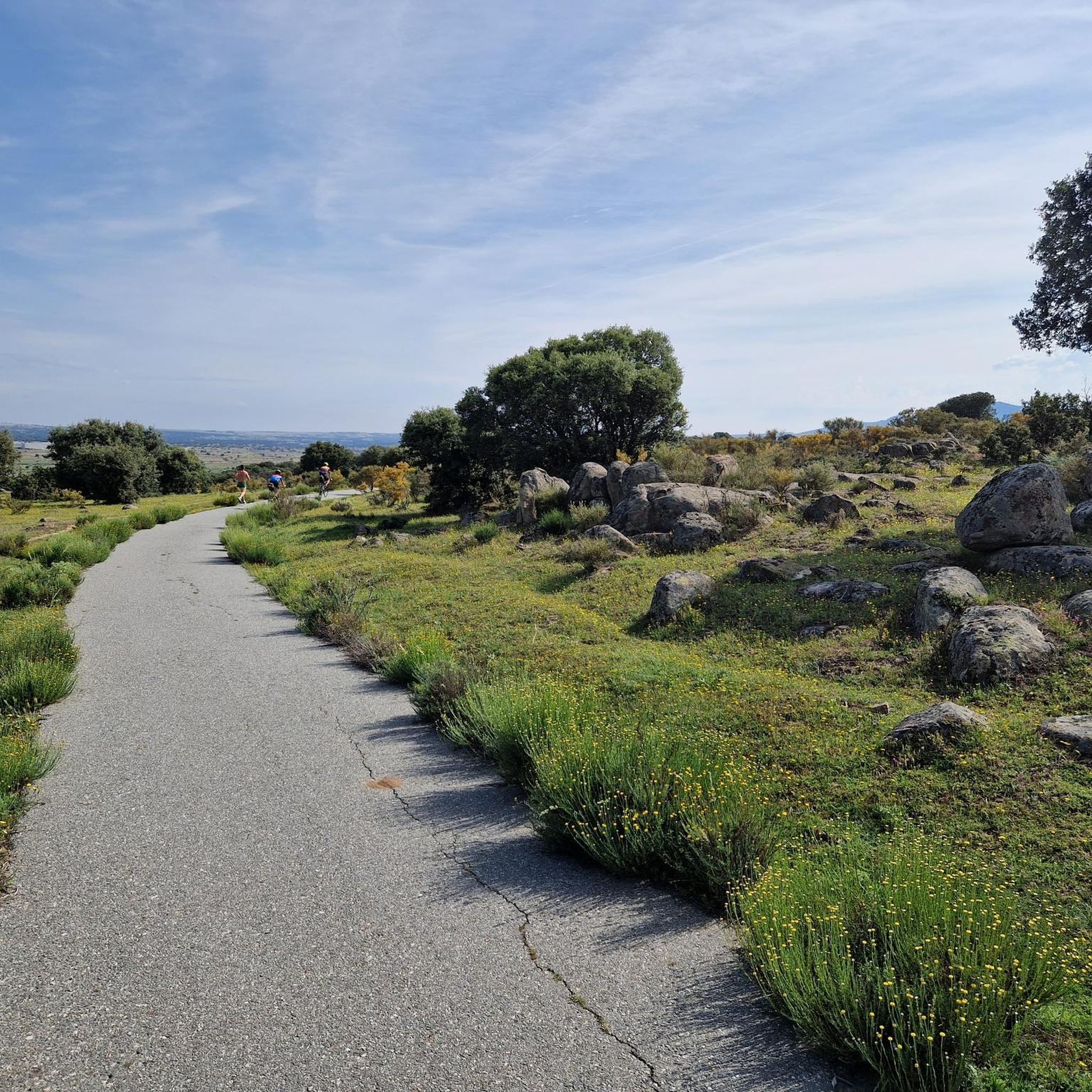
Road cycling routes around Berrocalejo De Aragona traverse a tranquil rural setting characterized by notable granite landscapes and diverse topography. Situated at an altitude of 1,102 meters, the region features rolling hills and open countryside, with more significant climbs available towards the nearby Sierras de Ávila and Ojos-Albos. The area's "berrocales" (granite rock formations) create visually interesting and undulating terrain, while low traffic conditions enhance the cycling experience.
Best road cycling routes around Berrocalejo De Aragona
- The most popular road…
Last updated: July 11, 2026
80
riders
53.4km
02:25
460m
460m
Moderate road ride. Good fitness required. Mostly well-paved surfaces and easy to ride.
5.0
(3)
85
riders
39.5km
01:59
220m
220m
Easy road ride. Great for any fitness level. Mostly well-paved surfaces and easy to ride.

Sign up for free
5.0
(1)
64
riders
66.4km
03:09
570m
570m
Moderate road ride. Good fitness required. Mostly well-paved surfaces and easy to ride.
5.0
(2)
65
riders
65.1km
02:57
280m
280m
Moderate road ride. Good fitness required. Some segments of this route may be unpaved and difficult to ride.
60
riders
51.6km
02:24
560m
560m
Moderate road ride. Good fitness required. Mostly well-paved surfaces and easy to ride.
Get access to more routes and recommendations from other explorers.
Sign up for free
Already have an account?
Our route recommendations are based on thousands of hikes, rides, and runs completed by other people on komoot.
Start today with a free account
Your next adventure awaits.
Login or Signup




Tips from the Community

The Sancti Spiritus Bridge in Ávila is a historic structure that crosses the Chico River, very close to the Chico River Park. It is a medieval-style stone bridge, probably linked to the ancient Monastery of Sancti Spiritus, founded in the 13th century.
1
0
The park extends between the bridge over the Chico River, the extension of Nuestra Señora de Sonsoles Street, and the Burgohondo road bridge, bordering Juan Pablo II Avenue. One of the most popular routes is the circular route from the Roman Bridge over the Adaja River, ideal for easy walks and enjoying the park's natural surroundings.
1
0

It's an open pass in the inhospitable landscape typical of this area. It's highly recommended because it offers easy connections to other passes such as Serranillos and Mijares.
0
0
The Chapel of Mosén Rubí, located in Ávila, is a beautiful example of architecture that combines late Gothic and Renaissance styles. It was built in the 16th century and is dedicated to Mosén Rubí de Bracamonte, lord of Fuentesol.
3
0

A relatively simple port, with good asphalt and road visibility, moderate (average 5%) and constant gradients. It can be tricky on a windy day.
0
0
This bridge was built to facilitate crossing the Adaja River and connect the Roman city of Ávila with the opposite bank. Although only the hidden abutments on the edges of the original Roman bridge remain, the bridge visible today dates back to the 12th century.
13
0

In the Great Market Square.
3
0
The bridge is nice, the area not so much.
0
1
Frequently Asked Questions
What kind of terrain can I expect on road cycling routes around Berrocalejo De Aragona?
The region around Berrocalejo De Aragona features a mix of gently rolling hills and open countryside, situated at an altitude of 1,102 meters. You'll encounter unique granite rock formations, known as "berrocales," which create visually interesting and undulating terrain. As you venture towards the nearby Sierras de Ávila and Ojos-Albos, routes offer more significant climbs and diverse topography, catering to various cycling preferences.
How many road cycling routes are available in the Berrocalejo De Aragona area?
There are over 50 road cycling routes available around Berrocalejo De Aragona, offering a wide range of options for cyclists of all abilities. These routes are highly rated by the komoot community, with an average score of 5.0 stars.
Are there routes suitable for beginners or families with children?
Yes, the area offers several easy routes perfect for beginners or family outings. For example, the Sancti Spiritu Bridge – Río Chico Park loop from Ávila is an easy 24.2-mile (38.9 km) path that provides a scenic journey through the local countryside with minimal elevation gain.
What are some of the more challenging road cycling routes in the region?
For experienced cyclists seeking a challenge, routes like the Convento de San José – Puerto de Navalmoral loop from Ávila offer significant elevation changes over 43.6 miles (70.2 km). Another demanding option is the Puerto de Navalmoral – Burguillo Reservoir loop from Ávila, which covers over 66 miles (106 km) with substantial climbing.
What is the best time of year to go road cycling in Berrocalejo De Aragona?
The region's climate makes spring and autumn ideal for road cycling, offering pleasant temperatures and generally stable weather conditions. While summer can be warm, early mornings or late afternoons can still provide enjoyable rides. Winter cycling is possible, but be prepared for cooler temperatures, especially at higher altitudes.
Are there any interesting landmarks or points of interest along the cycling routes?
Many routes pass by or are close to historical and natural attractions. You can explore the impressive Ávila City Walls, visit the historic Plaza del Mercado Chico, or see the Old Roman bridge over the Adaja River. The Basilica of San Vicente of Ávila is another notable site accessible from some routes.
What do other road cyclists enjoy most about cycling in Berrocalejo De Aragona?
The komoot community highly rates the road cycling experience in Berrocalejo De Aragona, with an average score of 5.0 stars. Cyclists frequently praise the tranquil rural setting, the unique granite landscapes, and the low traffic conditions, which enhance safety and enjoyment. The diverse topography, from rolling hills to challenging mountain ascents, also receives positive feedback.
Are there any circular road cycling routes available?
Yes, many of the routes in the area are designed as loops, allowing you to start and finish in the same location. For example, the popular Convento de San José – Río Chico Park loop from Ávila is a 32.9-mile (52.9 km) circular trail offering varied terrain.
Is Berrocalejo De Aragona suitable for dog-friendly cycling?
While the rural roads around Berrocalejo De Aragona generally have low traffic, specific regulations for cycling with dogs can vary. It's always recommended to keep dogs on a leash, especially near villages or on roads, and to ensure they are comfortable with the distance and terrain. Always carry enough water for both yourself and your pet.
Where can I find refreshments or accommodation in Berrocalejo De Aragona or nearby?
Berrocalejo De Aragona is a small, tranquil municipality. While options within the village might be limited, its proximity to Ávila (just 9 kilometers away) means you can easily access a wider range of cafes, pubs, and accommodation options in the city. Many routes start from or pass through Ávila, making it a convenient base for exploring the region.
What are the parking options for cyclists in Berrocalejo De Aragona?
Given its rural nature, Berrocalejo De Aragona likely offers informal parking options within the village. For more secure or designated parking, especially if starting a longer route, consider parking in nearby Ávila, which is well-equipped for visitors and provides easy access to many of the region's cycling routes.
Are there any permits or special regulations for cycling in Ávila province?
Generally, no special permits are required for road cycling on public roads in Ávila province. However, always adhere to standard traffic laws and respect local regulations, especially when passing through natural parks or protected areas. The rural nature of the area often means low traffic, enhancing the cycling experience.
Most popular routes around Berrocalejo De Aragona
Most popular attractions around Berrocalejo De Aragona

Get inspired with the komoot mobile app


Explore more
Browse the best Road cycling routes in other regions.
