The best MTB trails around Valdeavellano De Tera
4.0
(6)
65
riders
27
rides
Mountain biking around Valdeavellano De Tera offers diverse terrain within the "El Valle" region of Soria, Spain. The area features lush greenery, rolling hills, and rich forests, characterized by slopes covered with beech and oak trees. Rivers like the Razón and Tera flow through the landscape, which is set at the foot of the Sierra Cebollera, providing varied topography for mountain bike trails. Riders can explore a succession of valleys, troughs, and varying slopes, including areas near the Embalse de…
Last updated: October 20, 2026
20
riders
49.7km
04:51
1,050m
1,050m
Hard mountain bike ride. Very good fitness required. Advanced riding skills necessary.
3.0
(1)
3
riders
31.4km
03:00
640m
640m
Moderate mountain bike ride. Good fitness required. Advanced riding skills necessary.

3
riders
Easy mountain bike ride. Great for any fitness level. Suitable for all skill levels.
3
riders
16.6km
01:02
200m
200m
Moderate mountain bike ride. Great for any fitness level. Advanced riding skills necessary.
2
riders
28.6km
03:18
990m
990m
Hard mountain bike ride. Very good fitness required. Advanced riding skills necessary.
Get access to more routes and recommendations from other explorers.
Already have an account?
Our route recommendations are based on thousands of hikes, rides, and runs completed by other people on komoot.
Start today with a free account
Your next adventure awaits.


Tips from the Community

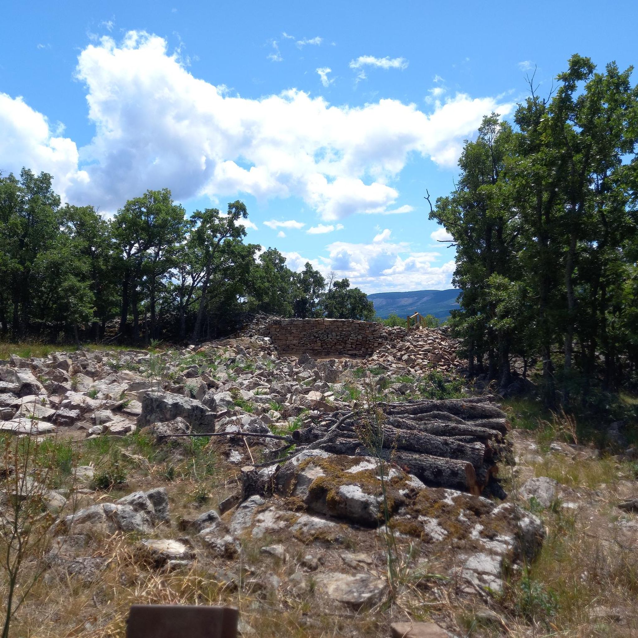
Pile of stones linked to the legend of the "miracle of meat" from the pilgrimage of Santos Nuevos. Tradition says that if you throw a stone and make a wish, it will come true.
2
0
From the Las Celadillas path, with medium-sized pine forests on one side and views of the Razón Valley and many of its villages on the other, it is a mandatory stop. Sunsets are incredible from this area. Worth noting is the flock of sheep that usually grazes in the area, with very committed dogs.
3
0
It is undoubtedly the most spectacular point on the entire CZ7 route. After several kilometers of climbing on a forest track with a large elevation gain and a final section on a path, the lagoon appears imposing, surrounded by the mountain range. It is worth staying for a while as it is a place to enjoy slowly.
2
0

One of the most beautiful and unknown places in Soria, recommended at any time of year, although access is more difficult with snow or mud
0
0
Hermitage in honour of the Virgen de las Angustias. The pilgrimage takes place on the first weekend of July, when the residents of the towns of Almarza and San Andrés take advantage of the opportunity to hold a day of brotherhood around this event.
3
0
Straight road that crosses the Pinar de Arguijo (Soria) that takes us directly to the Alto del Guardatillo gate.
2
0
Track that from Alto de Terrazas takes us into the Sierra de Cebollera along a path flanked by small pine trees, with a firm surface with plenty of loose stones, which gradually opens up, offering incredible views of the area. Vegetation typical of the height at which we are and wildlife can also be seen.
2
0
Gate that marks the boundary between Alto de Guardatillo and the path down to Las Celadillas. Once you have passed it, the Razón valley and its magnificent views open up before you. It is important to keep this gate well closed to prevent the escape of cattle that usually graze on both sides.
1
0
Frequently Asked Questions
How many mountain bike trails are there in Valdeavellano De Tera?
There are over 20 mountain bike routes available around Valdeavellano De Tera, offering a diverse range of experiences. Most of these, 18 to be exact, are of moderate difficulty, with a few easy and difficult options also available.
What kind of terrain can I expect when mountain biking in Valdeavellano De Tera?
The region, often called the 'Little Soria Switzerland,' features lush greenery, rolling hills, and rich forests, particularly beech and oak. You'll encounter varied topography with a succession of valleys, troughs, and varying slopes, making for engaging rides. Rivers like the Razón and Tera also flow through the landscape, adding to its natural charm.
Are there any easy mountain bike trails suitable for beginners or families?
Yes, there are a couple of easy routes. For a more relaxed ride, consider the Valdeavellano de Tera – Sotillo del Rincón loop from Valdeavellano de Tera. This 16.65 km route is designed for all fitness levels and takes about an hour to complete, offering a gentle introduction to the area's beauty.
What are some natural landmarks or viewpoints I can see along the mountain bike trails?
The trails often pass through areas with significant natural beauty. You might encounter the Cebollera Lagoon or even some picturesque Waterfalls. The region is also at the foot of the Sierra Cebollera, offering dramatic backdrops and potential viewpoints like Terrazas Heights.
Are there any circular mountain bike routes available?
Many of the routes in Valdeavellano De Tera are circular, allowing you to start and end in the same location. A popular option is the difficult Sotillo del Rincón loop from Valdeavellano de Tera, which covers 48.8 km through varied forest and open terrain.
What do other mountain bikers enjoy most about mountain biking in Valdeavellano De Tera?
The area is highly rated by the komoot community, with an average score of 3.0 stars. Riders often praise the diverse terrain, from lush forests to rolling hills, and the variety of trails that cater to different skill levels. The scenic beauty, especially around the Embalse de la Cuerda del Pozo, is also frequently highlighted.
Are there any routes that offer views of the Embalse de la Cuerda del Pozo reservoir?
Yes, several routes provide stunning views of the Embalse de la Cuerda del Pozo. The moderate Ocenill Bar – Embarcadero Trail loop from El Royo is a great choice, offering expansive views of the reservoir and its surrounding woodlands over its 45.5 km length.
What is the best time of year for mountain biking in Valdeavellano De Tera?
Valdeavellano De Tera's diverse vegetation, including beech and oak forests, suggests pleasant riding conditions in spring and autumn when temperatures are milder and the foliage is vibrant. Summer can also be good, especially in the shaded forest areas, but always check local weather forecasts.
Are there any historical or cultural attractions near the mountain bike trails?
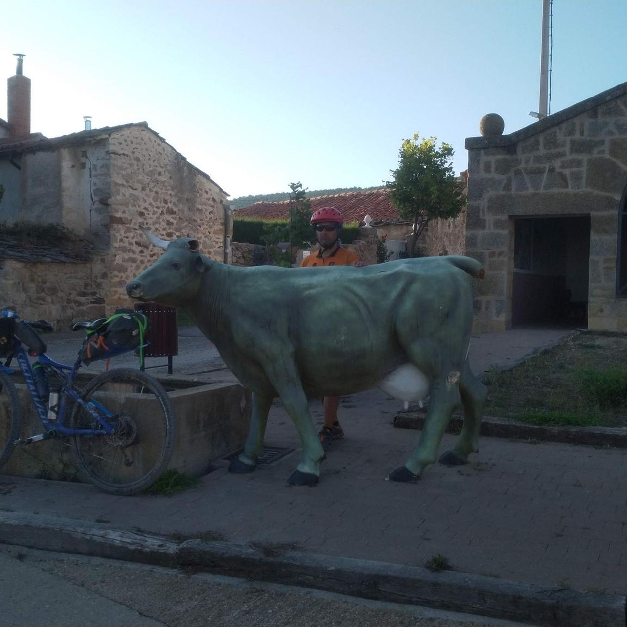
Beyond the natural beauty, the region offers glimpses into its history. You can find the Cow Sculptures of Sotillo del Rincón, or explore the area around the Hinojosa de la Sierra Castle, which adds a historical dimension to your ride.
What is the typical duration for mountain bike trails in this region?
Trail durations vary significantly based on difficulty and length. Easy routes, like the 16.65 km Valdeavellano de Tera – Sotillo del Rincón loop, can take around an hour. Moderate trails, such as the 32.9 km Ermita de Santos Nuevos Trail – Ermita Santos Nuevos loop, typically take about 3 hours, while more difficult and longer routes can extend to 4-5 hours.
Are there challenging mountain bike trails for experienced riders?
Yes, for experienced riders seeking a challenge, the region offers difficult routes. The Sotillo del Rincón loop from Valdeavellano de Tera is a prime example, covering 48.8 km with significant elevation changes, requiring good fitness and advanced riding skills.
What kind of forests will I ride through in Valdeavellano De Tera?
You'll primarily ride through slopes covered with beautiful beech and oak trees. The diverse arboreal landscape also includes pine forests, willows, and ash, especially along river courses, providing a constantly changing and engaging environment for your rides.
Most popular routes around Valdeavellano De Tera
Most popular attractions around Valdeavellano De Tera

Get inspired with the komoot mobile app


Explore more
Browse the best MTB trails in other regions.
