The best road cycling routes around Torronsuon kansallispuisto
4.0
(3)
320
riders
37
rides
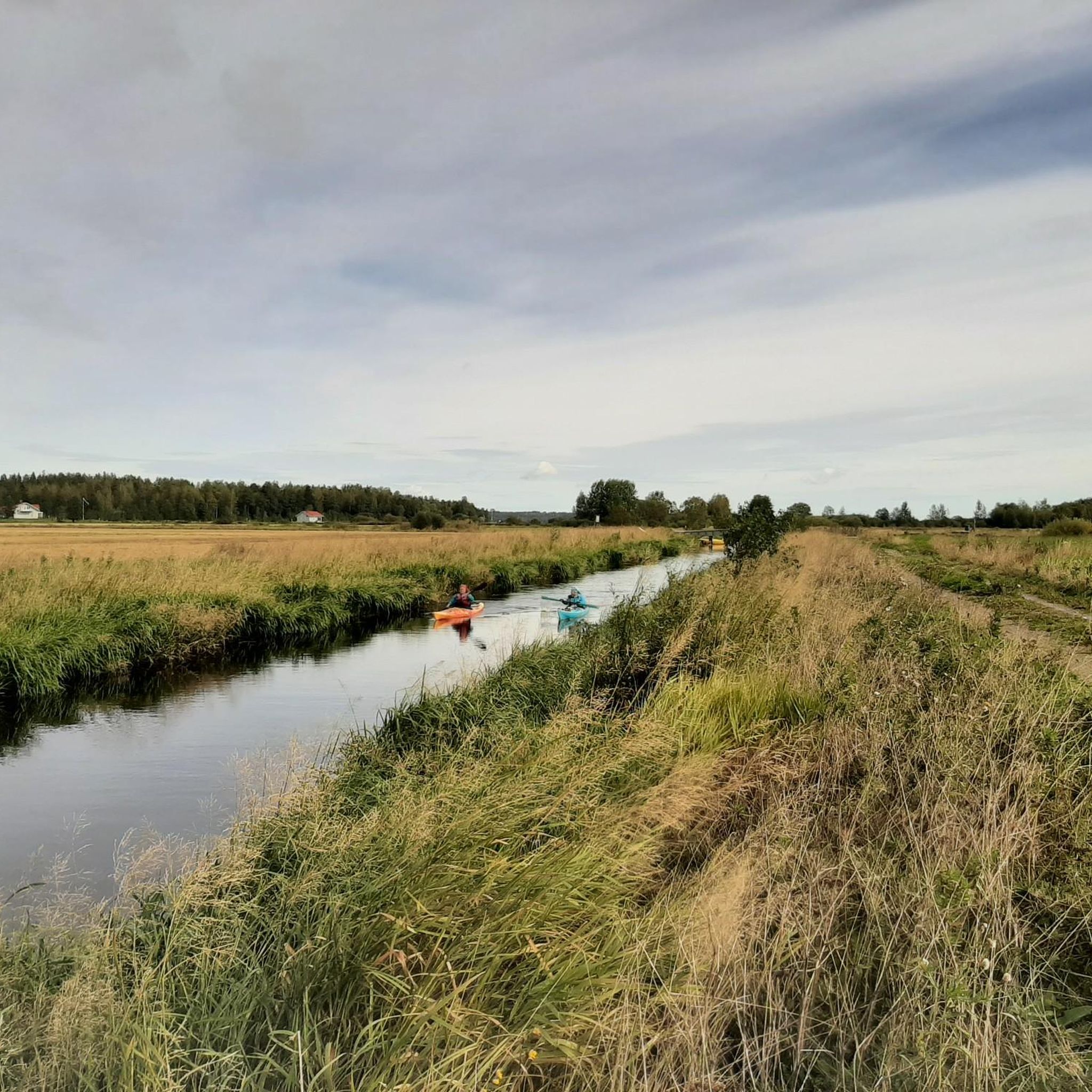
Road cycling routes around Torronsuon kansallispuisto primarily utilize the extensive networks in the surrounding Häme Lake Uplands region. While direct cycling within the core raised bog areas of the national park is limited, the periphery and nearby roads offer diverse terrain. The landscape features open bog areas, diverse forests, eskers, and ridge landscapes, providing varied cycling experiences. This region is characterized by peaceful country lanes and well-maintained gravel roads, connecting natural and cultural attractions.
Best road cycling routes around Torronsuon…
Last updated: July 12, 2026
5.0
(1)
11
riders
73.9km
03:04
360m
360m
Moderate road ride. Good fitness required. Some segments of this route may be unpaved and difficult to ride.
22
riders
108km
04:45
570m
570m
Moderate road ride. Good fitness required. Some segments of this route may be unpaved and difficult to ride.

Sign up for free
13
riders
45.2km
01:55
270m
270m
Easy road ride. Great for any fitness level. Mostly well-paved surfaces and easy to ride.
13
riders
34.3km
01:26
180m
180m
Moderate road ride. Great for any fitness level. Some segments of this route may be unpaved and difficult to ride.
6
riders
34.4km
01:31
190m
190m
Moderate road ride. Great for any fitness level. Some segments of this route may be unpaved and difficult to ride.
Get access to more routes and recommendations from other explorers.
Sign up for free
Already have an account?
Our route recommendations are based on thousands of hikes, rides, and runs completed by other people on komoot.
Start today with a free account
Your next adventure awaits.
Login or Signup
Popular around Torronsuon kansallispuisto

Other adventures around Torronsuon kansallispuisto

Tips from the Community

not much traffic, gently rolling with flat sections, good asphalt
0
0
gets you to/from the road heading north without having to ride more than a hundred metres or so on the highway, normal roadside path and a quiet village lane with okay asphalt (cracks)
0
0

Beautiful sandy beach with parking, changing rooms, hiking trails, café, kiosk and supervised diving tower!
0
0
unusual scenery for this part of the country, for a short while you could even think you were at Punkaharju or Pulkkilanharju
0
0
flat, little traffic across the path, good asphalt, brief glimpses of lake Pyhäjärvi in several places
0
0
little traffic, flat (on top of the 3rd Salpausselkä terminal moraine, goes around the Räyskälä aerodrome), asphalt old but okay save for a bumpier section next to the lake in the southeastern end
0
0
not too much traffic, gently rolling hills, okay asphalt part of the old highway from Turku to Hämeenlinna (as evidenced by the km-stones) and before that the medieval Tavastian Ox Road (Hämeen härkätie)
0
0
not much traffic, flat, okay asphalt, short bike path in the southern end (don’t bother)
0
0
Frequently Asked Questions
What kind of terrain can I expect when road cycling around Torronsuon kansallispuisto?
The road cycling routes primarily utilize the extensive networks in the surrounding Häme Lake Uplands region. You'll find a mix of peaceful country lanes and well-maintained gravel roads. The landscape features open bog areas, diverse forests, eskers, and ridge landscapes, offering varied cycling experiences through historic cultural landscapes and charming villages.
Are there any easy road cycling routes suitable for beginners or families?
Yes, there are several easy routes available. For instance, the Kahvila Lammenkulma loop from Forssa is an easy 42.9 km trail, and the Sukulantie Road loop from Forssa is another easy option at 45.2 km. Overall, about 8 of the 40 available routes are classified as easy, making them suitable for less experienced cyclists or family outings.
What are some notable landmarks or natural features I can see while cycling in the region?
While cycling the regional roads, you can experience the unique natural features of the Häme Lake Uplands. Torronsuo National Park itself is known for its vast raised bog and diverse birdlife. You might encounter the Kiljamo bird tower offering panoramic views, or see the distinctive Boardwalk Through the Mire from a distance. The historic Häme Ox Road also passes through picturesque cultural landscapes and idyllic villages like Porras and Renko, eventually leading towards Häme Castle.
What do other road cyclists enjoy most about cycling in this area?
The area is highly rated by the komoot community, with an average score of 3.5 stars. Cyclists often praise the peaceful country lanes, the diverse forests, and the opportunity to explore historic cultural landscapes. The varied terrain and well-maintained roads are frequently highlighted as positive aspects of the regional cycling experience.
Can I cycle directly within Torronsuon kansallispuisto?
Direct road cycling within the core bog areas of Torronsuon kansallispuisto is limited due to the delicate nature of the bog. However, cyclists are allowed on the access roads within the national park to reach parking areas like Kiljamo and Pehku, which serve as starting points for walking trails. The main road cycling opportunities are found on the extensive networks surrounding the park in the Häme Lake Uplands.
Are there any long-distance road cycling routes available?
Yes, the region offers several longer routes. The Susikkalantie Road – Lake Kuivajärvi loop from Eerikkilän urheiluopisto is a moderate 108.0 km path, providing a substantial ride through the regional landscape. Additionally, the historic Häme Ox Road (Hämeen Härkätie) is a 70-kilometer route that, while having some gravel sections, is largely paved and suitable for touring bikes, connecting various cultural and natural attractions.
What is the best time of year for road cycling around Torronsuon kansallispuisto?
The best time for road cycling in Southern Finland, including the Torronsuo region, is typically from late spring to early autumn (May to September). During these months, the weather is generally mild, and the natural landscapes are at their most vibrant. The region's unique bog and forest environments are particularly beautiful during these seasons.
Where can I find parking for road cycling routes in the area?
Parking is generally available at key starting points for routes. For instance, you can find parking at areas like Kiljamo and Pehku, which serve as access points to Torronsuon kansallispuisto. For routes starting from towns like Forssa or near Eerikkilä Sports Institute, there are usually designated parking facilities available.
Are there specific cycling networks in the Häme Lake Uplands that are good for road cycling?
Absolutely. The Häme Lake Uplands region boasts over 350 km of cycle trails. Key networks suitable for road cycling include the historic Häme Ox Road (Hämeen Härkätie), which is largely paved, and sections of the Häme Lynx Trail (Ilvesreitti) that incorporate asphalt and gravel roads. The Häme by Cycle Network also emphasizes peaceful country lanes and gravel roads, connecting major towns and natural sites.
What kind of elevation changes can I expect on the road cycling routes?
While the region is not mountainous, routes do feature varied terrain with moderate elevation changes. For example, the Tauluntie Road – Lake Kuivajärvi loop from Haudankorva has an elevation gain of approximately 364 meters over 74.3 km, and the longer Susikkalantie Road – Lake Kuivajärvi loop from Eerikkilän urheiluopisto includes about 567 meters of ascent over 108.0 km. These provide a good workout without being overly strenuous for most road cyclists.
Are there any cafes or places to stop for refreshments along the routes?
Yes, many routes pass through or near charming villages and towns where you can find cafes and other services. For example, the Kahvila Lammenkulma loop from Forssa is named after a cafe, indicating opportunities for refreshment stops. The historic Häme Ox Road also meanders through idyllic villages like Porras, Räyskälä, and Renko, which are likely to offer places to pause and refuel.
How many road cycling routes are available in total for this region?
There are approximately 40 road cycling routes available in the region around Torronsuon kansallispuisto, catering to various skill levels from easy to difficult.
Most popular routes around Torronsuon kansallispuisto
Most popular attractions around Torronsuon kansallispuisto

Get inspired with the komoot mobile app


Explore more
Browse the best Road cycling routes in other regions.
