The best running trails around Cervera De Buitrago
4.6
(5)
1,251
runners
66
runs
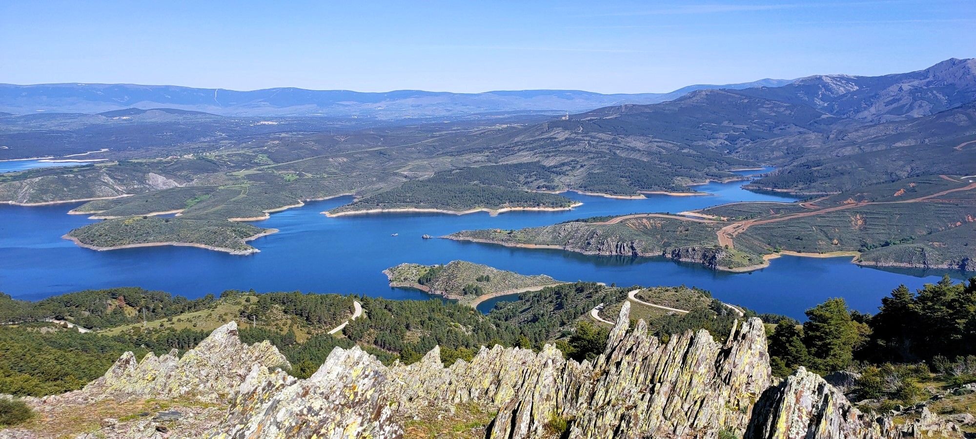
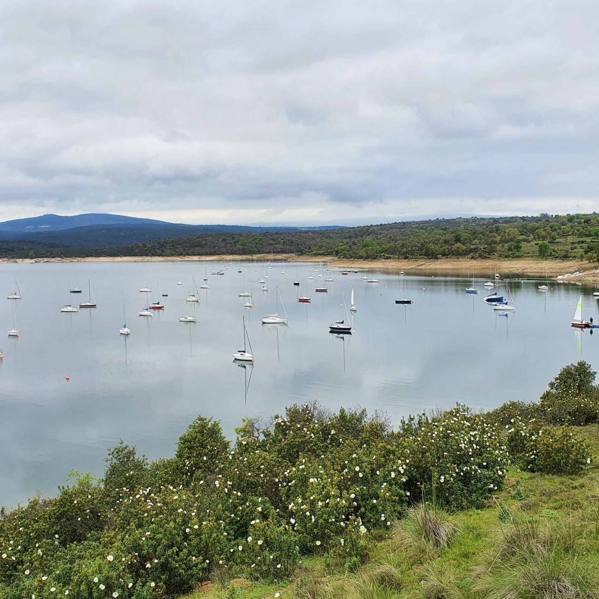
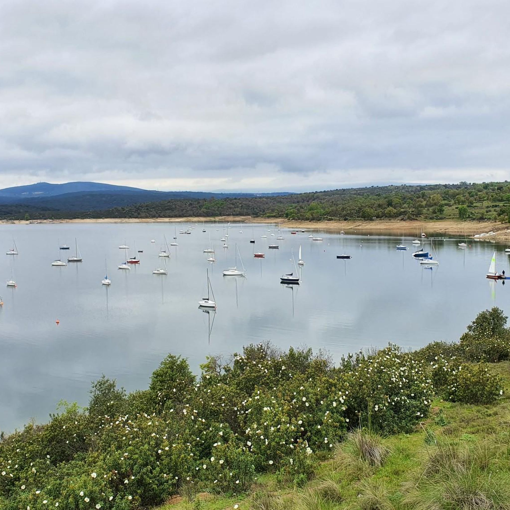
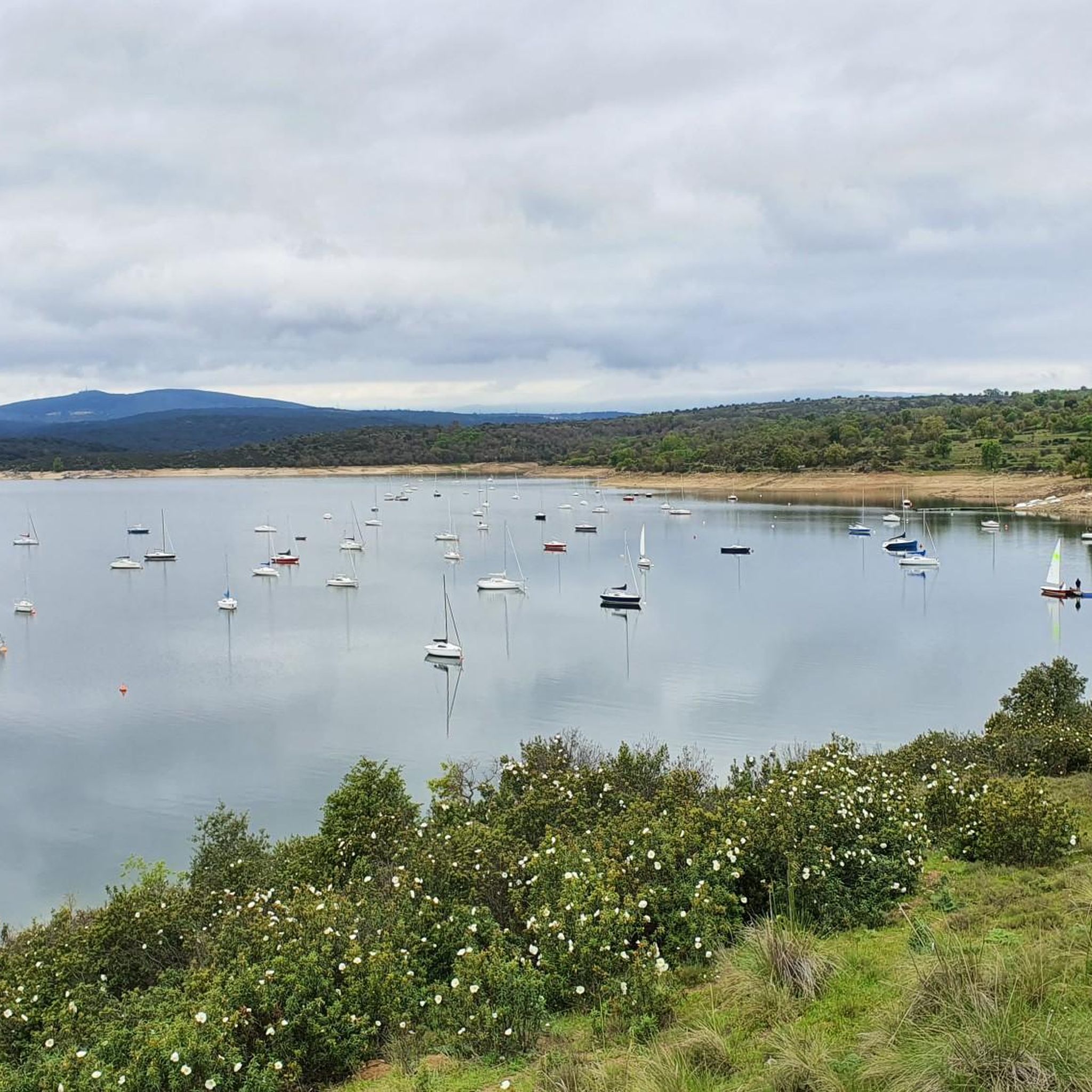
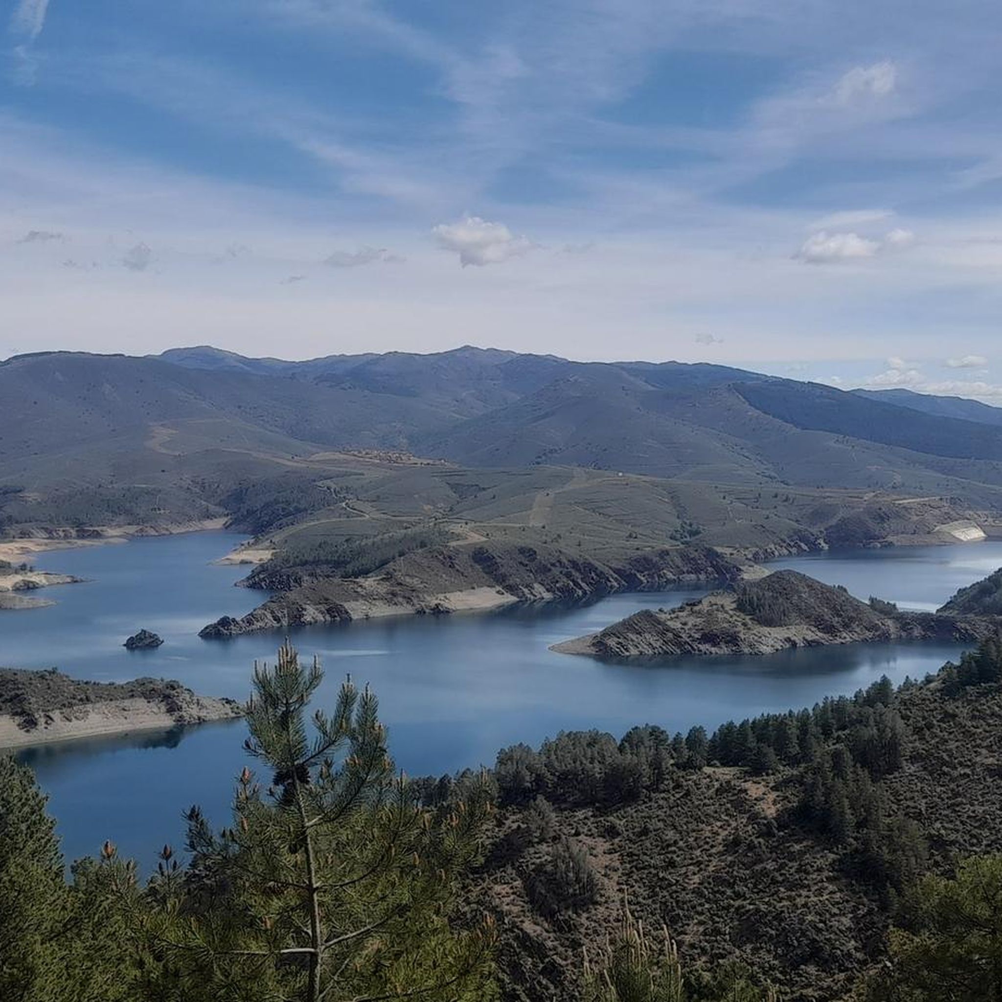
Jogging routes around Cervera De Buitrago are situated in the Sierra Norte of Madrid, characterized by its location on the El Atazar Reservoir. The landscape features a blend of mountain scenery with ash and oak forests, particularly along the reservoir's banks. This region offers varied terrain, from waterside paths to more elevated routes, providing diverse options for running.
Best jogging routes around Cervera De Buitrago
- The most popular jogging route is Cervera de Buitrago Beach loop from Cervera de Buitrago…
Last updated: October 17, 2026
27
runners
34.4km
05:22
1,440m
1,440m
Hard run. Very good fitness required. Sure-footedness, sturdy shoes and alpine experience required.
20
runners
26.6km
03:41
920m
920m
Hard run. Very good fitness required. Sure-footedness, sturdy shoes and alpine experience required.

14
runners
12.3km
01:52
500m
500m
Hard run. Very good fitness required. Sure-footedness, sturdy shoes and alpine experience required.
3
runners
5.26km
00:39
80m
80m
Moderate run. Good fitness required. Mostly paved surfaces. Suitable for all skill levels.
3.0
(1)
5
runners
11.0km
01:12
150m
150m
Moderate run. Good fitness required. Mostly paved surfaces. Suitable for all skill levels.
Get access to more routes and recommendations from other explorers.
Already have an account?
Our route recommendations are based on thousands of hikes, rides, and runs completed by other people on komoot.
Start today with a free account
Your next adventure awaits.

Other adventures around Cervera De Buitrago

Tips from the Community

A very pleasant pass to climb up the Puebla de la Sierra side. To do this, you have to access it from Robledillo, with very steep ramps to warm up, and a few kilometers on a narrow and bumpy road. The views and the route are totally worth it. Avoid weekends, especially busy hours, as motorcycles, and especially cars, can spoil the party a bit, as I say, the road is very narrow. There is a fountain at the lowest point between Robledillo and Puebla, and another one when leaving Puebla de la Sierra. They are the only two points where you will be able to fill your bottles "for free".
0
0

After the effort of the climb you get the reward of satisfaction.
0
0

Spectacular views, generally good climb with some demanding sections before crossing the firebreak. the rest, quite bearable
1
0

Cancho de la Cabeza, the highest peak in the municipality of Patones, rises majestically in the Sierra Norte region of Madrid. This beautiful natural viewpoint offers panoramic views of the El Atazar reservoir and, in the background, you can see the Peña de la Cabra, one of the numerous peaks of the Ayllón mountain range.
2
0
Cancho de la Cabeza, the highest peak in the municipality of Patones, rises majestically in the Sierra Norte region of Madrid. This beautiful natural viewpoint offers panoramic views of the El Atazar reservoir and, in the background, you can see the Peña de la Cabra, one of the numerous peaks of the Ayllón mountain range. Remember that Patones de Arriba is a small “kingdom” near Madrid, full of charm and tradition. Enjoy the natural beauty and stunning views that Cancho de la Cabeza offers! 🏞️🌄
1
0
Approach the information panel that describes the entire landscape around the Atazar reservoir, and then sit on the Geodesic to rest and enjoy. !It is a wonder
1
0

This point on the path is ideal for observing the Atazar reservoir and the northern mountains of Madrid. Without a doubt a point worthy of a photo.
1
0
Excellent place to recognize all the places in the Atazar reservoir. There is a great photo with the name of the places.
1
0
Frequently Asked Questions
How many running routes are available in Cervera de Buitrago?
There are over 60 running routes around Cervera de Buitrago, offering a wide variety of options for different fitness levels and preferences. You'll find everything from easy waterside paths to challenging mountain trails.
What kind of terrain can I expect on the running trails around Cervera de Buitrago?
The terrain varies significantly. You can expect a blend of reservoir-side paths, forested areas with ash and oak trees, and mountainous backdrops. Some routes feature minimal elevation gain, while others involve significant climbs through rugged, mountainous terrain.
Are there easy running routes suitable for beginners or casual joggers?
Yes, Cervera de Buitrago offers several easy running options. A great choice is the Cervera de Buitrago Beach loop from Cervera de Buitrago, which is a moderate 5.2 km trail along the shores of the El Atazar reservoir, taking about 38 minutes to complete.
Can I find challenging long-distance running trails in the area?
Absolutely. For experienced runners seeking a challenge, routes like the El Berrueco – Cancho de la Cabeza Summit loop from El Berrueco offer a difficult 21.5 km path with significant elevation gain. Another demanding option is the Cerro Porrejón – Peña Parda loop from Robledillo de la Jara, spanning 34.2 km.
Are there any circular running routes in Cervera de Buitrago?
Yes, many of the running routes in the area are circular, allowing you to start and finish in the same location. For example, the Cervera de Buitrago Beach loop from Cervera de Buitrago is a popular circular option along the reservoir.
What natural features or landmarks can I see while jogging?
While jogging, you'll be treated to stunning views of the El Atazar Reservoir, the largest in the Community of Madrid. Some routes also offer glimpses of prominent peaks like Cancho de la Cabeza Summit or the scenic El Villar Reservoir and Gorge, providing a unique blend of waterside and mountain scenery.
Are the running trails around Cervera de Buitrago suitable for families?
Yes, there are routes suitable for families, especially those looking for easier, shorter options. The 'Playa de Cervera de Buitrago' circular route (5.25 km) is described as easy and suitable for all fitness levels, making it a good choice for a family outing.
Can I bring my dog on the running trails?
Many trails in natural areas like Cervera de Buitrago are generally dog-friendly, especially if your dog is well-behaved and kept on a leash. It's always recommended to check local signage for any specific restrictions, particularly in protected areas or during certain seasons.
What do other runners say about their experience in Cervera de Buitrago?
The running routes in Cervera de Buitrago are highly rated by the komoot community, with an average score of 4.0 stars. Runners often praise the diverse terrain, the beautiful reservoir views, and the options available for different ability levels, from moderate loops to challenging long-distance routes.
Is there parking available near the running routes?
Yes, Cervera de Buitrago is generally accessible by car, and parking is typically available in or near the village, especially close to popular trailheads or the marina area. Specific parking details may vary by route starting point.
What is the best time of year to go jogging in Cervera de Buitrago?
The region offers pleasant conditions for jogging year-round. Spring and autumn provide mild temperatures and vibrant natural scenery. Summer mornings and evenings are also popular, allowing runners to enjoy the reservoir and mountain views without the midday heat. Winter can be beautiful, but some higher elevation trails might require more preparation.
How long do the running routes typically take to complete?
Running route durations vary widely based on distance and difficulty. An easy 5 km route might take around 40 minutes, while more challenging trails like the 34.2 km Cerro Porrejón – Peña Parda loop can take over 5 hours to complete.
Most popular routes around Cervera De Buitrago
Most popular attractions around Cervera De Buitrago

Get inspired with the komoot mobile app


Explore more
Browse the best Running Trails & Routes in other regions.
