The best running trails around Břehyně-Pecopala
5.0
(1)
108
runners
11
runs
Jogging routes Břehyně-Pecopala offer a variety of running experiences through a landscape characterized by forests, wetlands, and lakes. The region features relatively flat terrain with occasional gentle ascents, making it suitable for various fitness levels. Running paths often follow established trails around natural reserves and water bodies like Čepelský rybník. This area provides opportunities for both shorter, easy runs and longer, more challenging distances.
Best jogging routes around Břehyně-Pecopala
- The most popular jogging route is Holzweg loop from NPP Swamp…
Last updated: June 25, 2026
5
runners
6.60km
00:45
40m
40m
Moderate run. Good fitness required. Mostly paved surfaces. Suitable for all skill levels.
28
runners
Moderate run. Good fitness required. Mostly paved surfaces. Suitable for all skill levels.

Sign up for free
15
runners
Moderate run. Good fitness required. Mostly paved surfaces. Suitable for all skill levels.
2
runners
16.4km
01:48
240m
240m
Hard run. Very good fitness required. Mostly paved surfaces. Suitable for all skill levels.
5.0
(1)
41
runners
Moderate run. Good fitness required. Mostly paved surfaces. Suitable for all skill levels.
Get access to more routes and recommendations from other explorers.
Sign up for free
Already have an account?
Our route recommendations are based on thousands of hikes, rides, and runs completed by other people on komoot.
Start today with a free account
Your next adventure awaits.
Login or Signup

Tips from the Community

Wonderful, especially in the very early morning. The Máchovo jezero or Hirschberger Großteich was created in 1366, with Emperor Charles IV himself lending a hand. The pond is located in a spring area and is fed by two streams; the Okenský potok flowing from the Čepelský rybník (Tschöpelteich) and the Břehyňský potok coming from the Břehyňský rybník (Heideteich).
1
0
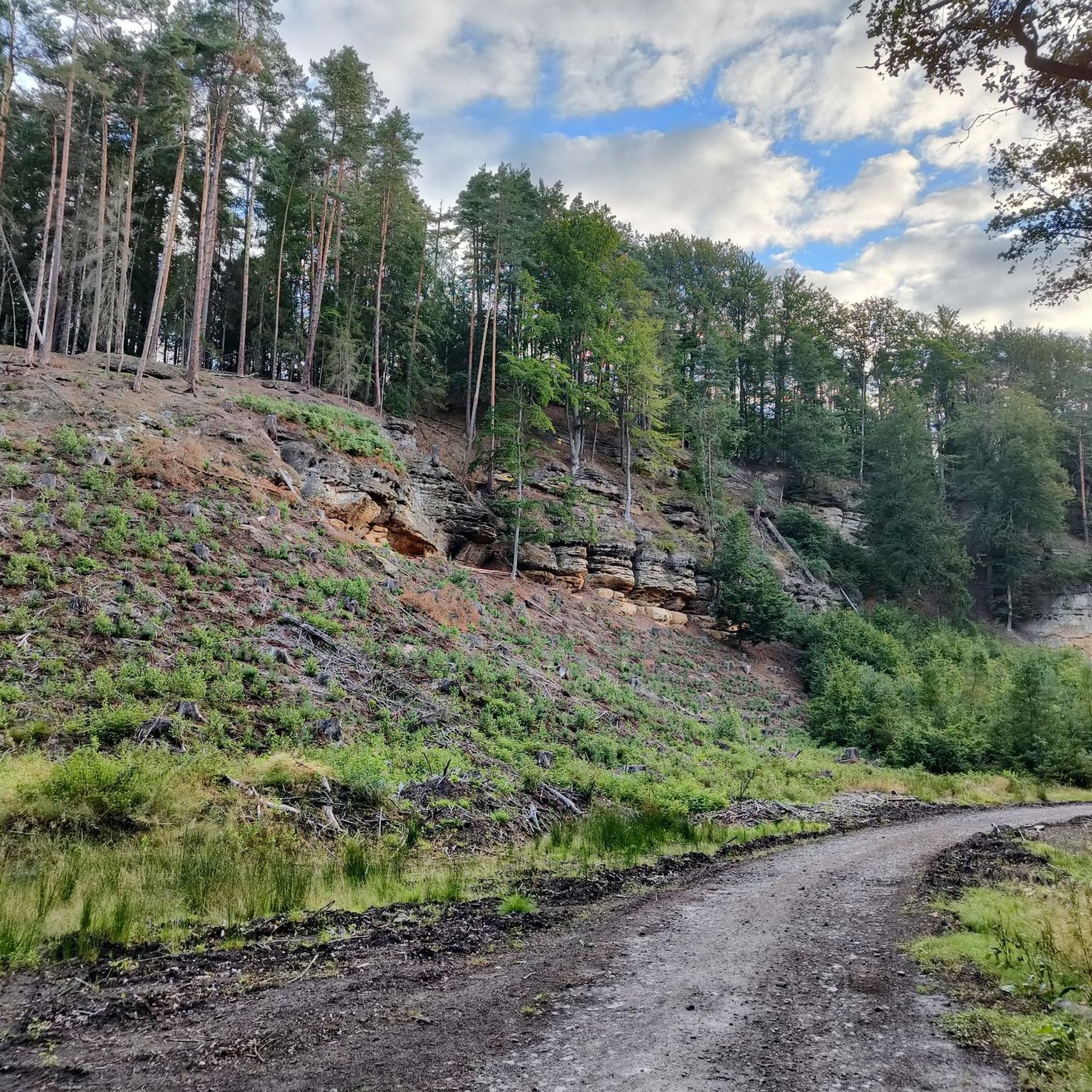
As part of the tourist development of the lake, this path was created through the rock.
0
0
Not only for the inflow and outflow of the Machasee, but also for the railway, a deep, long trench was hewn through the rock.
0
0
The Máchovo jezero or Hirschberger Großteich was the pond created in 1366, with Emperor Charles IV himself having a hand in it. It is located in a spring area and is fed by two streams; the Okenský potok flowing from the Čepelský rybník (Tschöpelteich) and the Břehyňský potok coming from the Břehyňský rybník (Heideteich).
0
0
Highlights include the outflow (here) and the inflow to Lake Macha, both magnificently carved out of the rock in the Middle Ages. Lake Macha or Hirschberger Großteich was created in 1366, with Emperor Charles IV himself lending a hand. It is located in a spring area and is fed by two streams; the Okenský potok flowing from the Čepelský rybník (Tschöpelteich) and the Břehyňský potok coming from the Břehyňský rybník (Heideteich).
0
0

A rocky ditch for the railway line!
0
0

It's better to cycle up the rocky gully or push your bike. You'll then reach a relatively wide forest path.
0
0

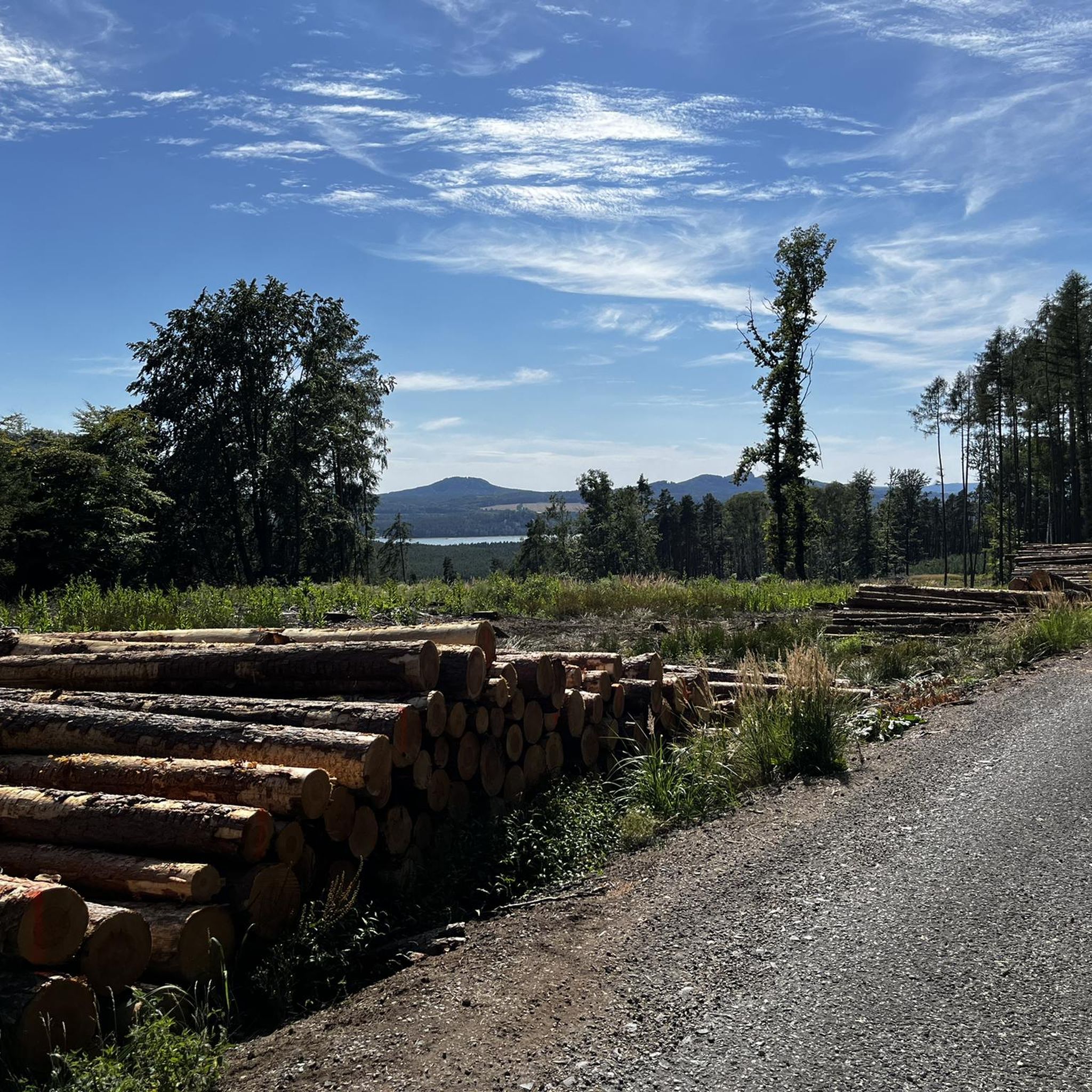
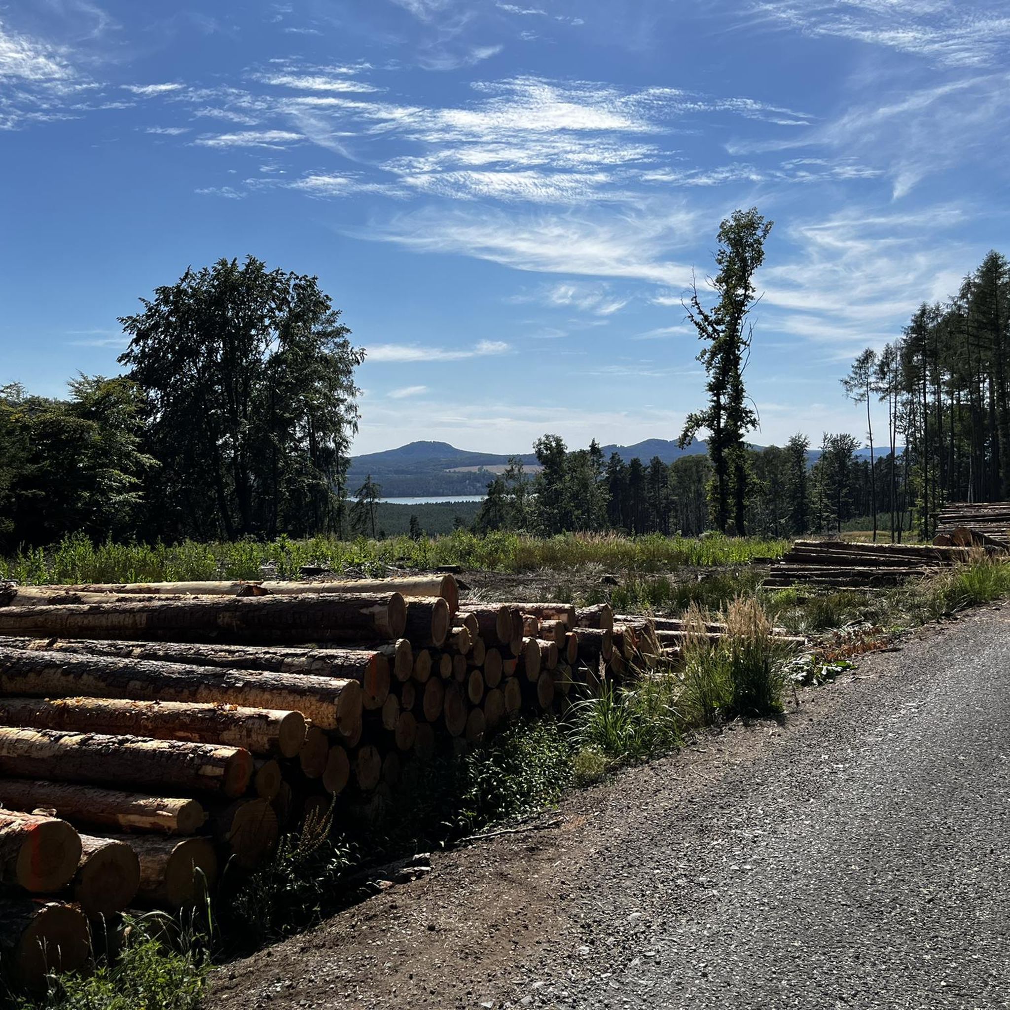
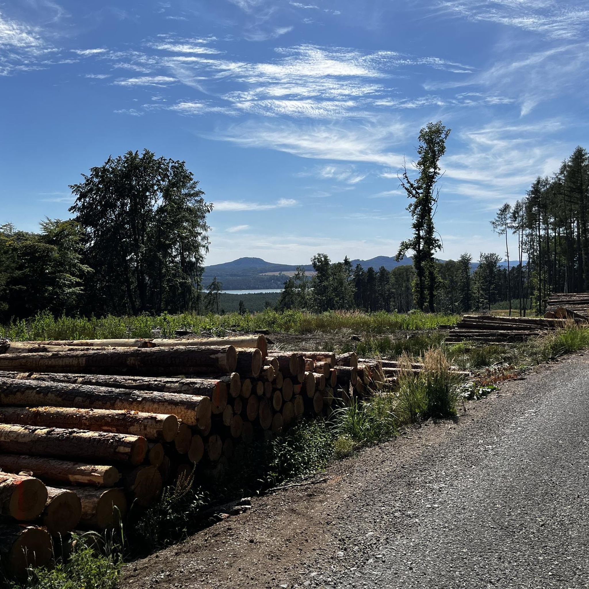
Great view of the lake to the Bösig mountain above the outlet structure at the dam
0
0
Frequently Asked Questions
How many running routes are available in the Břehyně-Pecopala area?
There are over 10 dedicated running routes in Břehyně-Pecopala, offering a variety of distances and difficulty levels suitable for different fitness levels.
Are there any easy jogging routes for beginners in Břehyně-Pecopala?
Yes, the region features relatively flat terrain with occasional gentle ascents, making it suitable for beginners. You'll find at least one easy route and several moderate options that are manageable for those new to running.
What kind of terrain can I expect on the running trails in Břehyně-Pecopala?
The running paths in Břehyně-Pecopala primarily wind through forests, wetlands, and around lakes. You can expect a mix of established trails, often following natural reserves and water bodies like Čepelský rybník.
Are there any long-distance running trails for experienced runners?
Absolutely. For a more challenging run, consider the Holzweg loop from Staré Splavy, which is a difficult 14.8 km (9.2 miles) path with some elevation gain. Another demanding option is the Čepelský rybník – Bezděz loop from Doksy, spanning 14.3 km (8.9 miles).
Can I find circular running routes in Břehyně-Pecopala?
Yes, many of the routes are designed as loops. For example, the Holzweg loop from NPP Swamp is a popular 6.6 km (4.0 miles) circular trail, and the Running loop from Doksy offers a 10.9 km (6.7 miles) circular experience through forested areas.
What do other runners say about the trails in Břehyně-Pecopala?
The running routes in Břehyně-Pecopala are highly rated by the komoot community, holding an average score of 5.0 stars. Runners often praise the diverse terrain, from quiet woodlands to scenic lake views, and the well-maintained trails.
Are the running paths in Břehyně-Pecopala suitable for families?
The region's relatively flat terrain and shorter, easier routes make it suitable for families. Look for the easy and moderate difficulty trails, which often follow established paths around natural reserves, providing a pleasant experience for all ages.
Are dogs allowed on the running trails in Břehyně-Pecopala?
Generally, dogs are welcome on trails in the Břehyně-Pecopala area, especially on established paths. However, as parts of the region are protected natural reserves, it's always best to keep dogs on a leash to protect local wildlife and ensure a pleasant experience for everyone.
Are there any scenic viewpoints or natural attractions along the running routes?
The Břehyně-Pecopala region is characterized by its unique wetland ecosystems, peat bogs, and pine forests. Running paths often offer views of water bodies like Čepelský rybník and provide opportunities to observe the natural beauty of this protected landscape.
What is the best time of year to go jogging in Břehyně-Pecopala?
Spring and autumn are particularly pleasant for jogging in Břehyně-Pecopala, with mild temperatures and beautiful natural scenery. Summer offers lush greenery, but be mindful of warmer weather. Winter running is possible, but trails might be icy or muddy, so appropriate footwear is recommended.
Are there any running routes that start near Doksy?
Yes, the town of Doksy serves as a convenient starting point for several routes. A popular choice is the Running loop from Doksy, a 10.9 km (6.7 miles) trail through forested areas. Another option is the more challenging Čepelský rybník – Bezděz loop from Doksy.
Where can I find parking for the jogging routes in Břehyně-Pecopala?
While specific parking details for each route vary, common starting points like Doksy or Staré Splavy typically offer public parking facilities. It's advisable to check the individual route details on komoot for the most precise parking information.
Most popular routes around Břehyně-Pecopala

Get inspired with the komoot mobile app


Explore more
Browse the best Running Trails & Routes in other regions.
