The best walks and hikes around El Atazar
4.6
(484)
2,857
hikers
139
hikes
Hiking trails around El Atazar are characterized by rugged terrain, expansive water bodies, and diverse ecosystems within the Sierra Norte of Madrid. The region's centerpiece is the El Atazar Reservoir, the largest in the Community of Madrid, surrounded by slate formations and varied woodlands. Hikers encounter a landscape shaped by water erosion, featuring deep gorges, oak groves, and juniper bushes. Elevation changes are common, offering panoramic views of the reservoir and surrounding mountain ranges.
Best hiking trails around El Atazar
…Last updated: October 12, 2026
4.6
(9)
32
hikers
Moderate hike. Good fitness required. Mostly accessible paths. Sure-footedness required.
5.0
(2)
9
hikers
Moderate hike. Good fitness required. Mostly accessible paths. Sure-footedness required.

4.0
(1)
8
hikers
13.0km
04:40
570m
580m
Moderate hike. Good fitness required. Mostly accessible paths. Sure-footedness required.
5.0
(1)
8
hikers
10.9km
03:11
280m
290m
Moderate hike. Good fitness required. Easily-accessible paths. Suitable for all skill levels.
9
hikers
17.0km
06:01
790m
800m
Hard hike. Very good fitness required. Mostly accessible paths. Sure-footedness required.
Get access to more routes and recommendations from other explorers.
Already have an account?
Our route recommendations are based on thousands of hikes, rides, and runs completed by other people on komoot.
Start today with a free account
Your next adventure awaits.



Tips from the Community

Panoramic loop through the Sierra del Rincón
0
0

Spectacular views, generally good climb with some demanding sections before crossing the firebreak. the rest, quite bearable
1
0

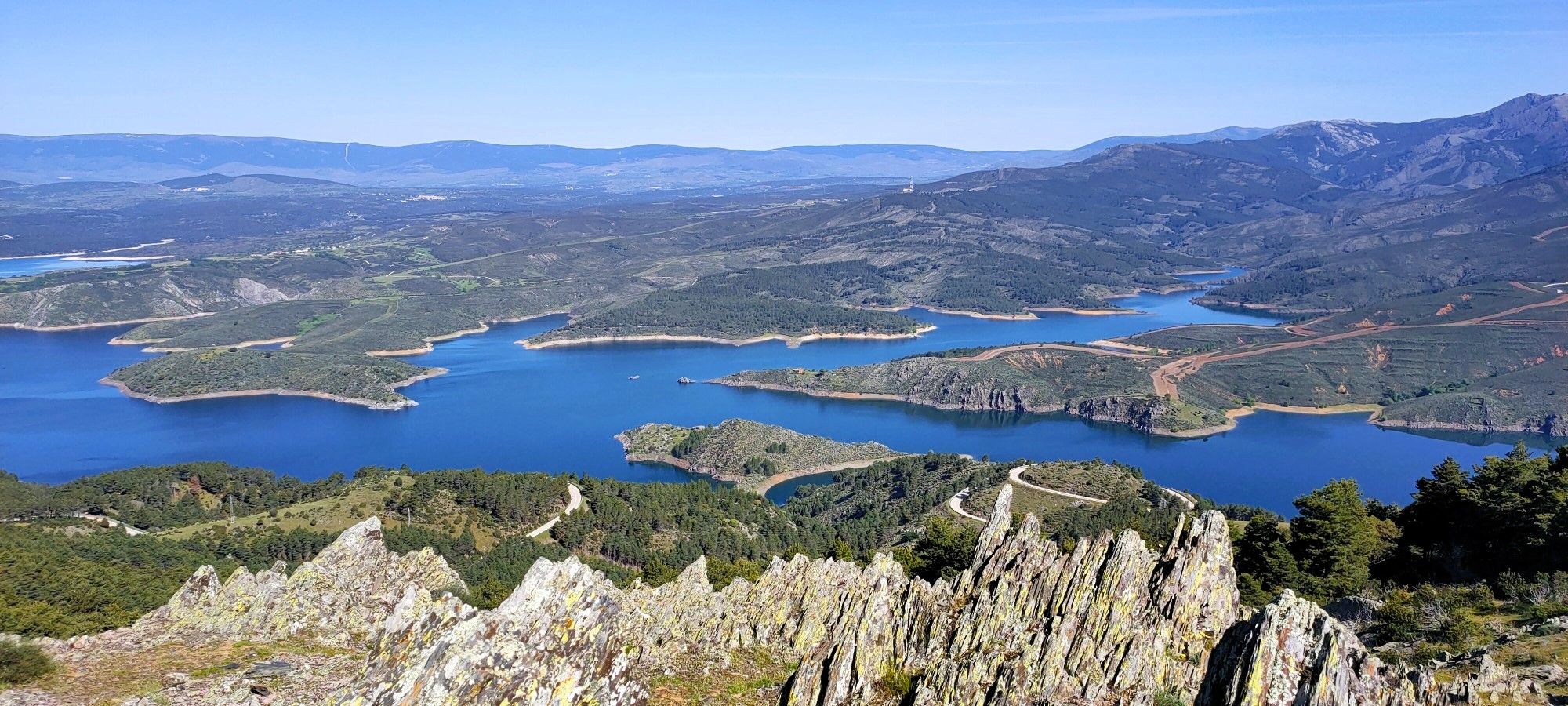
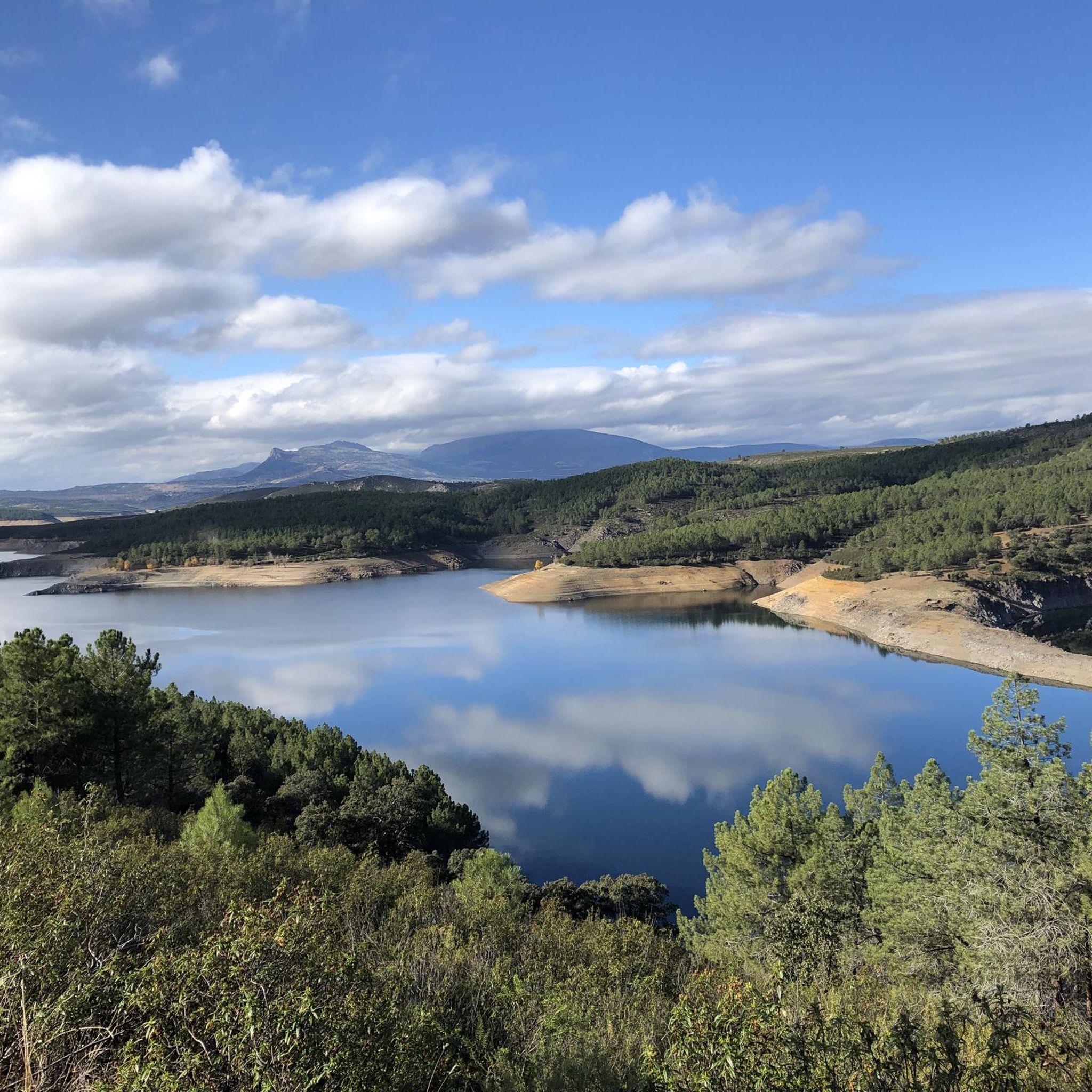
Cancho de la Cabeza, the highest peak in the municipality of Patones, rises majestically in the Sierra Norte region of Madrid. This beautiful natural viewpoint offers panoramic views of the El Atazar reservoir and, in the background, you can see the Peña de la Cabra, one of the numerous peaks of the Ayllón mountain range.
2
0
Cancho de la Cabeza, the highest peak in the municipality of Patones, rises majestically in the Sierra Norte region of Madrid. This beautiful natural viewpoint offers panoramic views of the El Atazar reservoir and, in the background, you can see the Peña de la Cabra, one of the numerous peaks of the Ayllón mountain range. Remember that Patones de Arriba is a small “kingdom” near Madrid, full of charm and tradition. Enjoy the natural beauty and stunning views that Cancho de la Cabeza offers! 🏞️🌄
1
0

Approach the information panel that describes the entire landscape around the Atazar reservoir, and then sit on the Geodesic to rest and enjoy. !It is a wonder
1
0
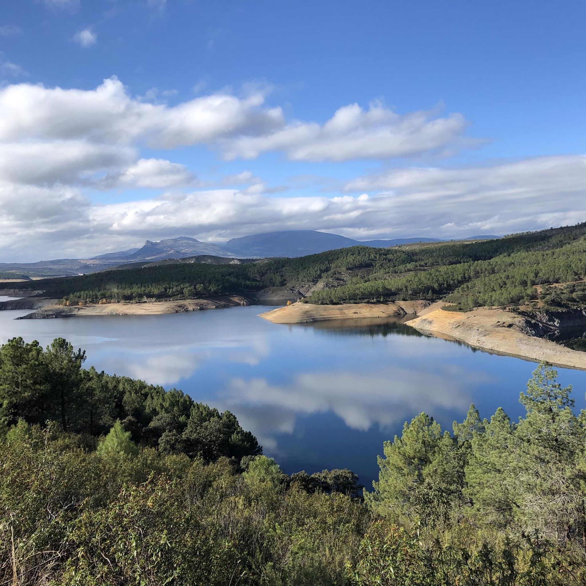
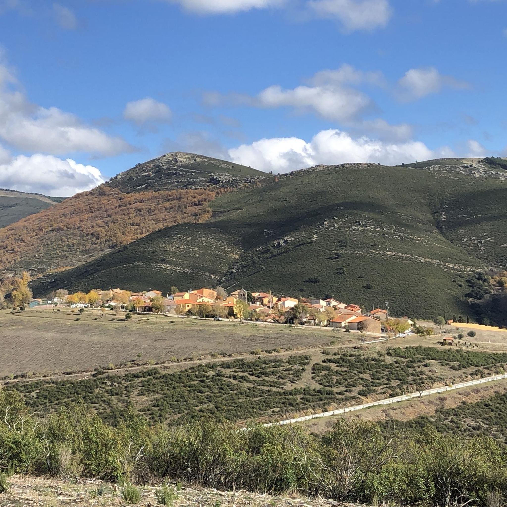
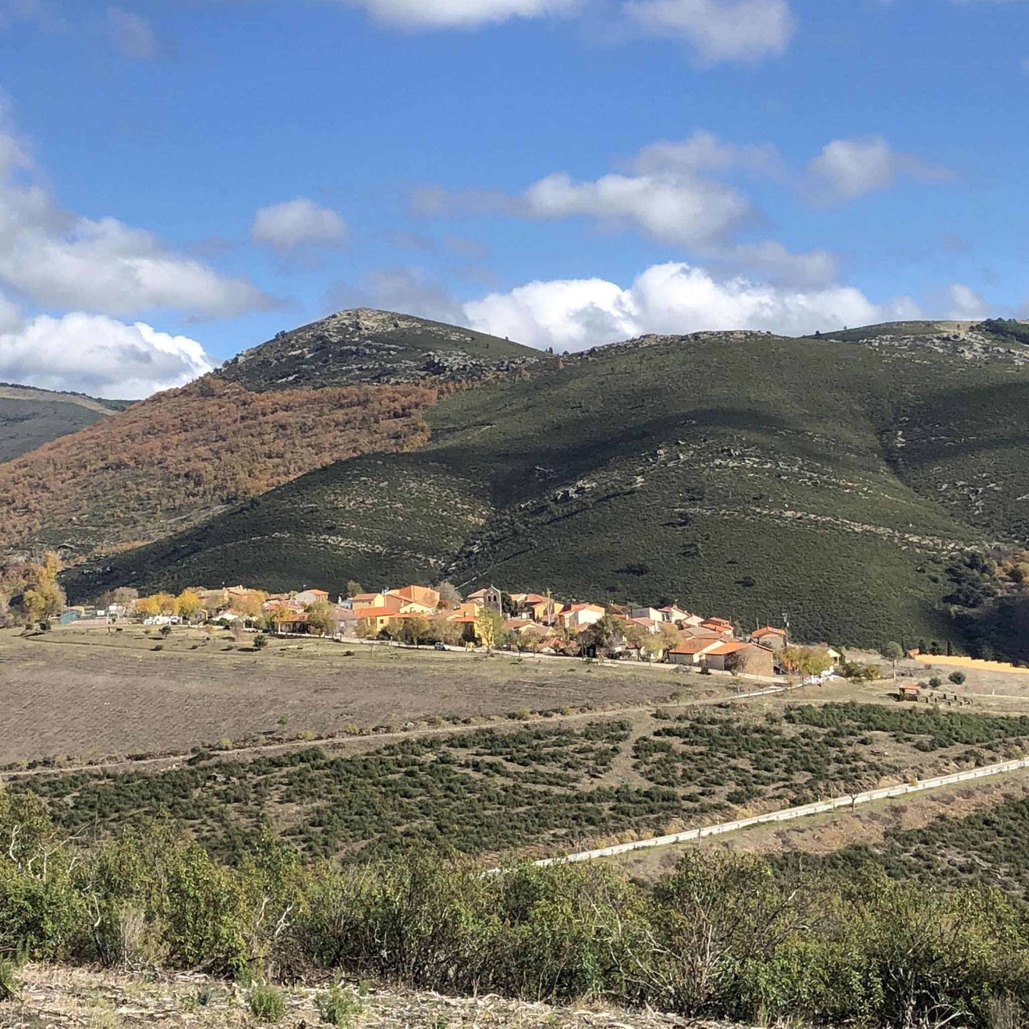
A beautiful town in a privileged location, between the Lozoya River Reservoir that bears the name of El Atazar, and the Sierra Norte of Madrid and Guadalajara. The surrounding landscape is extraordinary.
1
0

This point on the path is ideal for observing the Atazar reservoir and the northern mountains of Madrid. Without a doubt a point worthy of a photo.
1
0
Excellent place to recognize all the places in the Atazar reservoir. There is a great photo with the name of the places.
1
0
Frequently Asked Questions
What kind of terrain can I expect on hiking trails around El Atazar?
Hiking trails in El Atazar are characterized by a rugged and dramatic landscape, primarily featuring slate formations. You'll encounter diverse ecosystems including oak groves, juniper bushes, ash forests, and pine forests. The area also has unique geological formations like Las Cárcavas, known as 'Fairy's Chimneys,' and deep gorges carved by the Lozoya River. Elevation changes are common, offering panoramic views of the reservoir and surrounding mountains.
How many hiking trails are available in the El Atazar area?
There are over 120 hiking trails available around El Atazar. This includes a wide range of options, with approximately 24 easy routes, 78 moderate routes, and 21 more challenging trails, catering to various skill levels.
Are there any family-friendly hiking options in El Atazar?
Yes, El Atazar offers several family-friendly hiking options. Many of the 24 easy routes are suitable for families. While specific routes aren't detailed as 'family-friendly' in the data, trails like the Senda del Tinao del Águila are known for being easy and offering great views, making them good choices for a leisurely outing with children.
What are the best viewpoints of the El Atazar Reservoir?
The El Atazar Reservoir, often called the 'sea of Madrid,' offers stunning views from various points. The Mirador de El Atazar provides one of the best panoramic views of the impressive El Atazar Dam. Additionally, ascending the Cancho de la Cabeza Summit offers spectacular 360-degree views of the reservoir and surrounding mountain ranges.
Are there any circular hiking routes around El Atazar?
Yes, El Atazar has several circular hiking routes. A popular option is the El Atazar – El Atazar Viewpoint loop from El Atazar, which is 10.9 km long and takes about 3 hours 10 minutes. The Senda del Genaro is also a well-known circular route that traces the perimeter of the reservoir, connecting charming villages.
What kind of natural features or landmarks can I see while hiking in El Atazar?
Beyond the vast El Atazar Reservoir, you can explore unique natural features like the dramatic slate formations and the 'Fairy's Chimneys' (Las Cárcavas), which are curious shapes carved by water erosion. The area also boasts deep gorges carved by the Lozoya River. For specific landmarks, consider visiting the El Villar Reservoir and Gorge or enjoying the Views of the Lozoya River.
What do other hikers enjoy most about the trails in El Atazar?
The trails in El Atazar are highly rated by the komoot community, with an average score of 4.7 stars from over 360 reviews. Hikers frequently praise the diverse terrain, the expansive views of the reservoir, and the mix of woodlands and rugged landscapes. The opportunity to reach summits like Cancho de la Cabeza for panoramic vistas is also a highlight for many.
Are there any challenging hikes for experienced hikers in El Atazar?
Yes, for experienced hikers seeking a challenge, El Atazar offers 21 difficult routes. Trails leading to the Cancho de la Cabeza Summit are known for being rewarding with significant elevation gain. The Senda del Pisanchón is another moderately difficult trail that navigates considerable elevation changes over a short distance, passing through dense cistus shrubs and slate rock formations.
Can I find trails that explore the local villages and traditional architecture?
Yes, the region offers trails that allow you to explore charming local villages. The village of El Atazar itself is pedestrian-friendly and features traditional architecture built with black slate. The historic village of Patones de Arriba, known for its well-preserved black architecture, is also nearby and can be accessed via various routes, such as the Patones Gorge Trail.
Are there any trails that pass by ancient structures or historical sites?
While the primary focus is natural beauty, some trails offer glimpses into the region's past. The Senda del Tinao del Águila, for instance, provides views over the reservoir and allows you to see well-preserved ancient sheepfolds (tinados), which are traditional structures used by shepherds.
What is the best time of year to hike in El Atazar?
El Atazar offers good hiking conditions for much of the year. The Senda de la Dehesa is particularly known for its spectacular autumn colors from the oak and Pyrenean oak leaves, making autumn a beautiful time to visit. Spring and early summer also offer pleasant temperatures and vibrant flora. Summers can be hot, so early morning or late afternoon hikes are recommended, while winters can be chilly but offer crisp views.
Are there any trails that offer views of other mountain ranges from El Atazar?
Absolutely. From higher vantage points, particularly the Cancho de la Cabeza Summit, you can enjoy spectacular 360-degree panoramic views. On clear days, these views extend beyond the El Atazar Reservoir to include the Sierra de Ayllón, the Sierra de La Cabrera, and even the distant Peñalara peak, the highest in Madrid.
Most popular routes around El Atazar
Most popular attractions around El Atazar

Get inspired with the komoot mobile app


Explore more
Browse the best Hikes in other regions.
