The best running trails around La Garrovilla
5.0
(34)
1,273
runners
45
runs
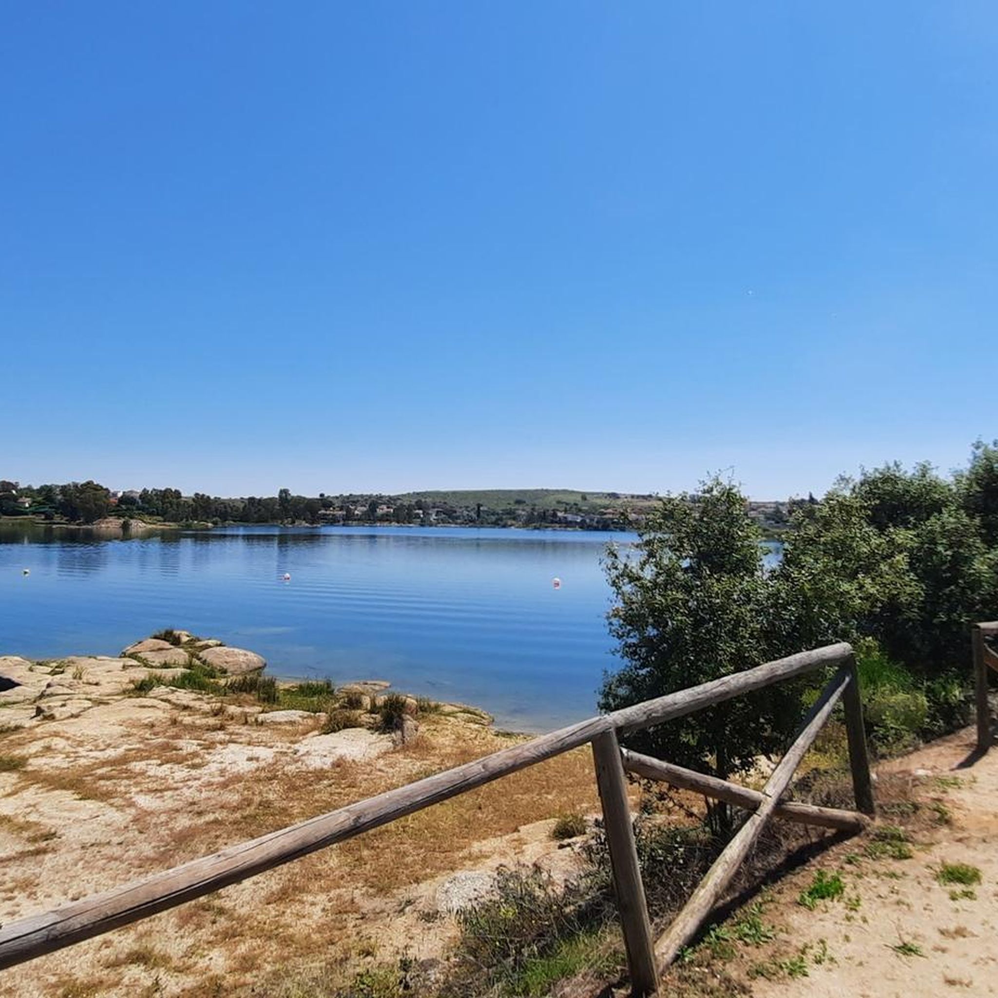
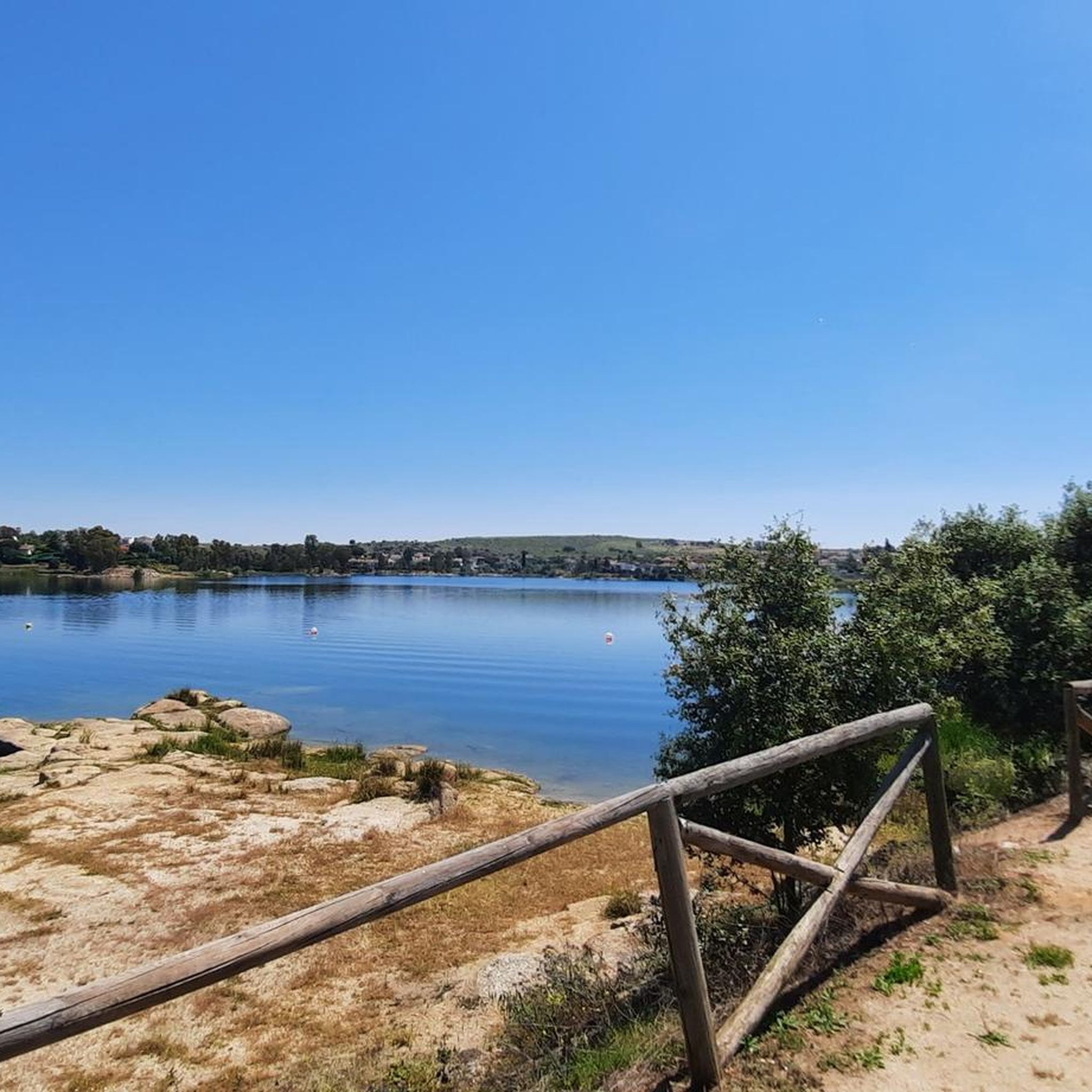
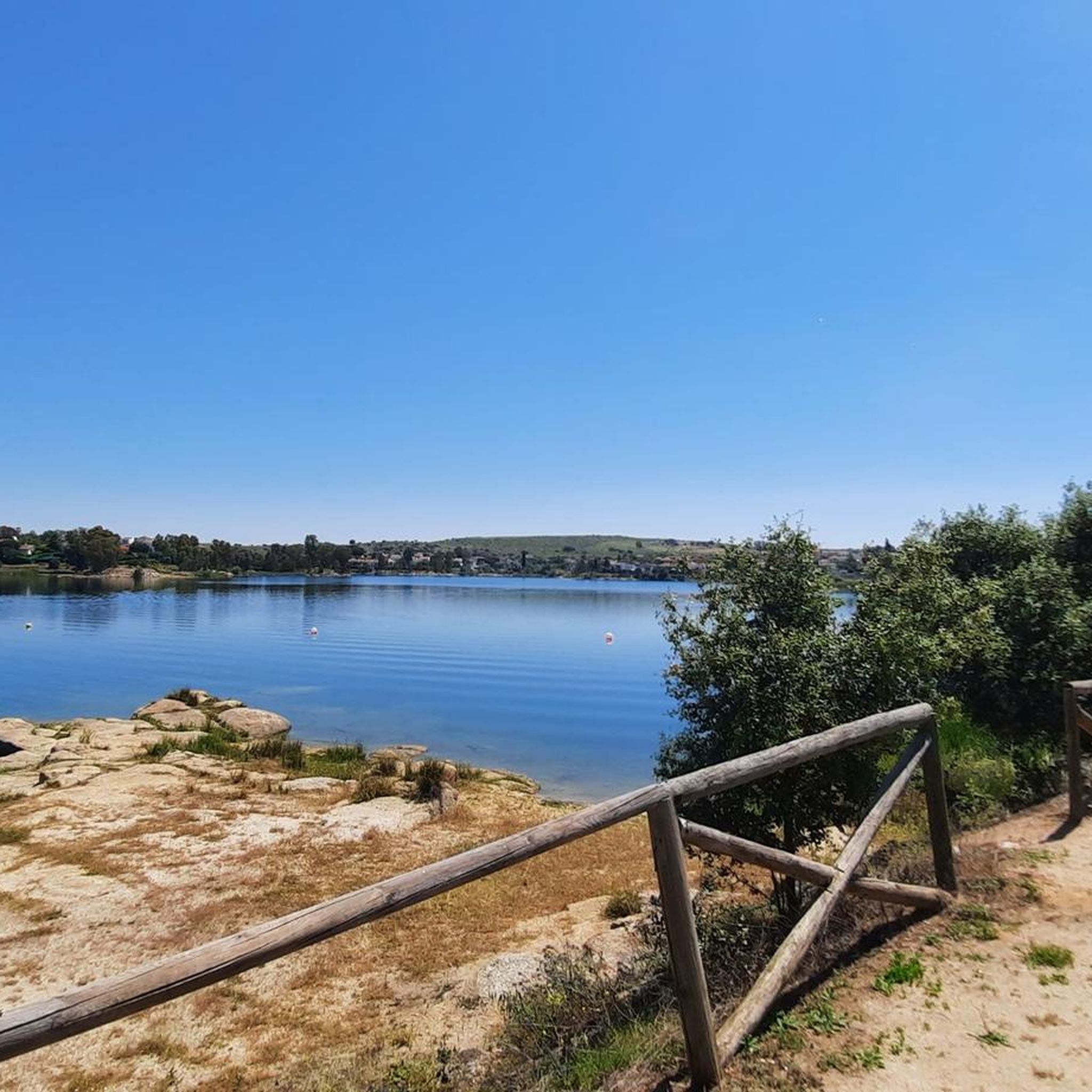
Jogging routes around La Garrovilla are set within the tranquil natural landscapes of the Lácara area, bordered by the Sierras de San Cerván and La Moneda. The region is characterized by diverse and scenic surroundings, including the notable Embalse de Los Canchales reservoir. This area offers a network of trails suitable for running, allowing for exploration of its varied natural environment.
Best jogging routes around La Garrovilla
- The most popular jogging route is Los Canchales Reservoir Circular Trail, an…
Last updated: August 21, 2026
4.38km
00:32
30m
30m
Easy run. Great for any fitness level. Mostly paved surfaces. Suitable for all skill levels.
7.20km
00:51
40m
40m
Moderate run. Good fitness required. Mostly paved surfaces. Suitable for all skill levels.

Sign up for free
35
runners
8.53km
01:02
350m
350m
Hard run. Very good fitness required. Mostly paved surfaces. Suitable for all skill levels.
10
runners
12.9km
01:35
390m
390m
Hard run. Very good fitness required. Mostly paved surfaces. Suitable for all skill levels.
14
runners
10.7km
01:08
60m
60m
Moderate run. Good fitness required. Mostly paved surfaces. Suitable for all skill levels.
Get access to more routes and recommendations from other explorers.
Sign up for free
Already have an account?
Our route recommendations are based on thousands of hikes, rides, and runs completed by other people on komoot.
Start today with a free account
Your next adventure awaits.
Login or Signup

Tips from the Community

Plasencia deserves to be walked through.
1
0

Cerro de San Serván is a popular hiking destination in the Arroyo de San Serván mountain range near Mérida. At an altitude of 608 metres, it offers stunning views of the surrounding plain.
4
0

The Roman Bridge marks the end of the Camino Mozarabe in Extremadura. From here you come to the Via de la Plata.
1
0

The highest peak of the Arroyo de San Serván mountain range, with its 608 m high, offers us beautiful views of the plain that surrounds us.
3
1

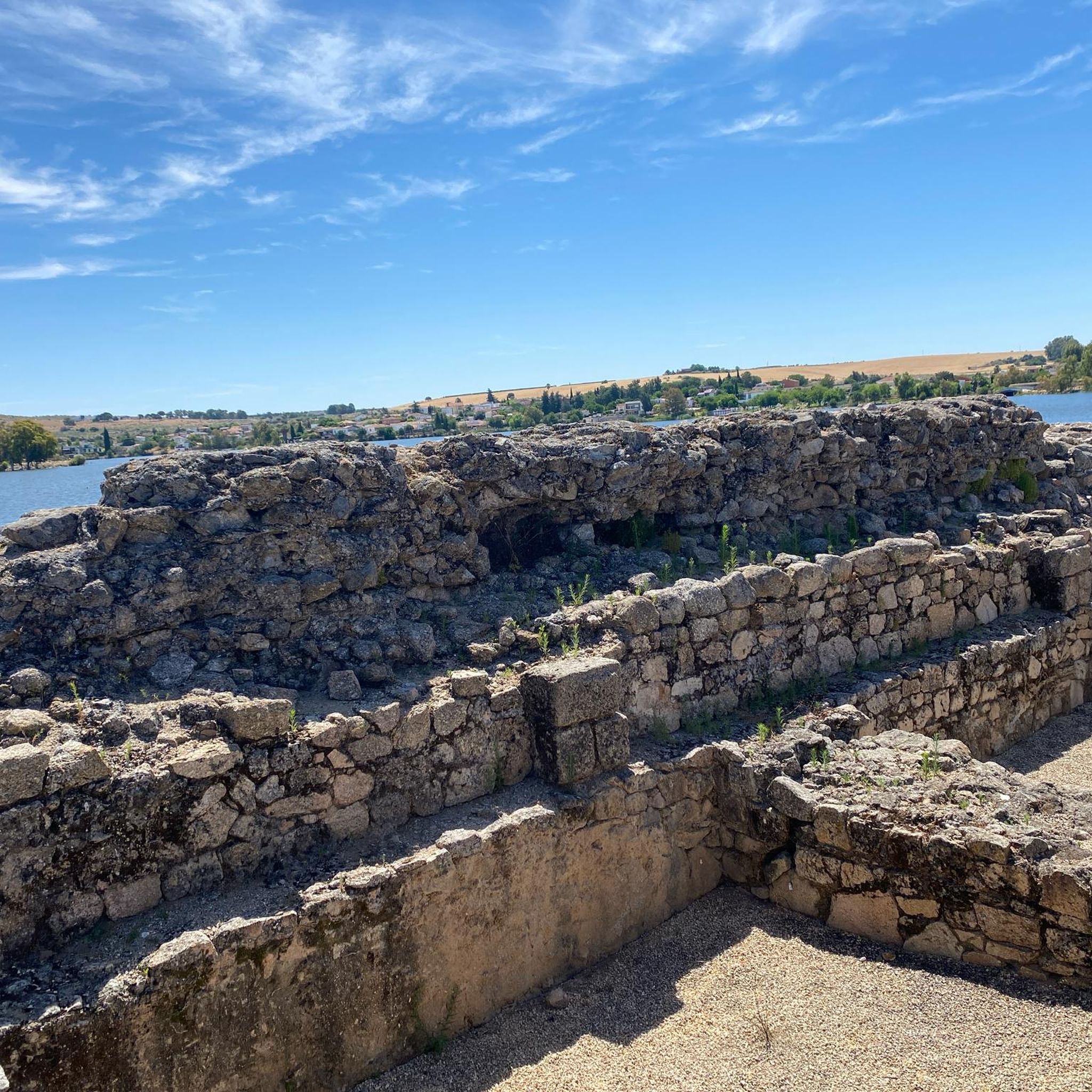
Nucleus very close to Mérida which is known for its Roman dam which is located in the north of the town. In the old center of the town is the Iglesia Purísima Concepción.
0
1
A natural lagoon that is well known in the area since in Roman times, they built a dam that is still preserved today!
0
0
Dam that collects the waters of the Riber de Lácara and where it is located to the north of the municipality of La Garrovilla.
0
1
Good place to walk with the little ones and good views of the Roman bridge.
14
0
Frequently Asked Questions
How many running routes are available in La Garrovilla?
There are over 40 dedicated running routes around La Garrovilla, offering a variety of options for different preferences and fitness levels. These routes are highly rated by the komoot community, with an average score of 5.0 stars from more than 20 reviews.
What kind of terrain can I expect on the jogging routes in La Garrovilla?
The jogging routes in La Garrovilla traverse tranquil natural landscapes, often bordering the Sierras de San Cerván and La Moneda. You can expect diverse and scenic surroundings, including paths around the Embalse de Los Canchales reservoir and routes near historic Roman dams. The area offers a mix of easy, moderate, and difficult terrains.
Are there any easy running routes suitable for beginners or a relaxed pace?
Yes, La Garrovilla offers several easy running routes. A popular choice is the Los Canchales Reservoir Circular Trail, an easy 2.7-mile (4.4 km) path that takes about 30 minutes to complete and provides scenic views of the reservoir.
Are there options for longer runs, perhaps around 10k or more?
Absolutely. For those looking for a longer challenge, the Running loop from Arroyo de San Serván is a 10.2-mile (16.5 km) trail that leads through varied terrain and can typically be completed in about 2 hours. There are also other moderate routes that offer significant distances.
Are there any circular running routes in La Garrovilla?
Yes, many of the running routes in La Garrovilla are circular, allowing you to start and end at the same point. For example, the Los Canchales Reservoir Circular Trail and the Charca Grande Roman Dam Loop from Esparragalejo are excellent circular options.
What interesting landmarks or natural features can I see while running?
The region is rich in natural beauty and historical sites. You can run alongside the biologically rich Los Canchales Reservoir, or explore routes that feature the historic Roman Dam "Charca Grande". Further afield, but still accessible, are significant Roman monuments in Mérida, such as the Temple of Diana and the Roman Bridge of Mérida.
Are the running trails in La Garrovilla dog-friendly?
While specific regulations for each trail may vary, the natural landscapes around La Garrovilla generally welcome dogs, especially on hiking and running paths. It's always advisable to keep your dog on a leash and ensure you clean up after them to preserve the natural environment for everyone.
Are there family-friendly jogging routes in La Garrovilla?
Many of the easier and moderate routes, particularly those around the Los Canchales Reservoir, are suitable for families. These paths offer relatively flat terrain and beautiful scenery, making them enjoyable for all ages. Always check the route details for distance and elevation to ensure it matches your family's capabilities.
Is parking available near the running trails?
Yes, for many of the popular running routes, especially those starting from towns like Esparragalejo or Arroyo de San Serván, you will typically find parking options. It's recommended to check the specific route details on komoot for information on designated parking areas near the trailheads.
What is the best time of year to go running in La Garrovilla?
The spring and autumn months generally offer the most pleasant conditions for running in La Garrovilla, with milder temperatures and beautiful natural scenery. Summers can be quite hot, so early morning or late evening runs are preferable during that season. Winters are usually mild, making year-round running possible, though some paths might be muddy after rain.
What do other runners say about the trails in La Garrovilla?
The running trails in La Garrovilla are highly regarded by the komoot community, boasting an impressive average rating of 5.0 stars from over 20 reviews. Runners frequently praise the tranquil natural landscapes, the well-maintained paths, and the opportunity to combine exercise with exploring the region's scenic beauty and historical sites like the Roman dams.
Most popular routes around La Garrovilla
Most popular attractions around La Garrovilla

Get inspired with the komoot mobile app


Explore more
Browse the best Running Trails & Routes in other regions.
