The best running trails around La Vall D'Uixó
3.7
(13)
666
runners
43
runs
Jogging routes around La Vall D'Uixó offer a diverse landscape, from the mountainous terrain of the Sierra de Espadán Natural Park to the extensive citrus groves in the lower elevations. The region is characterized by rugged hills, lush cork oak forests, and cool ravines, providing varied running environments. Peaks reaching up to 700 meters, such as Pipa and Penyalba, offer challenging ascents and panoramic views. Additionally, historical aqueduct trails and routes near the Coves de Sant Josep add unique elements…
Last updated: October 10, 2026
5.0
(1)
6
runners
14.7km
01:54
570m
570m
Tackle the difficult 9.1-mile Font del Nogueret - Font de Cabres Trail for panoramic views and a challenging jog through varied terrain.
3.0
(1)
87
runners
11.6km
01:29
320m
320m
Hard run. Very good fitness required. Sure-footedness, sturdy shoes and alpine experience required.

55
runners
21.9km
02:49
730m
730m
Hard run. Very good fitness required. Sure-footedness, sturdy shoes and alpine experience required.
27
runners
21.5km
02:33
530m
530m
Hard run. Very good fitness required. Sure-footedness, sturdy shoes and alpine experience required.
23
runners
17.0km
02:14
670m
670m
Hard run. Very good fitness required. Mostly paved surfaces. Suitable for all skill levels.
Get access to more routes and recommendations from other explorers.
Already have an account?
Our route recommendations are based on thousands of hikes, rides, and runs completed by other people on komoot.
Start today with a free account
Your next adventure awaits.

Tips from the Community

Sierra Espadán, a natural lung very close to the Mediterranean
0
0

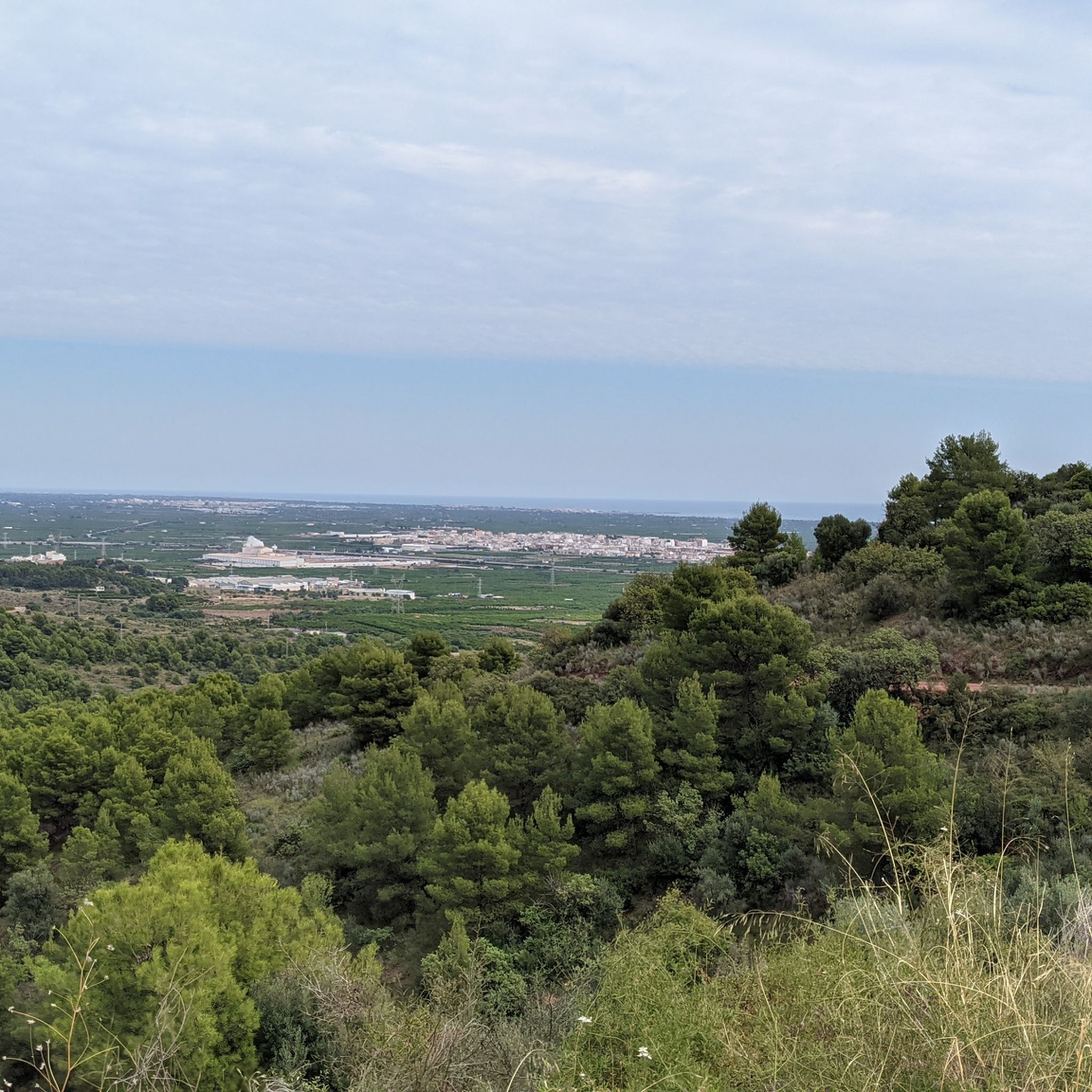
At this point, you have at your feet an extensive pine forest that adorns the mountain and, on the horizon, an immense valley that disappears into the horizon line. It is worth stopping for a few moments and enjoying the place.
1
0

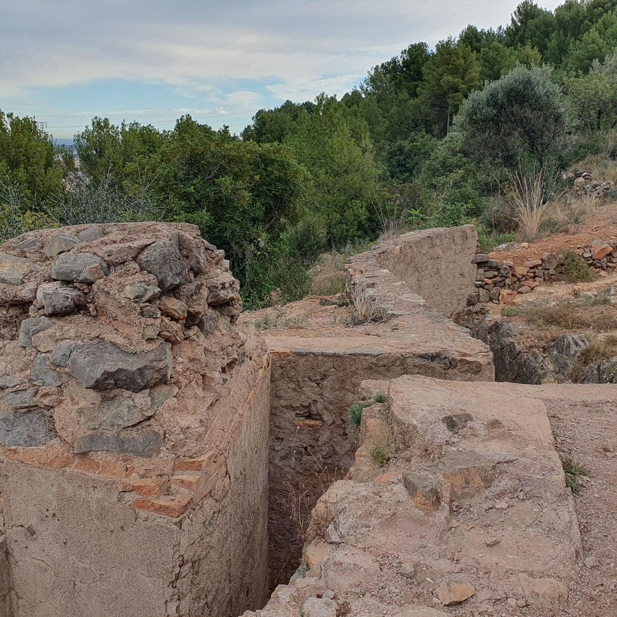
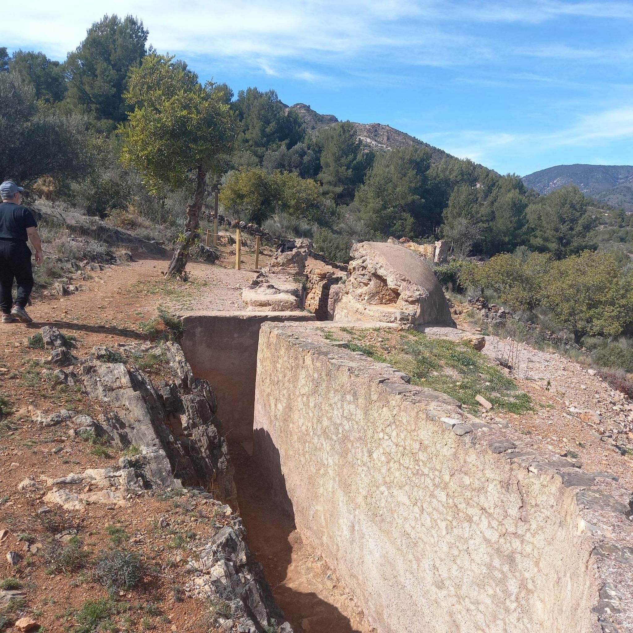
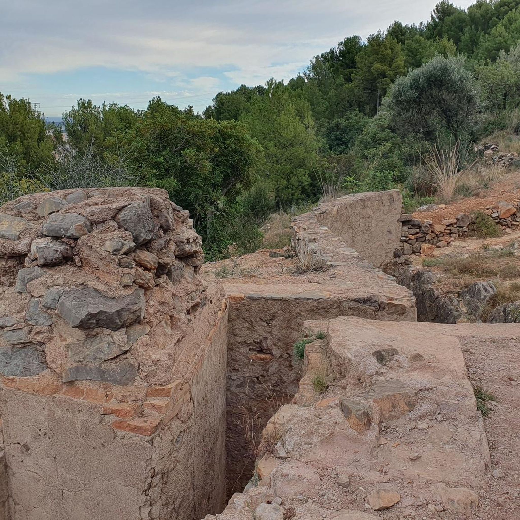
Fortress of La Creueta The XYZ Line was constructed as a final defensive barrier preventing Franco's advance towards Valencia. Its construction meant a boost in morale for those fighting a few kilometers away and a moral duty for those who fortified the fortress while their comrades lost their lives in the trenches on the front line of fire. Although it was caught in time, it largely achieved its objective, being crucial to the defense during the Battle of the Levante and preventing the fighting from reaching the lines closest to Valencia. This resistance is now viewed by many historians as a defensive victory.
10
0
The path leads us along the red rocks to the Pic de la Font de Cabres. Sure-footedness and a head for heights are required.
6
0

Beautiful views and good route of the trenches for both hiking and trail
0
0

Place with unbeatable views of the Castellón plain.
0
1

XYZ line machine gun nest. Defensive belt built by the army of the Republic in 1938 in order to stop the advance of the coup troops towards Valencia
2
0

Trenches from the Spanish Civil War
2
0
Frequently Asked Questions
How many running routes are available around La Vall d'Uixó?
There are nearly 50 running routes available around La Vall d'Uixó, offering a wide variety of distances and difficulty levels. This includes options from easier paths to challenging mountain runs.
What kind of terrain can I expect on the running trails in La Vall d'Uixó?
The running trails in La Vall d'Uixó offer diverse terrain. You'll find mountainous paths within the Sierra de Espadán Natural Park, characterized by lush cork oak forests and rugged landscapes. Lower elevations feature extensive citrus groves, while historical aqueduct paths provide flatter, scenic options. Expect a mix of challenging ascents and descents, especially on routes like Alt del Pipa – Penya del Migdia loop.
Are there any easy running routes suitable for beginners in La Vall d'Uixó?
Yes, while many routes are challenging, La Vall d'Uixó does offer some easier paths suitable for beginners. For instance, the Camí de l'Aigua (Water Route) is an urban trail that follows an old irrigation channel, passing by historical sites and offering a gentler experience. You can also find paths along the San José and La Alcudia aqueducts which are generally less strenuous.
What are the best times of year to go running in La Vall d'Uixó?
The best times of year for running in La Vall d'Uixó are typically spring and autumn when temperatures are milder. Summers can be quite hot, especially at midday, so early morning or late evening runs are advisable. Winters are generally mild, making it possible to run year-round, though some higher mountain trails might be cooler.
Are there any family-friendly running or walking options in La Vall d'Uixó?
Yes, for families, the Senda XYZ (XYZ Line Trail) offers an easy and historically interesting path, following a defense line from the Spanish Civil War. The Camí de l'Aigua, an urban route tracing an old irrigation channel, is also suitable for a leisurely family jog or walk, passing by Roman aqueducts and medieval windmills.
Can I bring my dog on the running trails in La Vall d'Uixó?
Many of the natural trails and paths in the Sierra de Espadán Natural Park and surrounding areas are generally dog-friendly, provided your dog is well-behaved and kept under control, especially in areas with wildlife or livestock. Always ensure to check local regulations for specific trails, and remember to carry water for your pet, particularly on longer or more exposed routes.
What historical or natural landmarks can I see while running in La Vall d'Uixó?
La Vall d'Uixó's routes are rich in landmarks. You can explore ancient Muslim towers and old agricultural structures on trails like the PR-V-164. The area is also home to the famous Coves de Sant Josep (San José Caves), known for Europe's longest navigable underground river. Nearby, you might encounter historical sites like the Castle of La Vall d'Uixó or the Castro Castle. For natural beauty, enjoy views of the Ajuez Reservoir or the Laguna de la Dehesa viewpoint.
Are there any circular running routes available in the area?
Yes, many of the running routes around La Vall d'Uixó are designed as loops, allowing you to start and finish in the same location. Popular circular options include the challenging Bassa del Quistel loop and the longer Coll Roig (Red Pass) loop, which both offer significant climbs and descents through the region's natural beauty.
What do other runners enjoy most about jogging in La Vall d'Uixó?
The running routes in La Vall d'Uixó are highly rated by the komoot community, with an average score of 3.8 stars. Runners frequently praise the diverse and challenging terrain, the stunning panoramic views from peaks like Pipa, and the opportunity to explore both natural park landscapes and historical sites. The variety of routes, from citrus groves to rugged mountains, is also a highlight.
Are there opportunities for wildlife spotting while running?
Running through the Sierra de Espadán Natural Park offers excellent opportunities for wildlife spotting. This protected area is home to diverse flora and fauna, including various bird species, wild boars, and other small mammals. The lush cork oak forests and cool ravines provide a rich habitat, especially during quieter times of the day.
Where can I find parking for the running trails?
Parking availability varies by trail. For routes starting near urban areas or popular attractions like the Coves de Sant Josep, you'll typically find designated parking lots. For trails deeper within the Sierra de Espadán Natural Park, parking might be more limited, often consisting of roadside pull-offs or small clearings. It's advisable to check the specific route details on komoot for parking information before you go.
Are there any routes that offer panoramic views?
Absolutely! Many routes in La Vall d'Uixó provide spectacular panoramic views, especially those that ascend the surrounding mountains. The Alt del Pipa – Penya del Migdia loop, for example, includes an ascent to the peak of Pipa, offering extensive vistas of the area, including the Mediterranean Sea on clear days. The rugged terrain of the Sierra de Espadán also provides numerous viewpoints.
Most popular routes around La Vall D'Uixó
Most popular attractions around La Vall D'Uixó

Get inspired with the komoot mobile app


Explore more
Browse the best Running Trails & Routes in other regions.
