The best running trails around Argelaguer
4.5
(23)
1,972
runners
113
runs
Jogging routes around Argelaguer traverse a diverse landscape characterized by the Fluvià River plain, surrounded by forested hills and volcanic terrain. The region offers a variety of scenic running routes through the Garrotxa Volcanic Zone Natural Park, featuring extinct volcanoes and lush vegetation. Runners can explore paths along waterways and through wooded areas, providing varied inclines and natural environments.
Best jogging routes around Argelaguer
- The most popular jogging route is Running loop from Sant Jaume de Llierca, a 4.9…
Last updated: June 29, 2026
9
runners
7.97km
00:51
100m
100m
Moderate run. Good fitness required. Mostly paved surfaces. Suitable for all skill levels.
8
runners
7.74km
00:49
100m
100m
Moderate run. Good fitness required. Mostly paved surfaces. Suitable for all skill levels.

Sign up for free
7
runners
9.88km
01:15
320m
320m
Hard run. Very good fitness required. Mostly paved surfaces. Suitable for all skill levels.
5.0
(1)
9
runners
21.3km
02:43
680m
680m
Hard run. Very good fitness required. Mostly paved surfaces. Suitable for all skill levels.
7
runners
15.9km
02:14
700m
700m
Hard run. Very good fitness required. Mostly paved surfaces. Suitable for all skill levels.
Get access to more routes and recommendations from other explorers.
Sign up for free
Already have an account?
Our route recommendations are based on thousands of hikes, rides, and runs completed by other people on komoot.
Start today with a free account
Your next adventure awaits.
Login or Signup

Tips from the Community

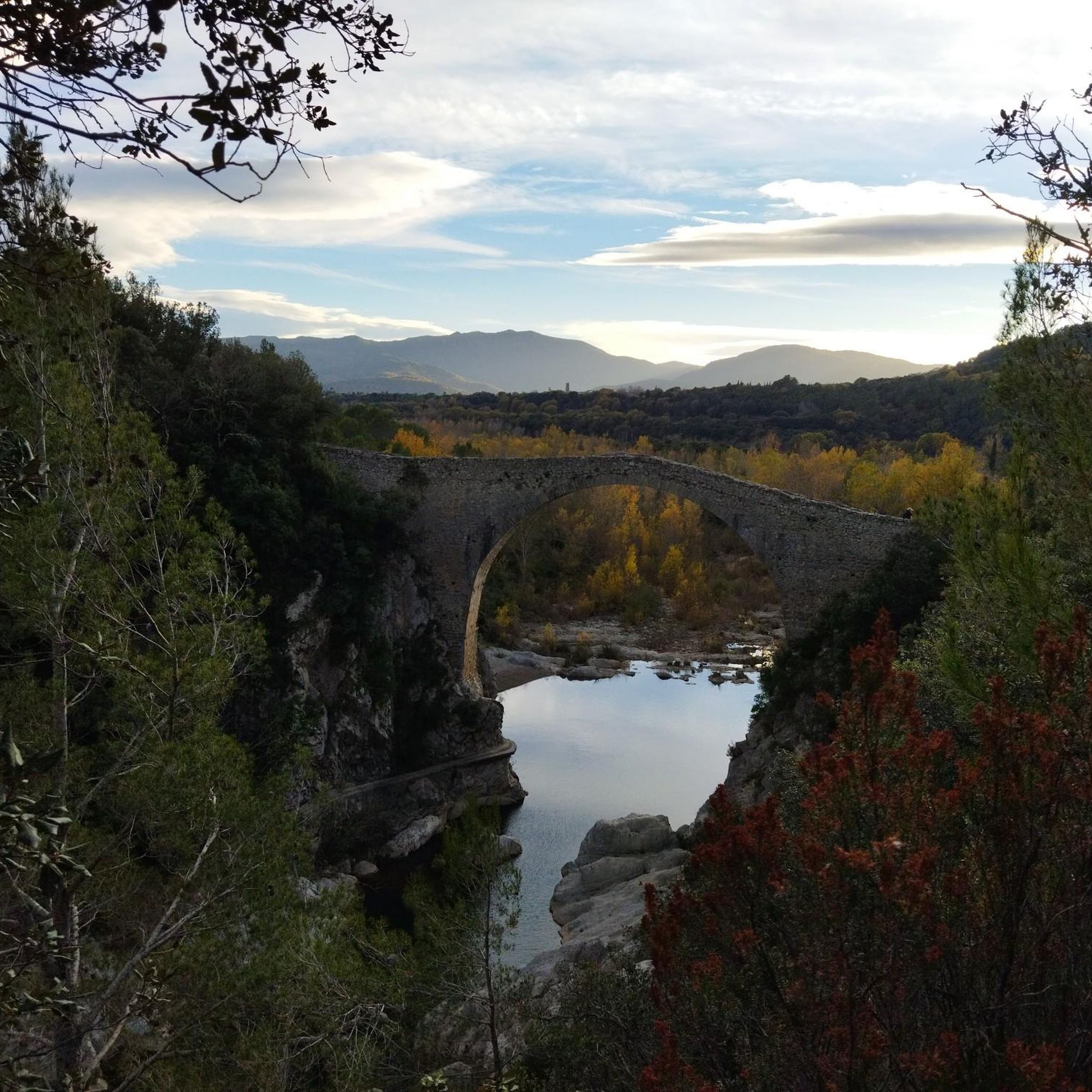
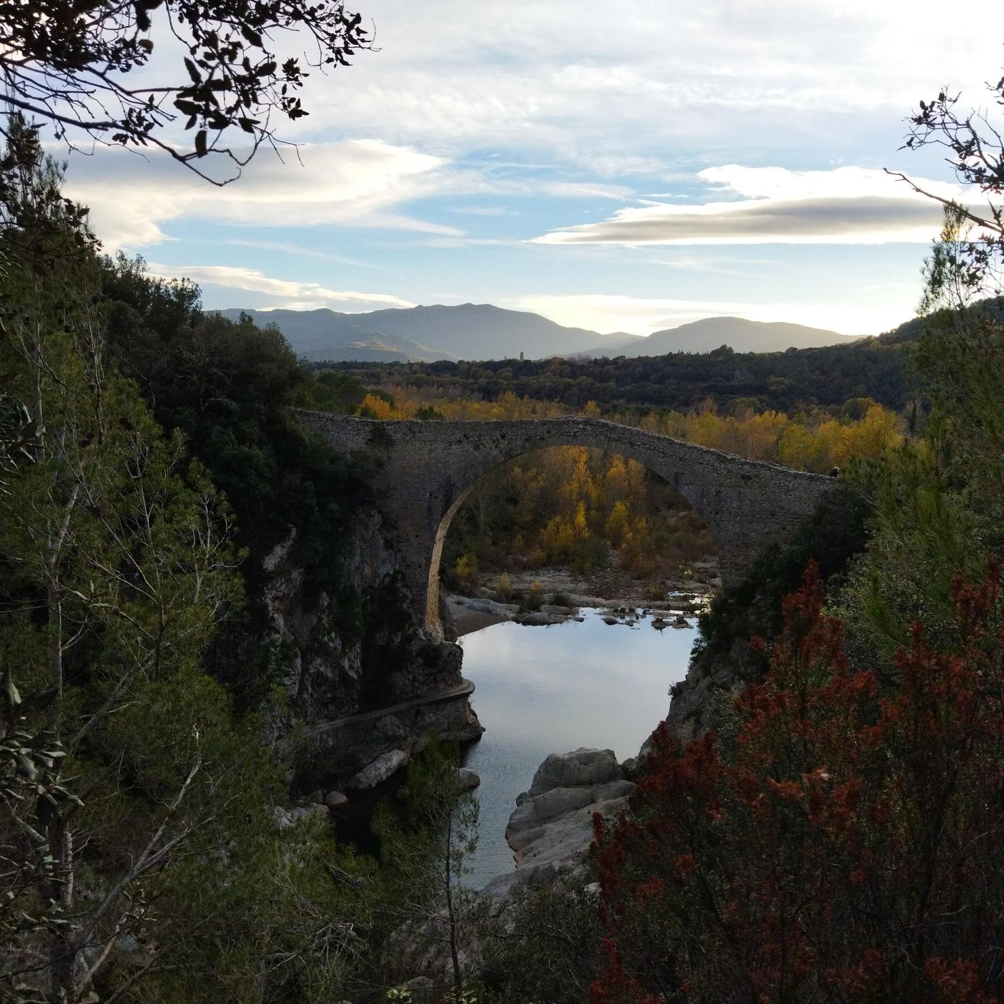
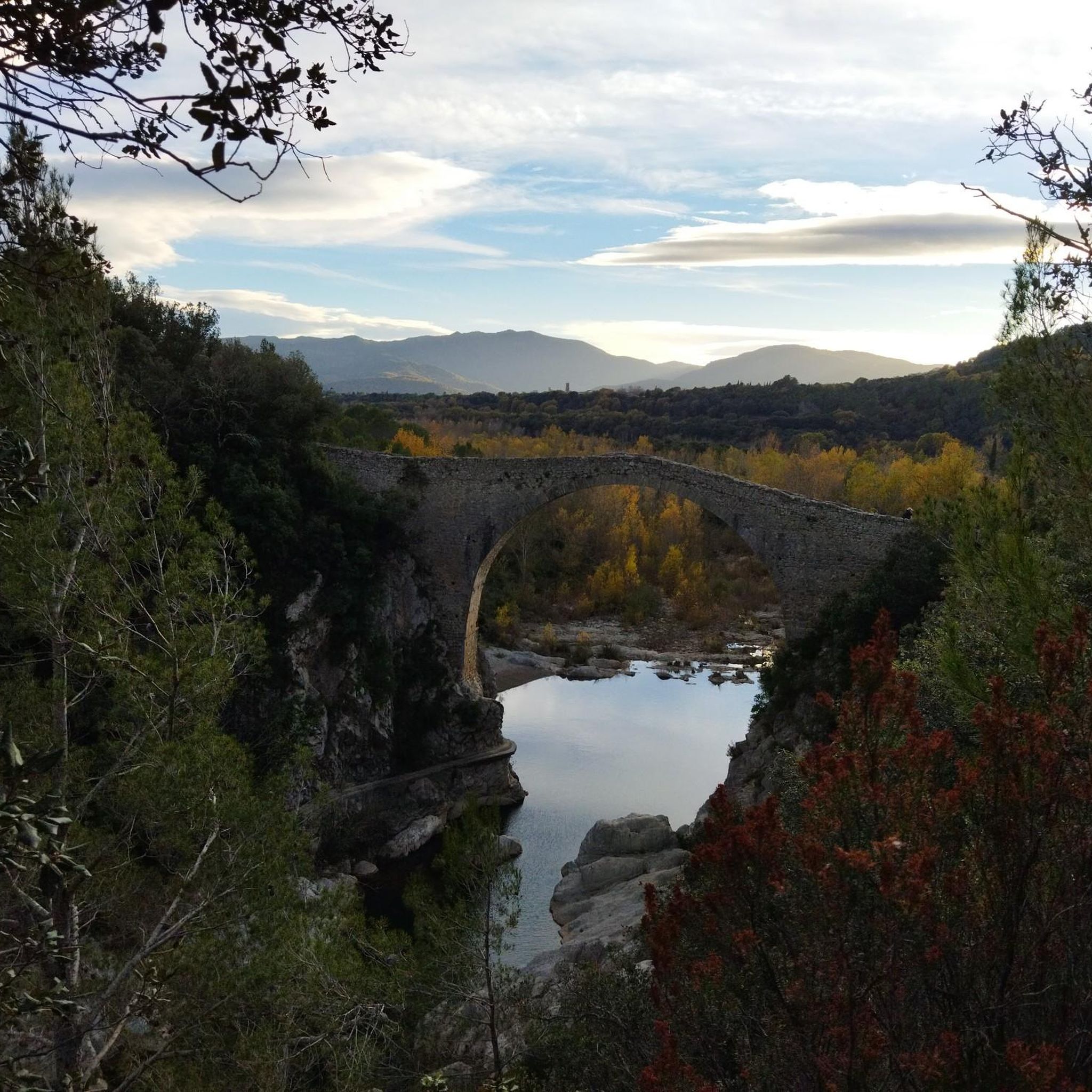
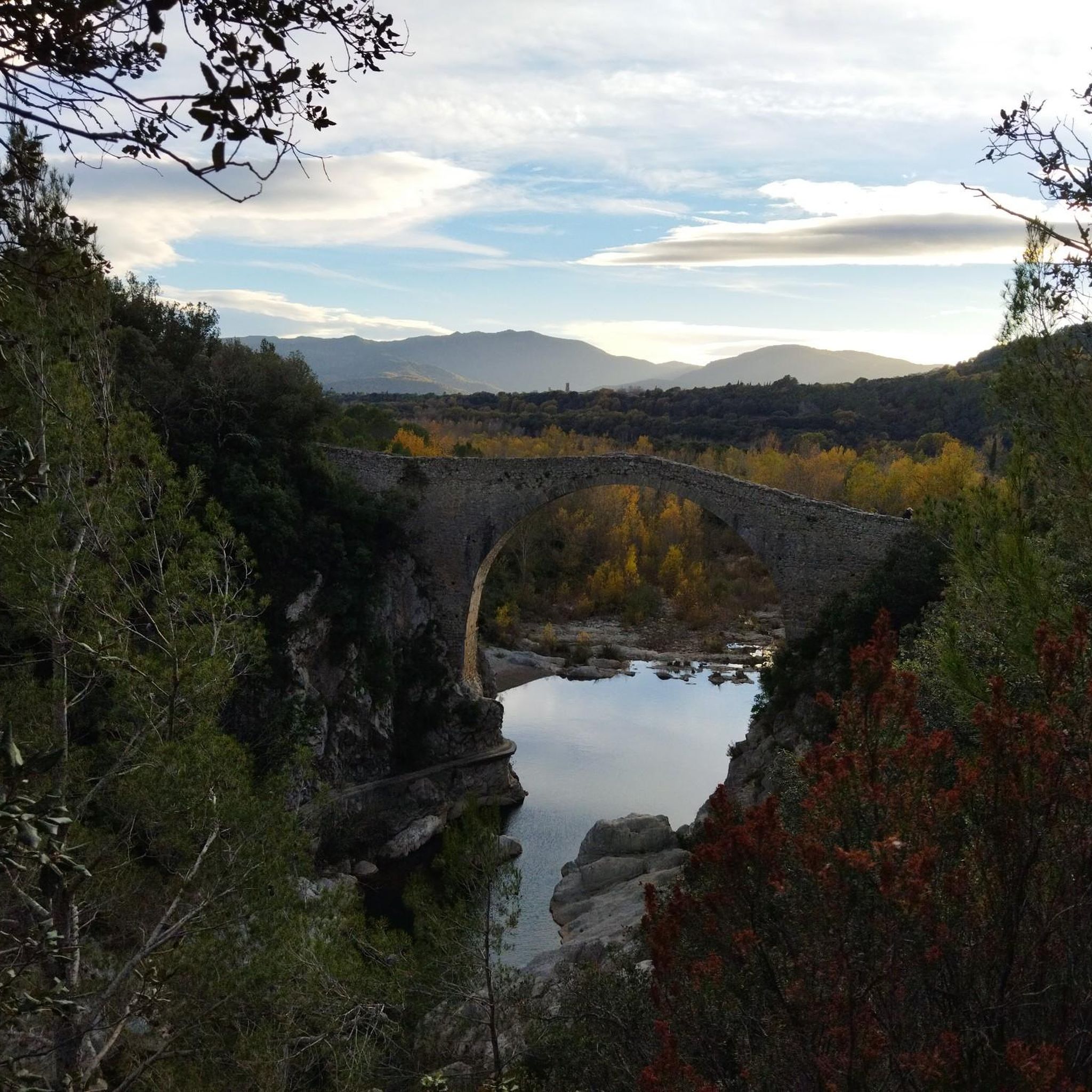
The area east of the bridge is not particularly suitable for gravel bikes. The bridge is definitely worth a visit.
0
0

Beautiful bridge with a view of the castle. Worth a visit.
2
0

In these Baumas and cavities, a certain number of protected cave-dwelling invertebrates and Bats live. It is advisable not to ENTER some of these Baumas and ensure that our passage through the area causes the least possible impact.🙋
1
0

A Romanesque bridge worth seeing. Be sure to take a detour there and take a look. You can easily walk across it.
3
0

The Llierca Bridge, also called Pont de Sadernes, is a bridge 28 m high, 52 m long and 3 m wide. With a single, very slender arch, it crosses the Llierca river between Tortellà and Sadernes. Romanesque in style, although we do not know the date of its construction, there is evidence of its use since at least the 14th century, when it is documented that a toll was paid to cross it. The bridge was probably built by order of the barons of Sales, to facilitate trade between the farmhouses located west of the Llierca river with the towns of Tortellà and Besalú.
0
0
It is a religious building, located at the top of a hill, on the left bank of the Llierca river, accessible from Montagut de Fluvià by a good paved road, which, after passing the river, becomes a forest track in good condition (from the river to Sardener is less than a km). It can be defined as a Romanesque construction, with a single nave with a pointed vault. The original bell tower, with a gable, was converted into a tower with a four-sided roof by adding a fortification that hides a stepped capcer on the east side, coinciding with the remodeling works carried out at the end of the medieval age. The door, exceptionally, opens to the west. On top of the previous one, a bull's-eye opened later, in such a way that the Romanesque window previously existing was replaced. A stone cornice runs along the walls both internally and externally, including the semicircular apse. Inside, on the north wall, you can see a walled-up hole, where, with all certainty, there was the baptismal font, which has now disappeared. Signs of the primitive slab roof remain on the stepped gable and on the roof of the apse.
0
0

very quiet place with fantastic views
0
0
Frequently Asked Questions
How many running routes are available in Argelaguer?
There are over 90 running routes available around Argelaguer, catering to various fitness levels and preferences. These trails traverse diverse landscapes, from river plains to forested hills and volcanic terrain.
Are there easy running trails suitable for beginners or a relaxed jog?
Yes, Argelaguer offers a few easy running trails perfect for beginners or those seeking a relaxed jog. These often follow the flat, shaded paths along the Fluvià River or through areas like Parc Garrell, providing a comfortable and scenic experience. You can find options like the 2.55 km easy hiking loop around Parc Garrell, which is also suitable for a leisurely run.
What kind of challenging running routes can I find in the Argelaguer area?
For those seeking a challenge, Argelaguer boasts over 50 difficult running routes. These trails often feature significant elevation changes through forested hills and volcanic landscapes, providing a rigorous workout. An example is the Running loop from Tortellà, a 9.9 km path with considerable ascents and descents.
What natural attractions can I see while running near Argelaguer?
The region around Argelaguer is rich in natural beauty. Runners can explore the unique landscapes of the Garrotxa Volcanic Zone Natural Park, including extinct volcanoes like Santa Margarida Volcano and the striking Croscat Volcano Scoria Slopes. Many routes also follow the Fluvià River and its tributaries, offering pleasant riverside views. Don't miss the impressive Llierca Bridge, a notable landmark often incorporated into longer runs.
Are there any circular running routes in Argelaguer?
Yes, many of the running routes in Argelaguer are circular, allowing you to start and finish at the same point. This is convenient for parking and exploration. For instance, the Running loop from Sant Jaume de Llierca is a popular 7.9 km circular trail.
What are the typical lengths of running trails in this region?
Running trails around Argelaguer vary significantly in length. You can find shorter, easier loops, but many routes range from 8 km to over 15 km. For example, the Llierca Bridge loop from Montagut is 12.2 km, while the Baumes de Caixurma – Virgin of the Devesa loop from Montagut extends to nearly 16 km.
Can I bring my dog on the running trails around Argelaguer?
While specific regulations can vary by trail, many natural areas in La Garrotxa are generally dog-friendly, especially if your dog is kept on a leash. It's always advisable to check local signage or specific route details for any restrictions, particularly within protected areas like the Garrotxa Volcanic Zone Natural Park. Most open trails are suitable for running with a well-behaved dog.
Are there family-friendly running options in Argelaguer?
For families, the easier and flatter sections along the Fluvià River or within Parc Garrell offer great opportunities for a gentle jog or walk. These areas are generally accessible and provide a pleasant environment for all ages to enjoy the outdoors. The 2.55 km loop around Parc Garrell, with its unique artistic installations, is a particularly engaging option for families.
What do other runners enjoy most about jogging in Argelaguer?
The running routes in Argelaguer are highly rated by the komoot community, with an average score of 4.5 stars from over 18 reviews. Runners often praise the diverse terrain, the stunning volcanic landscapes, and the tranquility of the forested paths. The blend of natural beauty and historical points of interest, such as the Llierca Bridge, also receives positive feedback.
Are there any interesting landmarks or cultural sites near the running routes?
Absolutely! Beyond natural features, you can encounter several interesting landmarks. Parc Garrell, with its unique wooden structures, is directly integrated into the natural surroundings. The region also has medieval heritage, including the ruins of Montpalau Castle and the Romanesque church of Santa Maria in Argelaguer's old quarter. The nearby town of Besalú, with its impressive Romanesque bridge, is also easily accessible and can be part of a longer run.
What is the best time of year to go running in Argelaguer?
The diverse climate of La Garrotxa makes Argelaguer suitable for running throughout much of the year. Spring and autumn offer pleasant temperatures and vibrant scenery, ideal for exploring. Summer can be warm, so early morning or late afternoon runs are recommended. Winter provides cooler conditions, and while some higher trails might be chilly, many lower-elevation routes remain accessible and enjoyable.
Is there public transport access to the running routes in Argelaguer?
Argelaguer is part of a well-connected region, and while specific bus routes to trailheads might be limited, the village itself is accessible by public transport. From Argelaguer, you can often start directly on trails or reach nearby starting points. For routes further afield, a combination of public transport to a nearby town and a short walk or taxi might be necessary.
Are there running routes with good viewpoints in the area?
Yes, many of the more challenging running routes, especially those that ascend into the forested hills or volcanic terrain, offer excellent viewpoints. You can expect panoramic views of the Garrotxa Volcanic Zone Natural Park, the Fluvià River valley, and the surrounding countryside. The dramatic basalt cliff of Castellfollit de la Roca, a short distance away, also provides magnificent natural viewpoints that can be incorporated into longer runs.
Most popular routes around Argelaguer
Most popular attractions around Argelaguer

Get inspired with the komoot mobile app


Explore more
Browse the best Running Trails & Routes in other regions.
