The best running trails around Valdemorillo
5.0
(1)
232
runners
33
runs
Jogging routes Valdemorillo traverse a diverse landscape within the Sierra Oeste region of Madrid, characterized by varied natural features. The area includes routes along the Río Perales and Río Aulencia, as well as paths surrounding the Valmayor Reservoir, the second-largest in the Community of Madrid. Runners can explore holm oak groves, pine forests, and granite formations, providing a range of environments for different running experiences. This region offers a mix of terrain from river valleys to more challenging ascents.
Best…
Last updated: June 28, 2026
37
runners
Hard run. Very good fitness required. Mostly paved surfaces. Suitable for all skill levels.
28
runners
20.5km
02:20
440m
440m
Hard run. Very good fitness required. Mostly paved surfaces. Suitable for all skill levels.

Sign up for free
18
runners
13.2km
01:27
200m
200m
Moderate run. Good fitness required. Mostly paved surfaces. Suitable for all skill levels.
18
runners
9.59km
01:02
150m
150m
Moderate run. Good fitness required. Mostly paved surfaces. Suitable for all skill levels.
5.0
(1)
7
runners
22.2km
02:36
430m
430m
Hard run. Very good fitness required. Mostly paved surfaces. Suitable for all skill levels.
Get access to more routes and recommendations from other explorers.
Sign up for free
Already have an account?
Our route recommendations are based on thousands of hikes, rides, and runs completed by other people on komoot.
Start today with a free account
Your next adventure awaits.
Login or Signup

Tips from the Community


I provide a photo of this place, where you can see several bullet holes in one of the walls of one of the buildings. The holes are quite grouped and at the height of a normal-sized person's head. The impact wall is on the east side. This position was defended by a tabor of marksmen from Ifni and by a century of phalanx from Valladolid. Some historians say that the first shots of the Battle of Brunete probably took place in this place on July 5, 1937. This position fell on the 7th. The attackers of the Red Army came after climbing the valley located to the west, the Valdeyerno valley, and from the north along the livestock route that crosses this plateau, leading to Valdemorillo. The impacts that can be seen on the facades of the east side of both buildings, I believe, are not the product of combat, but rather of shootings on those walls, of captured national soldiers.
0
1

Next to Alto de los Llanos are these ruins which, it is said, were the headquarters of the Republican command. Very close we can also find the geodesic vertex of the place, which is located at 746 meters of altitude.
0
1
The function of this type of chimneys is to act as pressure relief valves in hydraulic systems. In this case, it is located in the canal that carries water from the Picadas reservoir to the station that treats drinking water in Majadahonda.
1
0

In this area there are a series of bunkers, machine gun nests and trenches that are vestiges of the Civil War.
1
0

Famous throughout the western part of the Community of Madrid: the slope to Valdemorillo can delight any mountain biker or gravel carrier, especially in this designated section if it is done in an ascending direction. In winter, the rains can complicate the climb a lot, as mud tends to form. https://bigjoe.es/sol-a-sol-mtb-2020-circular-boadilla-del-monte-el-escorial/
0
0
Balancing chimneys (also called oscillation wells or piezometric towers) are a type of auxiliary construction in hydraulic systems that act as pressure relief valves. They are complementary structures to infrastructures that work with water and whose objective is to serve as a buffer against overpressures and underpressures in the canal. The Picadas Canal is a water transport channel that connects the Picadas reservoir with the Majadahonda Potable Water Treatment Station (ETAP). It has a length of 49.2 km and its entry into service was in 1967. It is the first major supply channel for Madrid that requires elevations, given that the catchment point (the Alberche River) is at a level much lower than that of the city of Madrid. It has two lift stations: Picadas and Colmenar del Arroyo I. More at https://bigjoe.es/iii-marcha-del-cocido-de-quijorna-2016/
1
0
Frequently Asked Questions
How many running routes are available in Valdemorillo?
Valdemorillo offers a diverse network of over 25 running routes, catering to various fitness levels. These include easy paths, moderate trails, and challenging runs through the region's varied landscapes.
Are there easy running routes suitable for beginners in Valdemorillo?
Yes, Valdemorillo has several easy running routes perfect for beginners or those looking for a relaxed jog. While specific easy routes are not detailed in the top picks, the overall network includes options suitable for all fitness levels, including 2 designated easy routes.
Can I find circular running trails in Valdemorillo?
Absolutely. Many of Valdemorillo's running paths are circular, allowing you to start and finish at the same point. For example, the region research mentions the "Ruta de los Molinos del Río Perales" as an easy 3.2-mile circular route, and the "Ruta Circular Embalse de Cerro Alarcón y Puente del Pasadero" as a moderate 4.1-mile loop.
What kind of landscapes and terrain can I expect on Valdemorillo's running paths?
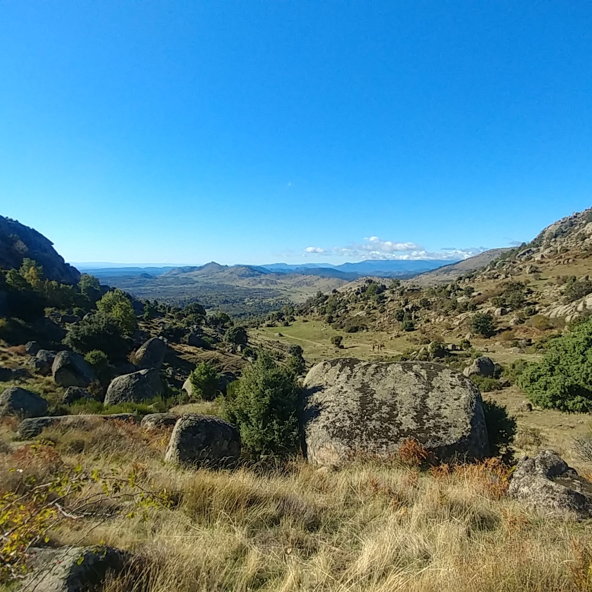
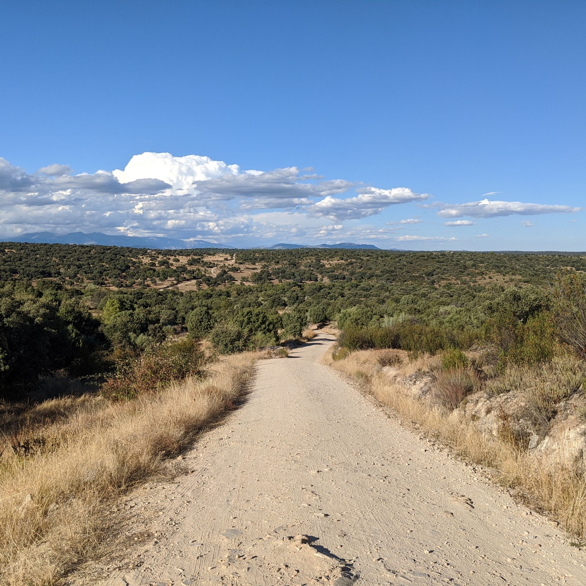
Runners in Valdemorillo can experience a rich variety of landscapes. The routes traverse holm oak groves, pine forests, and ash groves, with paths along the Río Perales and Río Aulencia. You'll also find trails around the Valmayor Reservoir and encounter impressive granite formations, offering diverse environments from river valleys to more challenging, elevated terrain.
Are there any scenic viewpoints or landmarks to discover while running in Valdemorillo?
Yes, Valdemorillo's routes are rich with scenic spots and landmarks. You can run past the expansive Valmayor Reservoir, or enjoy views from the historic Seat of Philip II. The area also features the Mount Abantos, offering rewarding views for those seeking a challenging ascent.
Are the running routes in Valdemorillo suitable for families?
Valdemorillo offers a range of trails, including easy paths that are generally suitable for families. The diverse terrain means there are options for different ages and fitness levels, allowing families to choose routes that match their capabilities.
Can I bring my dog on the running trails around Valdemorillo?
While specific regulations for dogs on every trail can vary, the natural environment of Valdemorillo, with its extensive forests and open spaces, generally welcomes dogs. It's always advisable to keep your dog on a leash and ensure you clean up after them to preserve the natural beauty for everyone.
What do other runners say about the trails in Valdemorillo?
The running routes in Valdemorillo are highly rated by the komoot community, with an average score of 5.0 stars. Over 200 runners have used komoot to explore the area, often praising the varied terrain, from river valleys to extensive forests and granite formations, which provide a rich and engaging running experience.
Are there any routes that pass by water features like rivers or reservoirs?
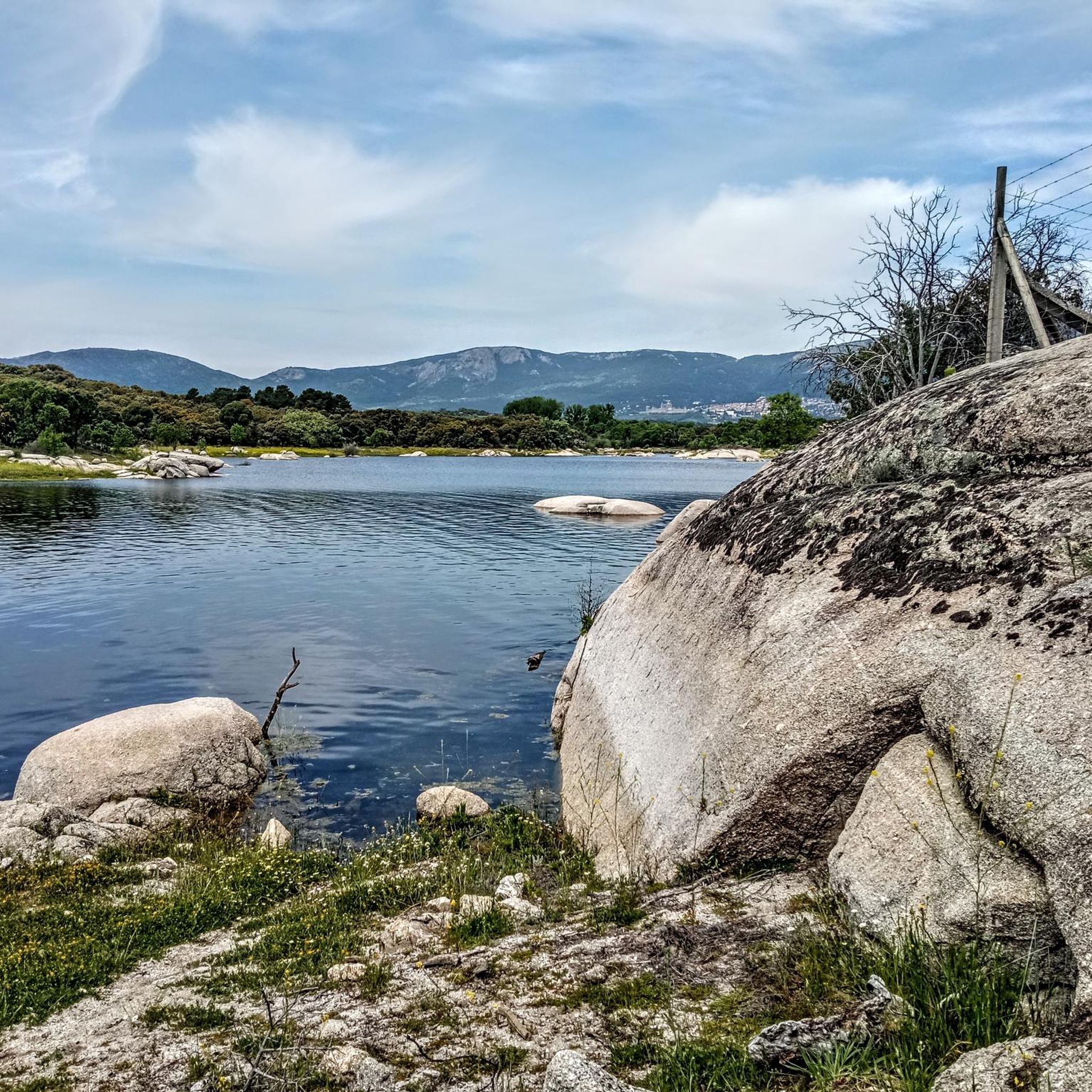
Definitely. Valdemorillo is known for its routes along the Río Perales and Río Aulencia, offering beautiful riverside scenery. Additionally, many paths encircle the Valmayor Reservoir, the second-largest in the Community of Madrid, providing stunning water views during your run.
What is the best time of year to go running in Valdemorillo?
Valdemorillo is an excellent destination for outdoor activities year-round. Spring and autumn offer pleasant temperatures and vibrant natural colors, ideal for running. Even in summer, the forested areas provide shade, and winter runs can be invigorating, especially along the varied terrain of the Sierra Oeste.
Are there challenging running routes for experienced runners in Valdemorillo?
Yes, Valdemorillo provides several challenging routes for experienced runners. For instance, the Valdemorillo Hill – Bunkers and trenches loop from Valdemorillo is a difficult 13.8-mile (22.2 km) trail with significant elevation gain. The region also features Mount Abantos, a classic peak of the Guadarrama mountain range, offering demanding ascents.
Is parking available near the starting points of running routes in Valdemorillo?
While specific parking information for every route isn't detailed, Valdemorillo is a municipality with various access points to its trail network. It's common to find parking options near residential areas or designated trailheads, especially for popular routes. Checking local maps or komoot route details can often provide more precise parking suggestions.
Are there any historical sites or cultural points of interest along the running trails?
Yes, the region integrates cultural interest into its natural routes. You can explore historic mills along the Río Perales and the ancient Puente del Hoyo bridge. Additionally, the Aulencia Castle and the Retamar Bridge are notable historical sites that can be encountered on or near some running paths.
Can I find routes that offer a mix of forest and open views?
Valdemorillo's diverse geography ensures you can find routes that combine the tranquility of dense forests with expansive open views. Trails often weave through holm oak groves and pine forests, then open up to vistas of the Guadarrama Valley or the Valmayor Reservoir, providing a dynamic running experience.
Most popular routes around Valdemorillo
Most popular attractions around Valdemorillo

Get inspired with the komoot mobile app


Explore more
Browse the best Running Trails & Routes in other regions.
