The best walks and hikes around Coll De Nargó
4.6
(113)
819
hikers
62
hikes
Hiking around Coll De Nargó offers diverse landscapes within the Alt Urgell region of Lleida, Spain. The area is characterized by dramatic mountains and valleys, including the Catalan pre-Pyrenees, and features the Segre River with its natural pools and the tranquil Fontanet Ponds. Hikers can traverse through rich forests of oaks and encounter imposing cliffs and unique rock formations. This varied terrain provides a scenic backdrop for a range of outdoor activities.
Best hiking trails around Coll De Nargó
- The…
Last updated: October 12, 2026
3.7
(3)
25
hikers
19.6km
07:31
1,070m
1,070m
Hard hike. Very good fitness required. Mostly accessible paths. Sure-footedness required.
5.0
(1)
12
hikers
3.51km
01:01
100m
100m
Easy hike. Great for any fitness level. Easily-accessible paths. Suitable for all skill levels.

10
hikers
16.8km
05:08
590m
590m
Hard hike. Very good fitness required. Easily-accessible paths. Suitable for all skill levels.
7
hikers
Moderate hike. Good fitness required. Easily-accessible paths. Suitable for all skill levels.
5.0
(1)
8
hikers
11.8km
04:06
640m
640m
Moderate hike. Good fitness required. Easily-accessible paths. Suitable for all skill levels.
Get access to more routes and recommendations from other explorers.
Already have an account?
Our route recommendations are based on thousands of hikes, rides, and runs completed by other people on komoot.
Start today with a free account
Your next adventure awaits.

Tips from the Community

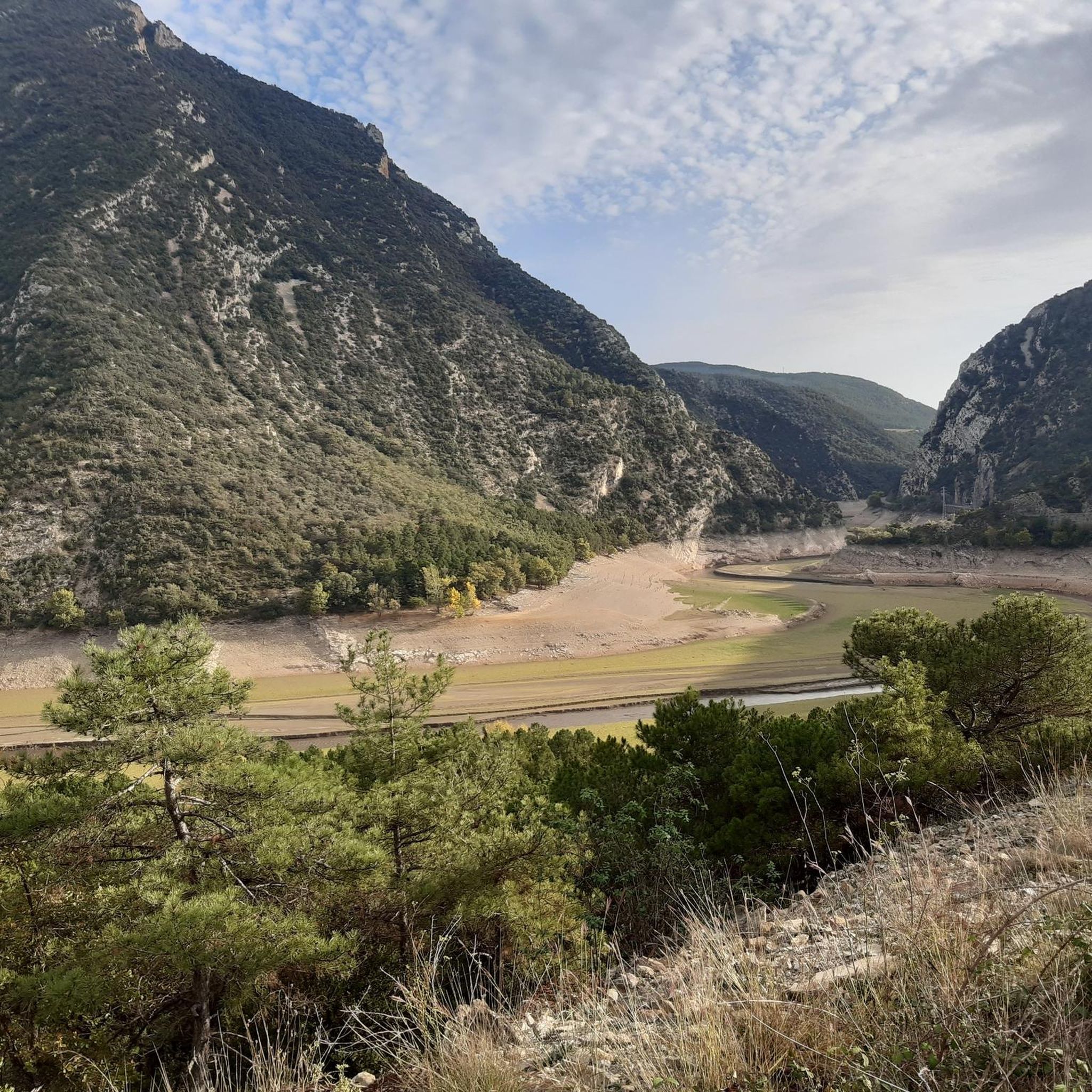
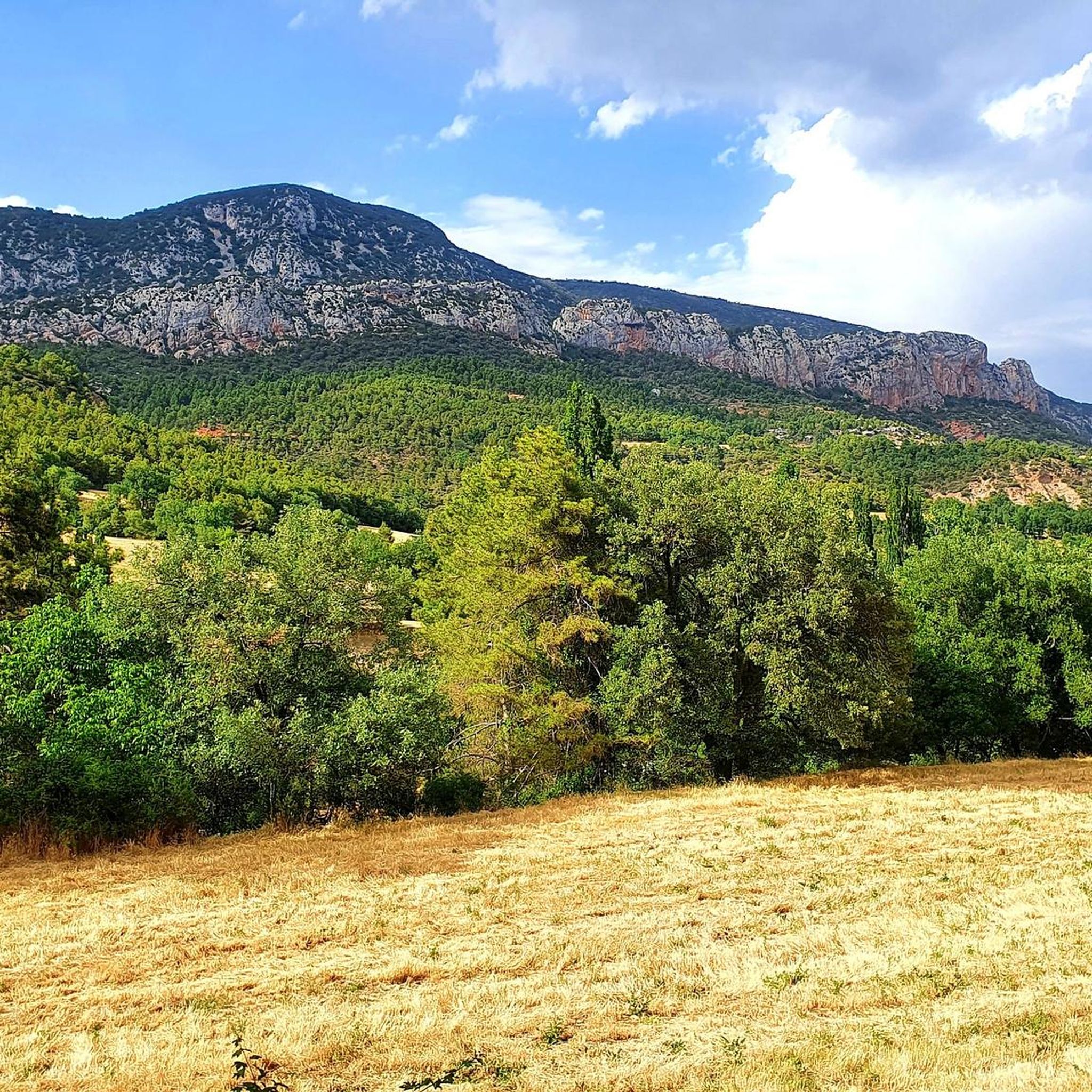
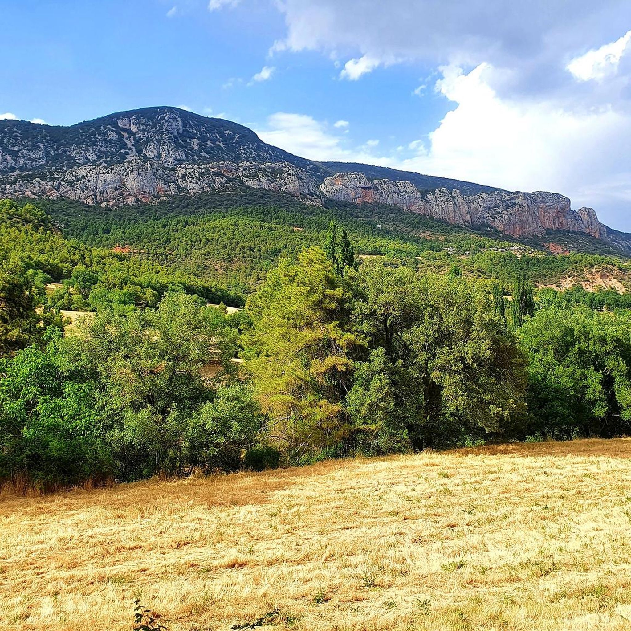
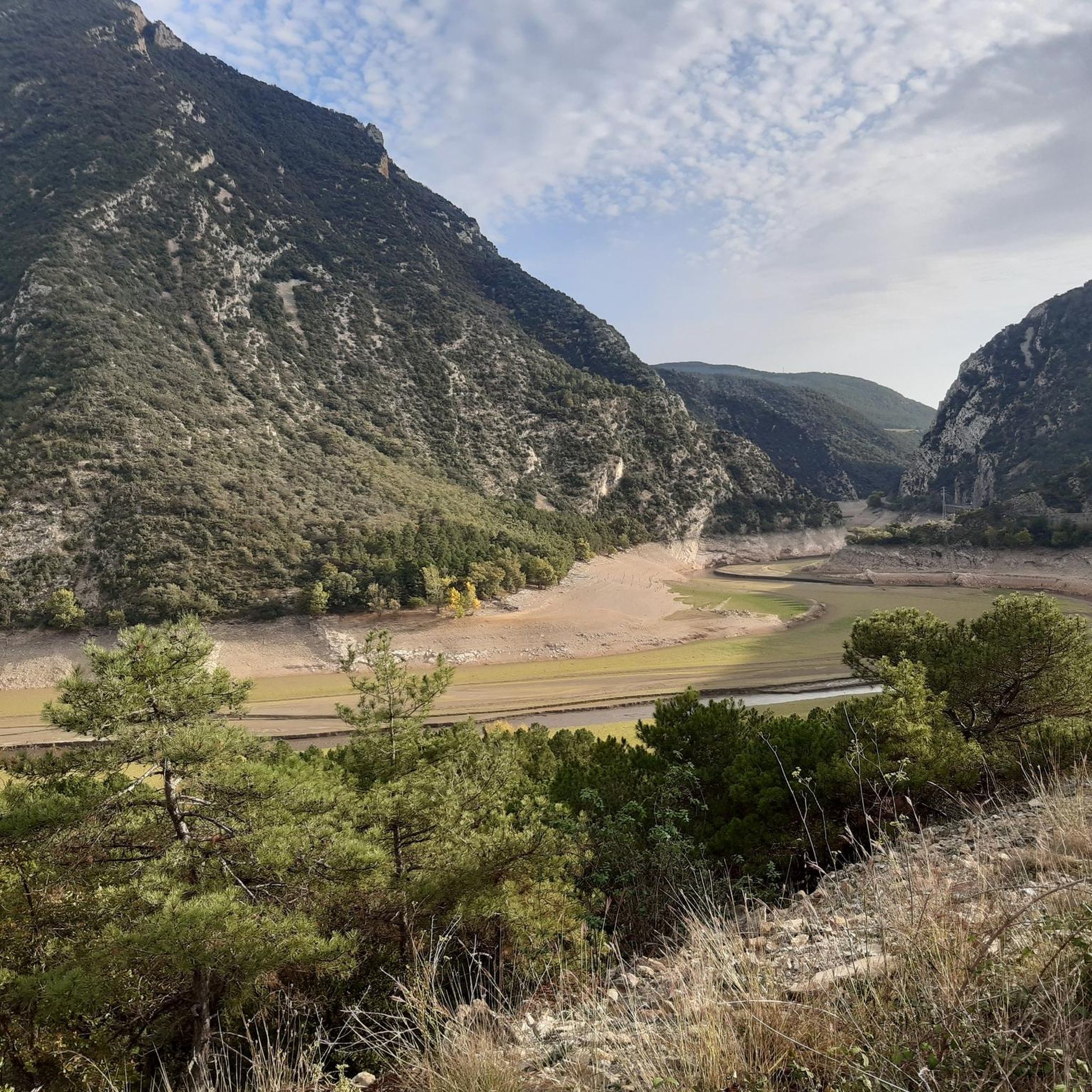
On the border between the municipalities of Peramola and Oliana, you will find the summit and viewpoint of Coscollet, one of the highest and most spectacular points in the Serra d’Aubenç, with extensive views over the Segre River, the Oliana Reservoir and a good part of Alt Urgell. The access road passes through demanding paths and tracks, often rocky and exposed, reserved for experienced cyclists with good legs, or e-bikes with autonomy. Arriving at the summit, at almost 1,610 meters above sea level, rewards the effort with one of the wildest and most solitary panoramas of the Catalan Pre-Pyrenees. The wind often blows strongly, and there is no service or shade, so you need to bring water, protection and everything you might need to stay there for a while. It is one of those places that is not easy, but that leaves its mark.
1
0

There is an 18km climb and almost no shadows.
1
0

The final repecho is a firm calcareous entertaining but cycleable up to the summit milestone. The views reach the Catalan Pyrenees, the Pre-Pyrenees, the Sierra del Cadí, the Pedraforca, the light silhouette of the spires of Montserrat, the Sierra de Montsec and the mountains of Pallars Jussá.
0
0
The great climb ends at Planell Ras. The path changes slope and goes down towards the Boumort Refuge, a key point on the itinerary. You have to cross the Canadian pass and continue straight ahead along the main track towards Coll de Llívia. The path on the left is a shortcut but it has a non-cyclable section. One kilometer from the refuge, the mountain path that goes up to the summit of Cap de Boumort starts on the left. The first ramp is hard, then it enters a valley that leads to the meadows where there is a gate that opens the way to this beautiful pre-Pyrenees peak.
0
0

Stone bridge. With the name, Puente de las Masias, it crosses the homonymous ravine, which carries water from the Valldarques River. Within the municipality of Coll de Nargó.
0
0
The Pico de Boumort is the highest peak of the Sierra de Boumort at 2077.2 m altitude.
1
0
Small stone shelter. It is located in the Sierra de Boumort, near the homonymous peak. It's basically a survival shelter.
1
0
Frequently Asked Questions
How many hiking trails are available in Coll De Nargó?
Coll De Nargó offers a wide variety of hiking experiences, with over 50 trails to explore. These range from easy walks suitable for families to more challenging treks through the mountainous terrain.
Are there any easy or family-friendly hiking trails in Coll De Nargó?
Yes, Coll De Nargó has several easy trails perfect for families or those seeking a relaxed walk. A great option is the Organyà to Fontanet Ponds Trail, an easy 5.3 km route featuring river scenery and tranquil ponds. Another accessible choice is the View of the Mountain Peak – Waterfalls of Organyà loop from Organyà, which is 6.7 km and leads to the refreshing Waterfalls of Organyà.
Can I find circular hiking routes in the area?
Yes, Coll De Nargó offers several circular routes. For a moderate challenge, consider the Tossal de Balinyó loop from Organyà, which is 9.6 km and provides panoramic views. Another option is the View of the Mountain Peak – Waterfalls of Organyà loop from Organyà, an easy 6.7 km trail.
Are there any trails that feature waterfalls or natural pools?
Absolutely. The region is known for its refreshing water features. The Organyà to Fontanet Ponds Trail leads to the tranquil Fontanet Ponds. You can also find the idyllic Waterfalls of Organyà along the View of the Mountain Peak – Waterfalls of Organyà loop from Organyà, a perfect spot to cool off.
What kind of natural features or landmarks can I expect to see while hiking?
Hikers in Coll De Nargó can experience diverse landscapes, including dramatic mountains, river valleys, and rich oak forests. Notable natural features include the imposing cliffs and unique rock formations, as well as the Omini Caves in Montanissell. You can also find stunning viewpoints like the Top of the Coscollet viewpoint and the View of Rocas de Sant Honorat.
What is the best time of year to go hiking in Coll De Nargó?
The region offers great hiking opportunities throughout much of the year. Spring and autumn provide pleasant temperatures and vibrant scenery. Summer is also popular, especially for trails near rivers and waterfalls where you can cool off. While winter hiking is possible, some higher elevation trails may be affected by snow or colder conditions.
Are there any dog-friendly hiking trails in Coll De Nargó?
Many trails in Coll De Nargó are suitable for hiking with dogs, allowing you and your canine companion to enjoy the natural beauty. It's always recommended to keep dogs on a leash, especially in areas with wildlife or livestock, and to follow local regulations regarding pet access.
Where can I park when visiting hiking trails in Coll De Nargó?
Parking availability varies by trailhead. Many routes, especially those starting from villages like Organyà or Coll De Nargó itself, will have designated parking areas nearby. It's advisable to check specific route details on komoot for information on starting points and parking facilities.
What do other hikers enjoy most about hiking in Coll De Nargó?
The komoot community highly rates the hiking experience in Coll De Nargó, with an average score of 4.7 stars from over 90 reviews. Hikers often praise the dramatic mountain scenery, the refreshing river landscapes, and the variety of trails suitable for different skill levels. The region's unique natural features, such as the Waterfalls of Organyà and the Fontanet Ponds, are frequently highlighted as favorites.
Are there any challenging hikes for experienced trekkers?
Yes, for experienced hikers seeking a challenge, Coll De Nargó offers more demanding routes. The Tossal del Faig – lo Coscollet loop from Collada del Roure is a difficult 17 km trail with significant elevation gain, often taking over 6 hours to complete. This route provides a true test of endurance and rewards with expansive views.
Are there any historical or cultural sites accessible from the trails?
Beyond natural beauty, the region boasts Romanesque heritage. You can visit the Sant Climent Church, known for its tall bell tower. Additionally, Coll De Nargó is famous for its dinosaur fossils; the Dinosaur Museum and the Mirador del Cretácico (Cretaceous Viewpoint) offer fascinating insights into the area's prehistoric past.
What kind of views can I expect on the trails?
The trails in Coll De Nargó offer stunning panoramic views of the Catalan pre-Pyrenees, dramatic mountains, and verdant valleys. Many routes lead to viewpoints or mountain passes, providing incredible vistas. For example, the Tossal de Balinyó loop from Organyà is known for its panoramic outlooks.
Most popular routes around Coll De Nargó
Most popular attractions around Coll De Nargó

Get inspired with the komoot mobile app


Explore more
Browse the best Hikes in other regions.
