The best MTB trails around Oroz-Betelu
4.6
(43)
586
riders
54
rides
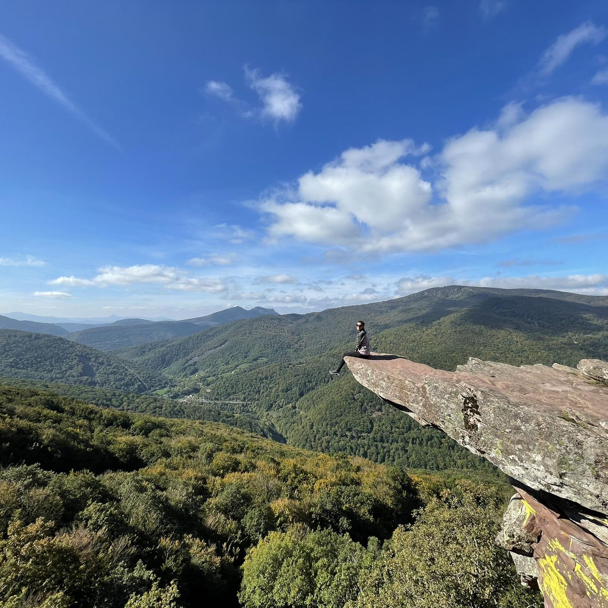
Mountain biking around Oroz-Betelu offers diverse terrain within the Navarrese Pyrenees, characterized by dramatic topography and varied elevations. The region features extensive ancient oak and beech woodlands, particularly in its Atlantic-influenced parts, alongside rugged mountains and deeply carved valleys. The Irati River system creates picturesque valleys, while distinct limestone mountains like Urrizkain provide challenging landscapes for riders. Elevations range from around 560 meters along the Irati River to over 1,300 meters at Monte Corona-Erratzu, ensuring a wide range of mountain bike terrain elevation difficulty.
Best mountain bike trails around Oroz-Betelu
- The most popular mountain bike trail is Cascada Irurrekaeat – circular desde Camping Urrobi, a 15.2 miles (24.5 km) moderate route that takes about 2 hours 30 minutes to complete, winding through varied forest landscapes.
- Another top favourite among local mountain bikers is Menditxuri (Askaxarreta Summit) – Burguete loop from Aurizberri, a difficult 30.5 miles (49.0 km) path. This route offers significant climbs and panoramic views of the Pyrenean peaks.
- Local mountain bikers also love the Trail to Col de Bentarte – Col d'Arnosteguy loop from Aurizberri, a 28.5 miles (45.8 km) trail leading through high mountain passes and dense woodlands, often completed in about 4 hours 10 minutes.
- Mountain biking around Oroz-Betelu is defined by Pyrenean topography, dense forests, and Irati River valleys. The network offers options for easy, moderate, and difficult routes, catering to various ability levels.
- The routes in Oroz-Betelu are highly rated by the komoot community with an average score of 4.6 stars from over 40 reviews. More than 500 mountain bikers have used komoot to explore Oroz-Betelu's varied terrain.
Last updated: July 3, 2026
2
riders
24.5km
02:30
670m
680m
Moderate mountain bike ride. Good fitness required. Advanced riding skills necessary.
5.0
(2)
17
riders
49.6km
04:48
1,110m
1,110m
Hard mountain bike ride. Very good fitness required. Advanced riding skills necessary. Some portions of the route may require you to push your bike.

Sign up for free
13
riders
45.9km
04:11
1,040m
1,040m
Hard mountain bike ride. Very good fitness required. Advanced riding skills necessary. Some portions of the route may require you to push your bike.
8
riders
21.0km
01:42
360m
360m
Moderate mountain bike ride. Good fitness required. Advanced riding skills necessary.
9
riders
22.8km
01:53
410m
410m
Moderate mountain bike ride. Good fitness required. Advanced riding skills necessary.
Get access to more routes and recommendations from other explorers.
Sign up for free
Already have an account?
Our route recommendations are based on thousands of hikes, rides, and runs completed by other people on komoot.
Start today with a free account
Your next adventure awaits.
Login or Signup

Tips from the Community

In choosing San Salvador as the patron saint of this church, the patronage was not placed under the protection of one of the many people we venerate as blessed or saints and ask for their heavenly intercession with God. Rather, the patronage was entrusted to God himself—in the person of his incarnate Son, Jesus Christ—who is venerated here under the honorary title of "San Salvador" (Redeemer and Savior).
3
0

Even if you don't plan or have the ability to walk the entire Camino Frances, the stage that reaches Roncesvalles is a must for the beauty of the landscapes and the evocative atmosphere it offers, especially when—descending from the Ibañeta Pass—the boundless Spanish landscape suddenly opens up before your eyes in the golden light of sunset. It's a magical moment, ideally shared with other pilgrims and then enhanced with a visit to the Collegiate Church. The stamp on the Credencial is also beautiful.
1
0

Don't miss a visit to the Pilgrims' Hospital and the Collegiate Church of Santa María. Also, learn about the history of Roncesvalles, as it's very interesting.
0
0

The ATALOZTI Pass is located in the heart of the Navarrese Pyrenees, where the Navarre Mountains meet, on the border between Navarre and Lower Navarre, between the municipalities of Auritz-Burguete, Erroibar, and Urepel—the former disappearing into the Sangüesa Sea and the latter into the Baigorri-Ortzaize region—and also on the watershed, where the vortex streams meet at the Irati River beach, the Mediterranean Sea beach, and the northern banks of the Errobi River, the Bizkaia countryside, meeting the Atlantic. The Atalozti Pass is situated in a charming location, between the peaks of Lindus (1,218 m) and Mendiaundi (1,213 m). The climb from Burguete along a track has extremely steep slopes.
0
0

Hemmingway loved this place.
0
0

Anyone who would like to have the church illuminated can switch on the lights for 8 minutes for a 1 € coin.
0
0
One of the most inhospitable and spectacular mountain passes in the eastern Pyrenees, with several slopes, all of them very difficult. The landscape is wild and wonderful. You can breathe absolute tranquility and you can dedicate yourself exclusively to enjoying the views, the horses, the sheep, the cows and the suffering on the bike. The summit is on the border with Spain, although there is no road that crosses the border, so the pass runs entirely in France. I have climbed it on 2 of its slopes. The first time I climbed it on the slope that crosses the Col d'Orgambide, on the D428 road, which starts from Estérençuby. The first 3 km are very easy, until you cross the detour to go up to Artaburu, where the road begins to have slopes of more than 10%. From there, to the summit, the climb is very hard, around 9%, on a very rough and bumpy road, with a lot of humidity and crossing a wonderful beech forest. Once you reach the top of the Col d'Orgambide, you turn right and continue climbing for another half kilometre with a gradient of 11%. There comes a small descent, to face the last 3 kms, the first 2 very hard with several 13% gradients. The last kilometre is very easy and has panoramic views that are simply wonderful. The second time I climbed it on the side that starts from Arneguy and Ondarolle. This side is harder than the previous one, with a central section that is hellish, being 6 kms at an average of 10%, and a very hard km at 12% and 18% gradients!!! The final part is more gentle. You cross the Croix de Thibault in the penultimate kilometre of the climb. The final kilometre is very gentle and with beautiful and exciting panoramic views.
1
0
It is a beautiful border pass between Spain and France, well known for being part of the most traditional route of the Camino de Santiago. Sportingly, the climb on both sides is easy, although on the French side it is much longer as it starts at a lower altitude. The Spanish side is just 6 km from Burguete, the last being the most difficult with an average gradient of 7%. On this side you pass the famous and well-known monastery of Roncesvalles. The French side is 18 km from Arnegui and an average gradient of 4%. The hardest part is 5 km from the summit, with one kilometre at 7%. The landscape on this side is of lush vegetation going up a very closed valley that hardly leaves room for views of the surrounding mountains. The road is very twisty. It is a port with very good asphalt and a lot of traffic in general... so, be careful!
1
0
Frequently Asked Questions
How many mountain bike trails are available in Oroz-Betelu?
There are over 50 mountain bike trails around Oroz-Betelu, offering a wide range of options for different skill levels. The komoot community has contributed 53 routes in total.
What kind of terrain can I expect on mountain bike trails in Oroz-Betelu?
The terrain in Oroz-Betelu is highly varied, defined by the Navarrese Pyrenees. You'll encounter rugged mountains, deeply carved valleys, and extensive ancient oak and beech woodlands. Trails can feature dark, rich soil, 'flow' sections, and significant climbs, with elevations ranging from around 560 meters along the Irati River to over 1,300 meters at Monte Corona-Erratzu.
Are there any easy mountain bike trails suitable for beginners in Oroz-Betelu?
Yes, Oroz-Betelu offers a few easy mountain bike trails perfect for beginners. While the majority are moderate or difficult, there are options to get started and enjoy the scenic environment.
What are some challenging mountain bike routes for experienced riders in Oroz-Betelu?
Experienced riders will find plenty of challenging routes. For instance, the Menditxuri (Askaxarreta Summit) – Burguete loop from Aurizberri is a difficult 30.5-mile (49.0 km) path with significant climbs. Another demanding option is the Trail to Col de Bentarte – Col d'Arnosteguy loop from Aurizberri, a 28.5-mile (45.8 km) trail through high mountain passes.
Can I find mountain bike trails with significant elevation changes in Oroz-Betelu?
Absolutely. The region's Pyrenean topography ensures many trails feature significant elevation changes. Routes like the Menditxuri (Askaxarreta Summit) – Burguete loop from Aurizberri involve over 1,000 meters of ascent, providing a good workout and panoramic views.
Are there any circular mountain bike routes in the Oroz-Betelu area?
Yes, many mountain bike routes in Oroz-Betelu are designed as loops, allowing you to start and finish at the same point. A popular moderate example is Cascada Irurrekaeat – circular desde Camping Urrobi, which winds through varied forest landscapes.
What historical or natural landmarks can I see while mountain biking in Oroz-Betelu?
The Oroz-Betelu area is rich in both natural beauty and historical significance. You can encounter landmarks such as the Roncesvalles Collegiate Church, an important stop on the Camino de Santiago, and the scenic Ibañeta Pass and the Roland Monument. The region's extensive oak and beech woodlands, especially along the Irati River, are also natural highlights.
What do other mountain bikers say about the trails in Oroz-Betelu?
The mountain bike trails in Oroz-Betelu are highly rated by the komoot community, with an average score of 4.6 stars from over 40 reviews. More than 500 mountain bikers have explored the varied terrain, often praising the diverse landscapes, from dense forests to high mountain passes, and the overall serene environment.
When is the best time of year to go mountain biking in Oroz-Betelu?
The region experiences a transition in climate, with Atlantic influences bringing abundant beech and oak forests. Autumn is particularly breathtaking as the foliage transforms into vibrant hues. While specific trail conditions vary, generally spring through autumn offers the most favorable weather for mountain biking, allowing you to fully appreciate the natural beauty.
Are there family-friendly mountain bike trails in Oroz-Betelu?
While many trails cater to moderate to difficult levels, there are a few easier routes that could be suitable for families with some biking experience. It's always recommended to check the difficulty grade and elevation profile of a specific route to ensure it matches your family's abilities.
Are dogs allowed on the mountain bike trails in Oroz-Betelu?
Generally, dogs are welcome on many outdoor trails in natural areas like Oroz-Betelu, especially if kept on a leash. However, specific regulations can vary by trail or protected area. It's advisable to check local signage or park authority guidelines for any particular route you plan to ride with your dog.
Are there mountain bike trails that pass through the Irati River valley?
Yes, the Irati River plays a crucial role in shaping the local geography, creating picturesque valleys and gorges. Many trails, particularly in the Atlantic-influenced parts of the region, will follow or cross the Irati River system, offering lush environments and appealing routes for exploration.
How long do mountain bike trails in Oroz-Betelu typically take to complete?
Trail durations vary significantly based on distance and difficulty. For example, a moderate route like Cascada Irurrekaeat – circular desde Camping Urrobi (15.2 miles / 24.5 km) takes about 2 hours 30 minutes. More difficult and longer routes, such as the Trail to Col de Bentarte – Col d'Arnosteguy loop from Aurizberri (28.5 miles / 45.8 km), can take around 4 hours 10 minutes or more.
Most popular routes around Oroz-Betelu
Most popular attractions around Oroz-Betelu

Get inspired with the komoot mobile app


Explore more
Browse the best MTB trails in other regions.
