The best running trails around Tinieblas De La Sierra
264
runners
23
runs
Jogging routes around Tinieblas De La Sierra traverse a region characterized by diverse natural landscapes within the Sierra de la Demanda and the Sabinares del Arlanza-La Yecla Natural Park. The area features extensive forests of junipers, holm oaks, and oaks, providing varied terrain and shaded paths. Joggers can explore mountainous areas, ravines, and numerous streams, including the Tinieblas River, which often create pleasant riverside paths. This environment offers a mix of challenging ascents and tranquil routes for outdoor activity.
Best…
Last updated: October 15, 2026
10.4km
01:17
130m
130m
Moderate run. Good fitness required. Mostly accessible paths. Some sure footedness required.
37
runners
10.1km
01:50
730m
730m
Hard run. Very good fitness required. Mostly paved surfaces. Suitable for all skill levels.

26
runners
35.1km
05:27
1,720m
1,720m
Hard run. Very good fitness required. Sure-footedness, sturdy shoes and alpine experience required.
20
runners
19.6km
02:58
990m
980m
Hard run. Very good fitness required. Mostly paved surfaces. Suitable for all skill levels.
18
runners
16.2km
02:09
590m
590m
Hard run. Very good fitness required. Mostly paved surfaces. Suitable for all skill levels.
Get access to more routes and recommendations from other explorers.
Already have an account?
Our route recommendations are based on thousands of hikes, rides, and runs completed by other people on komoot.
Start today with a free account
Your next adventure awaits.


Tips from the Community

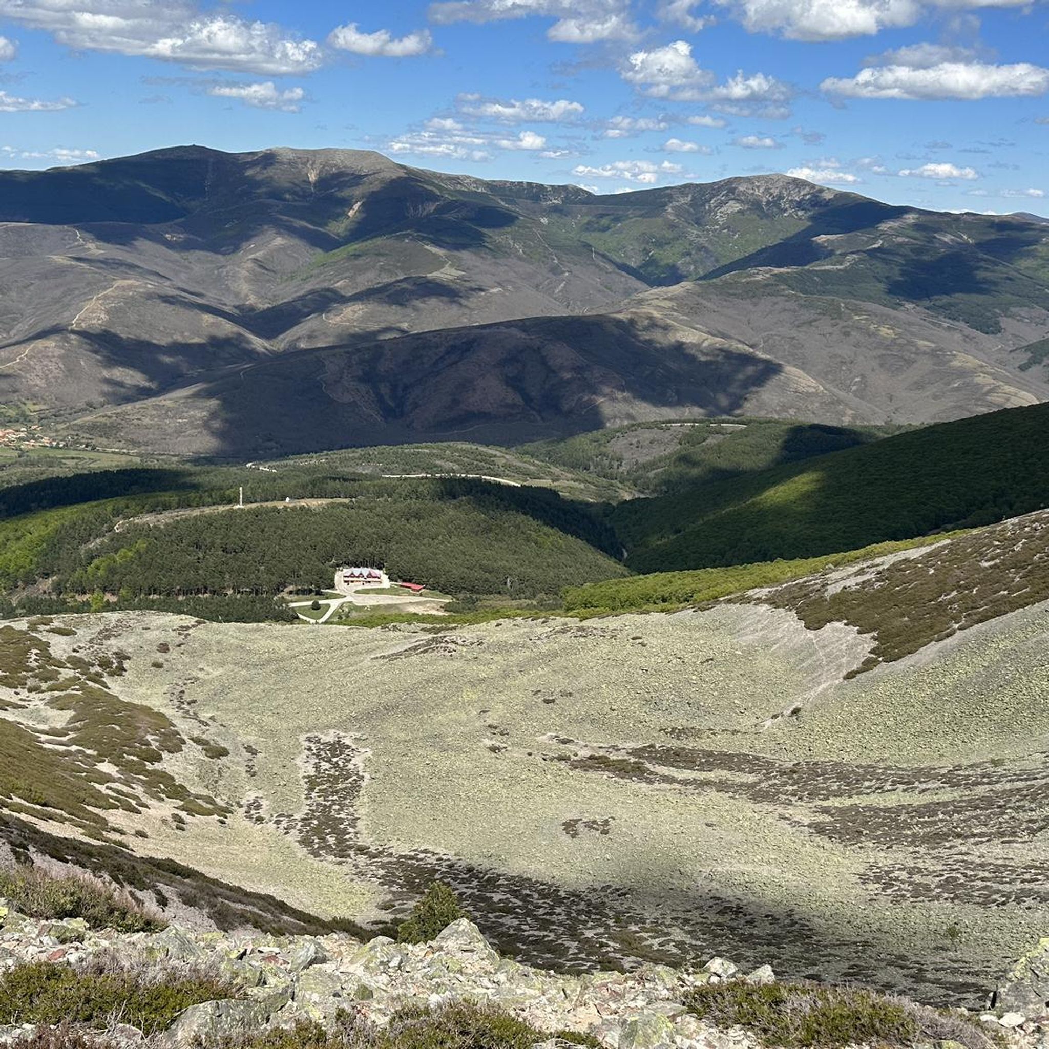
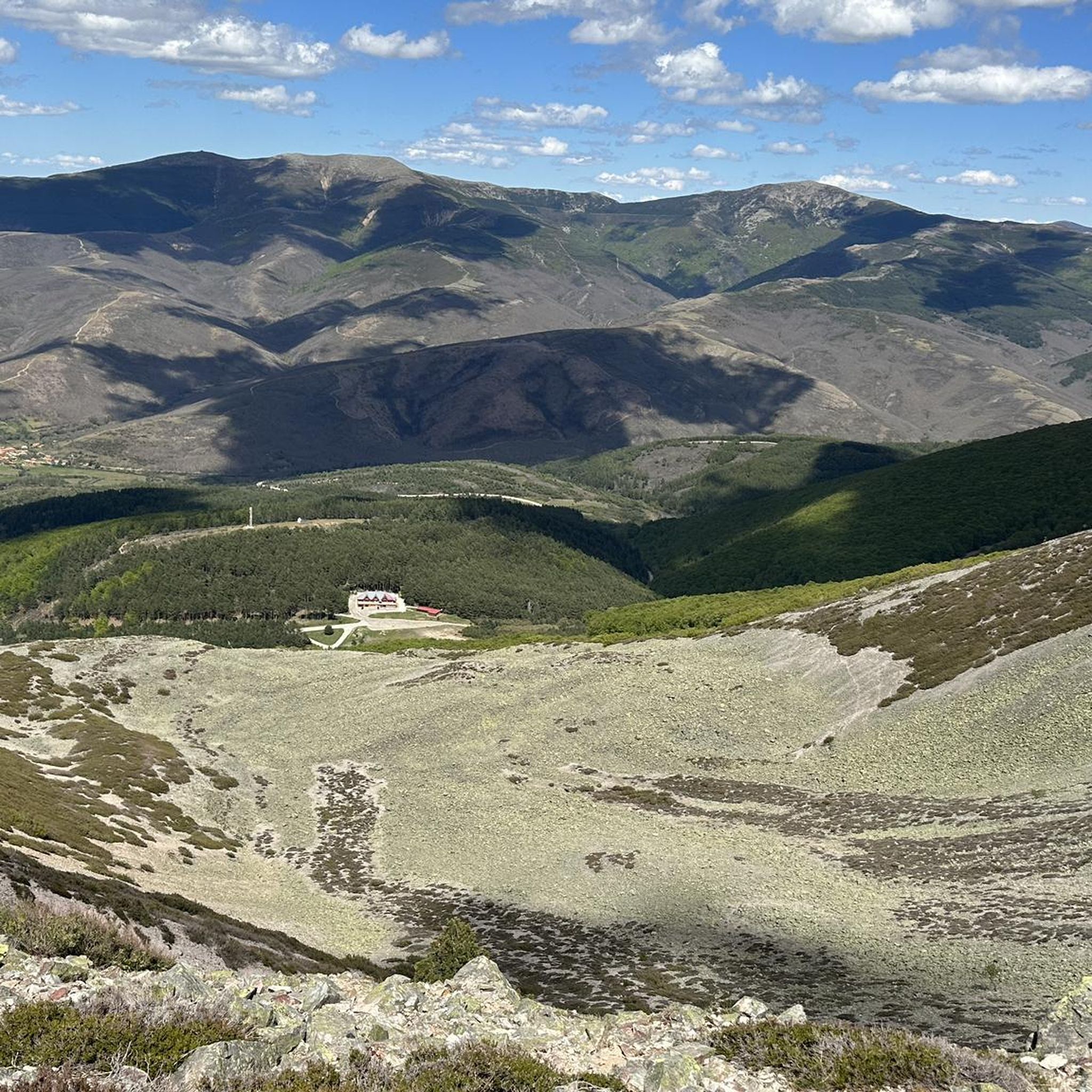
El Mencilla is the highest summit of the Mencilla mountain range, which in turn is part of the Sierra de la Demanda within the Iberian system. With an altitude of 1932 meters above sea level and a prominence of 532 meters, it gives its name to the homonymous mountain range. It is located in the Sierra de la Demanda natural space and the municipal terms of Pineda de la Sierra and Tinieblas de la Sierra converge here, part of the Sierra de la Demanda region, in the province of Burgos.
0
0
El Puerto del Manquillo is located between the towns of Pineda de la Sierra and Riocavado de la Sierra. The pass is an excellent starting point for excursions and visiting the main peaks of the sierra. The route of the Vía Verde de la Sierra Demanda also passes through the port.
0
0

beautiful climb via the greenway or the road
1
0

Spectacular area for hiking routes
0
0
Spectacular area for hiking routes
0
1
Spectacular area for hiking routes
0
0
Spectacular area for hiking routes
0
0
a highly recommended area for hiking.
0
1
Frequently Asked Questions
How many running routes are available around Tinieblas De La Sierra?
There are over 20 running routes available around Tinieblas De La Sierra, offering a variety of distances and difficulties for different preferences. More than 200 runners have already explored these trails using komoot.
What kind of terrain can I expect on the jogging trails in Tinieblas De La Sierra?
The terrain around Tinieblas De La Sierra is quite diverse, featuring extensive forests of junipers, holm oaks, and oaks, as well as mountainous areas and ravines. You'll find a mix of shaded paths, challenging ascents, and pleasant riverside trails along the Tinieblas River and other streams.
Are there any easy running routes for beginners in Tinieblas De La Sierra?
While most routes in the area are classified as difficult, there are a couple of moderate options suitable for those looking for a less strenuous run. For example, the Embalse de Arlanzón — circular by the foot of the Sierra de la Demanda is a moderate 6.5-mile (10.4 km) trail offering scenic views around the reservoir.
Are there any circular running routes in the area?
Yes, several routes in Tinieblas De La Sierra are circular, allowing you to start and end at the same point. The Embalse de Arlanzón — circular by the foot of the Sierra de la Demanda is a popular moderate circular option. For a more challenging loop, consider the Alto de la Cerca – Villaneda loop from Villasur de Herreros.
Can I bring my dog on the running trails?
Tinieblas de la Sierra's natural environment, with its extensive forests and open spaces, is generally welcoming for dogs. However, it's always recommended to check specific trail regulations or local signage for any restrictions, especially within protected areas like the Sabinares del Arlanza-La Yecla Natural Park. Always keep your dog under control and clean up after them.
Are there family-friendly jogging options in Tinieblas De La Sierra?
While many routes are more challenging, families might enjoy sections of the 'Senda de la Naturaleza' along the Tinieblas River, which offers a comfortable path through a small gorge. For specific routes, look for shorter, less elevated trails, though dedicated 'easy' routes are limited in this guide.
Are there running routes with waterfalls or riverside paths?
Yes, the region is crisscrossed by streams and rivers, including the Tinieblas River (also known as San Marcos River). The 'Senda de la Naturaleza' along the Tinieblas River is particularly noteworthy, winding through a small gorge with picturesque natural surroundings and small waterfalls, creating a tranquil and refreshing running experience.
Where can I find parking for the running routes?
Tinieblas de la Sierra is a rural area, and parking is generally available in or near the villages that serve as starting points for many trails. For routes like those around the Embalse de Arlanzón, designated parking areas are often available near the reservoir. It's advisable to check the specific route details on komoot for parking suggestions at the trailhead.
What are some notable landmarks or points of interest I might see while running?
While running, you might encounter several natural and historical points of interest. The Arlanzón Reservoir offers beautiful views, and you could spot the Pico Mencilla in the distance. The area also features natural monuments like Puerto del Manquillo and historical sites such as the Dolmen of Cubillejo de Lara, which can be part of a longer outdoor excursion.
What is the best time of year for running in Tinieblas De La Sierra?
The diverse forests and mountainous terrain make Tinieblas de la Sierra enjoyable for running across multiple seasons. Spring and autumn offer pleasant temperatures and vibrant natural colors. Summer provides shaded paths in the woodlands, while winter can offer unique, crisp running conditions, though some higher elevation trails might require appropriate gear due to snow or ice.
Are there opportunities for wildlife spotting on the trails?
Yes, the region is rich in flora and fauna, being part of the Sierra de la Demanda and the Sabinares del Arlanza-La Yecla Natural Park. While running, you might spot various bird species, including the impressive griffon vulture, which is native to the area. The tranquil rural setting also allows for encounters with other local wildlife.
Are there any challenging running routes for experienced runners?
Absolutely. Tinieblas De La Sierra is known for its challenging mountainous terrain. Many routes feature significant elevation gain, such as the San Millán loop from Valle del Sol, a difficult 21.6-mile (34.8 km) path with substantial ascent. Another demanding option is the Pineda de la Sierra – San Millán (2,131 m) loop from Pineda de la Sierra.
What do other runners say about the trails in Tinieblas De La Sierra?
Runners frequently praise the serene environment and the natural beauty of Tinieblas de la Sierra. The diverse forests provide a fresh atmosphere and varied terrain, while the tranquil rural setting offers a peaceful experience away from crowds. The mix of challenging ascents and picturesque riverside paths is often highlighted as a key appeal.
Most popular routes around Tinieblas De La Sierra
Most popular attractions around Tinieblas De La Sierra

Get inspired with the komoot mobile app


Explore more
Browse the best Running Trails & Routes in other regions.
