The best road cycling routes around Natural Park Leegmoor
4.6
(9)
206
riders
36
rides
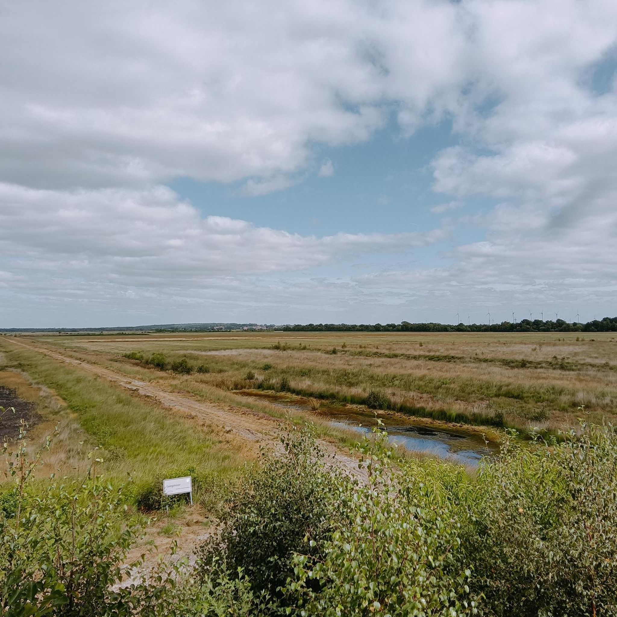
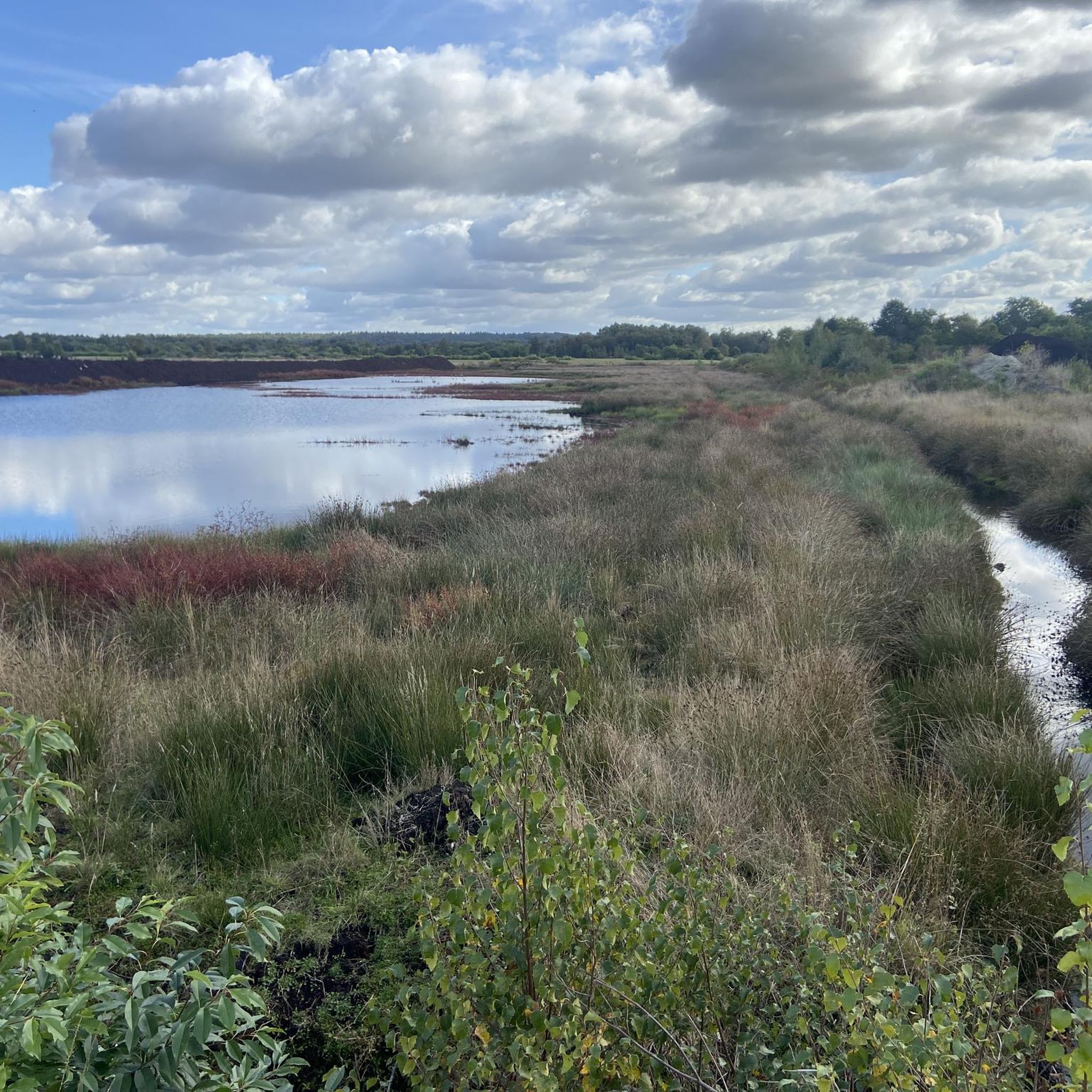
Road cycling around Natural Park Leegmoor is characterized by expansive and serene landscapes, primarily consisting of moorland, pasture, and meadow environments. The terrain is largely flat, offering long, unobstructed routes suitable for road cyclists. The park's proximity to the Küstenkanal also provides scenic routes often associated with canal paths. This area, part of the broader Emsland region, features a cycling-friendly infrastructure with quiet roads and minimal traffic.
Best road cycling routes around Natural Park Leegmoor
- The most popular road cycling…
Last updated: July 14, 2026
5.0
(1)
14
riders
Moderate road ride. Great for any fitness level. Some segments of this route may be unpaved and difficult to ride.
13
riders
Moderate road ride. Great for any fitness level. Some segments of this route may be unpaved and difficult to ride.

Sign up for free
5.0
(1)
9
riders
33.8km
01:22
110m
110m
Moderate road ride. Great for any fitness level. Some segments of this route may be unpaved and difficult to ride.
5.0
(1)
9
riders
Moderate road ride. Great for any fitness level. Some segments of this route may be unpaved and difficult to ride.
7
riders
45.6km
02:01
50m
50m
Moderate road ride. Good fitness required. Some segments of this route may be unpaved and difficult to ride.
Get access to more routes and recommendations from other explorers.
Sign up for free
Already have an account?
Our route recommendations are based on thousands of hikes, rides, and runs completed by other people on komoot.
Start today with a free account
Your next adventure awaits.
Login or Signup
Tips from the Community

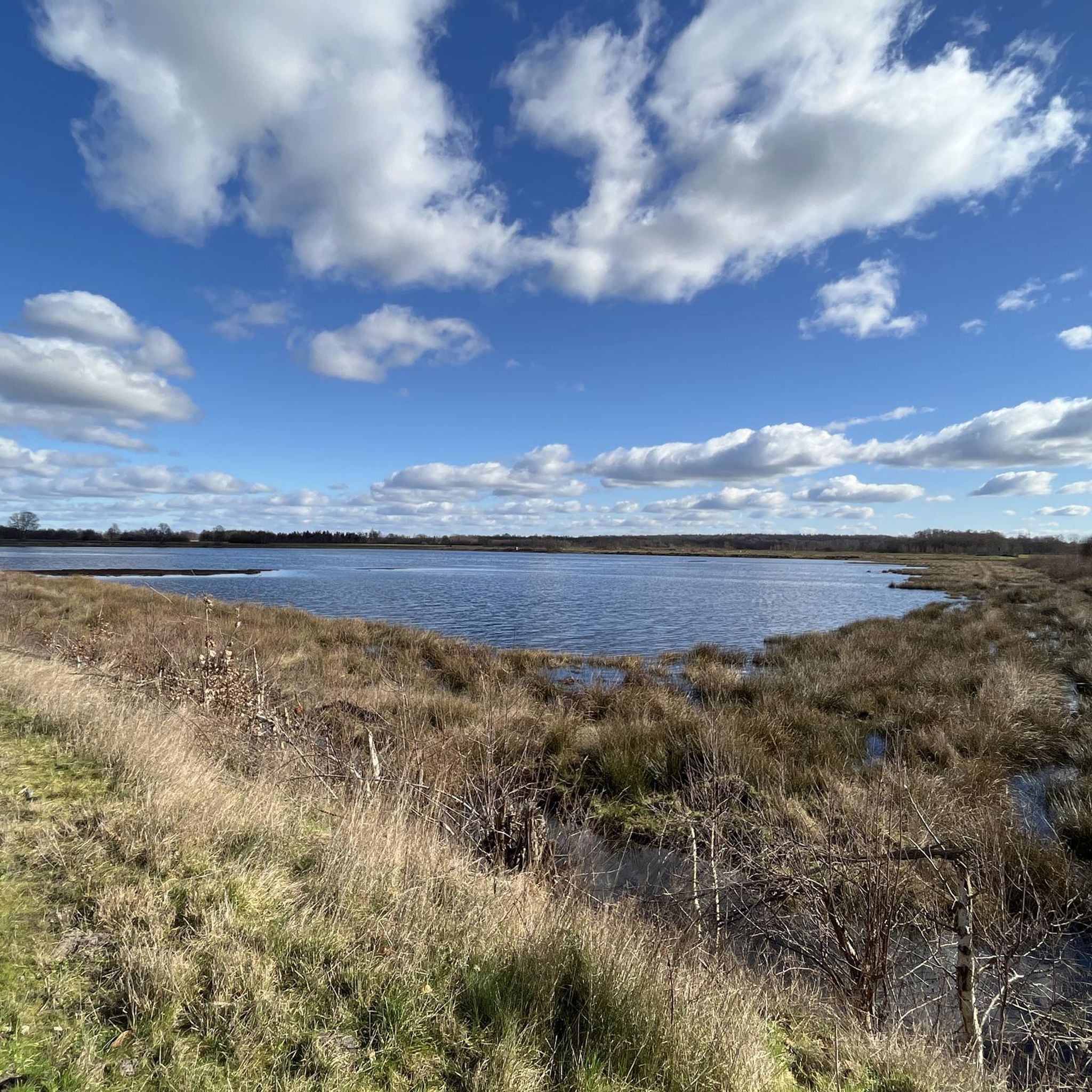
Viewing platform with viewing windows onto the Polder Holter Hammrich nature reserve and directly on the circular route (Heuweg). Sheep and birds are often found on the grassy areas. Cyclists can follow nodes 72 and 73.
0
0

The 35.8 km gravel loop runs along the towers. This agricultural road is NOT to be used and is closed off!!! The Jammertalstrasse should be approached from Langholt.
0
0

Funnily enough, the HL is now located at the Strenge company. It produces a wide range of soils and substrates. In the postwar period, black peat was highly valued as a fuel. In 1949, around 400,000 tons of fuel peat were extracted from the East Frisian moorlands, and the majority was produced using powerful machines. These machines operated in the moorlands, particularly around Ostrhauderfehn, from early spring to late summer. The compressed peat was transported from the moor in the fall by narrow-gauge railway and then loaded onto ships. A special peat loading station was set up over the canal of the 1st Südwieke, where the peat could be efficiently loaded onto ships. A narrow bridge made it possible to push the loaded peat piles onto the bridge, and up to 25 tons of peat could be loaded within a very short time. Not only peat ships were loaded, but also simple barges with a low carrying capacity. These barges were often unmotorized and had to be towed for miles. One or more people pulled the vessel with a rope, while the boatman steered the boat with a long pole at the stern.
3
0
Each mast is mounted on an approximately 3-meter-high ceramic insulator that can withstand a load of 4,000 tons and insulates voltages of up to 250 kV. The masts are each secured by nine guy wires at three levels, each offset by 120 degrees. Four masts form a common antenna that requires no overhead connection. The antenna is fed via coaxial cables to the tuning stations, where the power is adjusted and fed into the mast. It is worth noting that the antenna structure does not have a pronounced directional pattern, as it is smaller than the wavelength of 12.82 km at the current frequency of the DHO38. For inspection and maintenance work, there is a worm-gear-driven elevator and a ladder inside the masts. The elevator can transport up to three people and ensures safety through mandatory safety harnesses.
1
0
Superlatives The naval radio station is one of the tallest military structures in Western Europe and, at 352.8 meters, the second tallest structure in Germany, visible from over 30 kilometers away. The transmitter is located near Saterland-Ramsloh in the Cloppenburg district (Lower Saxony). The borders of the two districts of Cloppenburg and Leer run through the naval radio station site. Five antennas are located in East Frisia, and three are located in Cloppenburg. The site is surrounded by a 12-km-long, continuously monitored fence. A naval radio station with eight identical umbrella antennas mounted on 352.8-meter-high tubular steel masts. These masts have a diameter of 2.20 meters and wall thicknesses of 8 to 13 mm, depending on local loads.
1
0


Wonderful area, always lots of geese here and other birds
0
0

well, it's okay... no real highlight
0
0
Frequently Asked Questions
What is the terrain like for road cycling in Natural Park Leegmoor?
Natural Park Leegmoor offers predominantly flat terrain, characterized by expansive moorland, pasture, and meadow environments. This makes for long, unobstructed routes ideal for road cycling, with minimal elevation changes. The area's proximity to the Küstenkanal also means you'll find scenic routes along canal paths, which are typically well-paved.
How many road cycling routes can I explore in Natural Park Leegmoor?
There are over 35 road cycling routes available in Natural Park Leegmoor, catering to various preferences. These routes are highly rated by the komoot community, with an average score of 4.6 stars from 9 reviews, and have been explored by more than 200 road cyclists.
Are there options for different difficulty levels among the road cycling routes?
Yes, the routes in Natural Park Leegmoor offer a range of difficulty levels. You'll find 8 easy routes, 29 moderate routes, and 1 difficult route, ensuring there's something suitable for beginners and more experienced cyclists alike. The generally flat landscape makes many routes accessible.
Can I find circular road cycling routes in Natural Park Leegmoor?
Many of the road cycling routes in Natural Park Leegmoor are designed as loops, allowing you to start and end at the same point. For example, the Langholt–Esterwegen Cycle Path – St. Jakobus Church, Ramsloh loop from Bockhorst is a popular circular route covering 42.4 km.
What kind of nature and wildlife can I expect to see while cycling in Leegmoor?
Natural Park Leegmoor is a European protected area known for its rich birdlife, especially meadow birds, and year-round open water areas that attract resting birds. An observation tower provides excellent opportunities for birdwatching. You'll cycle through vast moorland, pastures, and meadows, experiencing the tranquil beauty of this rewetting landscape.
When is the best time of year to go road cycling in Natural Park Leegmoor?
The area is accessible year-round, but the best time for road cycling is typically during spring, summer, and early autumn when the weather is mildest. During these seasons, you can fully appreciate the vastness of the moor, especially during sunrise or sunset, when the landscape is bathed in warm light.
Are there places to stop for refreshments along the road cycling routes?
While specific cafes or pubs directly on every route are not detailed, the Emsland region, including areas around Leegmoor, is known for its cycling-friendly infrastructure. You can often find local pubs, cafes, or tea shops in nearby villages like Surwold or Bockhorst, perfect for a refreshment break.
Where can I park my car when visiting Natural Park Leegmoor for road cycling?
The region offers relatively good access for visitors. While specific parking spots for each route are not listed, you can generally find parking facilities in the surrounding municipalities like Surwold or near the starting points of popular routes. It's advisable to check local signage upon arrival.
Are there any notable viewpoints or landmarks to discover on the road cycling routes?
Yes, the park features an observation tower that offers impressive insights into the area's avian diversity and panoramic views of the moorland. Routes like the View of the Ems River – Market Fountain Lathen loop from Bockhorst also provide varied countryside views, potentially including glimpses of the Ems River.
Are there family-friendly road cycling routes in Natural Park Leegmoor?
Given the largely flat and quiet nature of the roads, many routes in Natural Park Leegmoor are suitable for families. The 8 easy routes available are particularly good options for those cycling with children, offering a relaxed experience through the scenic landscape.
What do other road cyclists say about their experience in Natural Park Leegmoor?
The komoot community rates road cycling in Natural Park Leegmoor highly, with an average score of 4.6 stars. Cyclists often praise the tranquil experience, the peaceful roads winding through magnificent countryside, and the absence of heavy traffic, making it an ideal destination for enjoying nature on two wheels.
Do the routes in Natural Park Leegmoor include scenic canal paths?
Yes, the Natural Park Leegmoor is situated south of the Küstenkanal, and its proximity means that many road cycling routes benefit from the scenic paths often associated with canal routes. These paths are typically paved and offer pleasant, flat riding conditions alongside the water.
Are there options for both shorter and longer road cycling excursions?
Absolutely. Natural Park Leegmoor offers a wide range of route lengths. You can find shorter loops, such as the Esterweger Dose Moor – Esterweger Dose Wetlands loop from Bockhorst at 22.9 km, as well as longer excursions like the View of the Ems River – Market Fountain Lathen loop from Bockhorst, which spans 77.2 km.
Most popular routes around Natural Park Leegmoor
Most popular attractions around Natural Park Leegmoor

Get inspired with the komoot mobile app


Explore more
Browse the best Road cycling routes in other regions.
