The best MTB trails around Muñogalindo
4.3
(4)
26
riders
12
rides
Mountain biking around Muñogalindo offers diverse terrain within the Amblés Valley, near Ávila, Spain. The region is characterized by singular granitic formations, particularly around Pico Zapatero, which have sculpted a unique labyrinth of stone sculptures. Riders can experience views of the Sierra de Paramera, Gredos, and Serrota mountain ranges, with routes featuring both paved and unpaved sections. This varied landscape provides options for different skill levels, from firm tracks to more challenging paths.
Best mountain bike trails around Muñogalindo
- The…
Last updated: July 1, 2026
4
riders
48.7km
04:42
1,020m
1,020m
Hard mountain bike ride. Very good fitness required. Suitable for all skill levels.
2
riders
38.7km
03:50
850m
850m
Moderate mountain bike ride. Good fitness required. Suitable for all skill levels.

Sign up for free
3
riders
39.5km
03:17
560m
560m
Moderate mountain bike ride. Good fitness required. Advanced riding skills necessary.
3
riders
37.7km
03:36
890m
890m
Moderate mountain bike ride. Good fitness required. Suitable for all skill levels.
3
riders
46.1km
03:44
270m
270m
Moderate mountain bike ride. Good fitness required. Suitable for all skill levels.
Get access to more routes and recommendations from other explorers.
Sign up for free
Already have an account?
Our route recommendations are based on thousands of hikes, rides, and runs completed by other people on komoot.
Start today with a free account
Your next adventure awaits.
Login or Signup

Tips from the Community

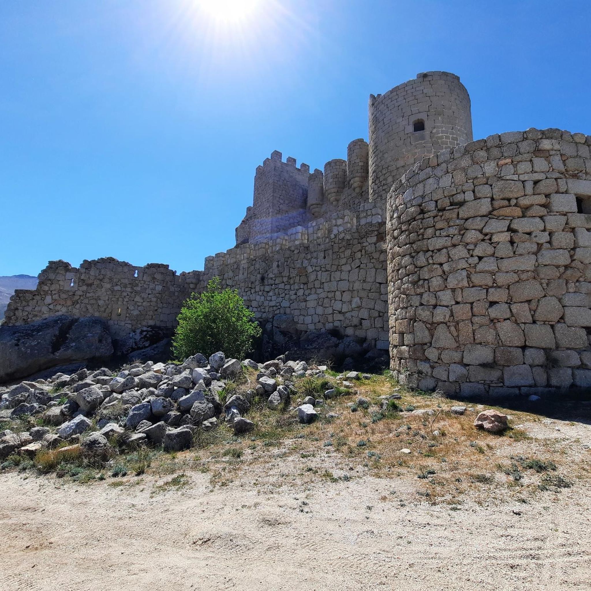
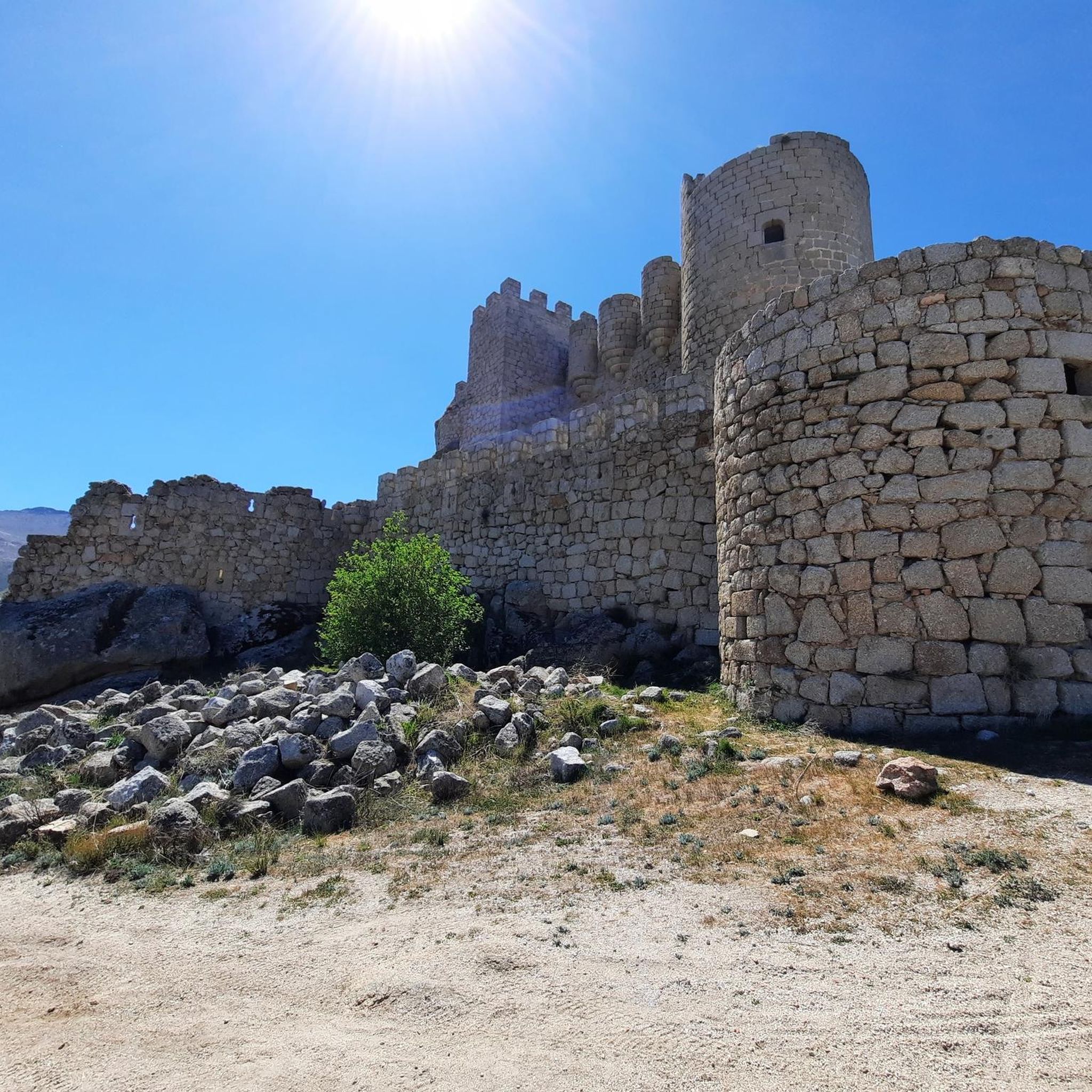
Manqueospese Castle, also known as "Althoughospese," is located in the municipality of Mironcillo, Ávila, at an altitude of 1,360 meters, overlooking the Amblés Valley. This castle is an example of a European mountain fortress, with strong walls adapted to the rocky terrain. Construction of the castle began in the 15th century by the Dávila family and was completed by Esteban Dávila in the 16th century. The castle is surrounded by legends, including stories of unrequited love and rivalries between knights. Its name, "Manqueospese," is said to come from the expression "although it weighs on you," which is related to these legends. From its privileged position, the castle offers stunning views of the Amblés Valley and the walls of Ávila. Although it is currently in ruins, restoration and cleaning work are underway.
5
0

A stream on the outskirts of the town that even in these times runs a trickle of water, you can see it in the rainy season.
0
0
Nice square where, in addition to the church, you can find a bar to regain strength or a waterfront.
0
0
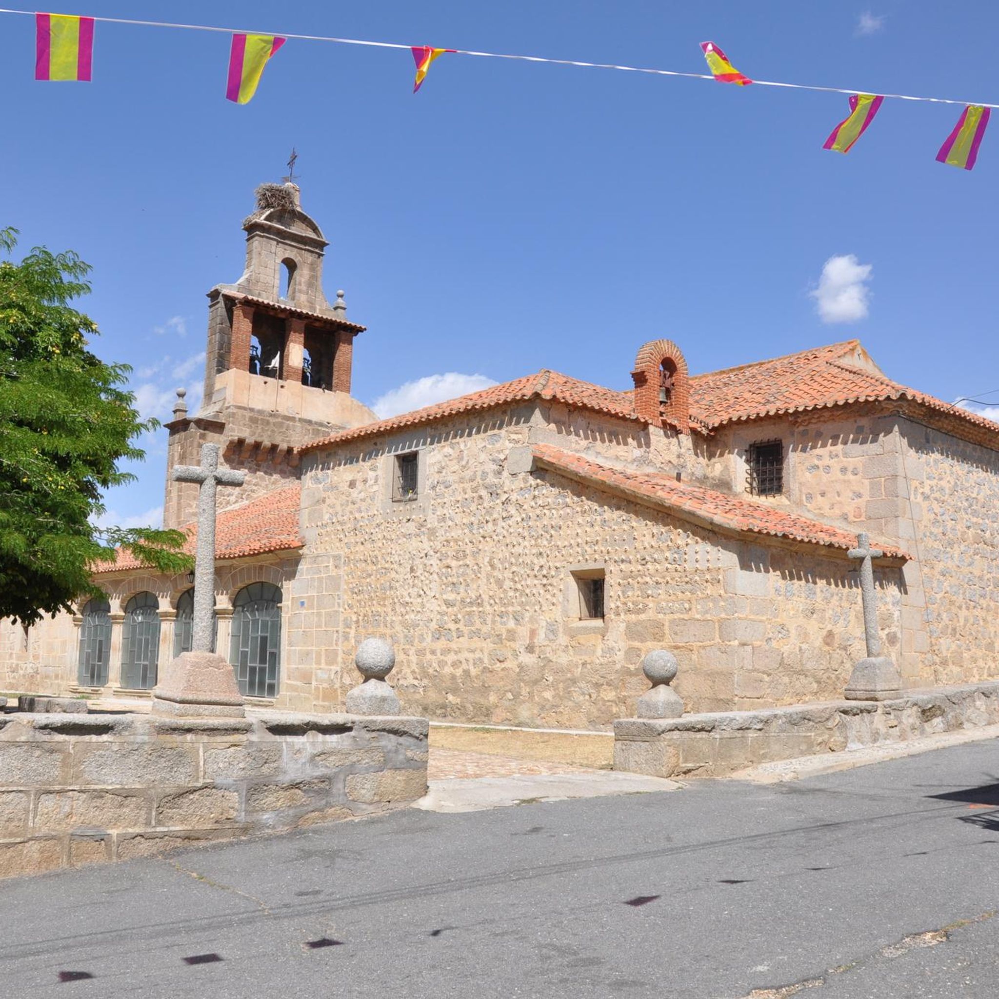
The Church of Our Lady of the Assumption in El Fresno is a religious building that occupies one of the sides of the town's Plaza Mayor. Built in the 19th century, it was consecrated in 1803 under the dedication of Our Lady of the Assumption. This church replaced a previous parish temple, dedicated to Our Lady of Galindos, which was located away from the urban center. Although its exterior appearance is simple, with ashlars and a brick belfry, its interior offers a reconstructed space with a flat plastered ceiling. On the west side, the belfry stands out with three openings for bells. The temple houses free-standing images, such as a wooden Crucified from the 17th-18th centuries and a Virgin and Child from 1867. The latter, the work of drawing professor Ramón Álvarez, is appreciated for the joyful expression of the Child. If you have the opportunity, I invite you to visit this church full of history and devotion. 🙏🌟
2
0

Leaving the river landscape you reach the center of the town and you can rest in the church of Nuestra Señora de la Asunción, from the 19th century.
1
1

According to legend, the castle would be built by Don Raimundo, to communicate with his beloved Doña Guiomar, locked in the balcony that crowns the door of the Rastro (in Ávila, access through the Dávila house), given the prohibition of her father. for the couple to continue their love affairs. Given the paternal attitude, Don Raimundo exclaimed: "I'll see her manqueospese" or "I'll see her even though she weighs", and it was then that he built his castle, from which he apparently communicated with his beloved Guiomar.
1
0

Population that is located at the foot of the northern side of the Sierra de Panamera and that on one of its sides is the Castillo de Manqueospese. As it is surrounded by mountains, as soon as you get up, you can see the entire core.
0
0
Impressive castle that is located close to the town of Sotalbo and that has a scene worthy of a movie. The walls and towers create a beautiful image on a hill!
1
0
Frequently Asked Questions
How many mountain bike trails are available around Muñogalindo?
There are 12 mountain bike trails around Muñogalindo listed on komoot, offering a variety of experiences for different skill levels.
What types of terrain can I expect on mountain bike trails in Muñogalindo?
The region features diverse terrain, including both paved and unpaved sections. You'll encounter unique granitic landscapes, especially around Pico Zapatero, which have sculpted a distinctive rocky environment. Some routes may involve challenging sections where you might need to push your bike.
Are there easy mountain bike trails suitable for beginners or families in Muñogalindo?
Yes, Muñogalindo offers 3 easy mountain bike routes. These routes typically last up to 2 hours with an elevation gain of up to 300 meters, primarily on firm, paved tracks, making them accessible for all fitness levels. While specific family-friendly routes are not detailed, these easy options are generally suitable.
What are some moderate mountain bike trails in the area?
For those seeking a moderate challenge, there are 8 routes available. An example is the Castillo de Villaviciosa – Fuente Fría Picnic Area loop from Solosancho, a 24.0-mile (38.7 km) path with 848 meters of elevation gain. These routes can extend up to 5 hours and may include unpaved or more challenging sections.
Are there challenging mountain bike trails for experienced riders in Muñogalindo?
Yes, there is 1 difficult mountain bike trail for experienced riders. The Sotalbo – Fuente Fría Picnic Area loop from Solosancho is a 30.3-mile (48.7 km) trail with over 1000 meters of elevation gain, taking approximately 4 hours 41 minutes. Difficult routes may exceed 5 hours or 900 meters of elevation gain and might require dismounting and pushing the bike in parts.
What kind of views can I expect on the mountain bike trails?
Many trails offer scenic views of the surrounding mountain ranges, including the Sierra de Paramera, Gredos, and the white reliefs of the Serrota mountain range towards the west. You can also find viewpoints like Views of Valdecasa along some routes.
Are there any natural monuments or landmarks to see along the trails?
Yes, the region is known for its unique granitic formations, particularly around Pico Zapatero and Cerro de Gorría. You might also encounter man-made monuments such as the Rollo de Muñotello and Plaza de la Torre and Fuente de Piedra.
What is the best time of year for mountain biking in Muñogalindo?
Muñogalindo offers good conditions for mountain biking across various seasons due to its diverse terrain. While specific recommendations depend on personal preference, the region's climate generally allows for enjoyable rides in spring, summer, and autumn. Always check local weather conditions before heading out.
Are there any circular mountain bike routes in Muñogalindo?
Yes, many of the mountain bike routes in Muñogalindo are designed as loops. For example, the Rollo de Muñotello – Villatoro loop from Muñogalindo is a 28.7-mile (46.1 km) trail that starts and ends in the same general area.
What do other mountain bikers say about the trails in Muñogalindo?
The mountain bike trails in Muñogalindo are highly rated by the komoot community, with an average score of 4.3 stars. Riders often praise the varied landscapes, the unique granitic formations, and the views of the surrounding mountain ranges.
Is there parking available for mountain bikers in Muñogalindo?
While specific parking locations are not detailed for every route, many trails start from towns or villages like Muñogalindo or Solosancho, where public parking is generally available. It's advisable to check the starting point of your chosen route for specific parking information.
Can I bring my dog on the mountain bike trails in Muñogalindo?
The general policy for bringing dogs on trails can vary. While many natural areas in Spain are dog-friendly, it's always best to check local regulations or specific trail rules before you go. Ensure your dog is well-behaved and kept on a leash, especially in areas with wildlife or other users.
Most popular attractions around Muñogalindo

Get inspired with the komoot mobile app


Explore more
Browse the best MTB trails in other regions.
