The 13 Most Amazing Peaks around Benifairó De Les Valls
Best mountain peaks around Benifairó De Les Valls are found in the surrounding mountainous terrain, particularly within the Serra Calderona Natural Park. Benifairó De Les Valls itself is situated on a flat plain with an average altitude of 88 meters, serving as a starting point for exploring nearby peaks. The region offers diverse landscapes, from plains to the Mediterranean coast, making it suitable for various outdoor activities. This area provides access to several notable summits and viewpoints.
Best mountain peaks…
Last updated: July 6, 2026
Garbí Viewpoint
Highlight • Viewpoint
Translated by Google •
Tip by

Mola de Segart
Highlight • Summit
Translated by Google •
Tip by
Sign up now to discover places like this
Get recommendations on the best single tracks, peaks, & plenty of other exciting outdoor places.
Sign up for free
Cross of Picayo Summit
Highlight • Summit
To go up, you need experience and bicycle as the slopes are steep and somewhat expensive.
Translated by Google •
Tip by

Mola de Segart
Highlight • Summit
Tip by

Muntanya Redona
Highlight • Summit
Translated by Google •
Tip by

Sign up for free to discover even more peaks around Benifairó De Les Valls.
Sign up for free
Already have an account?
Start today with a free account
Your next adventure awaits.
Login or Signup

Tips from the Community

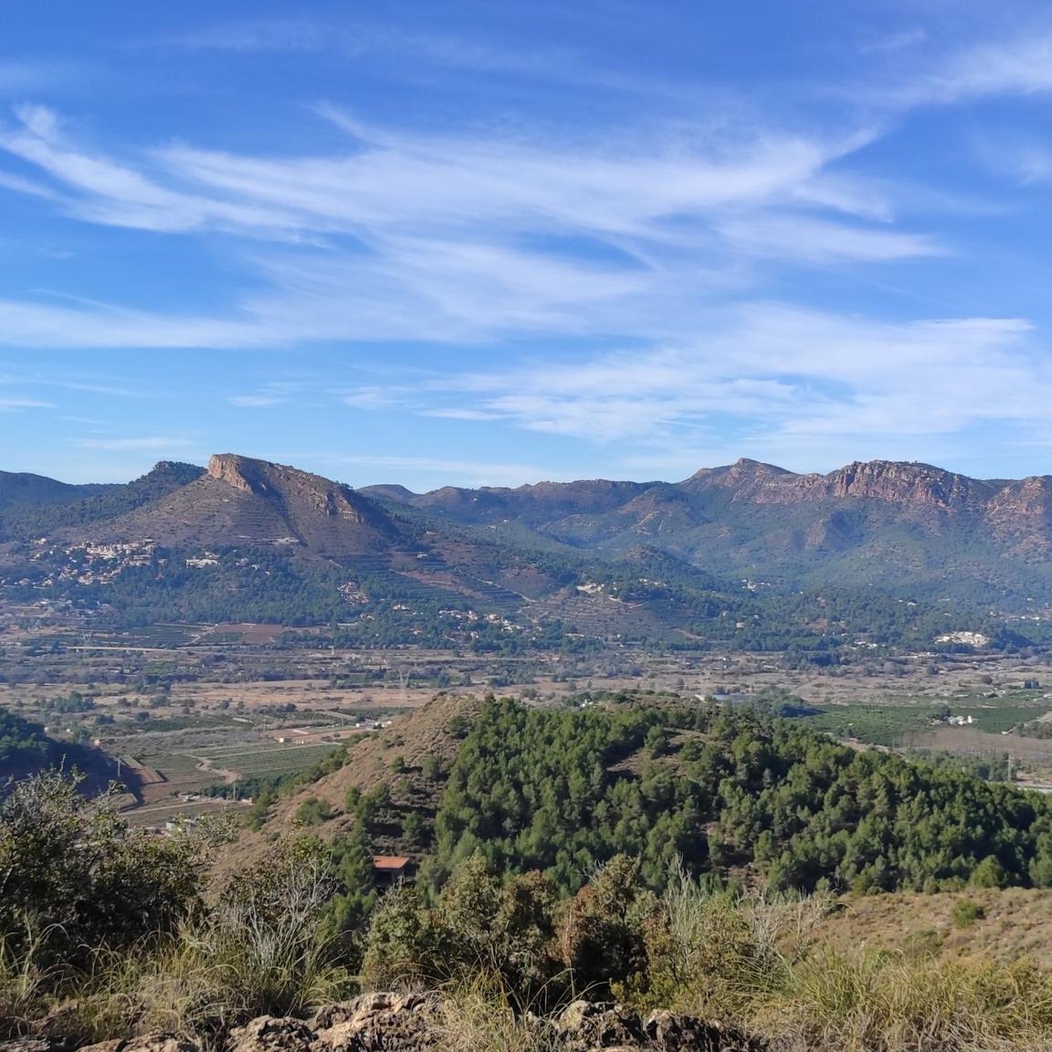
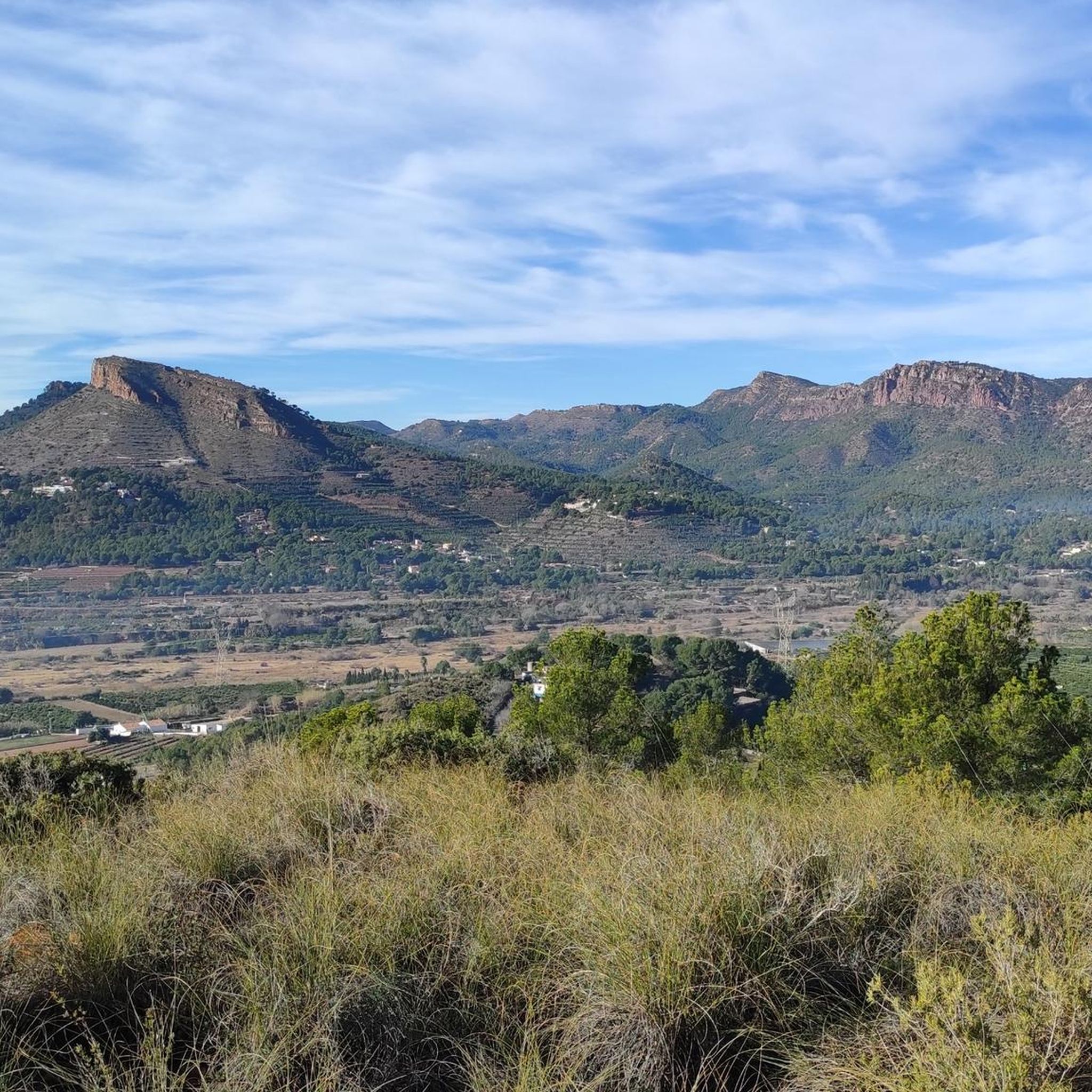
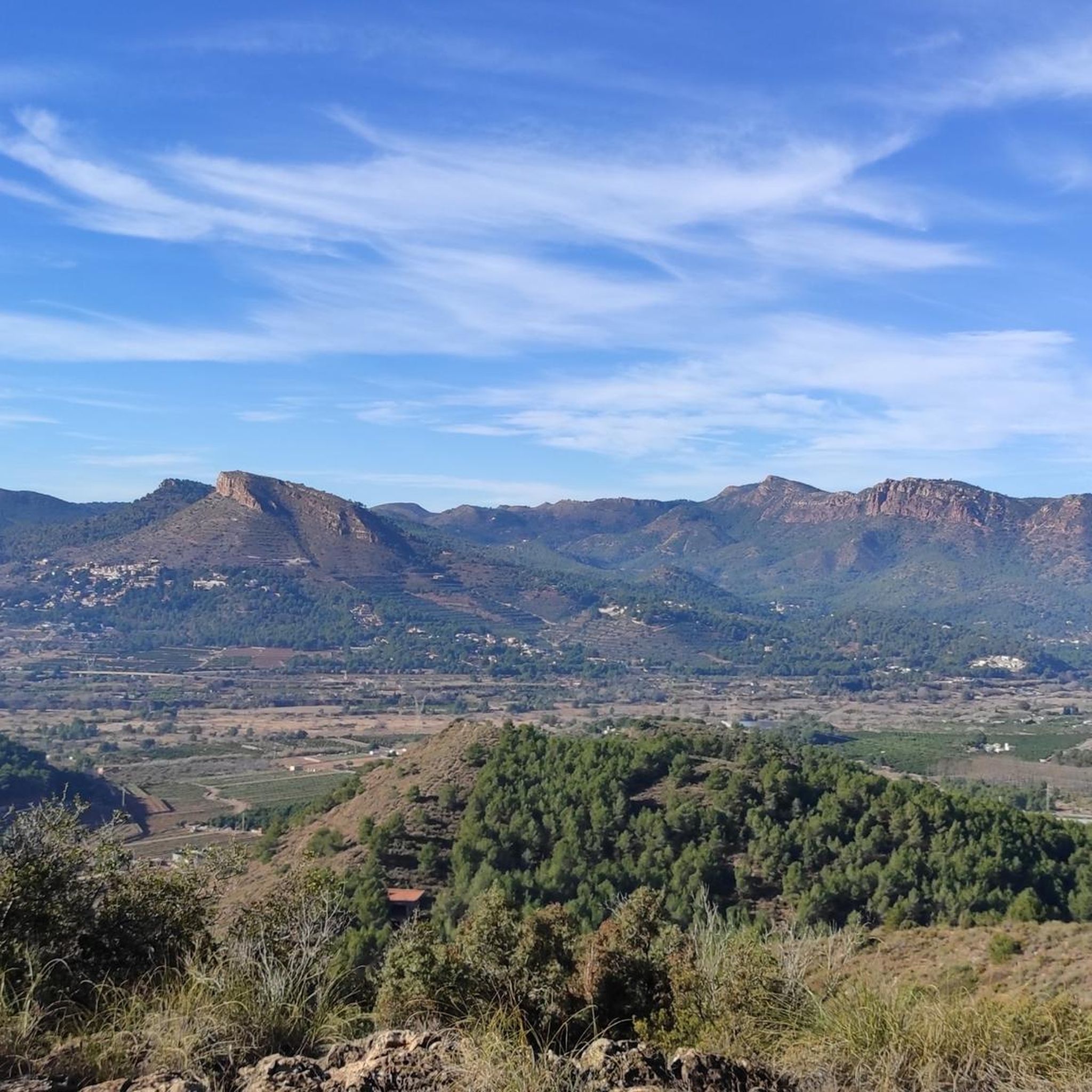
Garbí Viewpoint: Spectacular views of the Gulf of Valencia and, on clear days, as far as the Columbretes Islands. Ideal for sunrises and sunsets.
1
0

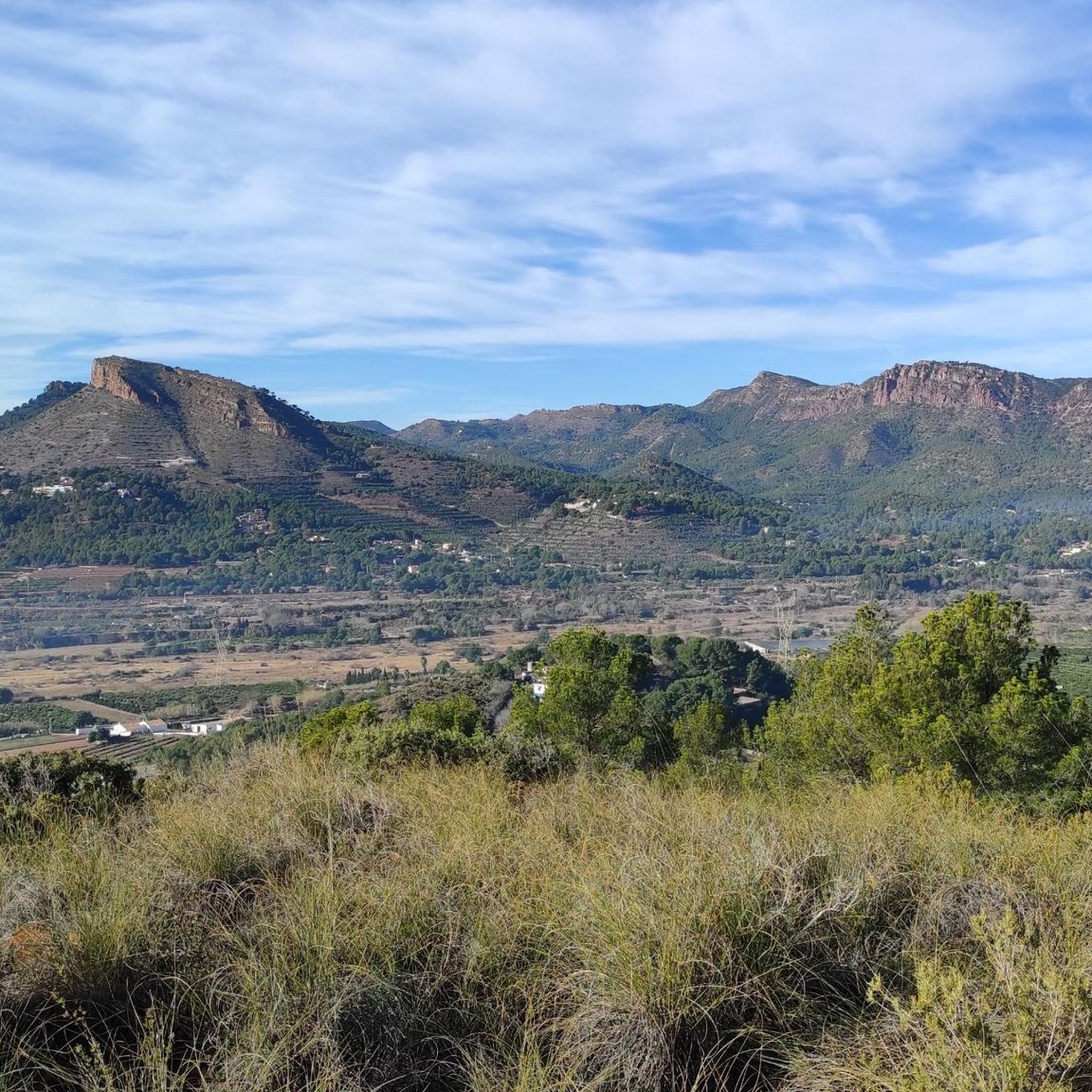
El Garbí is a mountain of 593 meters located in the Serra Calderona, in its eastern part, a short distance from the Mediterranean Sea, between the municipalities of Estivella, Segart and Albalat dels Tarongers, in the region of Camp de Morvedre, if well it should be noted that the viewpoints and the llossar are in Estivella. It has beautiful views of the north coast of Valencia and south of Castelló, as well as the Serra Calderona, to which it belongs.
1
1
More information here: https://www.valenciabonita.es/2018/05/02/el-garbi/
1
1

At the Tender hill appears the Camí de la Mola dirt track that goes up to the left from Segart and continues to the right surrounding the mountain. The route continues straight along a path that begins on the slope of the forest track and ascends directly up the side of the mountain to the summit of Mola de Segart (565 m). The geodesic vertex is on the eastern summit, on the western summit there is a stone marker and both have extraordinary views. The descent continues along a fairly vertical channel between the two summits. The first ten meters are aerial and dangerous, you have to get the steps right, then continue down the side of the mountain without complications, the path is very clear and frequented. The trail ends at the Mola hill and the route continues along the forest track of the Camí de Segart a Sant Espirit.
2
0
The path passes near the parking lot and continues along the main path to a pedestrian path marked with sticks that runs along the rocks and leads to the Garbí Viewpoint, installed on the main summit (601 m). In Pla del Garbí there are recreation areas, kiosks, a hermitage and extraordinary views of the Mediterranean coast in Sagunto and Valencia.
6
1

The last 200 meters of the path can be somewhat difficult, with an unmaintained path, loose stones and unmarked steps. It is not necessary that you reach the top, the views do not change and are already very beautiful from several meters below where the path is better maintained
2
0

Also to do, me from Valencia leaving at 4:30 a.m. arriving in Puçol at 5:30 a.m. I did the Picayo in + - 1 hour of intense effort with parts at + 10% D+. But after a nice climb made in the dark and arrival at dusk to get the satisfaction of the sunrise with a magnificent view of Valencia and its region. I recommend taking drinks and supplies for the summit.
2
0

Frequently Asked Questions
Which mountain peaks offer the best panoramic views near Benifairó de les Valls?
For spectacular panoramic views, head to Garbí Viewpoint. On clear days, you can see across the Mediterranean Sea, the Valencian coast, Albufera Lake, and even the Columbretes Islands. Another excellent spot is Cross of Picayo Summit, which provides expansive coastal views.
Are there family-friendly mountain peaks or viewpoints in the area?
Yes, Garbí Viewpoint is considered family-friendly due to its accessibility by car with a short walk to the main viewpoint. Additionally, Cruz del Monte Picaio Viewpoint is also listed as family-friendly, offering impressive views.
What is the difficulty level of hiking to the mountain peaks near Benifairó de les Valls?
The difficulty varies. Peaks like Garbí Viewpoint offer relatively easy access with options for moderate hiking trails. However, summits such as Cross of Picayo Summit involve demanding ascents in sections and are categorized as challenging. Mola de Segart and Muntanya Redona are generally considered intermediate climbs.
Where can I find parking for mountain trails in the Serra Calderona Natural Park?
For El Garbí, parking is available near the top, followed by a short walk to the main viewpoint. For other trails within the Serra Calderona Natural Park, it's advisable to check specific trailheads for designated parking areas. Some access roads, like those near Cruz del Monte Picaio Viewpoint, might be in private communities, so verify access beforehand.
Are there any permits required for hiking in the Serra Calderona Natural Park?
Generally, permits are not required for hiking on established trails within the Serra Calderona Natural Park. However, always respect local regulations, especially concerning protected areas, fire restrictions, and any specific rules posted at trailheads.
What kind of natural beauty can I expect to see on these mountain peaks?
The mountain peaks are part of the Serra Calderona Natural Park, characterized by Mediterranean forests, pine groves, and cork oak woods. You'll experience diverse landscapes, from lush forests to valleys and plains, with stunning coastal views from higher elevations. Sunsets from peaks like El Garbí are particularly noted as incredible.
What are the best times of year to hike the mountain peaks near Benifairó de les Valls?
The region generally enjoys a Mediterranean climate. Spring and autumn are often ideal for hiking, offering pleasant temperatures and vibrant natural scenery. Summer can be very hot, so early morning or late afternoon hikes are recommended, while winter offers cooler, crisp conditions, though some routes might be more challenging.
What other outdoor activities can I do near the mountain peaks around Benifairó de les Valls?
Beyond hiking, the area offers various outdoor activities. You can explore numerous cycling routes, including touring bicycle options like the 'Large mural – Torres Torres Castle loop' or road cycling routes such as the 'Oronet Pass – L'Oronet Pass Climb loop'. For mountain biking enthusiasts, there are trails like the 'Trail Along Barranco Codobal – La Catalana Trail loop'. You can find more details on these activities in the Cycling around Benifairó De Les Valls, Road Cycling Routes around Benifairó De Les Valls, and MTB Trails around Benifairó De Les Valls guides.
Are there any notable hiking trails that start directly from Benifairó de les Valls?
While Benifairó de les Valls is a gateway to the Serra Calderona, a popular moderate hiking trail originating from the town is La Creu de Quart. This trail offers varied terrain and views, with loop options ranging from approximately 4.2 miles (6.7 km) to 8.2 miles (13.2 km).
What do visitors enjoy most about the mountain peaks in this region?
Visitors frequently praise the spectacular panoramic views, especially from Garbí Viewpoint, which offers vistas of the coast and sea. The diverse landscapes, from forests to plains, and the sense of accomplishment from reaching summits like Mola de Segart, are also highly appreciated. The area is known for its natural beauty and the opportunity for both challenging and accessible outdoor experiences.
Can I reach the Serra Calderona Natural Park using public transport from Benifairó de les Valls?
While Benifairó de les Valls itself is well-connected, direct public transport options specifically to the trailheads deep within the Serra Calderona Natural Park can be limited. It's often more convenient to use a car to access the park's various entry points and popular peaks like El Garbí. Check local bus schedules for routes to nearby towns that might offer closer access.
Are there any specific tips for hiking to <a href="https://www.komoot.com/highlight/1054055" target="_blank" rel="noopener">Mola de Segart</a>?
The route to Mola de Segart is considered very beautiful, with spectacular views from the top. The climb from the west is relatively easy, but be aware that the final ascent to the summit can be somewhat challenging for young children. Always exercise caution, especially on steeper sections.
What should I wear for hiking the mountain peaks around Benifairó de les Valls?
Given the varied terrain and potential for demanding sections, wear comfortable, sturdy hiking shoes with good grip. Layered clothing is recommended to adapt to changing temperatures, especially if starting early or hiking into the evening. Bring sun protection, sufficient water, and snacks. For challenging routes, consider trekking poles.
Most popular routes around Benifairó De Les Valls
Most popular attractions around Benifairó De Les Valls

Get inspired with the komoot mobile app


Explore more
See even more amazing summits around Benifairó De Les Valls with these guides:
