The best road cycling routes around La Rinconada De La Sierra
4.9
(10)
370
riders
33
rides
Road cycling routes around La Rinconada De La Sierra are situated within the Sierra de Francia-Quilamas region, a protected natural area characterized by diverse terrain. The landscape features oak and chestnut forests, narrow valleys, and the Río de las Quilamas, offering varied road cycling experiences. Elevations range from moderate climbs to demanding ascents, including routes towards Pico Cervero and Puerto de Valero. This region provides a network of well-paved surfaces suitable for exploring its natural features and rural villages.
Best…
Last updated: July 14, 2026
71.2km
03:02
610m
610m
Moderate road ride. Good fitness required. Mostly well-paved surfaces and easy to ride.
52
riders
91.2km
04:44
1,660m
1,660m
Hard road ride. Very good fitness required. Mostly well-paved surfaces and easy to ride.

Sign up for free
18
riders
89.8km
04:14
1,180m
1,180m
Hard road ride. Very good fitness required. Mostly well-paved surfaces and easy to ride.
4.3
(3)
16
riders
82.0km
04:20
1,480m
1,470m
Hard road ride. Very good fitness required. Some segments of this route may be unpaved and difficult to ride.
17
riders
86.2km
04:28
1,530m
1,540m
Hard road ride. Very good fitness required. Mostly well-paved surfaces and easy to ride.
Get access to more routes and recommendations from other explorers.
Sign up for free
Already have an account?
Our route recommendations are based on thousands of hikes, rides, and runs completed by other people on komoot.
Start today with a free account
Your next adventure awaits.
Login or Signup
Popular around La Rinconada De La Sierra


Tips from the Community

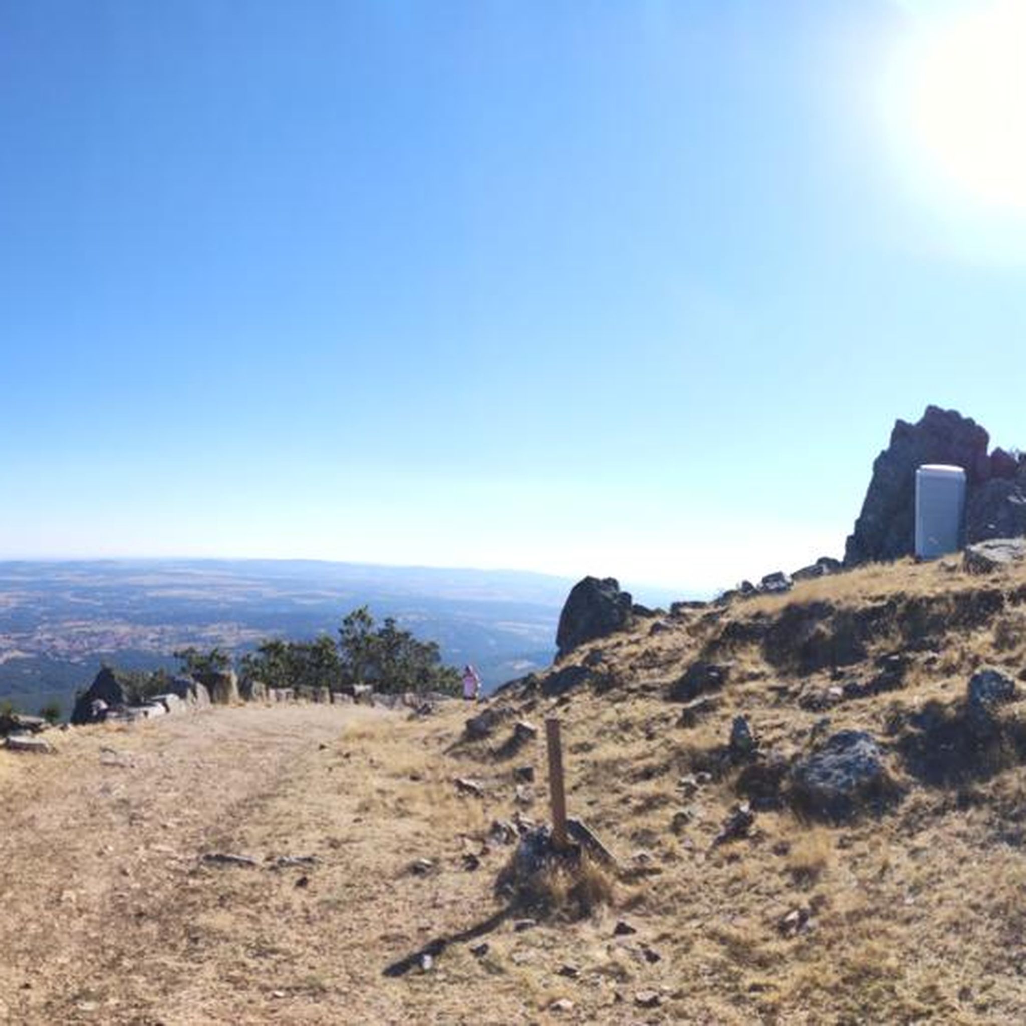
On the SA-205 highway, just outside San Esteban de la Sierra heading towards Santibáñez de la Sierra, you'll find the entrance to the Sierra Viewpoints Route, which includes several spectacular panoramic viewpoints. Views: The Alagón River Valley and its meanders. The Sierra de Francia mountain range with the Peña de Francia peak in the background. The Sierra de Béjar mountain range and the Las Quilamas Natural Area. This viewpoint is a magnificent natural balcony, perfect for photography and birdwatching (vultures, eagles, black storks).
2
0
What to see in Miranda del Castañar Medieval Walls: Over 600 meters remain intact, with four gates facing the cardinal directions: San Ginés, Nuestra Señora, La Villa, and El Postigo. Zúñiga Castle: A 15th-century fortress, symbol of the former County of Miranda. Although the interior is not open to the public, its exterior and keep are impressive. Square Bullring: Considered one of the oldest in Spain, built in the 16th century on the site of the former parade ground. Church of Santiago and San Ginés: Gothic in style (13th-16th centuries), with a detached 17th-century bell tower. Houses with Coats of Arms: More than 80 noble coats of arms adorn the facades, reflecting the town's aristocratic past.
8
0
Miranda del Castañar, one of the most beautiful villages in Spain, is located in the Sierra de Francia (Salamanca): Founded in 1213 by Alfonso IX of León as a town and council, it was the administrative capital of the Sierra de Francia. In the 15th century, the County of Miranda was created under the control of the Zúñiga family, consolidating its strategic importance.
9
0
The Soto Bridge, also known as the Roman Bridge of Sotoserrano, is a historic stone structure that spans the Alagón River in the Las Batuecas-Sierra de Francia Natural Park. It is located in the town of Sotoserrano, famous for being at the confluence of three rivers: the Alagón, the Francia, and the Cuerpo de Hombre. The bridge is one of the town's symbols and a key point on several hiking and cycling routes.
2
0
The Plaza Mayor of Ciudad Rodrigo is the historical and social heart of the city, with a rich history that reflects its importance as an urban center: Since the Middle Ages, the Plaza Mayor has been the hub of public life: markets, proclamations, and council meetings were held there in the cloister of the former Church of San Juan. In the 16th century, public butcher shops were built, and it became a consolidated space for commercial and festive activities. Until then, the square was home to the Three Roman Columns, a vestige of the ancient Miróbriga, which had been a symbol of the city since the 13th century. In 1580, the square was expanded, incorporating the space that once housed the old prison and the Audiencia (Courthouse). It even had corridors for watching bullfights, a tradition that continues during carnivals.
7
0


Historical town from the Middle Ages with a city wall is well worth seeing. We spent one night right in the central square of the city. The square offers several opportunities to eat and sit outside. 👍
0
0

Views of the dam and the waters of the Águeda River. The river is the border between the municipalities of Zamarra (to the east) and Pastores (to the west).
1
0
Frequently Asked Questions
How many road cycling routes are available in La Rinconada De La Sierra?
There are over 20 road cycling routes around La Rinconada De La Sierra. These include 2 easy routes, 11 moderate routes, and 10 difficult routes, offering options for various skill levels.
What kind of terrain can I expect on road cycling routes in this region?
The region offers diverse terrain, characterized by oak and chestnut forests, narrow river valleys, and significant ascents. You'll find well-paved surfaces, with routes ranging from moderate loops through rural villages to challenging climbs towards elevated points like Puerto de Valero and Pico Cervero.
Are there any challenging climbs for experienced road cyclists?
Yes, La Rinconada De La Sierra is known for its demanding ascents. Routes like the Miranda de Castañar – Ascent to Puerto de Valero loop from Linares de Riofrío feature over 2,000 meters of elevation gain, providing a significant challenge. The ascent from Puentes del Alagón to San Miguel de Valero is also a notable 12 km climb with almost 500 meters of ascent.
What natural features or landmarks can I see along the road cycling routes?
You can explore a variety of natural features and charming villages. Highlights include the demanding Cervero Peak, the scenic Ascent to Puerto de Valero, and the picturesque village of Sequeros with its traditional architecture. The Río de las Quilamas also adds to the scenic beauty, with routes often following its banks.
When is the best time of year for road cycling in La Rinconada De La Sierra?
The spring and autumn months are generally ideal for road cycling in La Rinconada De La Sierra. During these seasons, the weather is typically mild, and you can enjoy the natural sounds, vegetation, and aromas of wildflowers like rockroses, especially in spring.
Are there any circular road cycling routes in the area?
Yes, many routes in the region are designed as loops, allowing you to start and end in the same location. An example is the Campo Charro Loop from Tamames, which is a moderate 71.2 km ride through rural villages.
What do other road cyclists enjoy most about road cycling in La Rinconada De La Sierra?
The area is highly rated by the komoot community, with an average score of 5.0 stars. Cyclists often praise the diverse terrain, the quiet roads, and the immersive natural environment, particularly the oak and chestnut forests and the scenic river valleys.
Can I spot any wildlife while cycling in this region?
Yes, the region is part of a protected natural area within the Natura 2000 network, which helps preserve its ecosystems and wildlife. Keep an eye out for notable birds such as the golden eagle and griffon vulture, which can often be observed by those exploring the natural environment.
Are there any routes that pass through historic towns or sites?
Absolutely. Routes like the Cathedral of Santa María – Plaza Mayor Ciudad Rodrigo loop from El Cabaco lead through historic areas and charming villages. You can also visit places like Sequeros, known for its picturesque cobblestone streets and traditional stone houses, or see the San Martín del Castañar Castle.
What is the longest road cycling route available?
One of the longer and more challenging options is the Miranda de Castañar – Ascent to Puerto de Valero loop from Linares de Riofrío, which spans approximately 99.1 km and includes significant elevation gain.
Are there any moderate road cycling routes suitable for a good day out?
Yes, there are several moderate routes. The Campo Charro Loop from Tamames is a popular moderate option, covering 71.2 km with around 600 meters of elevation gain, taking you through rural villages and historic sites.
Most popular routes around La Rinconada De La Sierra
Most popular attractions around La Rinconada De La Sierra

Get inspired with the komoot mobile app


Explore more
Browse the best Road cycling routes in other regions.
