The best road cycling routes around Zagra
4.7
(10)
626
riders
45
rides
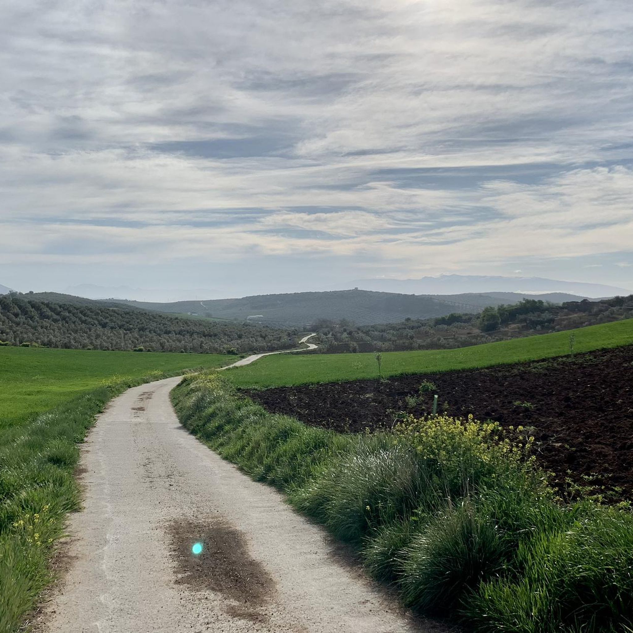
Road cycling routes around Zagra are situated within Andalusia, Spain, offering diverse and often challenging landscapes. The region is characterized by mountainous terrain from the Bética mountain range, rolling olive groves, and varied gradients suitable for road cyclists. Its proximity to the Sierras Subbéticas Natural Park provides routes through limestone formations and river valleys. This area presents a mix of challenging climbs and scenic rides through a tranquil rural setting.
Best road cycling routes around Zagra
- The most popular road cycling route is Mount Hacho Loop from Loja, a 28.8 miles (46.4 km) trail that takes 2 hours 14 minutes to complete. This moderate route features significant elevation changes and scenic views of the surrounding countryside.
- Another top favourite among local road cyclists is Almedinilla and Montefrío Loop, a difficult 42.2 miles (67.9 km) path. This route traverses varied terrain, including rolling hills and olive groves, with substantial elevation gain.
- Local road cyclists also love the Montefrío – View of Olive Groves loop from Loja, a 85.7 miles (137.9 km) trail leading through extensive olive groves and varied gradients, often completed in about 7 hours 11 minutes.
- Road cycling around Zagra is defined by mountainous terrain, rolling olive groves, and limestone formations. The network offers options for moderate to difficult ability levels, with routes featuring significant elevation changes.
- The routes in Zagra are highly rated by the komoot community with an average score of 4.5 stars from over 6 reviews. More than 500 road cyclists have used komoot to explore Zagra's varied terrain.
Last updated: July 13, 2026
3.0
(1)
5
riders
46.4km
02:14
480m
480m
Moderate road ride. Good fitness required. Mostly well-paved surfaces and easy to ride.
5
riders
67.9km
03:42
1,360m
1,360m
Hard road ride. Very good fitness required. Mostly well-paved surfaces and easy to ride.

Sign up for free
68
riders
137km
07:11
2,400m
2,400m
Hard road ride. Very good fitness required. Some segments of this route may be unpaved and difficult to ride.
5.0
(3)
46
riders
44.5km
01:59
310m
310m
Moderate road ride. Good fitness required. Some segments of this route may be unpaved and difficult to ride.
5.0
(3)
33
riders
74.7km
03:45
1,220m
1,220m
Hard road ride. Very good fitness required. Mostly well-paved surfaces and easy to ride.
Get access to more routes and recommendations from other explorers.
Sign up for free
Already have an account?
Our route recommendations are based on thousands of hikes, rides, and runs completed by other people on komoot.
Start today with a free account
Your next adventure awaits.
Login or Signup


Tips from the Community


Probably the most beautiful view of Montefrio. It is probably not for nothing that National Geographic magazine chose this view as one of the 10 most beautiful views in the world in 2016. A corresponding notice cannot be missed at the viewing point.
1
0

I went through the town which was cobblestone. Go around my route if you are not up for that.
0
0

Located on the outskirts of town, the viewpoint offers a great view of Montefrío and its well-known rocky mountain where the impregnable castle from the Nasrid period stands.
2
1

The Huétor tower was a tower in the walled fortified system of the Huétor farmhouse. This corresponds to the current town of Huétor-Tájar, located on the left bank of the Genil River, in the center of western Granada.
0
0
Passage of the Río Cacín between the towns of Villanueva Mesía and Huétor Tájar, where its passage has left a riparian space with tree plantations. Nearby is the Molino de Tajadilla.
0
1
Beautiful town where its castle, the Castillo de Montefrío is located at the top, on top of a rock. The rest of the population is located at its feet, white in color and where the Iglesia de la Encarnacion stands out with an immense unusual dome.
0
0
Declared an Asset of Cultural Interest, it dates from the 1st to the 7th centuries AD. and has one of the most complete surfaces in the Iberian Peninsula. Highlights its walls and the richness of its architectural elements such as mosaics, pavements, paintings...
0
0
Frequently Asked Questions
How many road cycling routes are available around Zagra?
The Zagra area offers a diverse network of over 35 road cycling routes. These routes cater to various skill levels, with options ranging from moderate to difficult, providing ample opportunities to explore the region's unique landscapes.
What kind of terrain can I expect on road cycling routes near Zagra?
Road cycling around Zagra is characterized by mountainous terrain from the Bética mountain range, rolling olive groves, and varied gradients. You'll encounter challenging climbs and descents, especially within the Sierras Subbéticas Natural Park, which features spectacular limestone formations and river valleys. The region offers a mix of demanding ascents and scenic rides through a tranquil rural setting.
Are there any easy or beginner-friendly road cycling routes in the Zagra area?
While many road cycling routes around Zagra are rated moderate to difficult, offering significant elevation changes, the broader region provides less strenuous options. For a more relaxed experience, the Mount Hacho Loop from Loja is a moderate route. Additionally, the Via Verde del Aceite (Greenway of the Olive Oil), a converted disused railway line, offers a flatter, less strenuous option suitable for various cyclists, though it's not a traditional road cycling route.
What are some notable natural features or landmarks I can see while cycling around Zagra?
The region around Zagra is rich in natural beauty and interesting landmarks. You can cycle past the dramatic limestone formations of the Sierras Subbéticas Natural Park and enjoy views of the Iznájar Reservoir. Specific highlights include the Infiernos of Loja and the Genil River, and the nearby Cave of the Infernos of Loja. You might also encounter historical sites like the Old Mill Ruins and Creek Path in Riofrío.
What is the best time of year for road cycling in Zagra?
Zagra and its surrounding areas benefit from over 300 days of sunshine annually, making it suitable for cycling throughout much of the year. The best time for road cycling is typically from late autumn to early spring, when temperatures are milder and more comfortable for longer rides, avoiding the intense heat of the summer months.
Are there options for circular road cycling routes?
Yes, many of the road cycling routes around Zagra are designed as loops, allowing you to start and end in the same location. Examples include the Almedinilla and Montefrío Loop and the Montefrío – View of Olive Groves loop from Loja, providing convenient options for exploring the region without retracing your path.
Where can I find parking for road cycling routes in Zagra?
While specific parking areas for each route are not detailed, Zagra is a smaller village, and you can typically find parking in or near the town center. For routes starting from larger towns like Loja or Algarinejo, designated parking areas are usually available. It's advisable to check local parking regulations upon arrival.
What do other cyclists say about road cycling in Zagra?
The road cycling routes in Zagra are highly rated by the komoot community, with an average score of 4.5 stars from over 6 reviews. Cyclists often praise the varied terrain, the challenge of the climbs, and the stunning scenic views of the surrounding countryside and olive groves. Over 500 road cyclists have used komoot to explore this region, highlighting its appeal.
Can I find places to eat or stay along the cycling routes?
While Zagra itself is a smaller village, the region is known for its authentic rural Andalusian charm. Cyclists can find quiet country lanes winding through fields of olive trees and past traditional whitewashed villages. These picturesque towns often feature local terrace bars, providing opportunities for tapas and coffee stops during your rides. Larger towns like Loja or Montefrío offer more extensive options for accommodation and dining.
What are some of the more challenging road cycling routes in the region?
For experienced road cyclists seeking a challenge, Zagra offers several difficult routes with substantial elevation gains. The Montefrío – View of Olive Groves loop from Loja is a demanding 85.7-mile (137.9 km) trail with over 2,400 meters of elevation gain. Another difficult option is the View of Olive Groves – Mirador de Sylvania loop from Algarinejo, covering nearly 79 km with significant climbing.
How long do road cycling routes around Zagra typically take to complete?
The duration of road cycling routes around Zagra varies significantly based on distance, elevation, and your cycling pace. For example, a moderate route like the Mount Hacho Loop from Loja (46.4 km) typically takes around 2 hours and 14 minutes. Longer, more difficult routes, such as the Montefrío – View of Olive Groves loop from Loja (137.9 km), can take approximately 7 hours and 11 minutes.
Are there any specific viewpoints or scenic spots recommended for road cyclists?
Absolutely. The region is dotted with numerous scenic spots, particularly due to its mountainous terrain and extensive olive groves. Routes often pass through areas with panoramic views of the Bética mountain range and the Sierras Subbéticas Natural Park. The name of the route View of Olive Groves – Mirador de Sylvania loop from Algarinejo itself suggests a notable viewpoint. Keep an eye out for traditional whitewashed villages perched on hillsides, offering picturesque vistas.
Most popular attractions around Zagra

Get inspired with the komoot mobile app


Explore more
Browse the best Road cycling routes in other regions.
