The best cycling routes around Bujalance
3.4
(35)
362
riders
67
rides
Touring cycling routes around Bujalance traverse the Campiña region of Córdoba, characterized by fertile agricultural land, extensive olive groves, and herbaceous crops. The terrain is generally gentle, offering accessible cycling conditions. The area includes the Arroyo de la Zarzuela, a natural island preserving Mediterranean and gallery forest, providing a unique ecological habitat. An extensive network of vías pecuarias and ancient Roman roads forms the basis for many cycling paths.
Best touring cycling routes around Bujalance
- The most popular touring cycling…
Last updated: August 23, 2026
44
riders
98.0km
08:21
1,600m
1,600m
Hard bike ride. Very good fitness required. You may need to push your bike for some segments of this route.
2.5
(2)
9
riders
44.0km
03:13
500m
500m
Hard bike ride. Very good fitness required. Mostly paved surfaces. Suitable for all skill levels.

Sign up for free
5
riders
41.1km
03:27
590m
590m
Hard bike ride. Very good fitness required. Mostly paved surfaces. Suitable for all skill levels.
4
riders
28.9km
02:24
360m
360m
Moderate bike ride. Good fitness required. Mostly paved surfaces. Suitable for all skill levels.
4
riders
49.1km
04:01
610m
610m
Hard bike ride. Very good fitness required. Mostly paved surfaces. Suitable for all skill levels.
Get access to more routes and recommendations from other explorers.
Sign up for free
Already have an account?
Our route recommendations are based on thousands of hikes, rides, and runs completed by other people on komoot.
Start today with a free account
Your next adventure awaits.
Login or Signup

Tips from the Community

A metal bridge crosses the Guadalquivir River on the outskirts of Villafranca de Córdoba. Built in the late 19th century, it is notable for its riveted iron structure, typical of the engineering of that era.
0
0

The first stop on the old road to the Sanctuary of the Virgin of the Head is where pilgrims rest and have a light lunch before continuing their journey. Here you'll find several watering troughs so the horses can quench their thirst during the approximately 20-kilometer trek from the city of Andújar. A small chapel has also been built where pilgrims can pray to the Virgin.
6
0
The hermitage of San Ginés is an important milestone for pilgrim walkers who make the journey from Andújar to the Sanctuary of the Virgen de la Cabeza, along what is known as the old road or bridle path. San Ginés is the place where there is a kind of hill that leaves Andújar behind in the view, to soon resume the views of the Jándula river valley. Walkers usually stop there to rest and regain strength. The hermitage and its surroundings were also rehabilitated a few years ago.
10
0
It is a hermitage of the same name and a resting place for pilgrims on the way up to the Sanctuary of the Virgin of the Head. From here a descent begins until the passage through the Jándula River.
13
0

Municipality located to the east of the province, from the foothills of Sierra Morena to the Guadalquivir, in a landscape of fertile lands of olive trees, meadows and herbaceous crops. On the banks of the river there are some thickets that are of great natural interest as they serve as a refuge for numerous aquatic birds. The town, presided over by the Garci-Méndez Tower - the rest of the old fortress - sits on a hill from which a wide panorama can be seen. Its urban configuration is reminiscent of fortress towns, built around a castle. Currently, the center of the town is occupied by the Plaza de la Constitución where the Parish of the Assumption is located.
0
0
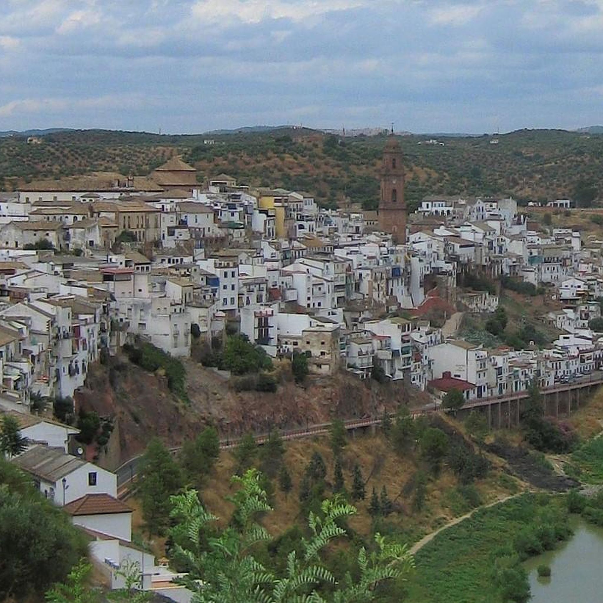
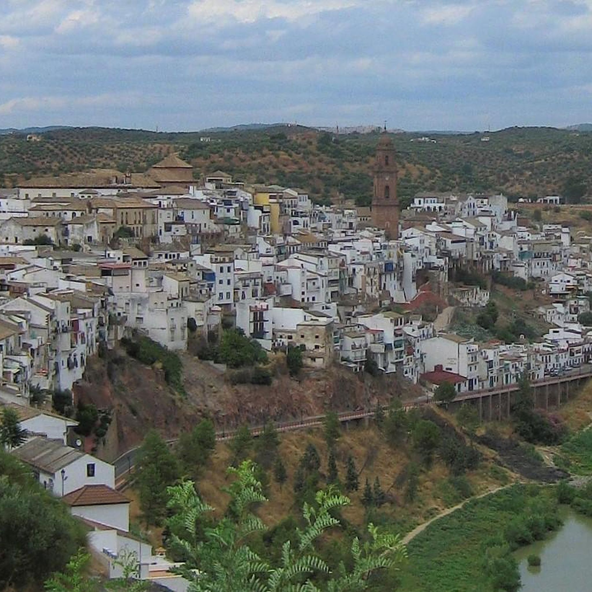
Municipality located to the east of the province of Córdoba, on the border with Jaén. Most of it is located in the foothills of Sierra Morena, making the Guadalquivir River the border with the countryside. Therefore, the mountains, the river and the countryside are the three elements that determine the landscape. The first is part of the Sierra de Cardeña y Montoro Natural Park, and in it we can find vegetation of holm oaks, wild olive trees, stone and maritime pines and a population of melojo oak, rare in Andalusia. It is also an area of great fauna, hunting and livestock value. The second, which surrounds the town, is the axis of the landscape, life and history of the town; Due to the beauty of the meander, it is also known as the Andalusian Toledo. The third, populated by olive trees, places us in a truly Cordoba environment. The town, with an Iberian, Greek, Roman, and Muslim past, is located on a small elevation that dominates the course of the river that divides it into two neighborhoods, offering an unmistakable image. Declared a Historic-Artistic Site in 1969, it brings together a multitude of attractions and tourist attractions to visit, such as the bridge over the river, the Church of San Bartolomé, the Casa de las Tercias, its steep streets of white houses, or the Torre de Villaverde. Its Holy Week, declared of Tourist Interest, reaches its greatest splendor on the afternoon of Holy Thursday with the presence of the Roman Empire. It is one of the towns included in the Baético Romana Route.
0
0
The Puente de las Donadas or Puente de las Doncellas, is located over the Guadalquivir River and connects the Retamar neighborhood with the rest of the town. Also known as Puente Mayor, it is located in the town of Montoro, Córdoba, and belongs to the Commonwealth of Alto Guadalquivir.
0
0
The Three Eyes Bridge or Iron Bridge is a bridge built by the French engineer Gustave Eiffel. It is located near Villa del Río in the province of Córdoba, Spain, on the A-3101 on the Guadalquivir River.
0
0
Frequently Asked Questions
How many touring cycling routes are available around Bujalance?
There are over 50 touring cycling routes around Bujalance, offering a wide range of options for exploring the region. These routes vary in difficulty, from easy to difficult, ensuring there's something for every cyclist.
What kind of terrain can I expect on touring cycling routes around Bujalance?
The terrain around Bujalance is primarily characterized by the Campiña, a fertile agricultural area dominated by extensive olive groves and herbaceous crops. You'll find a relatively gentle landscape, with many routes following ancient vías pecuarias and even old Roman roads. Some areas, like the Navallana Reservoir – Puente Mocho loop from El Carpio, feature more varied terrain.
What are the difficulty levels of touring cycling routes in Bujalance?
The touring cycling routes in Bujalance cater to various skill levels. You'll find 1 easy route, 24 moderate routes, and 32 difficult routes. This variety ensures that both casual riders and experienced touring cyclists can find suitable challenges.
Are there touring cycling routes suitable for families in Bujalance?
Yes, there is at least one easy touring cycling route available, which is generally more suitable for families or those seeking a relaxed ride. The gentle terrain of the Campiña region also means many moderate routes can be enjoyed by families with some cycling experience.
What natural attractions can I see while touring cycling around Bujalance?
While cycling, you can explore the unique ecological habitat of the Arroyo de la Zarzuela, a natural island preserving Mediterranean and gallery forest amidst the olive groves. The area is also home to one of Andalusia's most significant colonies of great bustards, an endangered species, making it interesting for birdwatching. Elevated points often provide beautiful panoramic views of the rural environs.
Are there historical landmarks or points of interest along the touring cycling routes?
Absolutely. Many routes follow historical pathways, including ancient Roman roads. You can visit the Ermita de Nuestro Padre Jesús, a chapel from 1580 that also offers stunning views, or the 10th-century Muslim fortress, Castillo de Bujalance. Other points of interest include the Fountain in Montoro and the historic town of Montoro itself.
Where can I find scenic viewpoints on touring cycling routes near Bujalance?
Several routes lead to elevated points offering picturesque vistas. For example, the Peñón del Águila – Sierra Morena Viewpoint loop from Morente is specifically designed to take you through areas with panoramic views. The location of the Ermita de Nuestro Padre Jesús also provides beautiful outlooks over the surrounding countryside.
What do other touring cyclists enjoy the most about cycling in Bujalance?
The touring cycling routes in Bujalance are highly rated by the komoot community, with an average score of 3.3 stars from over 20 reviews. Cyclists often praise the extensive network of historical paths, the serene olive groves, and the unique ecological pockets of the Campiña region, which offer a diverse and engaging experience.
Are there any circular touring cycling routes in Bujalance?
Yes, many of the touring cycling routes around Bujalance are designed as loops, allowing you to start and end your journey in the same location. Examples include the Marmolejo Spa – San Ginés Hermitage loop from Villa del Rio and the Peñón del Águila – Bell Tower of Adamuz loop from El Carpio.
What is the best time of year to go touring cycling in Bujalance?
The best time to go touring cycling in Bujalance is typically during the spring (March to May) and autumn (September to November) months. During these periods, the weather is generally milder and more pleasant, avoiding the intense heat of summer and the cooler, potentially wetter conditions of winter. This allows for comfortable exploration of the olive groves and historical paths.
Is parking available for cyclists near the touring cycling routes in Bujalance?
While specific dedicated cycling parking facilities are not detailed, Bujalance and surrounding towns like Villa del Río or El Carpio typically offer public parking options. It's advisable to check local parking availability in the starting towns of your chosen routes.
Are there any specific routes that pass by reservoirs or water features?
Yes, the Navallana Reservoir – Puente Mocho loop from El Carpio is a notable route that features varied terrain around the Navallana Reservoir. Additionally, the El Arenoso Reservoir is another significant water feature in the vicinity that may be accessible or visible from certain routes.
Most popular routes around Bujalance
Most popular attractions around Bujalance

Get inspired with the komoot mobile app


Explore more
Browse the best Cycling routes in other regions.
