The best walks and hikes around Brahmenau
4.6
(2994)
11,398
hikers
22
hikes
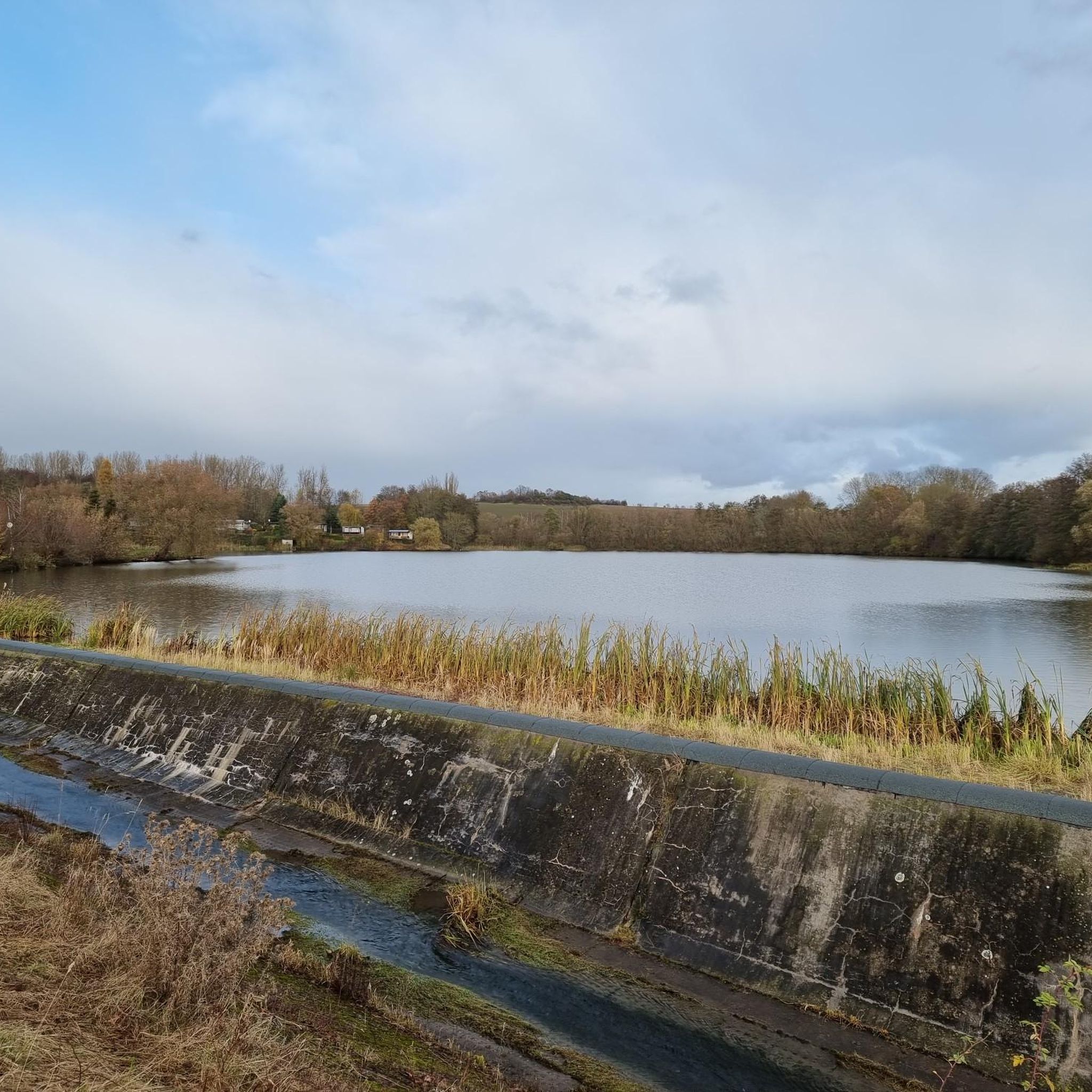
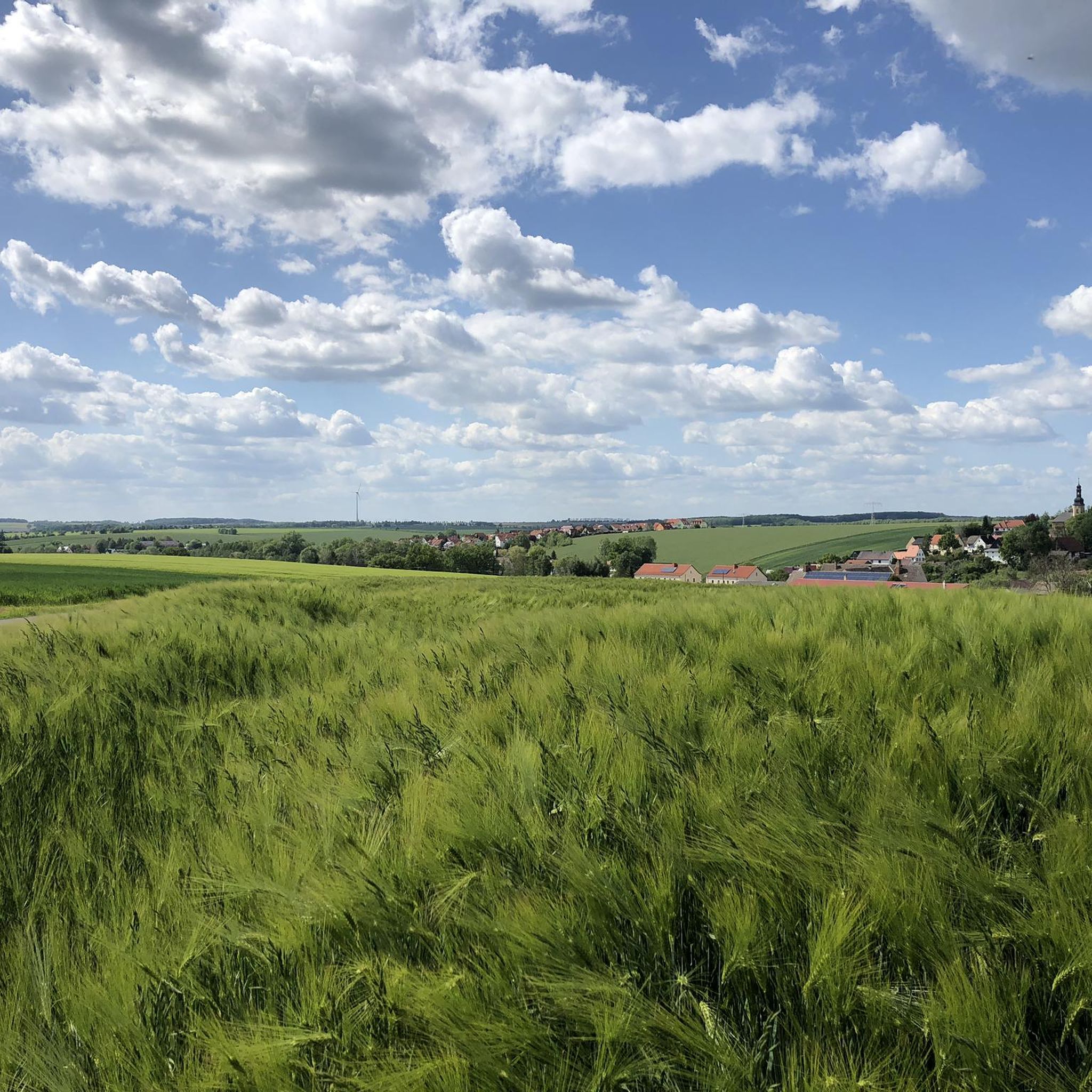
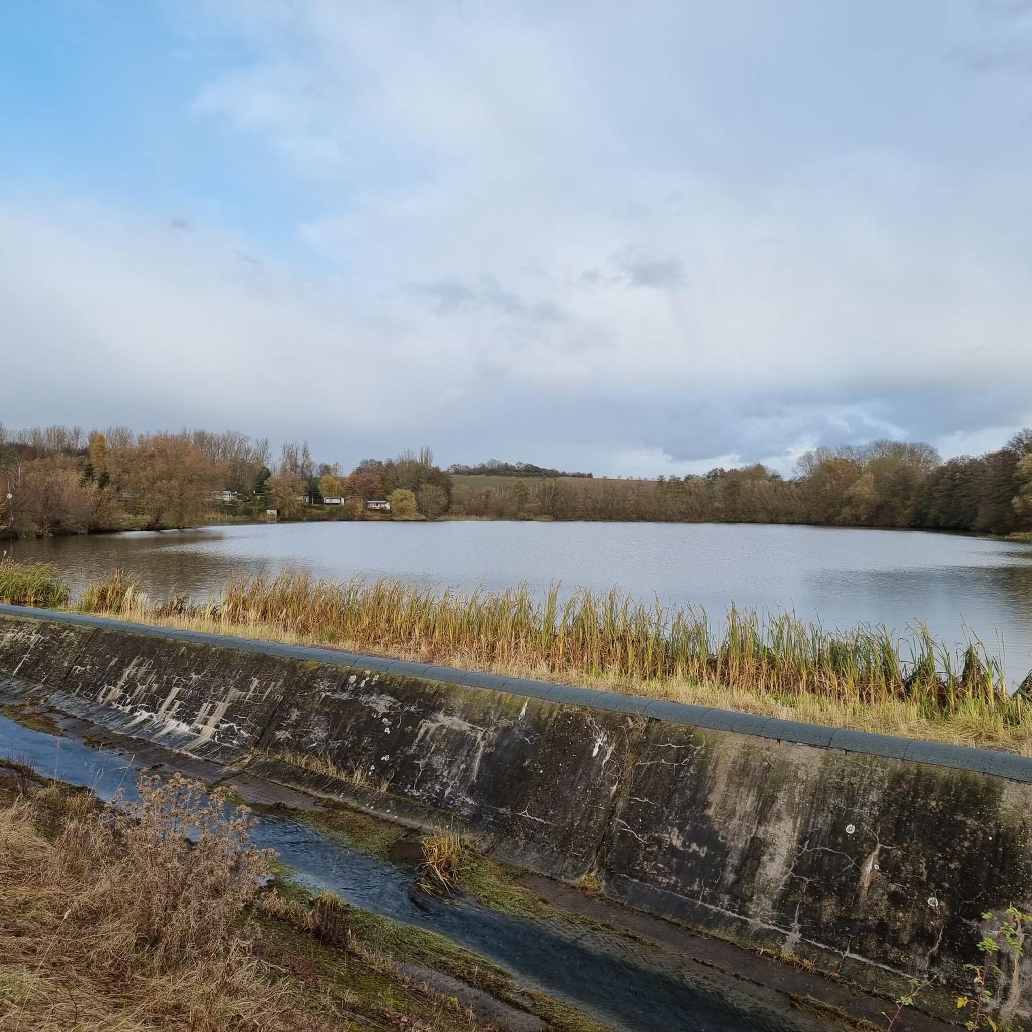
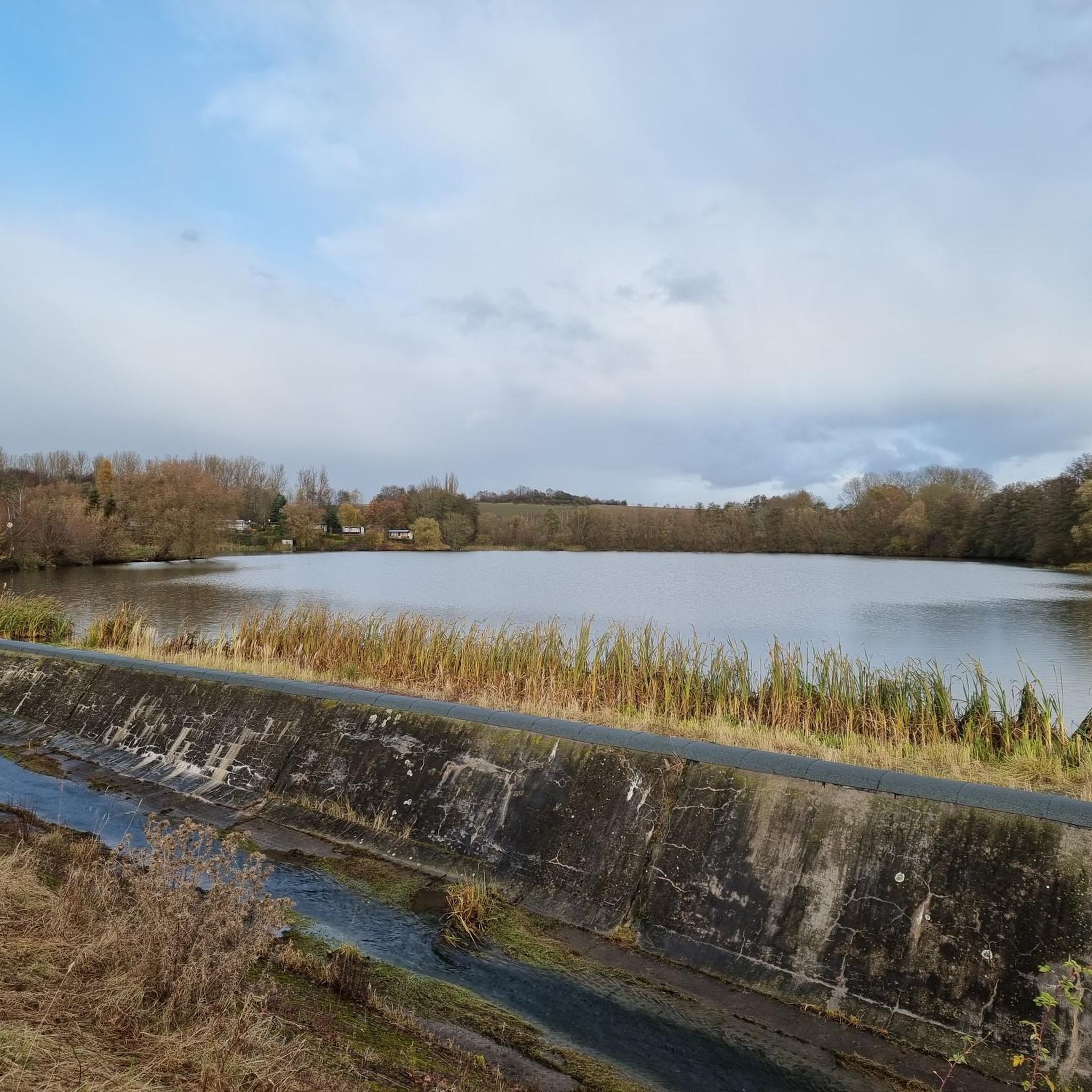
Hiking around Brahmenau offers varied terrain within the German federal state of Thuringia, bordering the Vogtland region. The landscape features rolling hills, dense forests, and several water bodies, including the Brahmenau Reservoir. The Brahmetal, where the Brahme river flows, provides near-natural river sections and remnants of floodplain forest. This area presents a network of trails suitable for different preferences and skill levels.
Best hiking trails around Brahmenau
- The most popular hiking route is Shady High Trail – Schwaara Village Church loop from Brahmenau, a 4.7 miles (7.6 km) trail that takes 2 hours to complete. This path offers views through forested areas.
- Another top favourite among local hikers is Brahme Stream – Millstones at Fuchsmühle loop from Brahmenau, a moderate 6.2 miles (10.0 km) path. This route leads through varied terrain alongside the Brahme Stream.
- Local hikers also love the Asparagus Field loop from Brahmenau, a 2.6 miles (4.2 km) trail leading through local scenery, often completed in about 1 hour 8 minutes.
- Hiking around Brahmenau is defined by rolling hills, dense forests, and reservoirs. The network offers options for different ability levels, from easy loops to more strenuous routes.
- The routes in Brahmenau are highly rated by the komoot community with an average score of 4.6 stars from over 2,800 reviews. More than 11,000 hikers have used komoot to explore Brahmenau's varied terrain.
Last updated: June 25, 2026
4.2
(9)
27
hikers
Easy hike. Great for any fitness level. Easily-accessible paths. Suitable for all skill levels.
4.6
(8)
36
hikers
7.59km
02:00
70m
70m
Moderate hike. Good fitness required. Easily-accessible paths. Suitable for all skill levels.

Sign up for free
4.5
(10)
21
hikers
10.1km
02:41
110m
110m
Moderate hike. Good fitness required. Easily-accessible paths. Suitable for all skill levels.
5.0
(2)
14
hikers
4.15km
01:08
60m
60m
Easy hike. Great for any fitness level. Easily-accessible paths. Suitable for all skill levels.
5.0
(3)
10
hikers
Moderate hike. Good fitness required. Easily-accessible paths. Suitable for all skill levels.
Get access to more routes and recommendations from other explorers.
Sign up for free
Already have an account?
Our route recommendations are based on thousands of hikes, rides, and runs completed by other people on komoot.
Start today with a free account
Your next adventure awaits.
Login or Signup

Tips from the Community

Open-air cellar The abandoned open-air cellar with its storage rooms and ventilation shafts is located on a slope that was expanded at the beginning of the last century with side walls and a vaulted ceiling. The vault was then covered with earth again. Open-air cellars and earth cellars were the preferred means of storing perishable goods until the invention of modern refrigerators. In the Sömmnitz cellar, beer was stored layered on ice. Hence the common name "ice cellar". Later, at the beginning of the nineties, electricity was even installed and the cellar was used for parties.
0
0

Nice quiet place to take a break, rest and linger.
1
0

Always happy 😉
0
0
The Brahmetal is located in the very north-east of the district and stretches between the municipality of Brahmenau and the city of Gera, where the Brahme flows into the White Elster. The Brahme is characterized by near-natural river sections with remnants of floodplain forest rich in old and dead wood.
0
0
A nice place to take a break 🤗
0
0
Beautiful wide forest path. Ideal for hiking or biking.
0
0
Beautiful idyllic place 😎
1
0
Millstones at the Fuchsmühle.
5
0
Frequently Asked Questions
How many hiking trails are available around Brahmenau?
Brahmenau offers a diverse network of over 20 hiking trails. These routes cater to various preferences, with 12 easy trails and 10 moderate trails, ensuring options for different fitness levels.
What kind of terrain can I expect on hikes in Brahmenau?
The region around Brahmenau is characterized by a varied topography of rolling hills and dense forests. You'll find both gentle slopes suitable for leisurely walks and more challenging ascents on longer routes, providing a diverse hiking experience.
Are there any easy, family-friendly hiking options in Brahmenau?
Yes, Brahmenau is well-suited for families and those seeking easier walks. Trails like the Asparagus Field loop from Brahmenau are designed to be accessible and enjoyable for all ages. The area also features easy loops around the Brahmenau Reservoir.
Are there any circular hiking routes in Brahmenau?
Many of the trails in Brahmenau are circular, offering convenient starting and ending points. A popular option is the Rest area at the Brahmenau reservoir – Brahmenau Reservoir loop from Brahmenau, which circles the scenic reservoir.
What natural features or landmarks can I see while hiking in Brahmenau?
Hikers in Brahmenau can enjoy several natural attractions. The Brahmenau Reservoir is a central feature, with paths around its perimeter. The region is also rich in forests and offers views of rolling hills. Nearby, you can explore various ponds and lakes, such as the Village Pond of Korbußen or the Large park pond.
What is the best time of year to go hiking in Brahmenau?
Spring and autumn are particularly recommended seasons for hiking in Brahmenau. During these times, the weather is generally pleasant, and the natural landscape, with its forests and rolling hills, offers beautiful scenery.
What do other hikers say about the trails in Brahmenau?
The hiking trails in Brahmenau are highly regarded by the komoot community, with an average rating of 4.6 stars from over 2,800 reviews. Hikers often praise the varied terrain, the scenic beauty of the forests and reservoirs, and the well-maintained paths.
Are there any longer or more challenging hikes available?
For those seeking a more strenuous experience, Brahmenau offers several moderate routes. The Brahme Stream – Millstones at Fuchsmühle loop from Brahmenau is a 10 km trail that leads through varied terrain and takes approximately 2 hours 39 minutes to complete, requiring good fitness.
Can I find trails that go through forested areas?
Yes, dense forests are a defining characteristic of the Brahmenau region. Many trails, such as the Shady High Trail – Schwaara Village Church loop from Brahmenau, offer views and paths winding through wooded areas, providing shade and a tranquil atmosphere.
Are there any trails near water bodies other than the Brahmenau Reservoir?
Beyond the Brahmenau Reservoir, the broader region features the White Elster river, enhancing the natural beauty. You can also find trails near various local ponds and lakes, such as the Nöbdenitz Tea House by the Pond, offering additional water-side hiking opportunities.
What is the typical duration for hikes in Brahmenau?
Hiking durations in Brahmenau vary depending on the trail. Easy loops like the Brahmenau Reservoir loop can be completed in about 1 hour 33 minutes, while moderate routes such as the Schwaara Village Pond – Schwaara Village Church loop might take around 2 hours 10 minutes.
Most popular routes around Brahmenau
Most popular attractions around Brahmenau

Get inspired with the komoot mobile app


Explore more
Browse the best Hikes in other regions.
