The best walks and hikes around Tornadizos De Ávila
4.4
(94)
1,109
hikers
105
hikes
Hiking around Tornadizos De Ávila offers diverse natural landscapes within the province of Ávila, Spain. The region is characterized by its mountainous terrain, situated in the Valle Amblés and at the foothills of the Sierra de Villafranca and Sierra de Ávila. Trails often feature high-altitude conditions, with elevations over 1,185 meters above sea level, and include landmarks like Cerro de la Cabeza and the Navalperal de Pinares Reservoir.
Best hiking trails around Tornadizos De Ávila
- The most popular hiking route…
Last updated: October 11, 2026
3.5
(2)
7
hikers
9.35km
02:29
90m
90m
Hike the Cuatro Postes from Ávila circular route, a moderate 5.8-mile trail offering stunning views of the Muralla de Ávila.
5.0
(1)
4
hikers
Moderate hike. Good fitness required. Easily-accessible paths. Suitable for all skill levels.

4.5
(2)
6
hikers
7.06km
01:54
90m
90m
Hike an easy 4.4-mile (7.1 km) circular route around the Navalperal de Pinares Reservoir, enjoying forests and views of Sierra de Gredos.
5.0
(1)
8
hikers
Moderate hike. Good fitness required. Easily-accessible paths. Suitable for all skill levels.
1
hikers
Moderate hike. Good fitness required. Easily-accessible paths. Suitable for all skill levels.
Get access to more routes and recommendations from other explorers.
Already have an account?
Our route recommendations are based on thousands of hikes, rides, and runs completed by other people on komoot.
Start today with a free account
Your next adventure awaits.


Tips from the Community

The visit to the medieval city wall from the 11th-14th century is highly recommended with its 88 towers and 9 city gates - the entrance fee is justified, a large part of the city wall is accessible. Unfortunately, there were too few audio guides - we didn't have any. You have grandiose views of the Congress Hall, the Carmelite Convent of San José (place of activity of St. Teresa in the 16th century), the Cathedral, the Romanesque Church of San Vicente and into the nearby mountains.
0
0

The park extends between the bridge over the Chico River, the extension of Nuestra Señora de Sonsoles Street, and the Burgohondo road bridge, bordering Juan Pablo II Avenue. One of the most popular routes is the circular route from the Roman Bridge over the Adaja River, ideal for easy walks and enjoying the park's natural surroundings.
1
0
The Church of San Miguel Arcángel in Tornadizos de Ávila is a church of great historical and cultural significance. Built of ashlar and masonry, it is liturgical in nature. The Brotherhood of the Holy True Cross, an institution of great importance in local religious life, was founded in this parish more than four centuries ago.
1
0
The Basilica of San Vicente in Ávila is one of the finest examples of Romanesque architecture in Spain. Built between the 12th and 14th centuries, this basilica is dedicated to the martyrs Vicente, Sabina, and Cristeta. According to tradition, these brothers were martyred in 306 during the Diocletian persecution. The basilica is also known for its cenotaph, a funerary monument depicting the legend of the martyrs and the repentance of the Jew responsible for their deaths.
15
0
The Casasola Route in Navalperal de Pinares is one of the longest and most popular hiking trails in the area. With a length of approximately 23 kilometers and a cumulative ascent of 346 meters, this route offers a complete experience for hiking enthusiasts. The route begins at the Hermitage of San Antonio and passes through diverse landscapes, including oak forests, reforested pine forests, and mountain meadows.
1
0
The Navalperal de Pinares Reservoir is a beautiful place located in the province of Ávila, ideal for enjoying nature and outdoor activities. Built in 1980, this reservoir is located on the Maillo Stream. It is a perfect destination for relaxation and recreation, offering activities such as fishing, picnicking, and hiking. Furthermore, the surrounding natural environment offers peaceful and enchanting landscapes, ideal for unwinding and enjoying the serenity of the place.
1
0
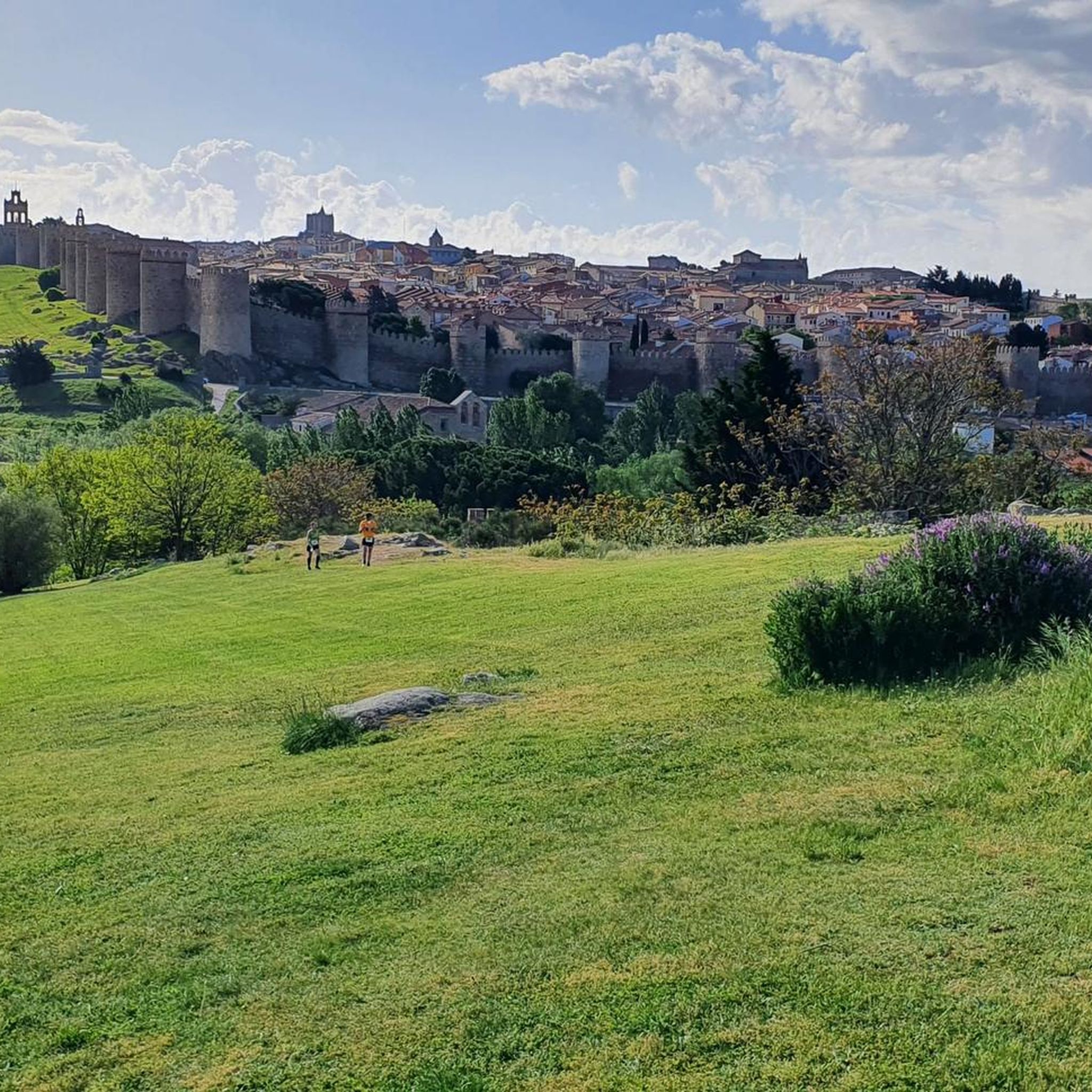
The Walls of Ávila are an impressive medieval fortification that surrounds the old town of Ávila, in Castile and León. These walls, built in the 11th century, are one of the best-preserved walled enclosures in Spain and were declared a UNESCO World Heritage Site in 1985.
11
0
This bridge was built to facilitate crossing the Adaja River and connect the Roman city of Ávila with the opposite bank. Although only the hidden abutments on the edges of the original Roman bridge remain, the bridge visible today dates back to the 12th century.
13
0
Frequently Asked Questions
What kind of terrain can I expect on hikes around Tornadizos De Ávila?
The region is characterized by its diverse mountainous terrain, situated in the Valle Amblés and at the foothills of the Sierra de Villafranca and Sierra de Ávila. You'll find trails with high-altitude conditions, often exceeding 1,185 meters above sea level, offering varied and sometimes challenging routes.
How many hiking trails are available in Tornadizos De Ávila?
There are nearly 100 hiking trails around Tornadizos De Ávila. This network includes a balanced mix of easy, moderate, and difficult routes, catering to various skill levels and preferences.
Are there any easy hiking trails suitable for beginners or relaxed walks?
Yes, nearly half of the trails in the area are rated as easy. An excellent option for a relaxed walk is the Navalperal de Pinares Reservoir Trail, an easy 7.1 km path that explores the peaceful natural environment around the reservoir.
What are some notable natural features or landmarks I can see while hiking?
Hikers can explore several significant natural features. The Cerro de la Cabeza summit offers panoramic views, while the Navalperal de Pinares Reservoir provides a beautiful setting for nature activities. You might also encounter the ancient Dolmen del Prado de Las Cruces.
Are there any circular hiking routes in the area?
Yes, Tornadizos De Ávila offers several circular routes. One example is the Paso del Río Chico y Adaja por Ávila — circular por el centro de la ciudad, a moderate 8.1 km loop. Another longer option is the Ermita de Sonsoles desde Ávila — Sendero circular de los ríos Chico y Adaja, which is a moderate 17.1 km trail.
What do other hikers say about the trails in Tornadizos De Ávila?
The trails in Tornadizos De Ávila are highly regarded by the komoot community, with an average rating of 4.4 stars from over 50 reviews. Hikers often praise the diverse natural landscapes, the peaceful environment, and the variety of routes available for different skill levels.
Can I combine hiking with cultural or historical sightseeing?
Absolutely. Tornadizos De Ávila is just 8 kilometers from the historic city of Ávila. Many routes offer views of or lead to the iconic Ávila City Walls. You can also explore highlights like the Ávila City Walls (North Section), the Old Roman bridge over the Adaja River, or the Basilica of San Vicente of Ávila.
Are there any trails that offer panoramic viewpoints?
Yes, the mountainous terrain provides several opportunities for stunning views. The Cerro de la Cabeza, for instance, is a prominent summit that offers extensive panoramic views of the surrounding landscape and valleys below, making it a rewarding destination for hikers.
What is the best time of year to go hiking in Tornadizos De Ávila?
While specific seasonal advice isn't provided, the region's mountainous terrain and high altitude suggest that spring and autumn would offer pleasant temperatures for hiking. Summers can be warm, and winters might bring colder conditions, especially at higher elevations.
Are there any trails that pass by water features?
Yes, the Navalperal de Pinares Reservoir Trail is an excellent option for those looking to hike near water. The reservoir is a beautiful spot for enjoying nature and offers peaceful landscapes.
What is the typical difficulty level of hikes in this region?
The hiking trails around Tornadizos De Ávila offer a balanced range of difficulties. There are 46 easy routes, 46 moderate routes, and 2 difficult routes, ensuring options for all experience levels, from leisurely strolls to more challenging mountain ascents.
Most popular routes around Tornadizos De Ávila
Most popular attractions around Tornadizos De Ávila

Get inspired with the komoot mobile app


Explore more
Browse the best Hikes in other regions.
