The best walks and hikes around Sallent
4.5
(315)
2,411
hikers
20
hikes
Hiking trails around Sallent are situated in the Aragonese Pyrenees, characterized by diverse natural landscapes. The region features majestic Pyrenean peaks, including those exceeding 3,000 meters, and is traversed by the Gállego and Aguas Limpias rivers. High-mountain lakes, known as "ibones," and varied terrain from forests to alpine meadows contribute to the area's composition. This environment offers a range of elevations and ecosystems for outdoor activities.
Best hiking trails around Sallent
- The most popular hiking route is Sallent loop from…
Last updated: August 11, 2026
4.4
(7)
81
hikers
27.5km
07:13
220m
220m
Hard hike. Very good fitness required. Easily-accessible paths. Suitable for all skill levels.
4.5
(4)
29
hikers
22.6km
05:51
130m
130m
Hard hike. Very good fitness required. Easily-accessible paths. Suitable for all skill levels.

Sign up for free
5.0
(1)
10
hikers
13.9km
03:44
180m
180m
Moderate hike. Good fitness required. Easily-accessible paths. Suitable for all skill levels.
7
hikers
4.18km
01:14
110m
110m
Easy hike. Great for any fitness level. Easily-accessible paths. Suitable for all skill levels.
7
hikers
17.1km
04:32
170m
170m
Moderate hike. Good fitness required. Easily-accessible paths. Suitable for all skill levels.
Get access to more routes and recommendations from other explorers.
Sign up for free
Already have an account?
Our route recommendations are based on thousands of hikes, rides, and runs completed by other people on komoot.
Start today with a free account
Your next adventure awaits.
Login or Signup
Popular around Sallent



Tips from the Community

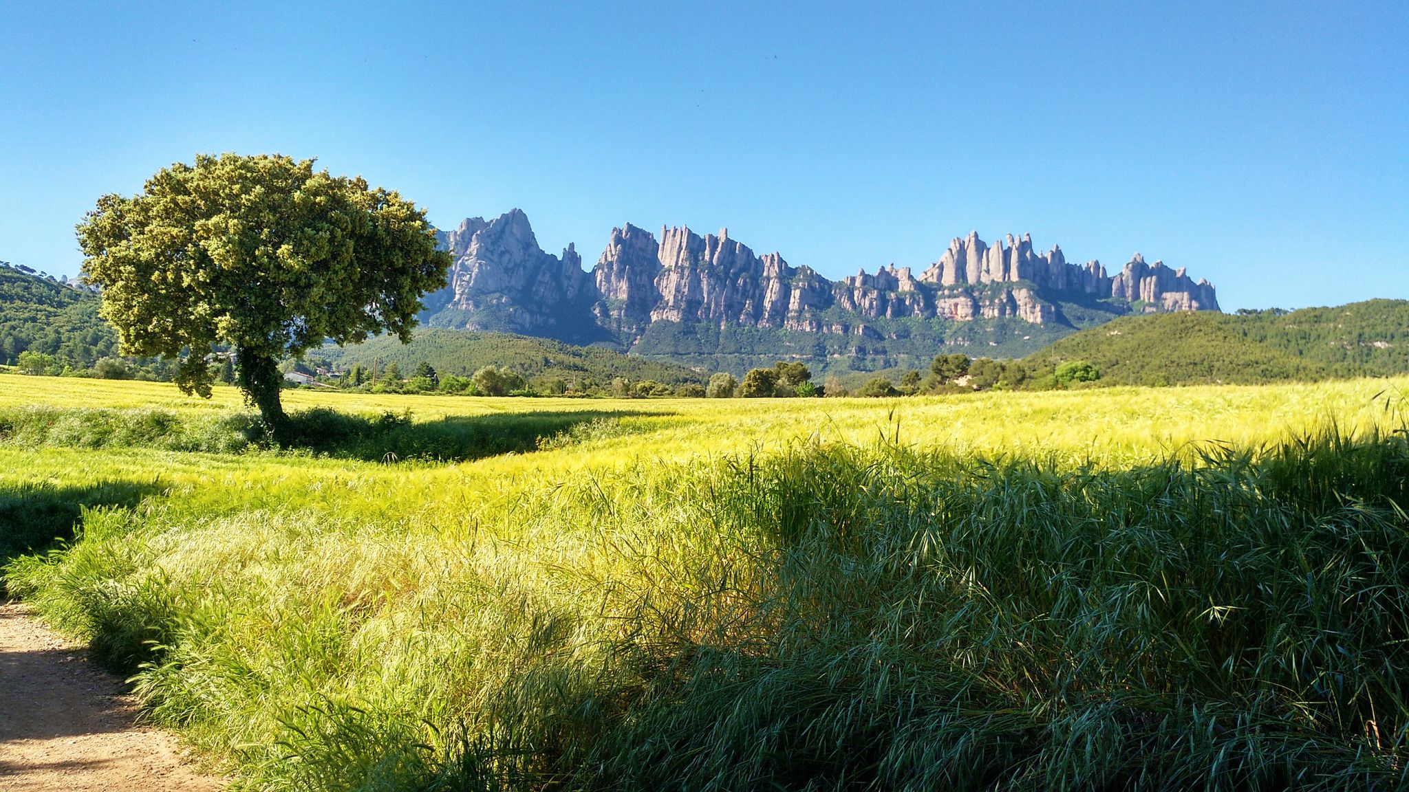
Recreation area with picnic area and spectacular views of Montserrat
1
0

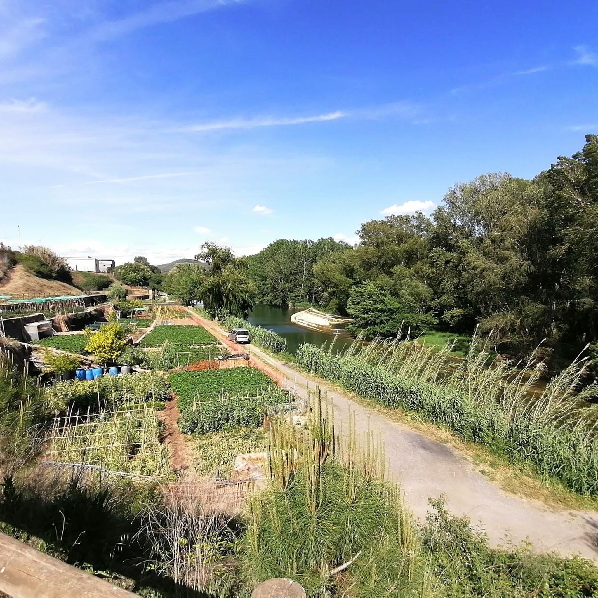
the Inici de la Sèqui, a space of great beauty, landscape and a space of tranquility
0
0
A good place to stop and make a vignette
0
0
The sections of the Sèquia combine beauty, nature and transport you to the medieval past of the Canal, especially the Section of Roure Gros and the sections of Mas de les Coves.
0
0

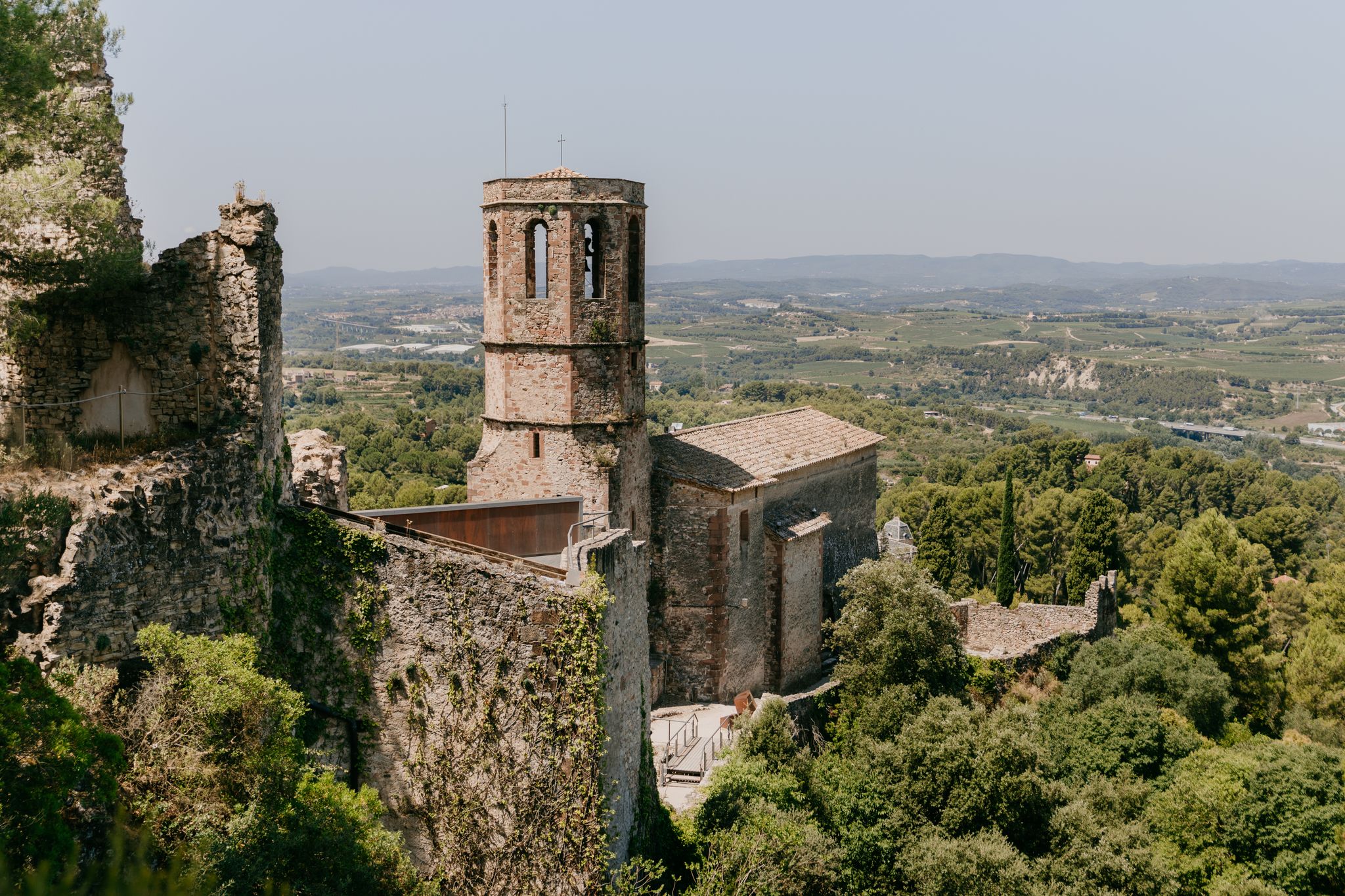
Sallent is a municipality in the Bages region. Located on the banks of the Llobregat River, the city has several factories and mining operations, typical of this Catalan industrial area on the edge of the river. The municipality has several Romanesque buildings and an interesting old town.
1
1

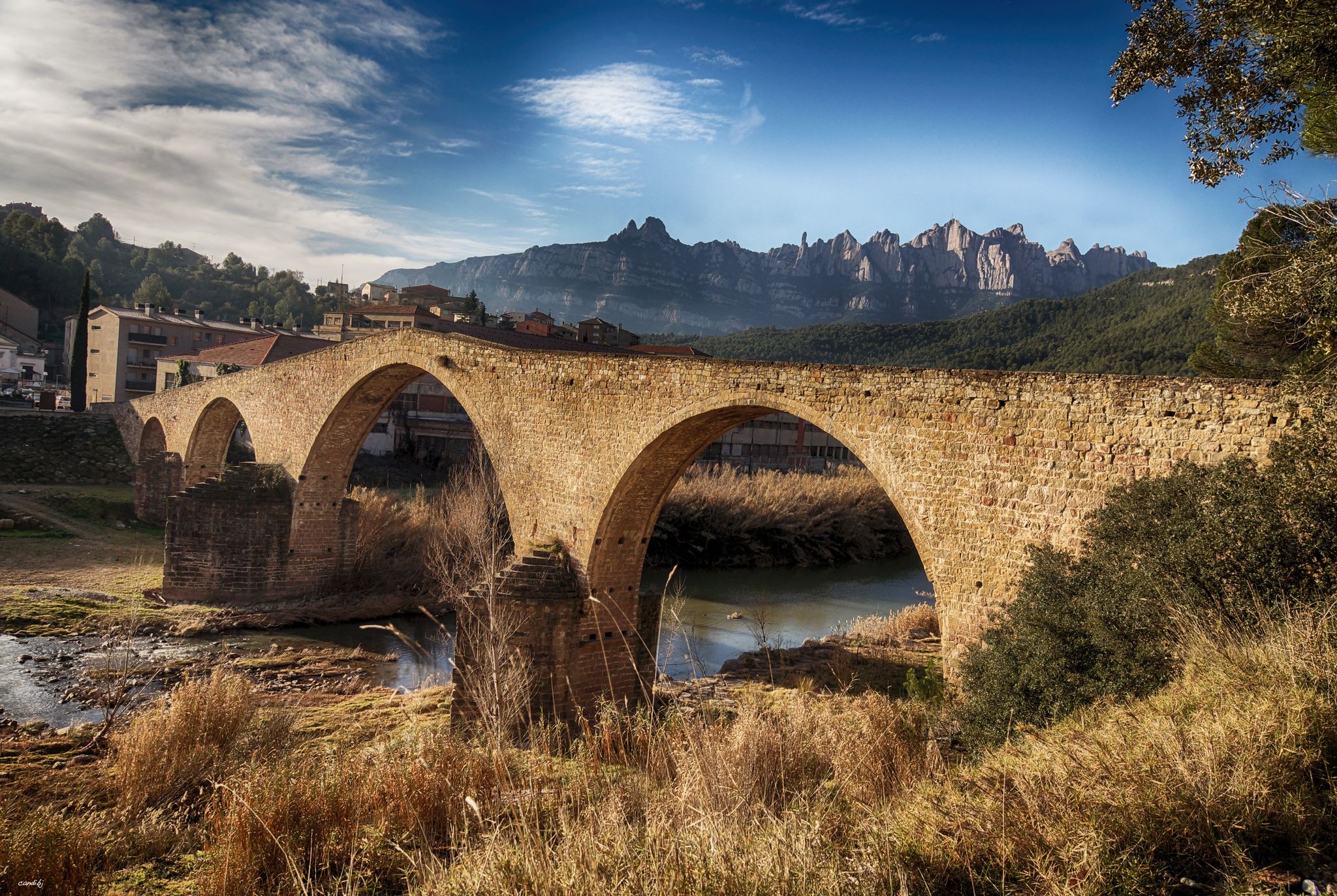
One of the largest aqueducts through which the Sèquia de Manresa runs. The Conangle aqueduct was built in 1340, it is 103 meters long, 3 meters high and consists of seven arches.
1
1
This 26-kilometre-long ditch that carries water to Manresa was built in the 14th century by the master Guillem Catà. Its construction was highly problematic, as the Bishop of Vic opposed its construction because it passed through the bishopric's land and threatened its promoters with excommunication. The bishop died before the works were finished and even so he really excommunicated the workers and the councilors of Manresa, in addition to interrupting the practice of the sacraments throughout the city. The bishop's successor maintained a more dialogue attitude, accepting the compensation offered by the city. However, legend has it that divine intervention became necessary, in the form of a mysterious light from Montserrat that entered through the stained glass windows of the Carmen church, at the same time that the bells began to ring by themselves. The bishop, seeing this phenomenon, regretted his position, but died shortly after, and his successor did not take long to reverse the situation and lift the excommunication.
1
1

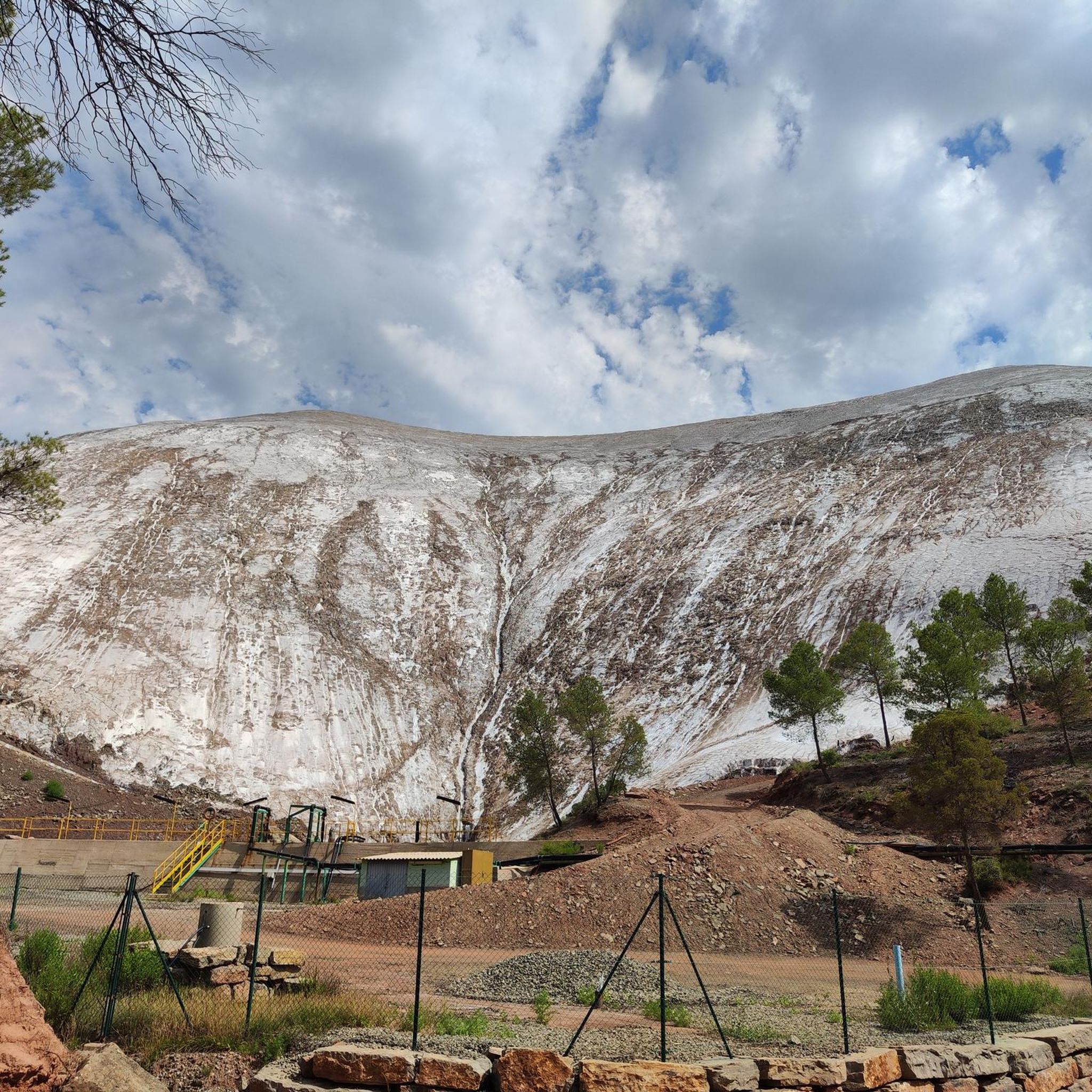
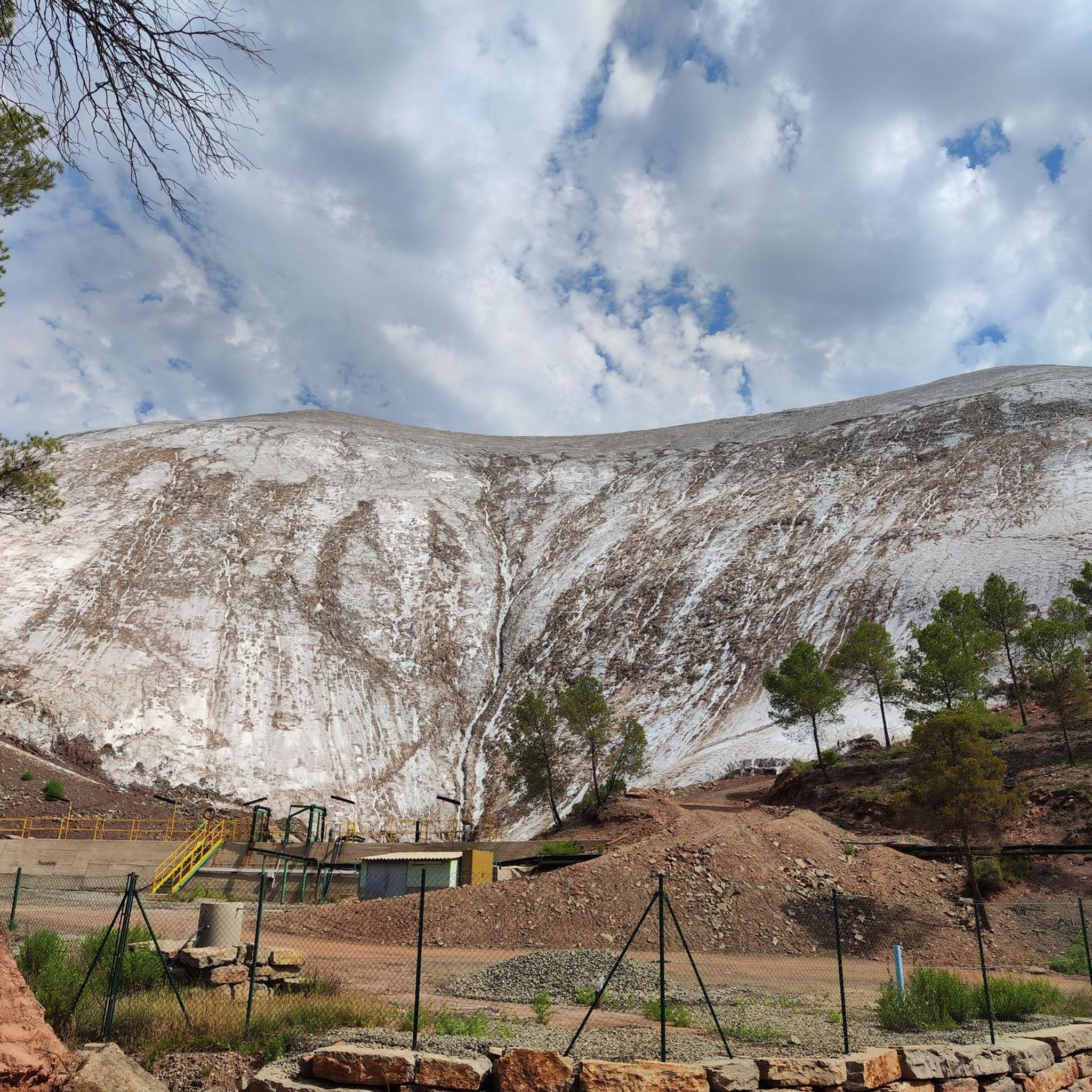
Mountain of saline and other waste created between 1945 and 1977. The La Botjosa salt dump measures 775 meters long by an average width of 150 meters, occupies 13.5 Ha and its content is estimated at around 4 million tons of salty waste. Since the start of the new Cogulló dump in 1977, the potash mining of Sallent and Balsareny stopped dumping saline waste in La Botjosa. Since then, a considerable portion of the saline residues dumped in the La Botjosa dump has disappeared by dissolution in rainwater and air humidity, as evidenced by the geomorphologies in lapiaz on the slopes and dame coiffée where an object acting as an umbrella has protected the salt below
2
0
Frequently Asked Questions
How many hiking trails are available in Sallent?
Sallent offers a diverse network of over 15 hiking trails, catering to various skill levels. You'll find everything from easy riverside paths to challenging alpine routes in the Aragonese Pyrenees.
Are there any easy hiking trails suitable for beginners or families in Sallent?
Yes, Sallent has several easy options. For a gentle introduction, consider the Sallent loop from Sallent, which is an easy 4.2 km walk. The Natural Path of Lanuza Reservoir also offers a relatively flat, circular route perfect for leisurely strolls. The Salto Sallent de Gállego circular trail is another easy 4.25 km option to explore the waterfall and river valley.
What kind of views can I expect on the hiking trails around Sallent?
Hikers in Sallent are treated to magnificent views of both French and Spanish Pyrenean peaks, including Foratata and Balaitous. The region features diverse landscapes, from high-mountain lakes (ibones) like the Anayet Lakes, which offer stunning views of the Pic du Midi d'Ossau, to river valleys, forests, and alpine meadows.
Are there any circular hiking routes in Sallent?
Yes, many trails in Sallent are circular. Popular options include the easy Sallent loop from Sallent, the moderate Hiking loop from Sallent, and the Conangle Aqueduct loop from Sallent. For a more challenging circular experience with panoramic views, consider the Pico El Pacino trail.
Can I find any waterfalls along the hiking trails in Sallent?
Absolutely. The region is known for its picturesque rivers and waterfalls. The Salto Sallent de Gállego is a notable waterfall that can be explored via an easy circular trail. Additionally, the Baga Cerdana Waterfall is another beautiful natural feature you might encounter.
What do other hikers say about the trails in Sallent?
The hiking trails in Sallent are highly regarded by the komoot community, boasting an average rating of 4.5 stars from over 280 reviews. Hikers frequently praise the diverse terrain, stunning Pyrenean views, and the variety of routes available for all skill levels.
Are there any challenging hikes for experienced hikers in Sallent?
Yes, Sallent offers challenging alpine routes for experienced hikers. The Pont Alvar Aalto – Parque de l'Agulla loop from Serrat dels Morts is a difficult 23 km route. Other demanding options include the Anayet Lakes and Peaks Trail, and the hike to Refugio and Embalse de Respomuso, which involves significant elevation gain and offers stunning high-mountain scenery.
What natural attractions or landmarks can I see while hiking in Sallent?
Beyond the majestic peaks and ibones, you can explore several natural attractions. Highlights include the dramatic Bigaire Gorge and Balç de la Creu. The Collbaix Summit offers panoramic views, and the Parque de l'Agulla provides a beautiful lakeside setting.
What is the best time of year for hiking in Sallent?
The best time for hiking in Sallent generally depends on the desired experience. Spring and autumn offer pleasant temperatures and vibrant landscapes, while summer is ideal for higher-altitude routes. Some trails may be accessible in winter, but require appropriate gear and experience due to snow and ice conditions.
Are there any mountain huts or refuges available for overnight stays on longer hikes?
Yes, for longer or multi-day excursions, mountain huts are available. The Refugio de Respomuso, for example, is a popular mountain hut situated at over 2,100 meters, offering a place to stay for hikers exploring the area around the Ibón de Respomuso.
Can I find trails that pass through varied ecosystems in Sallent?
Absolutely. Sallent's trails wind through diverse ecosystems. You'll experience forests of aspen and pine, expansive alpine meadows adorned with wildflowers, and picturesque river valleys along the Gállego and Aguas Limpias rivers, providing a rich and varied hiking experience.
Are there any trails that offer views of high-mountain lakes (ibones)?
Yes, the region is dotted with beautiful high-mountain lakes. The Anayet Lakes are particularly stunning, offering views of the Pic du Midi d'Ossau. The Ibón de Respomuso, though modified into a reservoir, is another prominent high-mountain water body accessible via hiking trails.
Most popular attractions around Sallent

Get inspired with the komoot mobile app


Explore more
Browse the best Hikes in other regions.
