The best walks and hikes around Guadalupe
4.4
(66)
295
hikers
25
hikes
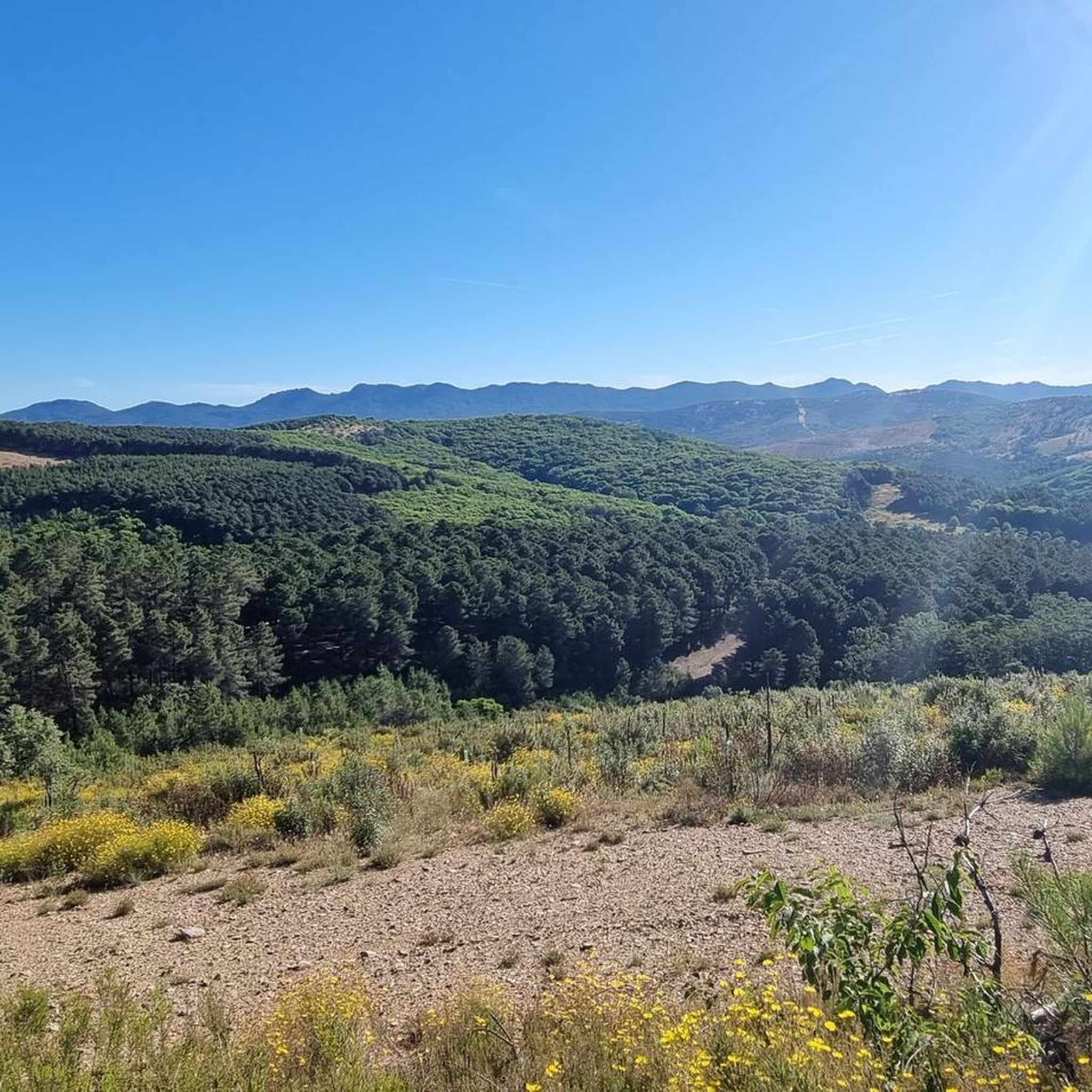
Hiking around Guadalupe offers a diverse landscape characterized by rolling hills, dense woodlands, and historical structures. The region features a network of trails that traverse areas around the Guadalupe Monastery and local viaducts. Hikers can explore paths alongside reservoirs and through varied terrain, providing opportunities for different activity levels. The area's topography includes gentle ascents and descents, making it accessible for various hiking experiences.
Best hiking trails around Guadalupe
- The most popular hiking route is Guadalupe Monastery and Viaduct Loop…
Last updated: August 17, 2026
4.8
(9)
29
hikers
5.47km
01:33
120m
130m
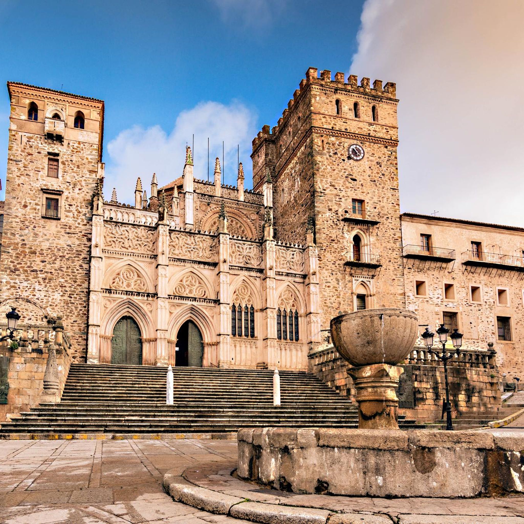
This easy 3.4-mile circular hike takes you past the Royal Monastery of Santa María de Guadalupe and the impressive Guadalupe Viaduct.
4.7
(6)
22
hikers
5.31km
01:33
150m
140m
Easy hike. Great for any fitness level. Easily-accessible paths. Suitable for all skill levels.

Sign up for free
4.8
(15)
54
hikers
8.37km
02:32
280m
280m
Moderate hike. Good fitness required. Easily-accessible paths. Suitable for all skill levels.
4.8
(13)
53
hikers
11.9km
03:22
260m
260m
Moderate hike. Good fitness required. Easily-accessible paths. Suitable for all skill levels.
3
hikers
14.2km
04:20
410m
410m
Moderate hike. Good fitness required. Mostly accessible paths. Sure-footedness required.
Get access to more routes and recommendations from other explorers.
Sign up for free
Already have an account?
Our route recommendations are based on thousands of hikes, rides, and runs completed by other people on komoot.
Start today with a free account
Your next adventure awaits.
Login or Signup
Tips from the Community

El Alto del Humilladero and Pico Villuercas, near Guadalupe (Cáceres), form one of the most spectacular mountain routes in Extremadura, within the Villuercas‑Ibores‑Jara UNESCO Geopark. It is the highest summit in Extremadura accessible by road.
2
0

In the multitude of Guadeloupe, there is little more information to be found than what is already here on the internet.
14
1
Ghadelupe is a small, cozy village where alleys and mountain houses with pristine facades coexist, resting on cobbled floors. The main square is the central heart of the village. Guadalupe is known for its monastery founded in 1340, a beautiful monastery in Mudejár architecture visited by pilgrims for centuries.
14
1
The floral decoration of the openings and the popular architecture of the adjacent houses give this gate one of the most unique images of the city. Continue further into Calle Sevilla to the fountain.
14
2
Gives the feeling of being on a film set or somewhere in Mexico. Perhaps not so strange, because the Virgin of Guadalupe is the patroness of Mexico. In the hills, the virgin is said to have been found seven centuries ago. Strictly forbidden to take photos inside the walls, monks walk with the group...
15
1
Arco del Tinte, the Verfpoort, was part of the network of gates that separated the upper and lower town at various points. This gave the population control over security and trade and gave the city the appearance of a medieval fortress.
13
2
The Arco de las Eras (Dorsenboog) is built of natural stone and brick in the arches and the superstructure. The architecture still preserves remnants of the old battlements that protected the entrance. This arch was part of the second defensive ring, which surrounded the city and protected its southern edge. The arch was restored in the early 20th century and served as an entrance gate
13
1
De Arco de las Eras (Dorsenboog) is constructed of natural stone and brick in the arches and the superstructure. The architecture still preserves remnants of the old battlements that protected the entrance. This arch was part of the second defensive ring, which surrounded the city and protected the southern edge. The arch was restored in the early 20th century and served as an entrance gate for
12
1
Frequently Asked Questions
How many hiking trails are available in Guadalupe?
There are over 20 hiking routes documented in Guadalupe, offering a variety of experiences for different skill levels. The komoot community has explored these trails over 200 times, sharing their insights and photos.
Are there hiking options for all skill levels in Guadalupe?
Yes, Guadalupe offers a range of trails catering to various abilities. You'll find 6 easy routes, 16 moderate trails, and 1 challenging route, ensuring there's something for everyone from casual walkers to experienced hikers.
What historical sites can I see while hiking in Guadalupe?
The region is rich in history. Many trails pass by significant landmarks such as the Royal Monastery of Santa María de Guadalupe and the impressive Guadalupe Viaduct. You can also explore sections of the historic Isabel la Católica Trail.
Are there any natural landmarks to explore near the trails?
Absolutely. Hikers can discover the serene Cancho del Fresno Reservoir and the intriguing La Chiquita Cave. For those seeking panoramic views, the Pico Villuercas Summit and the Viewpoint at the Estrecho de Peña Amarilla offer stunning vistas.
What do other hikers say about the trails in Guadalupe?
The trails in Guadalupe are highly regarded by the komoot community, boasting an average rating of 4.4 stars from over 50 reviews. Hikers frequently praise the diverse landscapes, the well-maintained paths, and the blend of natural beauty with historical interest.
Are there any circular hiking routes in Guadalupe?
Yes, many of the trails in Guadalupe are circular, allowing you to start and end at the same point. For example, the Viaducto de Guadalupe — circular desde Guadalupe is an easy 3.3-mile loop offering great views of the viaduct.
Are there any longer, more challenging hikes for experienced trekkers?
For experienced trekkers, the region offers more demanding routes. One such option is the Guadalupe Viaduct from Cañamero via the Isabel la Católica Trail (PR-CC 242), a difficult 17.3-mile (27.9 km) journey with significant elevation changes.
Can I find family-friendly hiking trails in Guadalupe?
Yes, Guadalupe has several easy and moderate trails suitable for families. The varied terrain, including paths alongside reservoirs and through woodlands, provides engaging experiences for all ages. The Embalse del Cancho del Fresno y Cueva la Chiquita — circular desde Cañamero is a moderate 2.5-mile (4.1 km) trail that explores a reservoir and cave, perfect for a family adventure.
What kind of wildlife might I encounter while hiking?
Guadalupe's diverse ecosystems, including dense woodlands and reservoir areas, are home to various wildlife. While specific sightings are never guaranteed, hikers might spot local bird species, small mammals, and reptiles. Always observe wildlife from a respectful distance.
Are there any trails that feature water elements like reservoirs or rivers?
Yes, several trails incorporate water features. The Walk around the Embalse del Cancho del Fresno from Cañamero is a moderate 9.3-mile (15 km) route that circles the reservoir, offering scenic views of the water.
What is the typical duration for a moderate hike in Guadalupe?
Moderate hikes in Guadalupe can vary in length and duration. For instance, the Embalse del Cancho del Fresno y Cueva la Chiquita — circular desde Cañamero is a moderate 2.5-mile (4.1 km) trail that typically takes about 1 hour 12 minutes to complete.
Most popular attractions around Guadalupe

Get inspired with the komoot mobile app


Explore more
Browse the best Hikes in other regions.
