The best walks and hikes around Casares De Las Hurdes
4.8
(14)
112
hikers
13
hikes
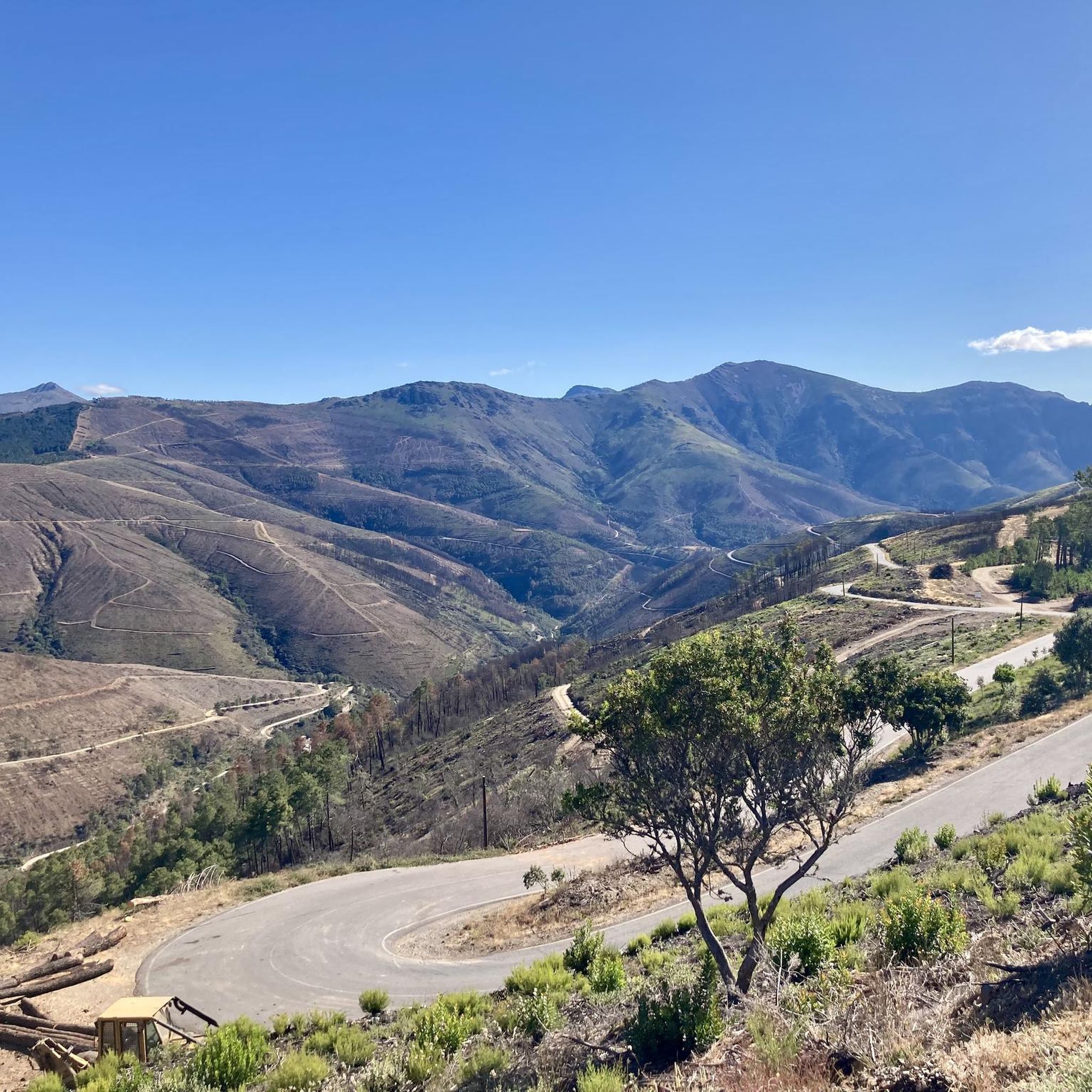
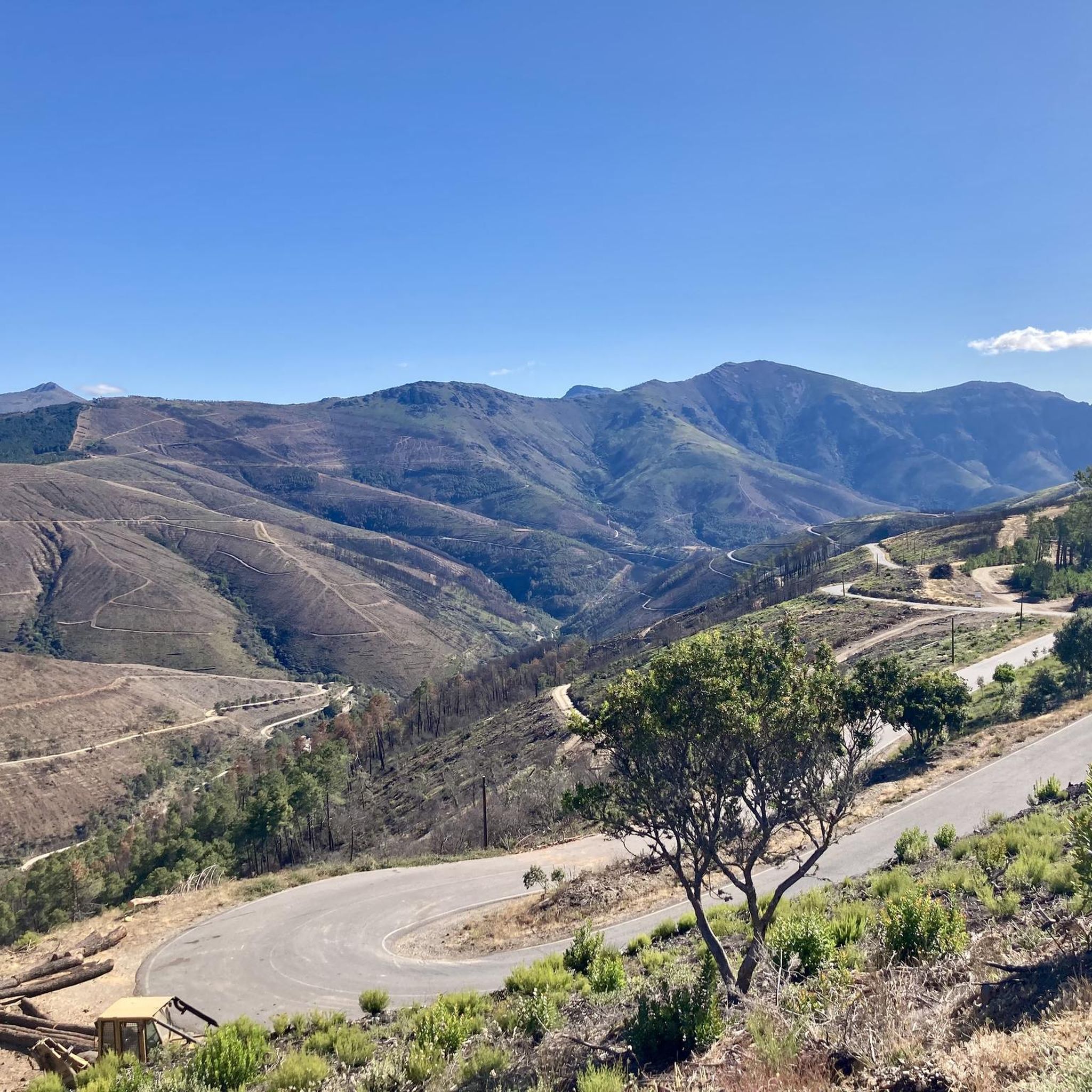
Hiking around Casares De Las Hurdes offers exploration of a mountainous region characterized by winding terrain, deep valleys, and abundant natural water features. The landscape is shaped by successive mountain ranges and rivers like the Hurdano, Ladrillar, and Malvellido, which carve impressive meanders. This area in northern Cáceres, Extremadura, provides a diverse environment for outdoor activities, with numerous waterfalls and natural pools.
Best hiking trails around Casares De Las Hurdes
- The most popular hiking route is El Chorro de la…
Last updated: October 10, 2026
4.8
(5)
64
hikers
2.60km
00:55
150m
150m
Easy hike. Great for any fitness level. Easily-accessible paths. Suitable for all skill levels.
5.0
(1)
2
hikers
7.39km
02:19
280m
280m
Moderate hike. Good fitness required. Mostly accessible paths. Sure-footedness required.

4.0
(1)
12
hikers
10.8km
03:17
350m
350m
Moderate hike. Good fitness required. Easily-accessible paths. Suitable for all skill levels.
5.0
(1)
10
hikers
3.80km
01:04
70m
70m
Easy hike. Great for any fitness level. Easily-accessible paths. Suitable for all skill levels.
5.0
(3)
8
hikers
9.57km
03:11
450m
450m
Moderate hike. Good fitness required. Easily-accessible paths. Suitable for all skill levels.
Get access to more routes and recommendations from other explorers.
Already have an account?
Our route recommendations are based on thousands of hikes, rides, and runs completed by other people on komoot.
Start today with a free account
Your next adventure awaits.
Popular around Casares De Las Hurdes

Tips from the Community

The Chorro de la Meancera is an impressive waterfall located in the hamlet of El Gasco, in the region of Las Hurdes, Cáceres. This waterfall is one of the highest and most aesthetic in the region, with a drop of approximately 100 meters. The best time to visit the Chorro de la Meancera is from autumn to spring, when the water flow is greater due to the rains. In summer, the flow may be lower, but the beauty of the place is still impressive.
3
0

a clearing by the river with the shade of cherry trees
1
0
After a steep, well-paved climb you reach this magnificent place, don't let anything stop you
1
0
Go around the town and continue to the next section, be sure to see it, it's worth it
1
0

El Gasco is a farmhouse in the municipality of Nuñomoral and is nestled between mountains, on the banks of the Malvellido river. Nearby is the volcano, declared a Place of Scientific Interest in 2003. This has a 10-meter crater, inside which there is molten rock. Although traditionally it has been considered a volcano
0
0

Nice panoramic point very close to the border with Salamanca and that allows you to clearly appreciate the picturesque landscape of the north of Extremadura. A route that can be started in Casarrubia, which can be easily reached by car.
3
0
Located in the region of Las Hurdes in the extreme north of Extremadura and on the bed of the Meancera stream, this waterfall is one of the most visited in the area and rightly so. A waterfall about 100 meters high with easy access, only about 2.5 km round trip from the town of El Gasco.
3
0
Frequently Asked Questions
What kind of natural features can I expect to see while hiking in Casares De Las Hurdes?
The region is characterized by its chaotic and winding mountainous terrain, intricate valleys, and abundant natural water features. You'll encounter impressive river meanders, such as the Meandros del Malvedillo visible from Mirador de El Gasco, and powerful waterfalls like the spectacular Chorro de la Meancera.
Are there any easy hiking trails suitable for beginners or families?
Yes, there are several easy routes. The El Chorro de la Meancera waterfall from El Gasco trail is an easy 2.6 km walk, typically taking about an hour. Another accessible option is the Clearing by the River – El Gasco loop from La Meancera, which is just under 2.7 km.
Where can I find impressive viewpoints in the area?
The region offers several stunning viewpoints. The Pregonera Viewpoint provides panoramic views of the Hurdano River Valley and the surrounding mountain ranges. Additionally, the Meandro del Melero, though slightly outside the immediate area, offers a spectacular panoramic view from the Mirador La Antigua within Las Hurdes.
Are there any trails that lead to waterfalls?
Absolutely. The El Chorro de la Meancera waterfall from El Gasco is a popular easy hike directly to the impressive Chorro de la Meancera. This waterfall is best visited from autumn to spring for the strongest flow.
What is the best time of year to go hiking in Casares De Las Hurdes?
The region is generally suitable for hiking year-round. However, for experiencing the waterfalls at their most powerful, autumn to spring is ideal due to higher water flow. The Fuente del Colla'o Hiking Route, for example, is described as transitable year-round.
Are there any longer or more challenging hiking options available?
For those seeking a longer experience, the Alfonso XIII Path (PR-CC 212 Senda de Alfonso XIII) is a 22 km footpath connecting Casares de las Hurdes with Las Mestas. The region also features sections of larger hiking networks like the GR10 and GR22.3. For a moderate challenge, consider the Pregonera Viewpoint loop from Casares de las Hurdes, which covers 9.6 km with significant elevation gain.
Can I find natural pools for swimming after a hike?
Yes, the clear waters of the rivers in Las Hurdes form natural pools. Charco de La Olla in Las Mestas, fed by the Ladrillar river, is a notable spot offering opportunities for wild swimming.
What do other hikers say about the trails in Casares De Las Hurdes?
The hiking routes in Casares De Las Hurdes are highly rated by the komoot community, with an average score of 4.9 stars from more than 10 reviews. Hikers often praise the varied terrain, the stunning natural beauty, and the well-maintained paths that lead to impressive natural features.
Are there any unique geological sites to explore?
Yes, the El Gasco Volcano is a unique geological feature in the area. It is famed for being formed by a meteorite impact two million years ago, with the presence of ringwoodite making it a global rarity.
Are there any circular hiking routes in the area?
Yes, several routes offer a circular experience. The Pregonera Viewpoint loop from Casares de las Hurdes is a moderate 9.6 km circular trail. Another option is the Chorro de la Meancera – Clearing by the River loop from Fragosa, a moderate 10.4 km loop.
What kind of cultural or historical points of interest can be found along the trails?
Beyond natural beauty, hikers can discover ancient settlements, such as the remains of a Bronze Age settlement near El Gasco, and rock engravings. The region also features unique slate architecture in its small farmhouses, reflecting a rich cultural heritage.
Is there parking available near the trailheads?
While specific parking details for every trailhead are not provided, Casares De Las Hurdes and the surrounding villages typically offer parking options for visitors. It is advisable to check local signage upon arrival or consult specific route descriptions for detailed parking information.
Most popular routes around Casares De Las Hurdes
Most popular attractions around Casares De Las Hurdes

Get inspired with the komoot mobile app


Explore more
Browse the best Hikes in other regions.
