The best running trails around Torres De Albarracín
5.0
(7)
738
runners
45
runs
Jogging routes around Torres De Albarracín traverse a diverse landscape within the Sierra de Albarracín mountain range, characterized by striking red sandstone formations, dense pine forests, and numerous water features. The region's geomorphology provides varied terrain, from gentle paths alongside rivers to more challenging routes with significant elevation changes. This area offers a natural environment for runners seeking both scenic beauty and physical challenge.
Best jogging routes around Torres De Albarracín
- The most popular jogging route is Barranco del Cabrerizo…
Last updated: October 14, 2026
29
runners
7.37km
01:03
130m
130m
Hard run. Good fitness required. Sure-footedness, sturdy shoes and alpine experience required.
7
runners
4.70km
00:30
40m
40m
Easy run. Great for any fitness level. Mostly paved surfaces. Suitable for all skill levels.

13
runners
11.7km
01:37
390m
390m
Hard run. Very good fitness required. Mostly paved surfaces. Suitable for all skill levels.
9
runners
9.90km
01:07
180m
180m
Moderate run. Good fitness required. Mostly paved surfaces. Suitable for all skill levels.
10
runners
20.7km
02:51
670m
670m
Hard run. Very good fitness required. Mostly paved surfaces. Suitable for all skill levels.
Get access to more routes and recommendations from other explorers.
Already have an account?
Our route recommendations are based on thousands of hikes, rides, and runs completed by other people on komoot.
Start today with a free account
Your next adventure awaits.

Tips from the Community

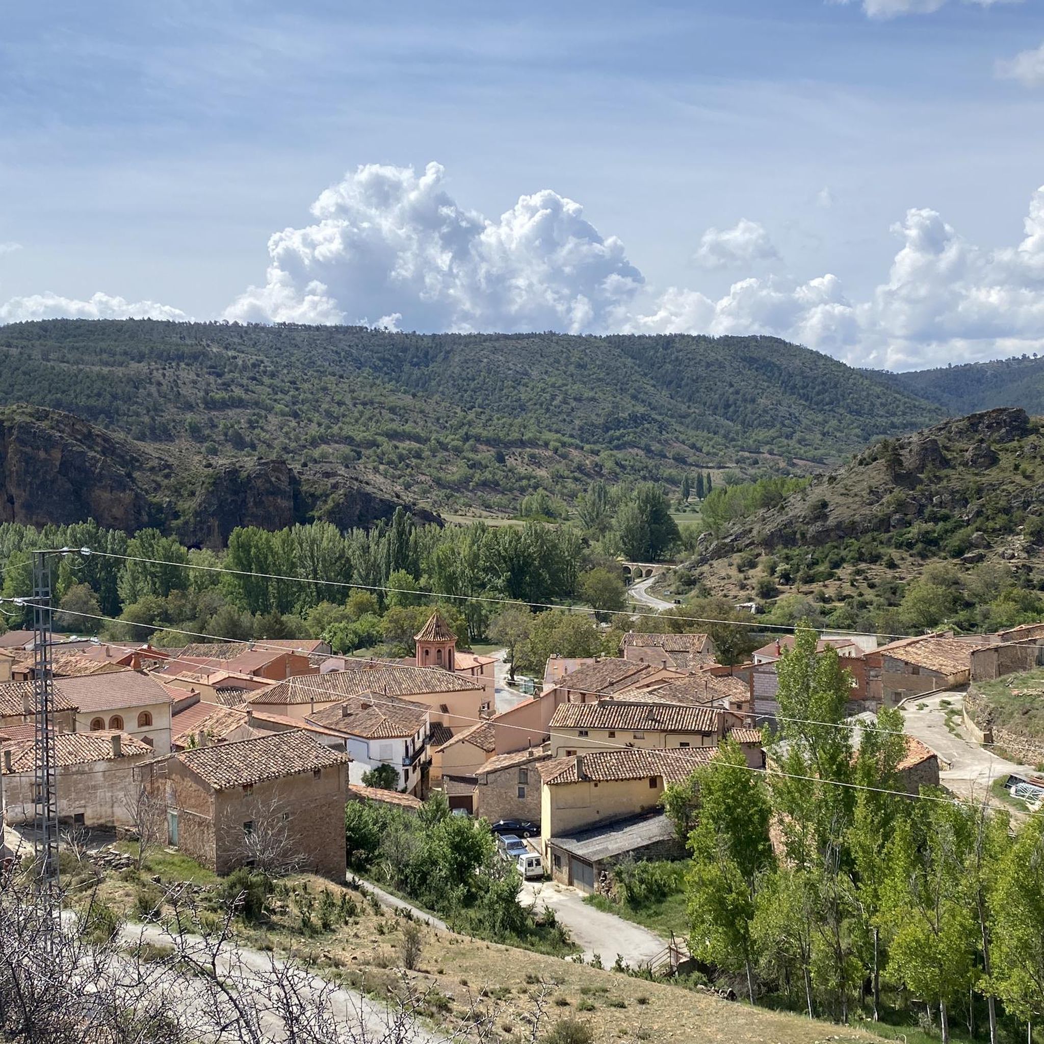
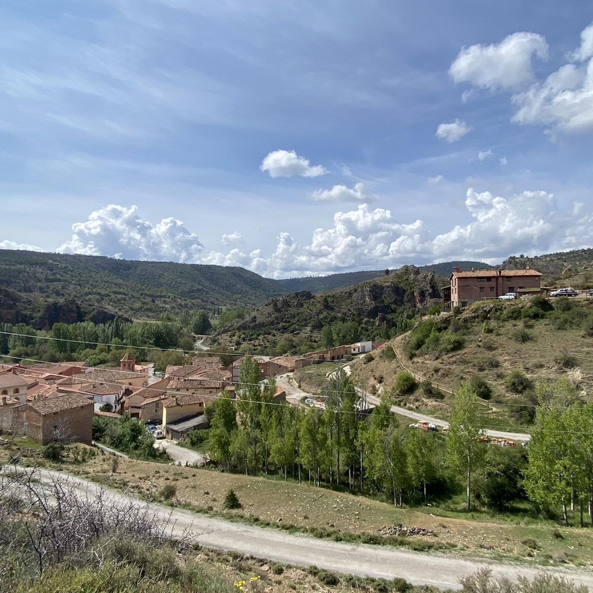
The view of the Guadalaviar Ravine in Tramacastilla, within the Sierra de Albarracín, is one of the most spectacular in the area, especially in the section known as Barranco Hondo. This setting combines rugged nature, crystal-clear water, and impressive rock formations.
4
0

We are in Bronchales, a town located in the Sierra de Albarracín, in the southwest of the province of Teruel with a diversity of natural and cultural heritage such as the beautiful Hermitage of Santa Bárbara or the parish church. For lovers of mountain biking, the Bronchales Sierra Alta race begins here, one of the best in the Sierra de Albarracín with endless climbs and heart-stopping descents through the dense Scots pine forests of the Montes Universales at an average altitude of 1,500 meters above sea level.
4
0

Breathtaking views of the gorge and adventurous trails
1
0
Frequently Asked Questions
How many running routes are available around Torres De Albarracín?
There are over 30 dedicated running routes around Torres De Albarracín, offering a wide range of options for different preferences and fitness levels. The komoot community has explored these trails over 600 times.
What kind of terrain can I expect on the jogging trails in this region?
The jogging trails around Torres De Albarracín traverse a diverse landscape. You'll encounter striking red sandstone formations, dense pine forests, and numerous water features like rivers and springs. The geomorphology provides varied terrain, from gentle paths alongside rivers to more challenging routes with significant elevation changes.
Are there easy or family-friendly jogging routes in Torres De Albarracín?
Yes, there are options for all fitness levels. For an easy experience, consider the Running loop from Albarracín, which is just under 3 miles (4.7 km) with minimal elevation gain. The region's 'Estación Trail Running' system also classifies routes, with 'green' routes being easy and under 6 km, perfect for families or beginners.
Are there any jogging routes that pass by waterfalls or other natural monuments?
Absolutely. The Sierra de Albarracín is known for its impressive waterfalls, such as the Cascada de Calomarde. While specific jogging routes directly to the waterfall might require some exploration, you can find routes that offer views of the region's natural beauty. The area also features highlights like the Moricacho of the Gorge and the Cabrerizo Viewpoint, which can be incorporated into your runs.
What do other runners say about the trails in Torres De Albarracín?
The running routes in Torres De Albarracín are highly rated by the komoot community, with an average score of 5.0 stars from 4 reviews. Runners often praise the unique red sandstone formations, the immersive pine forests, and the variety of terrain that offers both scenic beauty and physical challenge.
Are there circular running routes available?
Yes, many routes are designed as loops. A popular choice is the Barranco del Cabrerizo y Mirador de Peñas Royas – running circular through the Pinares de Rodeno, a moderate 7.1-mile (11.3 km) trail that showcases the unique red sandstone formations. Another option is the Cueva del diablo loop from Calomarde, a 4.6-mile (7.4 km) trail through varied terrain.
Can I bring my dog on the running trails?
Generally, dogs are welcome on trails in natural areas like the Sierra de Albarracín, provided they are kept on a leash and you follow local regulations regarding waste disposal. It's always a good idea to check for specific signage at trailheads or local visitor information centers for any particular restrictions.
Are there challenging running routes for experienced trail runners?
Definitely. The region offers 19 difficult routes for those seeking a greater challenge. For example, the Lázaro Shelter loop from Albarracín is a difficult 6.3-mile (10.2 km) path with a notable elevation gain of over 800 feet (250 meters). The high altitude of the Sierra de Albarracín also makes it an excellent location for mountain runners to train.
What are some notable landmarks or points of interest I might see while jogging?
Beyond the stunning natural landscapes, you might encounter ancient rock art within the Cultural Park of Albarracín, especially in areas like Pinares del Rodeno. Other points of interest include historical sites such as the Shelter of the Archer of the Enclosed Ravines and the Prado del Navazo Bulls Rock Shelter.
Is there a specific route that highlights the unique red sandstone formations?
Yes, the Barranco del Cabrerizo y Mirador de Peñas Royas – running circular through the Pinares de Rodeno is an excellent choice. This moderate route specifically offers views of the unique red sandstone formations that characterize the region, providing a picturesque backdrop for your run.
Are there any routes that offer significant elevation for training?
For runners looking for elevation, the Peña del Fraile loop from Albarracín is a challenging 6.6-mile (10.6 km) route with over 1000 feet (315 meters) of elevation gain. The Sierra de Albarracín's high altitude and varied terrain make it ideal for demanding training sessions.
Most popular routes around Torres De Albarracín
Most popular attractions around Torres De Albarracín

Get inspired with the komoot mobile app


Explore more
Browse the best Running Trails & Routes in other regions.
