The best cycling routes around Castilblanco
29
riders
4
rides
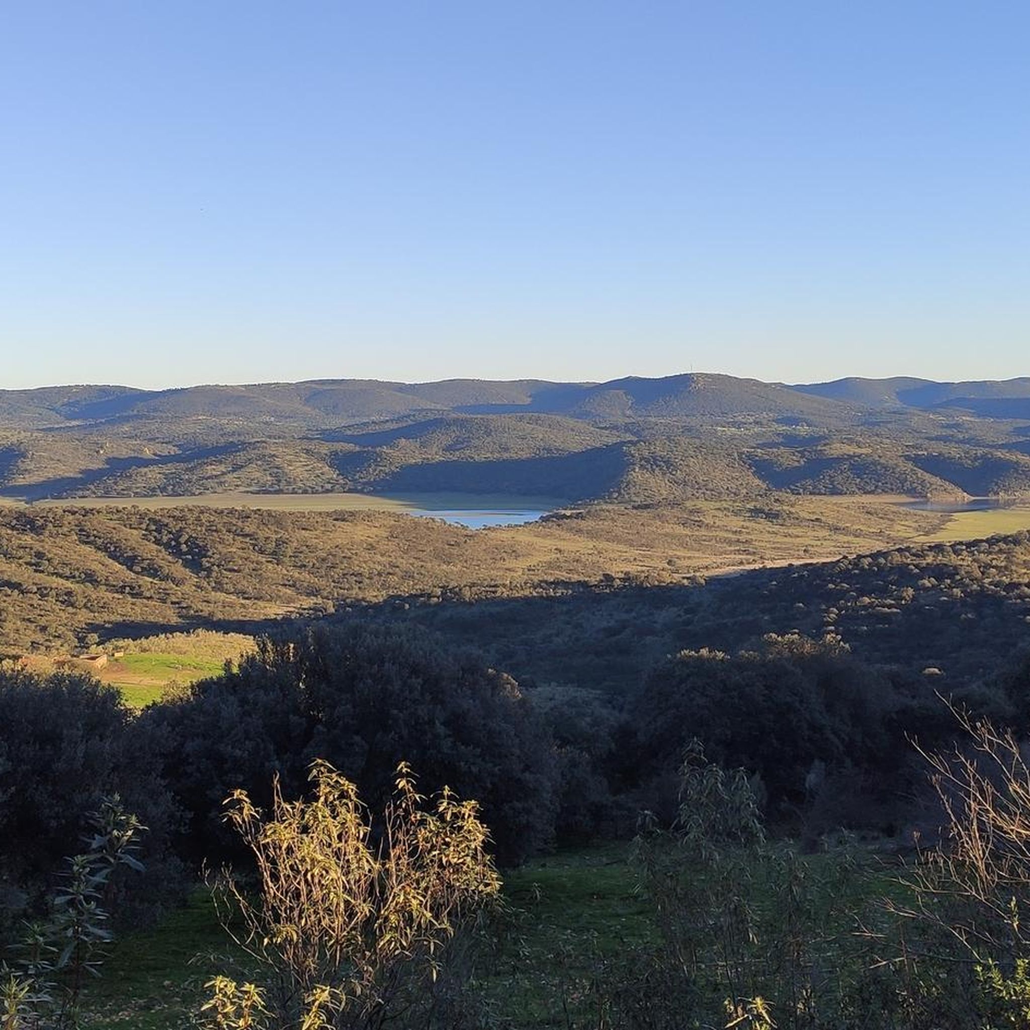
Touring cycling around Castilblanco de los Arroyos offers routes through the foothills of the Sierra Morena, characterized by rolling hills and Mediterranean woodlands. The terrain includes low undulations and some challenging ascents, with the Siete Arroyos river flowing through Mediterranean forests. This region is situated at the gates of Seville's Sierra Morena, providing diverse landscapes for cyclists.
Best touring cycling routes around Castilblanco
- The most popular touring cycling route is Garcia de Sola Reservoir and Herrera del Duque Castle Loop…
Last updated: August 17, 2026
60.7km
04:31
840m
840m
Hard bike ride. Very good fitness required. Some segments of this route may be unpaved and difficult to ride.
58.9km
04:19
600m
600m
Hard bike ride. Very good fitness required. Some segments of this route may be unpaved and difficult to ride.

Sign up for free
15
riders
20.2km
01:35
170m
170m
Moderate bike ride. Good fitness required. Mostly paved surfaces. Suitable for all skill levels.
6
riders
17.1km
01:02
150m
150m
Easy bike ride. Great for any fitness level. Mostly paved surfaces. Suitable for all skill levels.
2
riders
Moderate bike ride. Good fitness required. Mostly paved surfaces. Suitable for all skill levels.
Our route recommendations are based on thousands of hikes, rides, and runs completed by other people on komoot.
Start today with a free account
Your next adventure awaits.
Login or Signup
Popular around Castilblanco

Tips from the Community

Beautiful viewpoint with a small parking lot, there is a path of approx. 600 meters to the gorge. Hundreds of swallows nest in the opposite cave.
5
0

What to see in Alía (the village) Church of Our Lady of the Table: The main monument of the village. Of medieval origin, with later reforms. Its altarpiece and its elevated location, which offers good views of the surroundings, stand out. Old town: Narrow and quiet streets. Stone houses and traditional Extremaduran architecture. Ideal for strolling without haste and enjoying the rural atmosphere.
2
0
Alía is a small and beautiful village in the province of Cáceres, in Extremadura, located in the heart of the Las Villuercas-Ibores-Jara region, an ideal destination if you are looking for nature, tranquility, rural heritage, and good hiking.
2
0
Mirador del Estrecho de la Peña Amarilla (Yellow Rock Strait Viewpoint), one of the most interesting panoramic viewpoints in the Villuercas-Ibores-Jara Geopark, in Alía (Cáceres). The viewpoint overlooks the Estrecho de la Peña Amarilla, a spectacular river gorge carved by the Jarigüela stream amidst the quartzite formations of the Armorican Quartzite, a characteristic feature of the geopark. One of the routes that passes through this point is the one that connects Alía – Mirador del Estrecho – Puerto de San Vicente, a section of the Villuercas Natural Trail, with moderate scenery and elevation changes (17.78 km, +596 m).
5
0
This Almohad-era castle, now devoid of walls and decoration, is built on an octagonal plan atop a high crag south of the town, on a summit difficult to access. It lacks a keep, towers, and external defenses, perhaps due to its reconstruction during the Christian era, which only preserved the wall, omitting any other defensive elements beyond the rugged terrain on which it stands.
2
0
The García de Sola Reservoir, also known as Puerto Peña, is located on the Guadiana River, in the La Siberia Extremeña region (Badajoz). It was built in 1962 as part of the Badajoz Plan and has a capacity of 554 hm³. It is an emblematic site for its natural, scenic, and recreational value.
5
0
The Herrera del Duque Castle, located in the province of Badajoz (Extremadura), is an impressive 15th-century fortress that dominates the landscape of the La Siberia region from the top of the Sierra Chamorro. It is said that wailing sounds can be heard at night from the "Tower of Sighs," and there are legends about a hidden treasure protected by a curse.
6
0

This spectacular reservoir was built during the 1960s. The reflection of the sunsets in the water and the surrounding landscape make it a must-see if you're exploring the Guadiana Nature Trail.
0
1
Frequently Asked Questions
What kind of terrain can I expect when touring cycling around Castilblanco de los Arroyos?
The region offers diverse terrain, characterized by rolling hills, expansive dehesas (Mediterranean woodlands with holm and cork oaks), and picturesque rural roads. While many routes feature paved surfaces, some include unpaved sections. You'll encounter low undulations and some more challenging ascents, particularly in areas bordering the Sierra Morena.
Are there any circular touring cycling routes available?
Yes, several routes are designed as loops. For example, the Garcia de Sola Reservoir and Herrera del Duque Castle Loop is a challenging option, and the Peña Amarilla Gorge Loop Trail also offers a circular experience through varied landscapes.
What are some scenic natural features or landmarks I can see along the touring cycling routes?
You can explore the stunning natural beauty of the region, including the Garcia de Sola Reservoir, known for its imposing rock formations and dense Mediterranean forests. The Sierra Norte de Sevilla Natural Park offers spectacular regional views, such as from the Cerro del Calvario Viewpoint. You might also encounter the Siete Arroyos river flowing through Mediterranean forests, adding riparian vegetation to the scenery.
Are there any family-friendly touring cycling routes in the area?
While many routes feature challenging ascents and some unpaved sections, the broader concept of 'Vías Verdes' (converted railway lines) in the region offers flatter, more accessible options. These greenways are generally suitable for families, providing a scenic and safer environment away from traffic. Always check the specific route details for difficulty and surface conditions.
What is the best time of year for touring cycling around Castilblanco de los Arroyos?
The region's Mediterranean climate makes spring and autumn ideal for cycling, offering pleasant temperatures and lush landscapes. Summers can be very hot, especially in July and August, making early mornings or late afternoons preferable if cycling during these months. Winters are generally mild but can have cooler, wetter periods.
Where can I find parking for touring cycling routes in the Sierra Norte de Sevilla Natural Park?
Parking availability varies by trailhead. Many routes originating from towns like Castilblanco de los Arroyos or other villages within the Sierra Norte de Sevilla Natural Park will have designated parking areas or street parking. For specific routes, it's advisable to check local information for the starting point to ensure convenient access.
Are there any historical or cultural sites accessible by touring bike?
Absolutely. Castilblanco de los Arroyos is situated on the historic Ruta de la Plata and the Way of Saint James (Camino de Santiago from Seville), allowing cyclists to follow ancient pilgrimage paths. The town itself features whitewashed houses, the Mudejar-style El Divino Redentor Parish Church, and the Casa de la Sierra, which houses an ethnology museum. You can also pass by the Shrine to San Benito Abad.
What are some of the more challenging touring cycling routes in the Castilblanco area?
For experienced cyclists seeking a challenge, routes like the Garcia de Sola Reservoir and Herrera del Duque Castle Loop and the Peña Amarilla Gorge Loop Trail are rated as difficult. These routes feature significant elevation gains and cover substantial distances, requiring good physical condition.
Are there any moderate touring cycling routes suitable for intermediate riders?
Yes, there are several moderate options. The Playa hormigonada de Peloche loop from Dehesa Boyal is a moderate 12.5-mile (20.2 km) trail through rural landscapes. Another good choice is the Flooded country road – Helechosa de los Montes loop from Helechosa de los Montes, which is also rated moderate and covers about 12.5 miles (20.2 km).
Can I find cafes or pubs along the touring cycling routes for refreshments?
While the routes often traverse rural landscapes, towns and villages like Castilblanco de los Arroyos, Herrera del Duque, and Helechosa de los Montes offer opportunities for refreshments. These settlements typically have local cafes, bars, and restaurants where you can stop for a break, a meal, or to refill water bottles. Planning your route with these stops in mind is recommended.
What kind of wildlife might I encounter while cycling in the Sierra Morena region?
The Sierra Morena, including the Sierra Norte de Sevilla Natural Park, is rich in biodiversity. You might spot various bird species, including griffon vultures, black vultures, and golden eagles, especially around the Garcia de Sola Reservoir. The Mediterranean forests and dehesas are also home to deer, wild boar, and a variety of smaller mammals and reptiles.
Most popular routes around Castilblanco
Most popular attractions around Castilblanco

Get inspired with the komoot mobile app


Explore more
Browse the best Cycling routes in other regions.
