The best walks and hikes around Thuir
4.3
(716)
4,305
hikers
16
hikes
Hiking around Thuir offers trails through the varied landscape of the Pyrénées-Orientales, characterized by rolling hills, vineyards, and Mediterranean vegetation. The region features accessible paths around the town as well as more challenging routes leading to local summits. Hikers can explore a mix of open countryside and shaded sections, often with views of the surrounding plains and distant mountains.
Best hiking trails around Thuir
- The most popular hiking route is Roc de Majorque summit – Entrance gate to Castelnou loop…
Last updated: October 12, 2026
3.0
(1)
30
hikers
10.7km
03:09
310m
310m
Moderate hike. Good fitness required. Easily-accessible paths. Suitable for all skill levels.
3.0
(1)
16
hikers
25.1km
07:35
790m
790m
Hard hike. Very good fitness required. Easily-accessible paths. Suitable for all skill levels.

5.0
(1)
5
hikers
11.5km
03:13
220m
220m
Moderate hike. Good fitness required. Easily-accessible paths. Suitable for all skill levels.
4.0
(2)
8
hikers
5.52km
01:28
60m
60m
Easy hike. Great for any fitness level. Easily-accessible paths. Suitable for all skill levels.
7
hikers
16.5km
04:12
50m
50m
Moderate hike. Good fitness required. Easily-accessible paths. Suitable for all skill levels.
Get access to more routes and recommendations from other explorers.
Already have an account?
Our route recommendations are based on thousands of hikes, rides, and runs completed by other people on komoot.
Start today with a free account
Your next adventure awaits.


Tips from the Community


Great village! I enjoyed the visit and, of course, the restaurant.
1
0


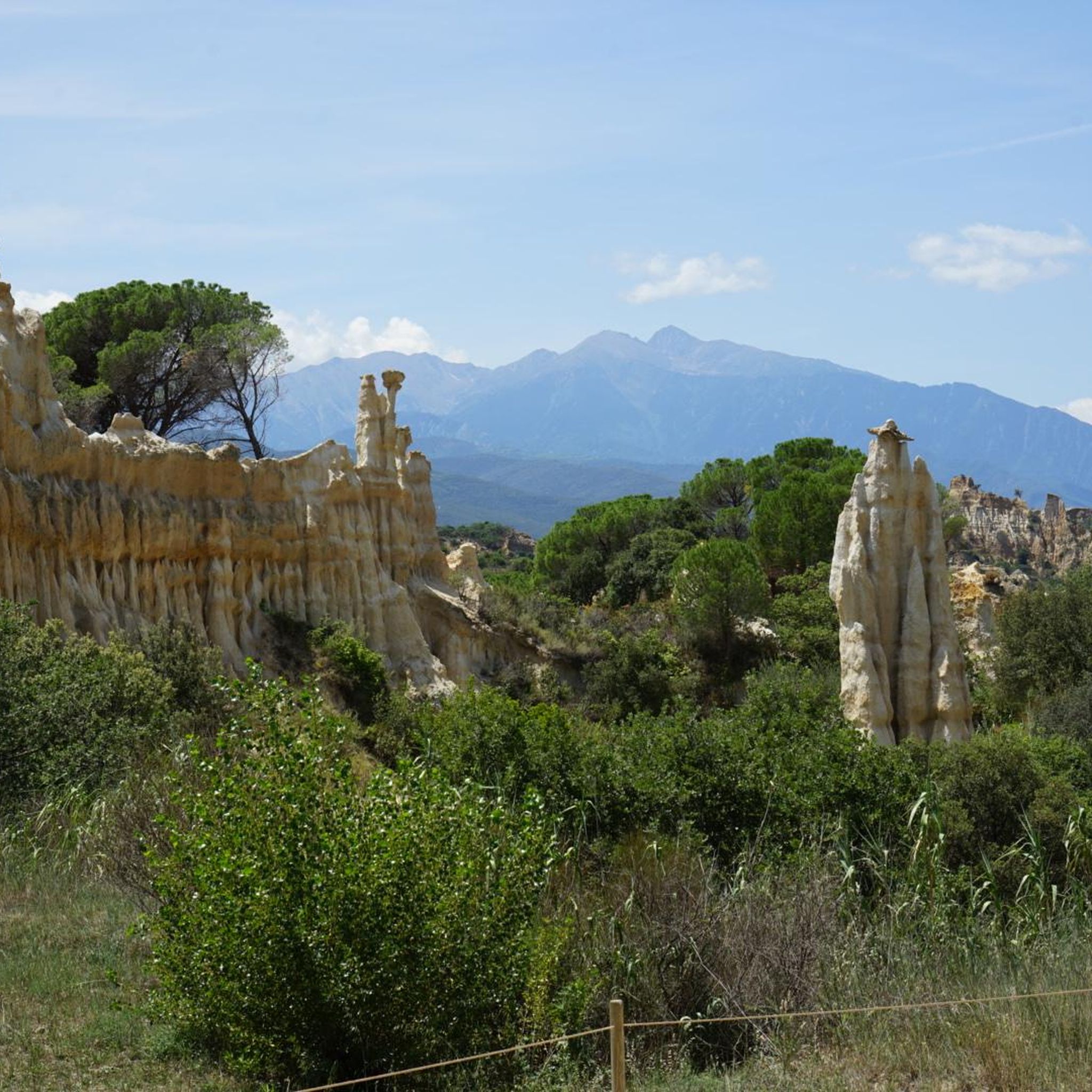
The view of Castelnou Castle, perched on a hill in the heart of the Aspres, is breathtaking. Dominating the medieval village below, this 10th century castle stands proudly in a landscape of vineyards, forests and mountains. From the surrounding trails, the panorama offers a grandiose spectacle with the Pyrenees as a backdrop.
2
1

Sainte-Colombe-de-la-Commanderie owes its name to the historical presence of a Templar commandery, which operated in the village in medieval times. During the 12th and 13th centuries, the Knights Templar settled in the region, where they managed agricultural land and protected pilgrims. Although much of the original architecture has disappeared or been modified, the Templar legacy remains palpable in the identity of the village.
2
0
This place is known for its rich history linked to the Order of the Knights Templar and for its rural beauty, surrounded by vineyards and hills. The village and its immediate surroundings are perfect for those who enjoy medieval history, hiking and peaceful landscapes.
2
0

Frequently Asked Questions
How many hiking trails are available around Thuir?
There are over 10 hiking trails around Thuir, catering to various skill levels. The komoot community has explored these routes over 4000 times, providing an average rating of 4.4 stars.
Are there easy hiking trails suitable for beginners in Thuir?
Yes, Thuir offers several easy trails perfect for beginners. For instance, the Thuir loop from Thuir is an easy 3.4-mile (5.5 km) path that takes about 1 hour 28 minutes to complete, leading through the local countryside.
What is the best time of year to go hiking in Thuir?
The best time to hike in Thuir is typically during spring (April to June) and autumn (September to October). During these seasons, the weather is mild and pleasant, ideal for exploring the vineyards and rolling hills. Summer can be quite hot, while winter offers cooler, sometimes crisp, conditions.
Are there any circular hiking routes in the Thuir area?
Yes, many of the trails around Thuir are circular, allowing you to start and end at the same point. A popular moderate option is the Roc de Mallorca – Roc de Majorque summit loop from Thuir, which offers a substantial climb and rewarding vistas.
What kind of viewpoints can I expect on hikes near Thuir?
Hikes around Thuir often provide panoramic views of the surrounding plains, vineyards, and distant mountains, including the Pyrénées. Trails leading to local summits like Roc de Majorque offer particularly expansive vistas.
Are there any challenging hikes for experienced hikers around Thuir?
For experienced hikers seeking a challenge, the Roc de Majorque summit – Entrance gate to Castelnou loop from Thuir is a difficult 15.5-mile (24.9 km) trail with significant elevation gain, taking over 7 hours to complete and offering extensive views.
What attractions or landmarks can I see near the hiking trails in Thuir?
While hiking around Thuir, you can explore several interesting landmarks. The historic village of Castelnou is a notable highlight, and the Roc de Mallorca summit offers great views. You might also encounter religious sites like Sant Martí de la Roca.
Are there any lakes or water features accessible from Thuir's hiking routes?
While Thuir itself is not directly on a large lake, the region has several nearby reservoirs. The Villeneuve-de-la-Raho Reservoir and Lake Raho are within a reasonable distance and offer additional recreational opportunities, though they may require a short drive from Thuir's immediate hiking areas.
What do other hikers enjoy most about hiking in Thuir?
The komoot community highly rates the trails around Thuir, with an average score of 4.4 stars from over 600 reviews. Hikers often praise the varied landscape, which includes rolling hills and vineyards, and the options for different ability levels, from easy loops to more challenging ascents with rewarding views.
Are there any moderate hikes around Thuir that offer a good balance of challenge and scenery?
Yes, Thuir has several moderate hikes. The Ste Colombe loop from Thuir is a moderate 5.8-mile (9.3 km) trail that takes about 2 hours 28 minutes, offering a pleasant journey through the local landscape.
Is it possible to hike with public transport access in Thuir?
Thuir is a well-connected town, and while specific trailheads might require a short walk from bus stops, public transport can be used to reach the town center, from where many routes begin or are easily accessible. It's advisable to check local bus schedules for routes connecting to specific starting points.
Where can I find parking for hiking trails in Thuir?
Parking is generally available in and around Thuir, particularly near the town center or designated starting points for popular trails. Many routes, being loops, often begin and end in areas with convenient parking options.
Most popular attractions around Thuir

Get inspired with the komoot mobile app


Explore more
Browse the best Hikes in other regions.
