The best walks and hikes around Isenheim
4.5
(2879)
15,677
hikers
13
hikes
Hiking around Isenheim offers access to diverse landscapes at the foothills of the Vosges mountains in northeastern France. The region is characterized by rounded summits, dense forests, and high pastures, forming part of the Regional Natural Park of Ballons des Vosges. Hikers can explore a network of trails that traverse beech-fir forests, bogs, and areas with rivers and lakes. This varied terrain provides options for different hiking experiences, from gentle paths to more challenging ascents.
Best hiking trails around Isenheim
…Last updated: June 28, 2026
4.0
(2)
6
hikers
12.5km
03:31
250m
250m
Moderate hike. Good fitness required. Easily-accessible paths. Suitable for all skill levels.
5
hikers
7.34km
01:53
30m
30m
Easy hike. Great for any fitness level. Easily-accessible paths. Suitable for all skill levels.

Sign up for free
4.0
(1)
5
hikers
Easy hike. Great for any fitness level. Easily-accessible paths. Suitable for all skill levels.
5
hikers
5.34km
01:22
20m
20m
Easy hike. Great for any fitness level. Easily-accessible paths. Suitable for all skill levels.
5
hikers
10.6km
02:48
90m
90m
Moderate hike. Good fitness required. Easily-accessible paths. Suitable for all skill levels.
Get access to more routes and recommendations from other explorers.
Sign up for free
Already have an account?
Our route recommendations are based on thousands of hikes, rides, and runs completed by other people on komoot.
Start today with a free account
Your next adventure awaits.
Login or Signup
Tips from the Community

Statues and decorative creations, regularly replaced throughout the seasons and major holidays.
0
0
Bucolic mural, dated 18.05.2019. Who knows, perhaps a prelude to the "Ça va bomber" festival which was launched the following year?
0
0
Graffiti created during the first Ça va bomber urban art festivals (boxed set in 2020, passage de la grange in 2021). The painted window is located at the end of the passage, above the small supermarket parking lot next to the barn.
0
0
The giant hamster of Alsace, a mural created by Stom500 during the Ça va bomber 2022 urban arts festival.
0
0
Mange du miel Wildi, graffiti created during the urban arts festival Ça va bomber 2022, by Key Lox, on the building of the former dispensary. A bus shelter on the same theme can be found in Uffholtz ( https://www.komoot.com/fr-fr/highlight/8337497 ).
0
0
Magnificent mural created during the Ça va bomber 2023 urban arts festival, by Stom500, on the water tower reservoir at a height of 30 meters.
0
0

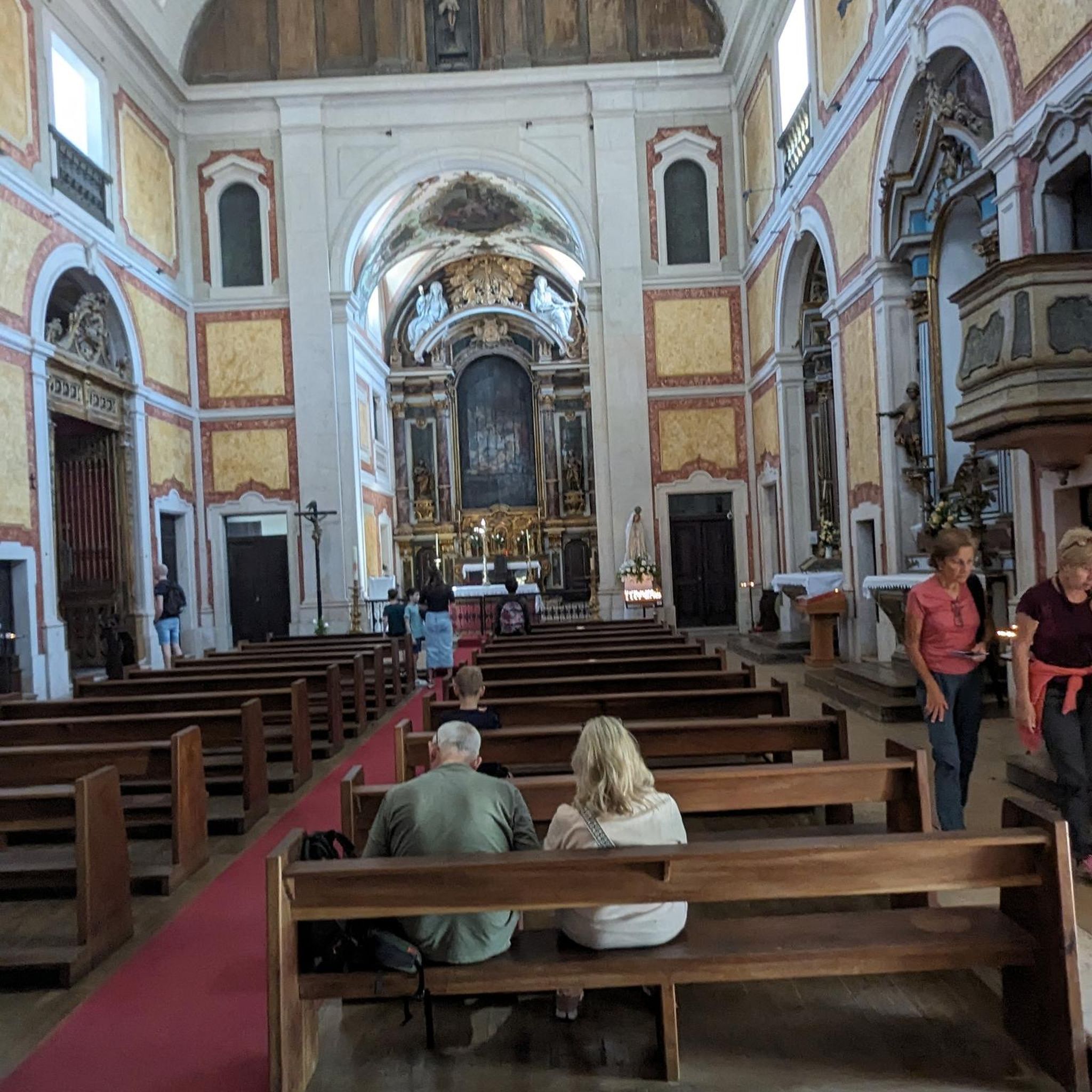
The church cannot be visited at this time as it is closed for renovations.
2
0
Frequently Asked Questions
What types of hiking trails can I find around Issenheim?
Issenheim, situated at the foothills of the Vosges mountains, offers a diverse range of hiking trails. You'll find paths traversing dense beech-fir forests, high pastures, and areas with rivers and lakes, all within the scenic Regional Natural Park of Ballons des Vosges. The terrain varies from gentle strolls to more challenging ascents, catering to different fitness levels.
Are there many hiking routes available in the Issenheim area?
Yes, the Issenheim area boasts a wide selection of hiking routes. There are over 780 routes available, with a good mix of difficulties: approximately 300 easy trails, over 420 moderate routes, and around 60 more challenging options for experienced hikers.
What are some popular viewpoints or natural landmarks to discover on hikes near Issenheim?
The region is rich in natural beauty and historical sites. You can find stunning panoramic views from the Viewpoint at the summit of Vieil Armand. Other notable natural features in the broader Vosges area include Hohneck and Grand Ballon, the highest peak in the Vosges, offering expansive vistas. The Firstplan Pass and Col Amic are also popular mountain passes to explore.
Are there any easy hiking trails suitable for families or beginners?
Absolutely. For an easier option, consider the Oelberg Way of the Cross – Orschwir Castle loop from Bergholtzzell. This trail is approximately 6 km long with minimal elevation gain, making it suitable for all skill levels and a pleasant choice for families.
Can I find circular hiking routes around Issenheim?
Yes, many of the trails around Issenheim are designed as circular routes, allowing you to start and end at the same point. An example is the View of Guebwiller – Croix de la Mission loop from Guebwiller, a moderate 10.9 km path offering scenic overlooks and forest sections.
What do other hikers say about the trails in Issenheim?
The hiking routes in Issenheim are highly regarded by the komoot community, holding an average rating of 4.6 stars from over 2,600 reviews. Hikers often praise the quiet woodlands, varied terrain, and the well-maintained paths that offer a rewarding outdoor experience.
Are there any historical sites or unique attractions along the hiking paths?
Yes, the region has a rich history, particularly from World War I. You can explore sites like the Hartmannswillerkopf National Monument. There are also several historical bunkers and tunnels, such as the Adlerhorst Command Post – World War I and the Veilchenstein German WW1 Bunker, offering a glimpse into the past.
What is a good moderate hike to experience the forests near Issenheim?
For a moderate forest experience, the Dead tree – calvary in the forest loop from Soultz-Haut-Rhin is an excellent choice. This 8.2 km trail leads you through dense forest, typically taking about 2 hours and 27 minutes to complete.
Can I combine hiking with other activities, like exploring local culture or wine tasting?
Absolutely. Issenheim's proximity to the scenic Alsace Wine Route means you can easily combine your hiking adventures with cultural experiences. Explore picturesque villages and vineyards after your walk, enjoying the local charm and culinary delights of the region.
Are there any longer, more challenging hikes available for experienced hikers?
While many trails are moderate, the region offers options for longer distances and greater elevation. For example, the – Thierenbach pond loop from Soultz-Haut-Rhin is a moderate 11.8 km route with over 350 meters of elevation gain, providing a good workout and scenic views.
What are the typical durations for hikes around Issenheim?
Hiking durations vary depending on the trail's length and difficulty. Easy trails might take 1-2 hours, while moderate routes often range from 2.5 to 4 hours. For instance, the Croix de la Mission – View of Guebwiller loop from Bergholtzzell, a moderate 11.4 km trail, typically takes about 3 hours and 20 minutes.
Most popular attractions around Isenheim

Get inspired with the komoot mobile app


Explore more
Browse the best Hikes in other regions.
