Saint-Antonin-Sur-Bayon
Saint-Antonin-Sur-Bayon
The best walks and hikes around Saint-Antonin-Sur-Bayon
4.6
(727)
7,442
hikers
48
hikes
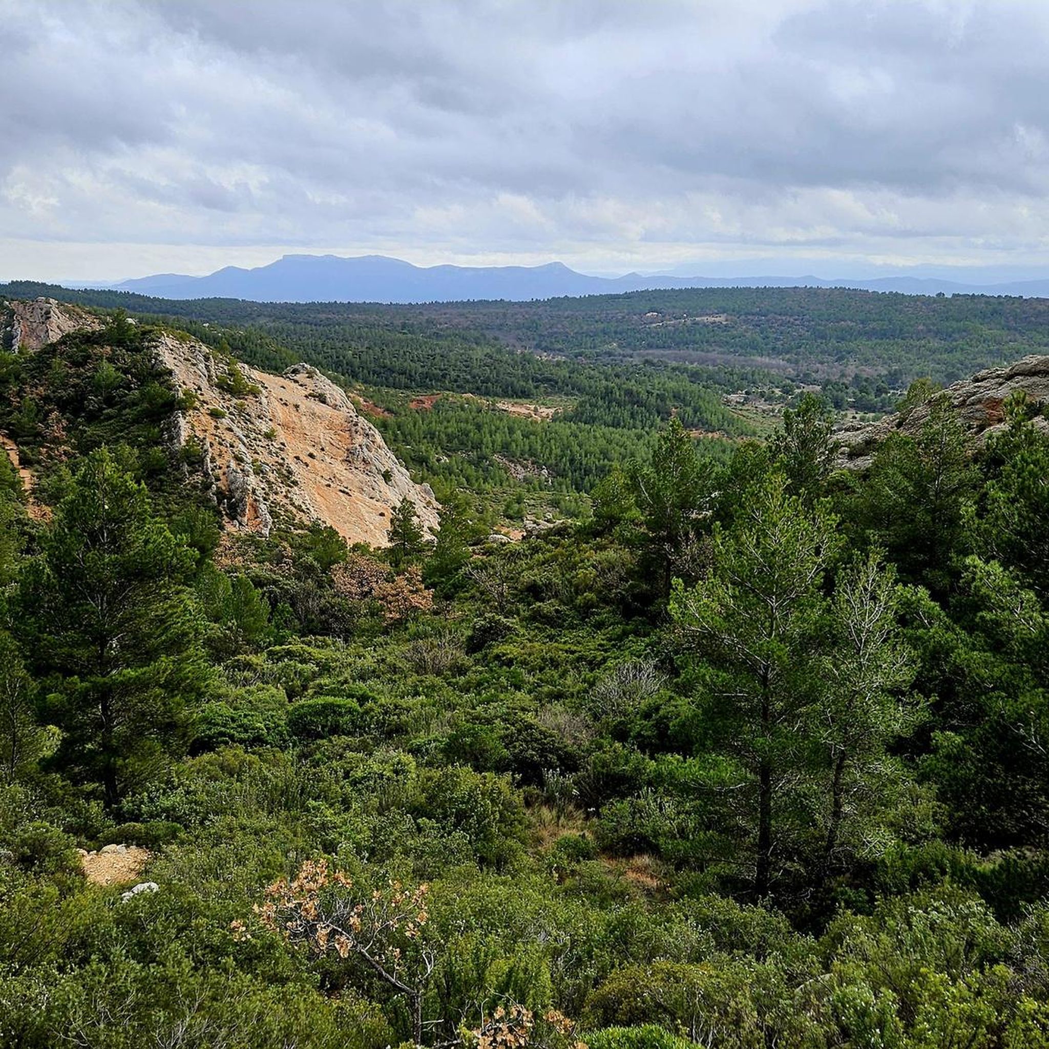
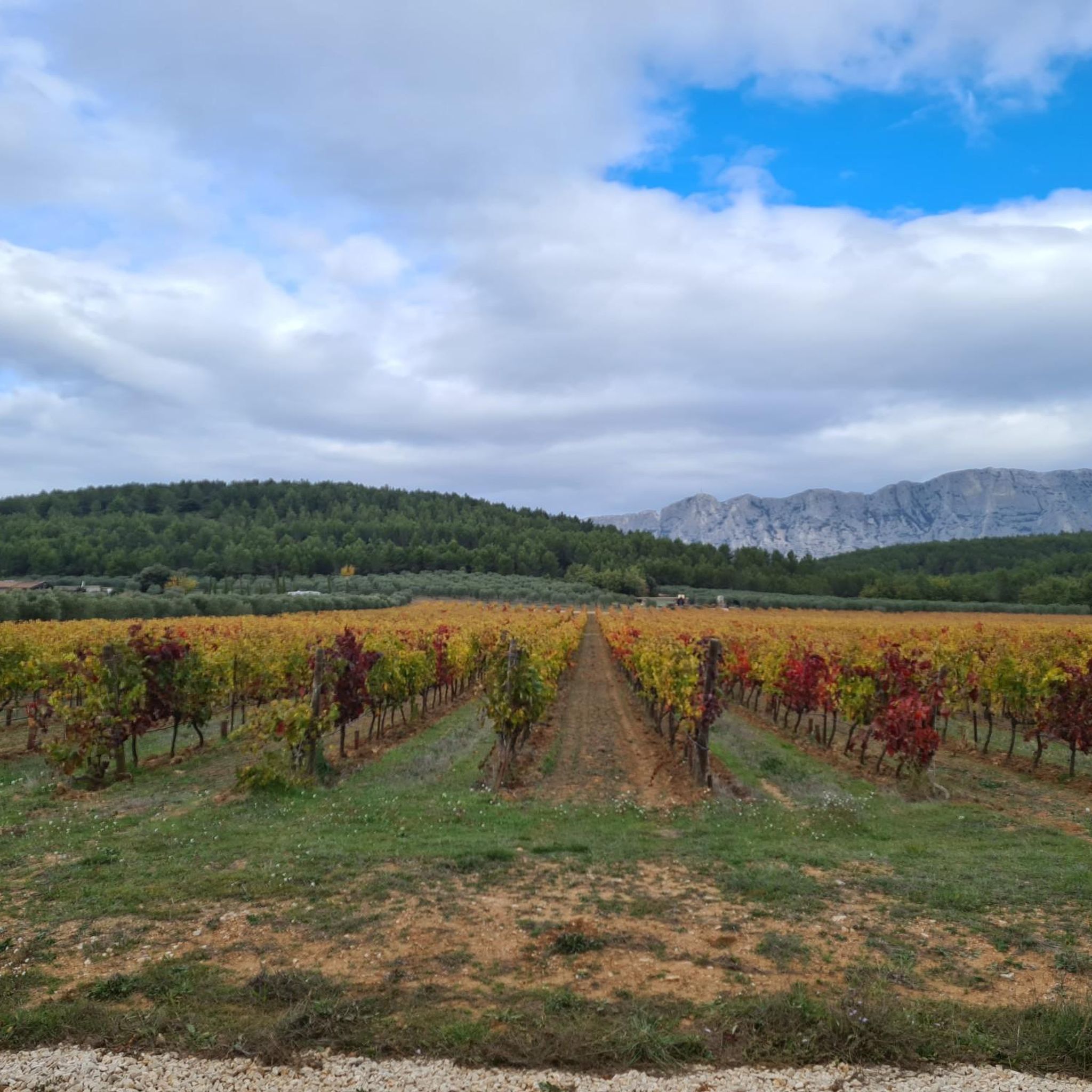
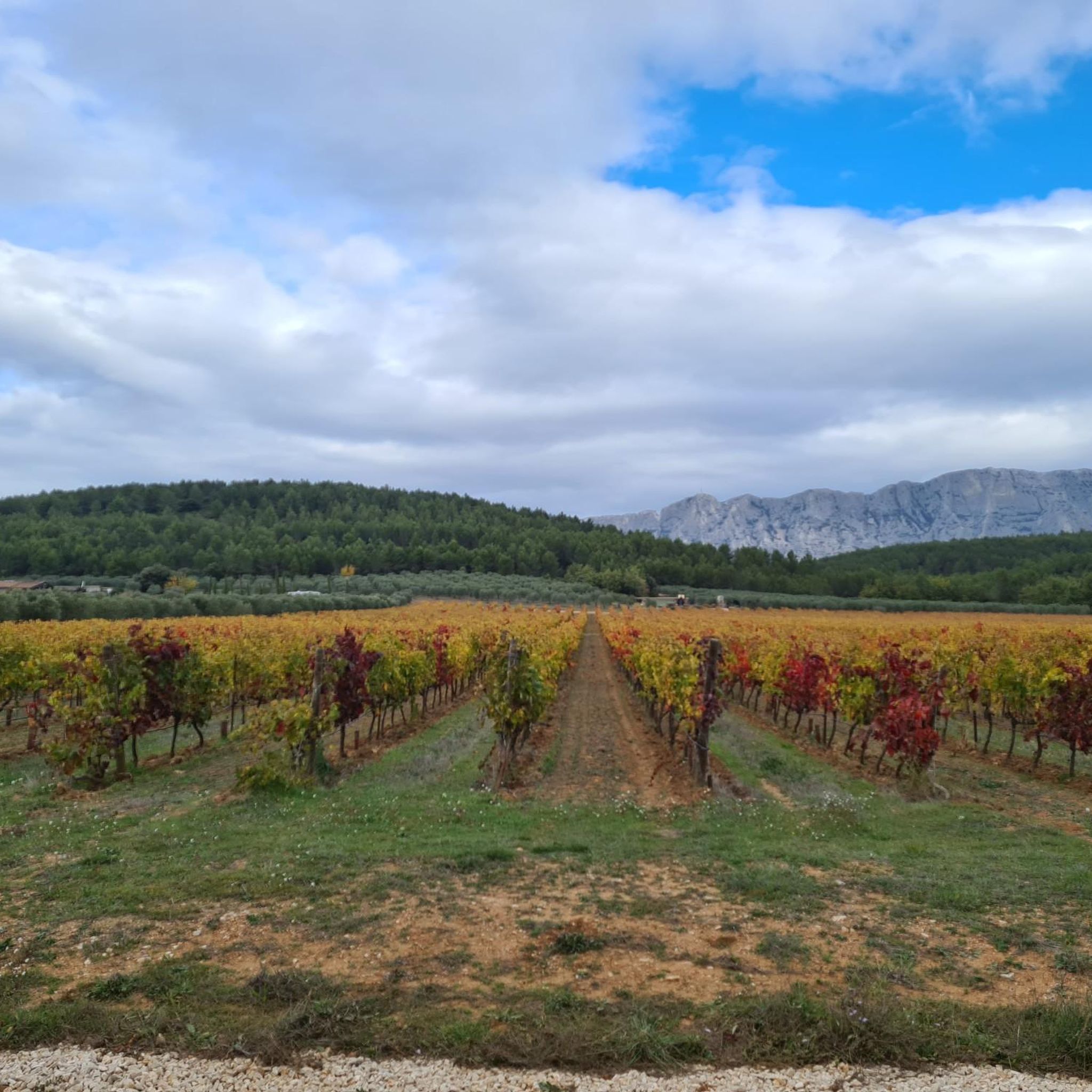
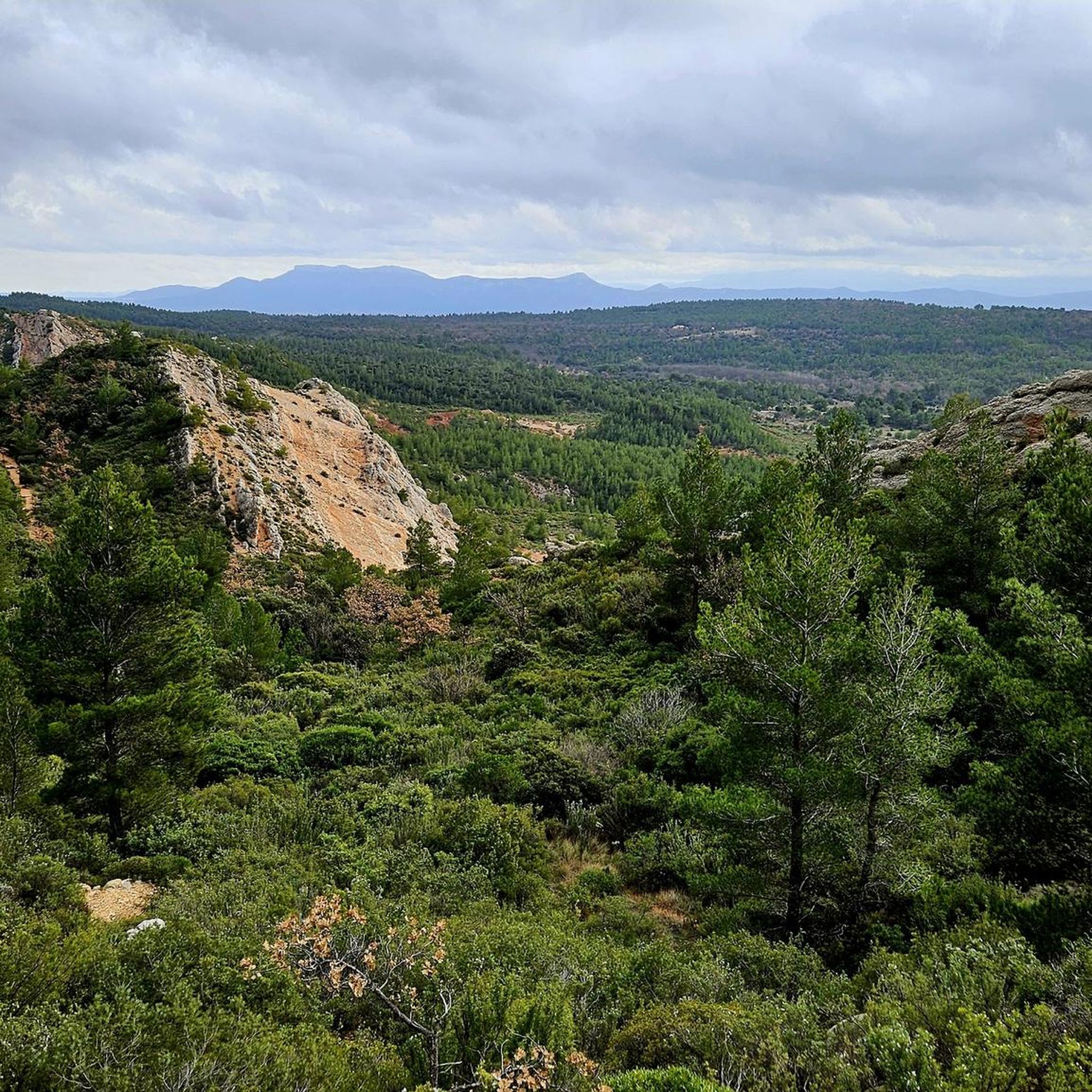
Hiking around Saint-Antonin-Sur-Bayon is centered around the Sainte-Victoire mountain, a prominent limestone massif that dominates the horizon. The region features a landscape of crests, picturesque valleys, and red earth flanks adorned with garrigue vegetation, including Kermes oaks and Aleppo pines. The small Bayon stream traverses the village, adding to its scenic appeal. This Mediterranean environment offers a diverse range of hiking opportunities.
Best hiking trails around Saint-Antonin-Sur-Bayon
- The most popular hiking route is Pas du Moine Trail to Croix de Provence, a 4.1 miles (6.6 km) trail that takes 3 hours 12 minutes to complete. This difficult route leads to the Croix de Provence, offering expansive views.
- Another top favourite among local hikers is Plateau du Cengle – loop, a moderate 9.8 miles (15.8 km) path. This trail offers a different perspective of the region's diverse landscape.
- Local hikers also love the Small dam – Ice-cold bathing pool loop from Saint-Antonin-sur-Bayon, a 4.1 miles (6.6 km) trail leading through varied terrain, often completed in about 2 hours 2 minutes.
- Hiking around Saint-Antonin-Sur-Bayon is defined by limestone massifs, garrigue-covered hillsides, and scenic valleys. The network offers options for different ability levels, from moderate walks to challenging ascents.
- The routes in Saint-Antonin-Sur-Bayon are highly rated by the komoot community with an average score of 4.6 stars from over 690 reviews. More than 7000 hikers have used komoot to explore Saint-Antonin-Sur-Bayon's varied terrain.
Last updated: July 7, 2026
4.6
(77)
1,214
hikers
6.63km
03:13
550m
550m
Hike the difficult Pas du Moine Trail to Croix de Provence for 4.1 miles (6.6 km) with 1811 feet (552 metres) of elevation gain.
4.6
(19)
96
hikers
15.8km
04:25
310m
310m
Moderate hike. Good fitness required. Easily-accessible paths. Suitable for all skill levels.

Sign up for free
4.7
(89)
1,167
hikers
Hard hike. Good fitness required. Sure-footedness, sturdy shoes and alpine experience required.
4.5
(19)
148
hikers
Hard hike. Good fitness required. Sure-footedness, sturdy shoes and alpine experience required.
4.4
(8)
110
hikers
18.9km
08:20
1,110m
1,110m
Hard hike. Very good fitness required. Sure-footedness, sturdy shoes and alpine experience required.
Get access to more routes and recommendations from other explorers.
Sign up for free
Already have an account?
Our route recommendations are based on thousands of hikes, rides, and runs completed by other people on komoot.
Start today with a free account
Your next adventure awaits.
Login or Signup
Popular around Saint-Antonin-Sur-Bayon


Tips from the Community

A pass not so hard, just require some climbing basics.
0
0
A summit with very few peoples on it compared to the croix de Provence. Can be accessed by the crest, much harder and longuer than the Imoucha path.
1
0
Beautiful, it's also a good place to take a nap or just rest under the shade.
1
0

Magnificent place, lost under the cliff. Small chapel dug into the rock and fantastic viewpoint ❤️
0
1
Lost and magical place amidst cliffs and trees - I love it. Always open, possibility to spend the night and make a fire (not in summer).
0
0
Not the most beautiful place on Sainte-Victoire in itself, but what an extraordinary view 🔥 Sainte-Baume and the mountains of Marseille to the South, the Bessillons and the Alps behind the Verdon to the East, the Montagne de Lure, the Écrins, the Ventoux...
1
0
Magical place, panoramic view from the "balcony".
1
0

Frequently Asked Questions
How many hiking trails are available in Saint-Antonin-Sur-Bayon?
There are over 45 hiking routes in Saint-Antonin-Sur-Bayon, offering a diverse range of experiences from moderate walks to challenging ascents around the Sainte-Victoire mountain.
What kind of terrain can I expect on the hiking trails around Saint-Antonin-Sur-Bayon?
The terrain is primarily characterized by limestone massifs, garrigue-covered hillsides, and picturesque valleys. You'll encounter red earth flanks, Kermes oaks, Aleppo pines, and the scenic Bayon stream. Trails can range from well-trodden paths to more rugged, rocky sections, especially on higher elevations of Sainte-Victoire.
Are there easy hiking trails suitable for beginners in Saint-Antonin-Sur-Bayon?
Yes, Saint-Antonin-Sur-Bayon offers 8 easy hiking routes perfect for beginners or those seeking a more relaxed walk. These trails provide a gentle introduction to the region's natural beauty without significant elevation changes.
Are there challenging hikes for experienced mountaineers?
Absolutely. For experienced hikers, there are 14 difficult routes, many of which lead to iconic landmarks like the Croix de Provence or the Pic des Mouches, the highest point of the Sainte-Victoire massif. These trails often involve significant elevation gain and rugged terrain, such as the Pas du Moine Trail to Croix de Provence.
What landmarks or viewpoints can I discover while hiking?
Hikers can discover numerous landmarks and enjoy breathtaking views. Notable points include the Croix de Provence, the Pic des Mouches, and the tranquil Hermitage of Saint-Ser. You can also explore historical sites like the Oppidum Untinos, a Celtic-Ligurian site, or the ancient Aqueduc de Saint-Antonin-sur-Bayon.
Are there any circular hiking routes available?
Yes, the region offers several circular routes, allowing you to start and end your hike in the same location. An example is the Plateau du Cengle – loop, which provides a different perspective of the diverse landscape. Many trails around Sainte-Victoire are designed as loops for comprehensive exploration.
What is the best time of year to go hiking in Saint-Antonin-Sur-Bayon?
The Mediterranean climate makes spring and autumn ideal for hiking, with pleasant temperatures and vibrant natural colors. Summer can be very hot, especially on exposed trails, so early mornings or late afternoons are recommended. Winter offers crisp air and fewer crowds, but some higher trails might be more challenging due to cooler conditions.
Are there any family-friendly hiking options?
While specific family-friendly routes are not detailed, the presence of 8 easy trails suggests options suitable for families. Look for routes with less elevation gain and shorter distances, which can be found among the easier graded tours. The area's diverse landscape offers gentle walks through valleys and along the Bayon stream.
What do other hikers enjoy the most about hiking in Saint-Antonin-Sur-Bayon?
The area is highly rated by the komoot community, with an average score of 4.6 stars from over 690 reviews. Hikers often praise the stunning panoramic views from Sainte-Victoire, the diverse Mediterranean landscape, and the well-preserved natural environment that inspired artists like Cézanne. The variety of trails catering to all fitness levels is also a frequently mentioned positive aspect.
Are there any natural water features or swimming spots along the trails?
The small Bayon stream traverses the village, adding to its scenic appeal. While not explicitly designated for swimming, the Small dam – Ice-cold bathing pool loop from Saint-Antonin-sur-Bayon suggests the presence of refreshing spots. Additionally, nearby attractions include Lake Bimont and the Zola Dam, which might offer opportunities for water-related activities or scenic views.
Where can I find information about the local flora and fauna?
The Maison Sainte-Victoire, located in an old agricultural building, serves as an excellent resource. It provides extensive information about Sainte-Victoire, its geology, and features exhibitions on the local flora and fauna, offering insights into the region's unique garrigue vegetation, including Kermes oaks and Aleppo pines.
Are there any historical sites to explore in the area?
Yes, the region is rich in history. You can visit the Oppidum Untinos, a Celtic-Ligurian site with remains of a medieval castrum, or explore the ancient Aqueduc de Saint-Antonin-sur-Bayon. The Château de Saint-Antonin-sur-Bayon, a registered historic monument, also adds to the area's historical charm.
Most popular routes around Saint-Antonin-Sur-Bayon
Most popular attractions around Saint-Antonin-Sur-Bayon

Get inspired with the komoot mobile app


Explore more
Browse the best Hikes in other regions.
