The best running trails around Chindrieux
4.7
(98)
5,868
runners
295
runs
Jogging around Chindrieux offers diverse landscapes, from the tranquil shores of Lac du Bourget and the Savière Canal to the challenging foothills of the Sapenay mountain. The region features varied terrain, including forests, agricultural lands, and marshes, providing a range of running experiences. Routes often follow flat, accessible paths along waterways or ascend to viewpoints like Col du Chat and Col de la Chambotte, offering elevation gains. This area provides a mix of natural environments for runners seeking both leisurely…
Last updated: August 11, 2026
5.0
(2)
28
runners
6.98km
00:50
190m
190m
Moderate run. Good fitness required. Mostly paved surfaces. Suitable for all skill levels.
13
runners
6.84km
01:05
250m
250m
Hard run. Good fitness required. Sure-footedness, sturdy shoes and alpine experience required.

Sign up for free
5.0
(1)
10
runners
8.43km
00:59
200m
200m
Hard run. Good fitness required. Sure-footedness, sturdy shoes and alpine experience required.
6
runners
9.57km
01:05
270m
270m
Moderate run. Good fitness required. Mostly paved surfaces. Suitable for all skill levels.
7
runners
Hard run. Very good fitness required. Sure-footedness, sturdy shoes and alpine experience required.
Get access to more routes and recommendations from other explorers.
Sign up for free
Already have an account?
Our route recommendations are based on thousands of hikes, rides, and runs completed by other people on komoot.
Start today with a free account
Your next adventure awaits.
Login or Signup

Tips from the Community

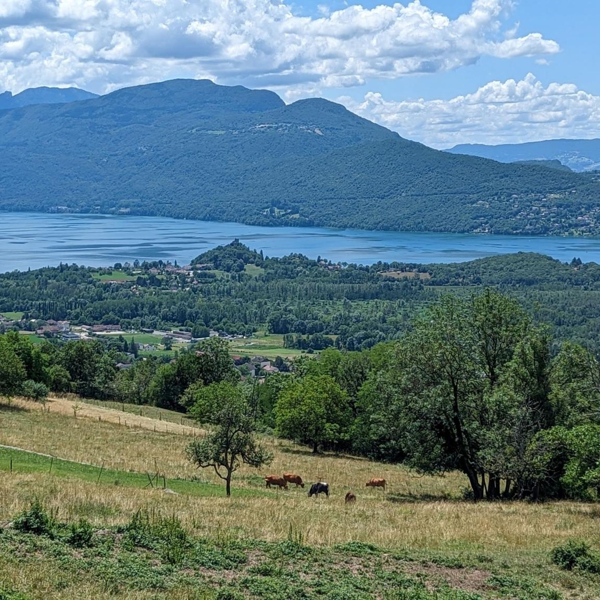
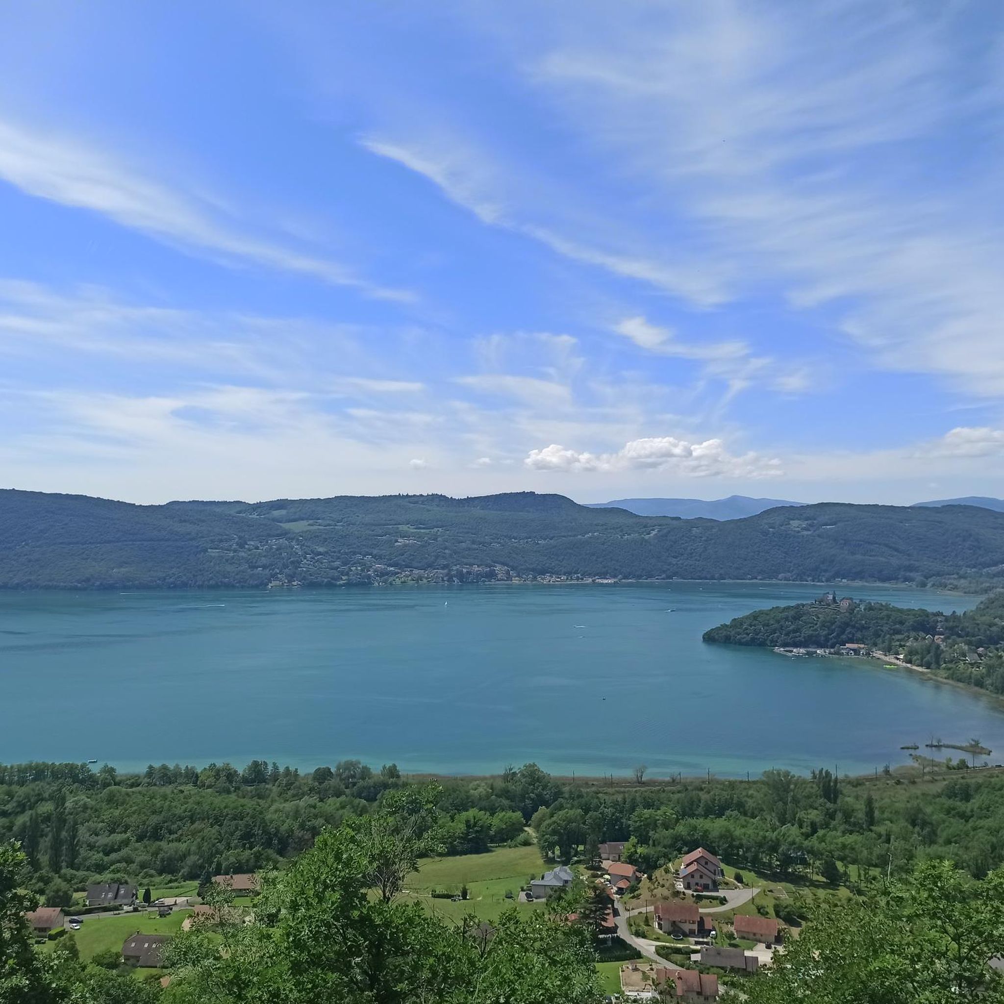
Great pass with very little traffic which allows you to enjoy a panorama in complete tranquility. The viewpoint at the summit offers a beautiful view of the Chautagne and Lake Bourget from the paragliding departure slope (accessible from a path from the parking lot up there) 🪂 Pass accessible 2km from Chindrieux station or 11km from Culoz station 🚃
0
0

Good road with not too many cars
0
0
There is a new section of the Via Rhona between Motz and Serriere en Chautagne. It is well signposted towards Motz and then winds through fields and parallel to the main road without much guidance.
2
0

Magnificent pass, view of Lake Bourget all along.
1
0
Super pass, regular, with a view of the Bauges on the Cessens side.
1
0
nice walk through the forest of Moye
0
0

Incredible view of Lac du Bourget
0
0
Frequently Asked Questions
How many running routes are available around Chindrieux?
Chindrieux offers a wide selection of over 300 running routes, catering to various preferences and fitness levels. You'll find everything from easy strolls to challenging mountain runs.
What kind of terrain can I expect on the jogging trails in Chindrieux?
The terrain around Chindrieux is incredibly diverse. You can enjoy serene waterside paths along Lac du Bourget and the Savière Canal, explore forests and agricultural lands, or tackle more challenging climbs in the foothills of the Sapenay mountain. This variety ensures a different experience for every run.
Are there any easy or beginner-friendly running routes in Chindrieux?
Yes, Chindrieux has 23 easy running routes perfect for beginners or those looking for a relaxed jog. Many of these are likely to be found along the flat, accessible paths of the Savière Canal or Lac du Bourget.
Where can I find challenging running trails with significant elevation gain?
For a more challenging run, explore the 96 difficult routes available. The foothills of the Sapenay mountain, including ascents towards Col du Chat or Col de la Chambotte, offer rewarding views and substantial elevation. For example, the Chambotte Pass – A good way to unwind loop from La Tour features over 250 meters of elevation gain.
What are some scenic viewpoints or natural features I can discover while running?
Chindrieux is rich in scenic spots. You can enjoy magnificent views of Lac du Bourget from routes ascending towards Col de la Chambotte, or discover the tranquil Savière Canal. Other notable natural features and viewpoints include the Grand Colombier Cross and orientation table, the Fairies' Cave, and the picturesque Lake Barterand.
Are there any circular running routes around Chindrieux?
Yes, many of the running routes in Chindrieux are designed as loops, offering convenient circular paths. Popular options include the Les Mazures loop from Sous la Tour or the longer Savière Canal – Maison de Boigne loop from Ruffieux.
What do other runners think about the trails in Chindrieux?
The running routes in Chindrieux are highly regarded by the komoot community, boasting an average rating of 4.6 out of 5 stars from over 100 reviews. Runners frequently praise the diverse landscapes, from serene waterside paths to challenging mountain climbs, and the variety of experiences available.
Can I find running routes that pass through charming villages or historical sites?
Absolutely. The region offers routes that allow you to discover local charm. For instance, runs along the Savière Canal can take you past Chanaz, known as 'Savoy's Little Venice,' with its artisans and lively atmosphere. You might also encounter old farmhouses, bread ovens, and washhouses along various discovery trails.
Are there any long-distance running options in the Chindrieux area?
Yes, for those looking for longer runs, there are several routes exceeding 10 kilometers. The Savière Canal – Maison de Boigne loop from Ruffieux is a great example, covering 16.1 kilometers, offering a substantial distance for endurance training or a longer scenic run.
What are some of the cultural or historical landmarks near the running trails?
Beyond the natural beauty, you can encounter historical sites like the Butte Saint-Romain and Chapel. The area also features the historic village of Chanaz and the impressive Château de Châtillon, perched overlooking Lac du Bourget, adding a touch of heritage to your outdoor experience.
Are there any routes that offer views of Lac du Bourget?
Many routes in the Chindrieux area provide stunning views of Lac du Bourget. The ascent towards Col de la Chambotte, for example, offers magnificent panoramas throughout the climb, with superb 360-degree views from the Belvedere beyond the pass. The Chambotte Pass – A good way to unwind loop from La Tour is a prime example.
How many people have explored the running routes in Chindrieux using komoot?
Over 5,000 runners have used komoot to explore the varied terrain and beautiful landscapes of Chindrieux, highlighting its popularity among the outdoor community.
Most popular routes around Chindrieux
Most popular attractions around Chindrieux

Get inspired with the komoot mobile app


Explore more
Browse the best Running Trails & Routes in other regions.
