Attractions and Places To See around Belmont-Tramonet - Top 20
Best attractions and places to see around Belmont-Tramonet include a blend of historical sites, natural beauty, and cultural points of interest. This commune is located in the Savoie department of the Auvergne-Rhône-Alpes region, nestled in the Avant-Pays Savoyard. Its western borders are defined by the Rhône and Guiers rivers, while the Mont du Chat and the northern end of the Chartreuse alpine massif lie to its east. The area offers diverse landscapes, from plains and reliefs to significant natural parks.
Best attractions and places to see around Belmont-Tramonet
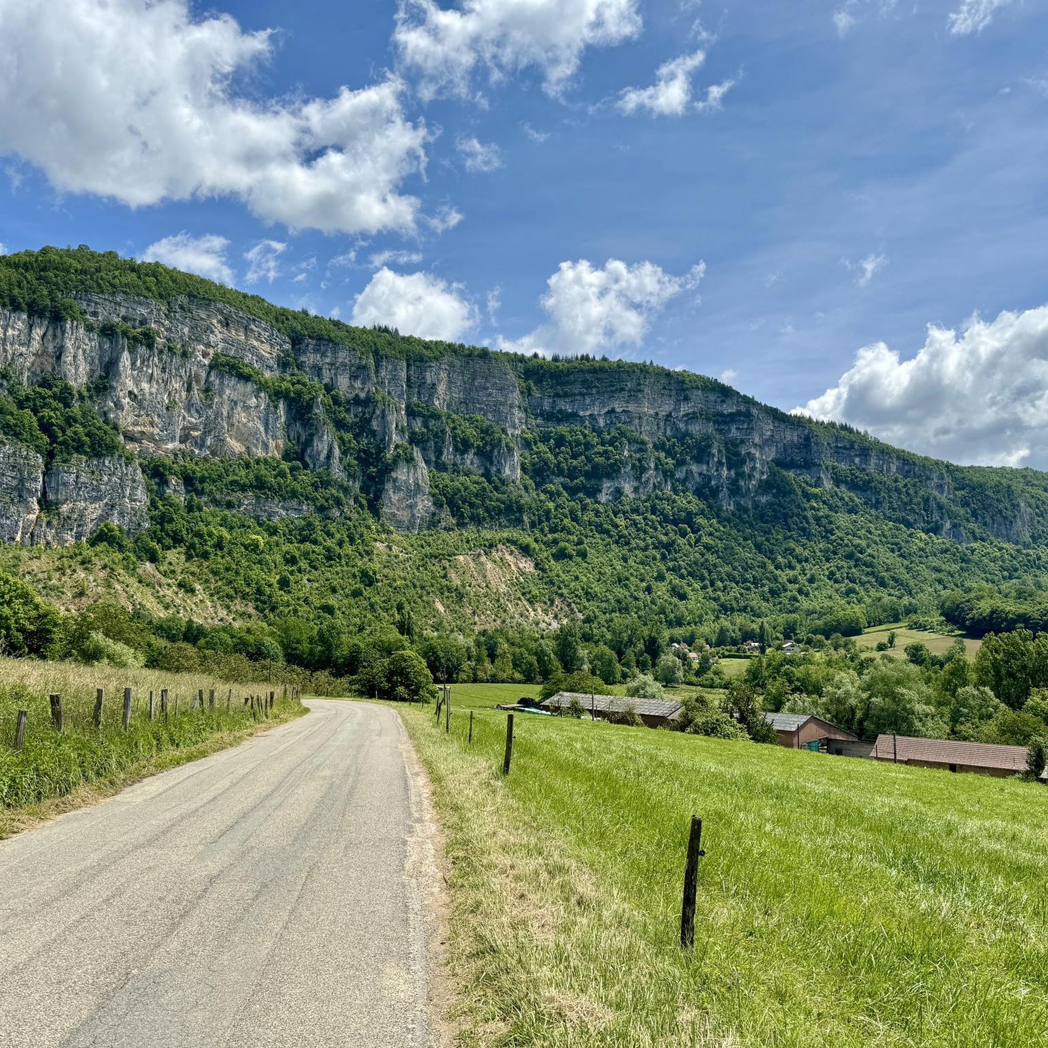
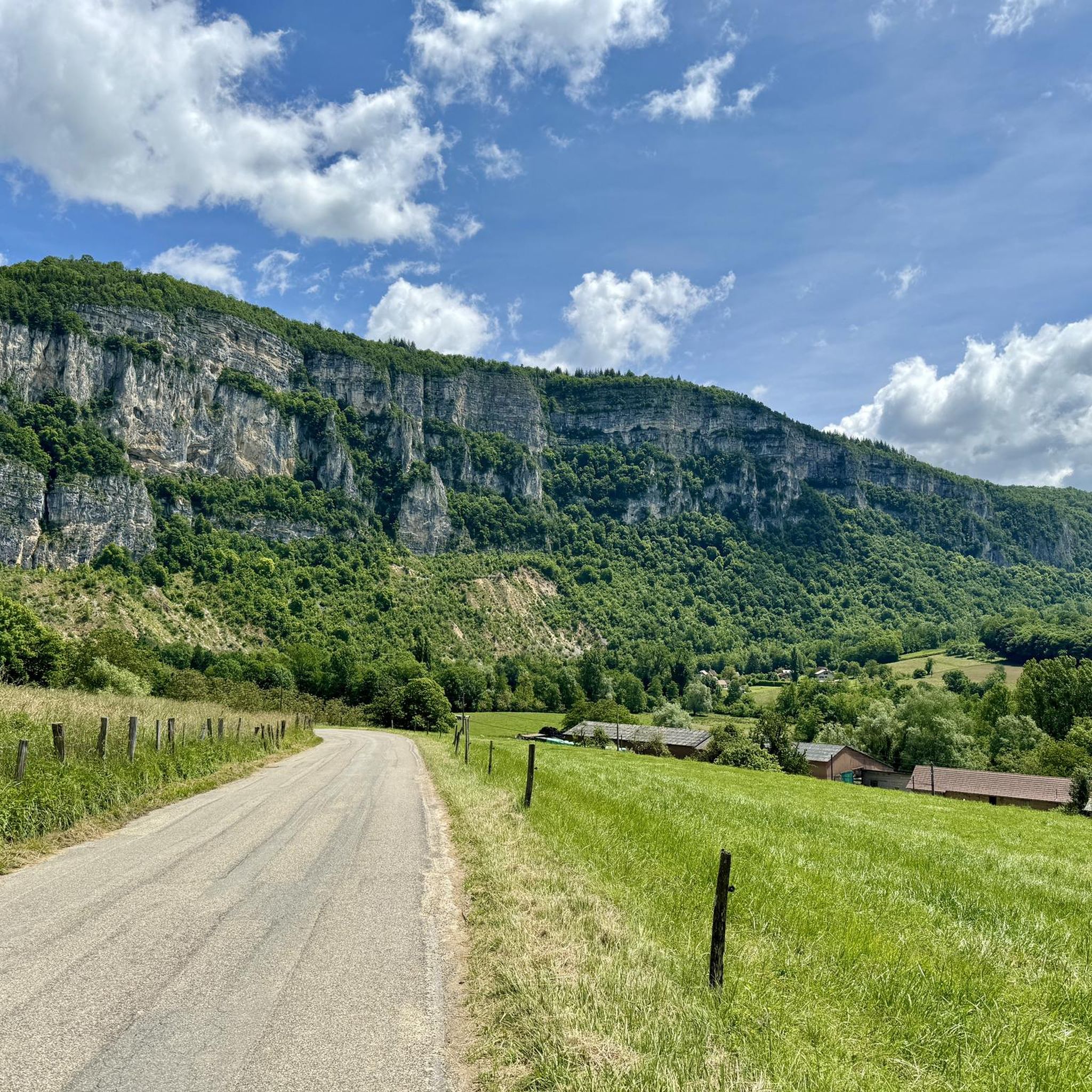
- The most popular attractions is Épine Pass, a summit that connects the Thônes and Faverges valleys. At an altitude of 987 meters, it offers views of Chambéry, Lake Bourget, and the Bauges massif.
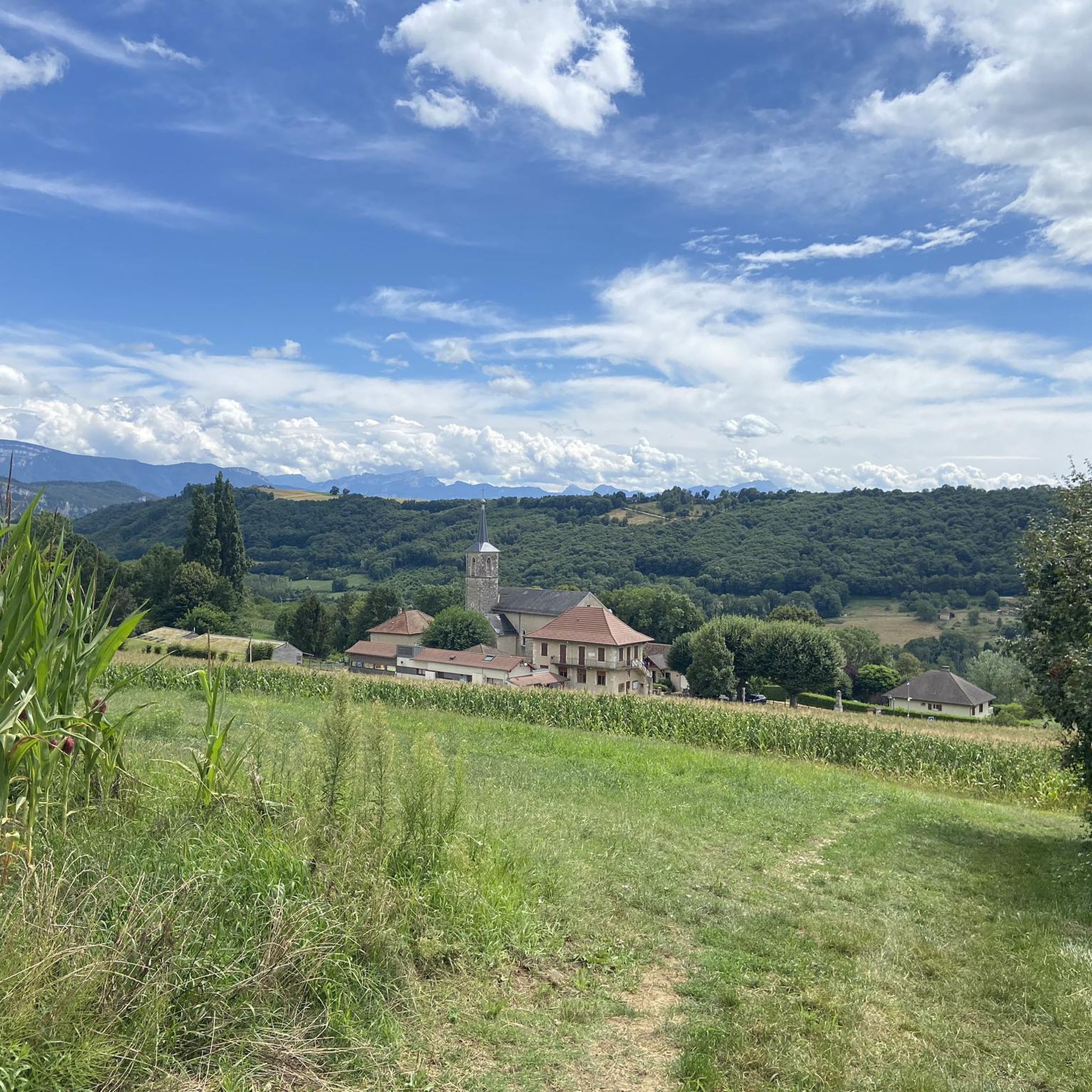
- Another must-see spot is ViaRhôna Cycle Path Along the Rhône Near Brens, a well-maintained cycle path. This route provides scenic cycling between mountains, hills, and the Rhône River, with numerous spots to stop and enjoy the views.
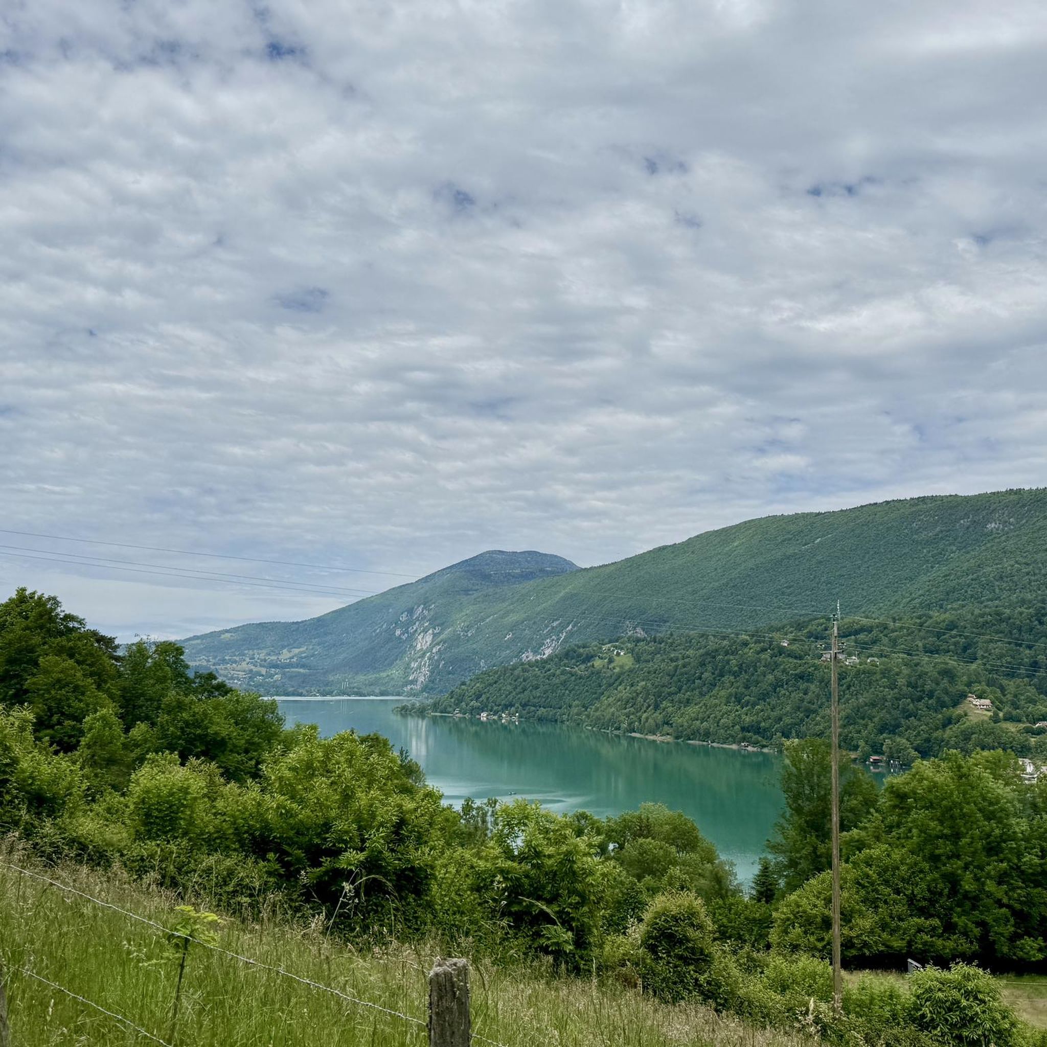
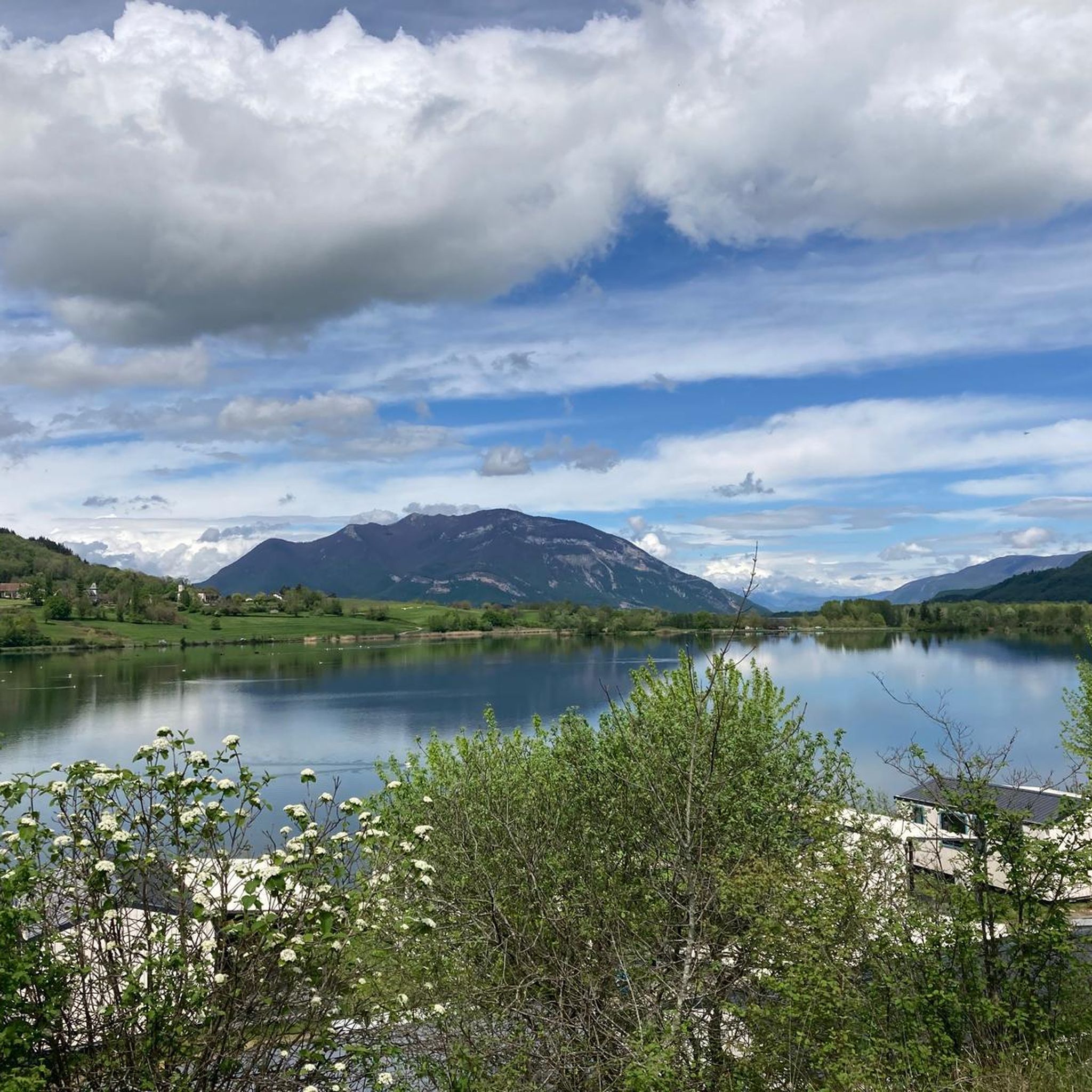
- Visitors also love Lac d'Aiguebelette, a natural lake approximately 10 minutes away. It is known for its often green color and offers an easy ride around its perimeter with views of the surrounding mountains.
- Belmont-Tramonet is known for its mountain passes, cycle paths, and natural lakes. The region provides a variety of attractions to see and explore, from historical landmarks like Château de Belmont to nearby regional natural parks.
- The attractions around Belmont-Tramonet are appreciated by the komoot community, with more than 140 upvotes and over 25 photos shared by visitors.
Last updated: October 9, 2026
ViaRhôna Cycle Path Along the Rhône Near Brens
Highlight (Segment) • Cycleway
Translated by Google •
Tip by

Épine Pass
Highlight • Summit
The pass is closed in winter
Translated by Google •
Tip by

Sign up now to discover places like this
Get recommendations on the best single tracks, peaks, & plenty of other exciting outdoor places.
Lac d'Aiguebelette
Highlight • Lake
Translated by Google •
Tip by
Crucifix Pass
Highlight • Mountain Pass
So I wish that many people … visit the crosses, whether as places of stillness and breathing space before God, whether as places for community gatherings, prayer and praise to God.”
(Text source: Dean Rainald M. Ollig
in: "Crossroads... small sacred monuments as a sign of popular piety")
Translated by Google •
Tip by

Col du Banchet
Highlight • Mountain Pass
The view rewards the efforts made to get there.
Translated by Google •
Tip by

Sign up for free to discover even more attractions around Belmont-Tramonet.
Already have an account?
Start today with a free account
Your next adventure awaits.

Tips from the Community


A very quiet and pleasant road. On the Chambéry side, a good part is in the shade, the slope of the main road is rather constant around 7-8%. On the Novalaise side, the mineral aspect with the cliff is more present in the middle of the climb. This side is quite steep with kilometers at 8-9%. On each side, 1 belvedere offers a breathtaking view of Lake Aiguebelette (approx. 2 km from the summit) and on the other side of Chambéry, the Bauges, Belledonne, the Chartreuse (500 m from the summit). The summit is in the forest.
1
0

Leaving from Chambery, the beginning hurts a little, but the rest is quite good
0
1

There is a mistake about the valleys!
2
0

Pass without too much traffic. Quite steep start to reach Saint Sulpice, the rest is rather regular. The pass is closed in winter
2
0

Unmissable “road cycling” of the Col de l'Épine located at an altitude of 990 m.
1
0

The Col d'Épine connects the Thônes and Faverges valleys. At the summit, which rises to an altitude of 987 m, to the west you have a breathtaking view of Chambéry, the south of Lake Bourget and the Bauges massif. On the eastern slope, you can enjoy a superb panoramic view of Lake Aiguebelette.
1
1

Rhône cycle route
1
0
Frequently Asked Questions
What natural landmarks can I explore near Belmont-Tramonet?
The region around Belmont-Tramonet is rich in natural beauty. You can visit Lac d'Aiguebelette, known for its often green waters and scenic views, located about 10 minutes away. Other natural sites include the picturesque Cascade de Glandieu (12 km away) and Lac de Romagnieu (7 km away). Additionally, the commune is near the Chartreuse Regional Natural Park and the Massif des Bauges Regional Natural Park, offering extensive opportunities to enjoy the natural landscape.
Are there any historical sites or cultural points of interest in Belmont-Tramonet?
Yes, Belmont-Tramonet and its surroundings offer several historical and cultural sites. The village features the Church of Notre-Dame of the Assumption, built in 1844, and the Château de Belmont, a 13th-century fortified house now serving as an abbey. Nearby, you can explore Le Repaire de Mandrin (3 km away), linked to an 18th-century smuggler, or visit the Château de Montfleury (4 km away) in Avressieux. For those interested in regional history, the Musée du Lac d'Aiguebelette (17 km), Musée Gallo-Romain d'Aoste (6 km), and Musée archéologique du lac de Paladru (21 km) provide further insights.
What outdoor activities are popular around Belmont-Tramonet?
Belmont-Tramonet is an excellent base for outdoor activities. Cycling is very popular, especially on the ViaRhôna Cycle Path Along the Rhône Near Brens, which offers scenic routes between mountains, hills, and the Rhône River. You can also find numerous road cycling routes, such as those detailed in the Road Cycling Routes around Belmont-Tramonet guide. For gravel biking, explore options like the 'Crusille Pass – View of Lake Aiguebelette loop' found in the Gravel biking around Belmont-Tramonet guide. Running trails are also available, with routes like the 'Running loop from Belmont-Tramonet' in the Running Trails around Belmont-Tramonet guide.
Are there any good viewpoints for panoramic scenery near Belmont-Tramonet?
Absolutely. The Épine Pass is a highly recommended viewpoint. At an altitude of 987 meters, it offers breathtaking views of Chambéry, the southern part of Lake Bourget, and the Bauges massif to the west. On its eastern slope, you can enjoy a superb panoramic view of Lac d'Aiguebelette. Another excellent spot is the Col du Banchet, which rewards efforts with a beautiful view.
What is special about Lac d'Aiguebelette?
Lac d'Aiguebelette is a significant natural attraction located about 10 minutes from Belmont-Tramonet. It is unique for its often green color, contrasting with the bluer Lake Annecy and the steel-gray Lake Bourget. The lake is private, managed to preserve its water quality, and thermal motorboats have been prohibited since 1967. It's also been France's first regional freshwater nature reserve since 2015, making it an ideal spot for tranquil water activities and enjoying the surrounding mountain atmosphere.
Are there family-friendly activities available around Belmont-Tramonet?
Yes, the area offers several family-friendly options. Lac d'Aiguebelette is a great destination for families, offering an easy ride around its perimeter with plenty of spots to stop and cool off. The ViaRhôna Cycle Path is also well-maintained and suitable for family cycling, with numerous places to rest and enjoy the views. The nearby regional natural parks provide opportunities for gentle walks and picnics amidst nature.
What are the characteristics of the mountain passes near Belmont-Tramonet?
The region around Belmont-Tramonet is known for its mountain passes, offering diverse experiences for cyclists and hikers. The Épine Pass, at 987 meters, is a popular cycling route with a steep start but generally regular terrain, offering extensive views. The Col du Banchet is described as a small, shaded pass without significant difficulty, with a rewarding view from the top. The Crucifix Pass is an ancient passage point, accessible via several paths, and features a symbolic wayside cross.
What do visitors enjoy most about the attractions around Belmont-Tramonet?
Visitors particularly appreciate the diverse landscapes and well-maintained routes. The ViaRhôna Cycle Path is highly recommended for its scenic beauty between mountains and the Rhône, and its excellent infrastructure. The road around Lac d'Aiguebelette is praised for offering an easy ride with beautiful mountain and lake views. The mountain passes, like Épine Pass, are valued for their challenging yet rewarding climbs and panoramic vistas.
Are there any local markets or unique shopping experiences near Belmont-Tramonet?
While Belmont-Tramonet itself is a smaller commune, nearby towns host various markets throughout the week, offering a glimpse into local life and produce. You can find markets in Le Pont-de-Beauvoisin (Mondays), Saint-Genix-sur-Guiers (Wednesdays), Novalaise (Wednesdays & Sundays), and Chambéry (Tuesdays, Thursdays, Sundays & Saturdays). These markets are great places to discover local specialties and crafts.
What are the options for cycling enthusiasts in the Belmont-Tramonet area?
Cycling enthusiasts have excellent options around Belmont-Tramonet. The ViaRhôna Cycle Path Along the Rhône Near Brens is a highlight, offering a well-maintained, mostly flat route with stunning river and mountain views. For more challenging rides, the region's mountain passes like Épine Pass and Col du Banchet are popular. You can find detailed routes for various cycling styles, including road cycling and gravel biking, in the dedicated komoot guides for the area.
Is public transport available to reach attractions around Belmont-Tramonet?
Information on specific public transport routes directly to all attractions from Belmont-Tramonet is limited. However, the commune's strategic location means it's accessible, and larger nearby towns like Chambéry are well-connected. For exploring the natural sites and trails, having a car might offer more flexibility. It's advisable to check local transport schedules for specific destinations if relying on public transport.
What is the general terrain like around Belmont-Tramonet?
Belmont-Tramonet is situated in the Avant-Pays Savoyard, a natural region characterized by a blend of plains and reliefs. Its western borders are defined by the Rhône and Guiers rivers, while to the east, you'll find the Mont du Chat, the Thorn chain (part of the Jura massif), and the northern end of the Chartreuse alpine massif. This diverse terrain offers everything from gentle riverside paths to more challenging mountain passes and trails.
Most popular routes around Belmont-Tramonet
Most popular attractions around Belmont-Tramonet

Get inspired with the komoot mobile app


Explore more
Still not found the Highlight you’re looking for? See guides of the top attractions in other regions:
