The best cycling routes around Satolas-Et-Bonce
4.6
(404)
3,274
riders
303
rides
Touring cycling around Satolas-Et-Bonce offers routes through varied terrain in the Isère department. The area is characterized by expansive agricultural plains, interspersed with wooded areas and natural features such as the Étang de Chalignieu. With elevations ranging from 200m to 285m, the routes present manageable inclines suitable for touring cyclists. This rural setting provides a tranquil environment for exploring the countryside.
Best touring cycling routes around Satolas-Et-Bonce
- The most popular touring cycling route is Seuillière Washhouse – Étang de Chalignieu…
Last updated: October 18, 2026
5
riders
46.2km
04:03
620m
620m
Hard bike ride. Very good fitness required. Mostly paved surfaces. Suitable for all skill levels.
4.3
(3)
9
riders
25.8km
02:23
530m
530m
Hard bike ride. Very good fitness required. Mostly paved surfaces. Suitable for all skill levels.

4
riders
17.4km
01:12
130m
130m
Easy bike ride. Great for any fitness level. Mostly paved surfaces. Suitable for all skill levels.
6
riders
7.59km
00:28
60m
60m
Easy bike ride. Great for any fitness level. Mostly paved surfaces. Suitable for all skill levels.
5
riders
26.4km
02:07
190m
190m
Moderate bike ride. Good fitness required. Mostly paved surfaces. Suitable for all skill levels.
Get access to more routes and recommendations from other explorers.
Already have an account?
Our route recommendations are based on thousands of hikes, rides, and runs completed by other people on komoot.
Start today with a free account
Your next adventure awaits.

Tips from the Community

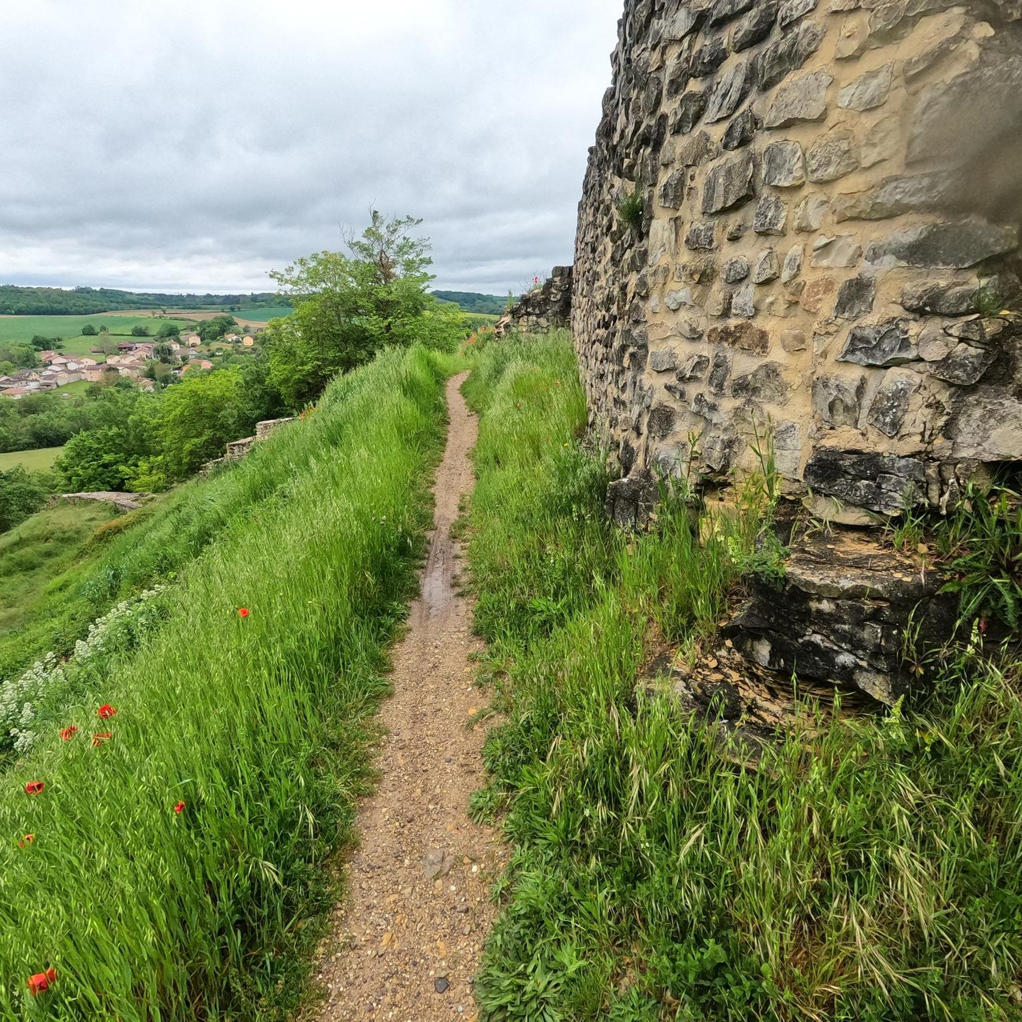
Dominant point, the ruin is overgrown with vegetation.
0
0

Venturing here allows you to go quite straight between Pont-de-Chéruy and Jonage. Good to know: (only) suitable for road bikes.
0
0

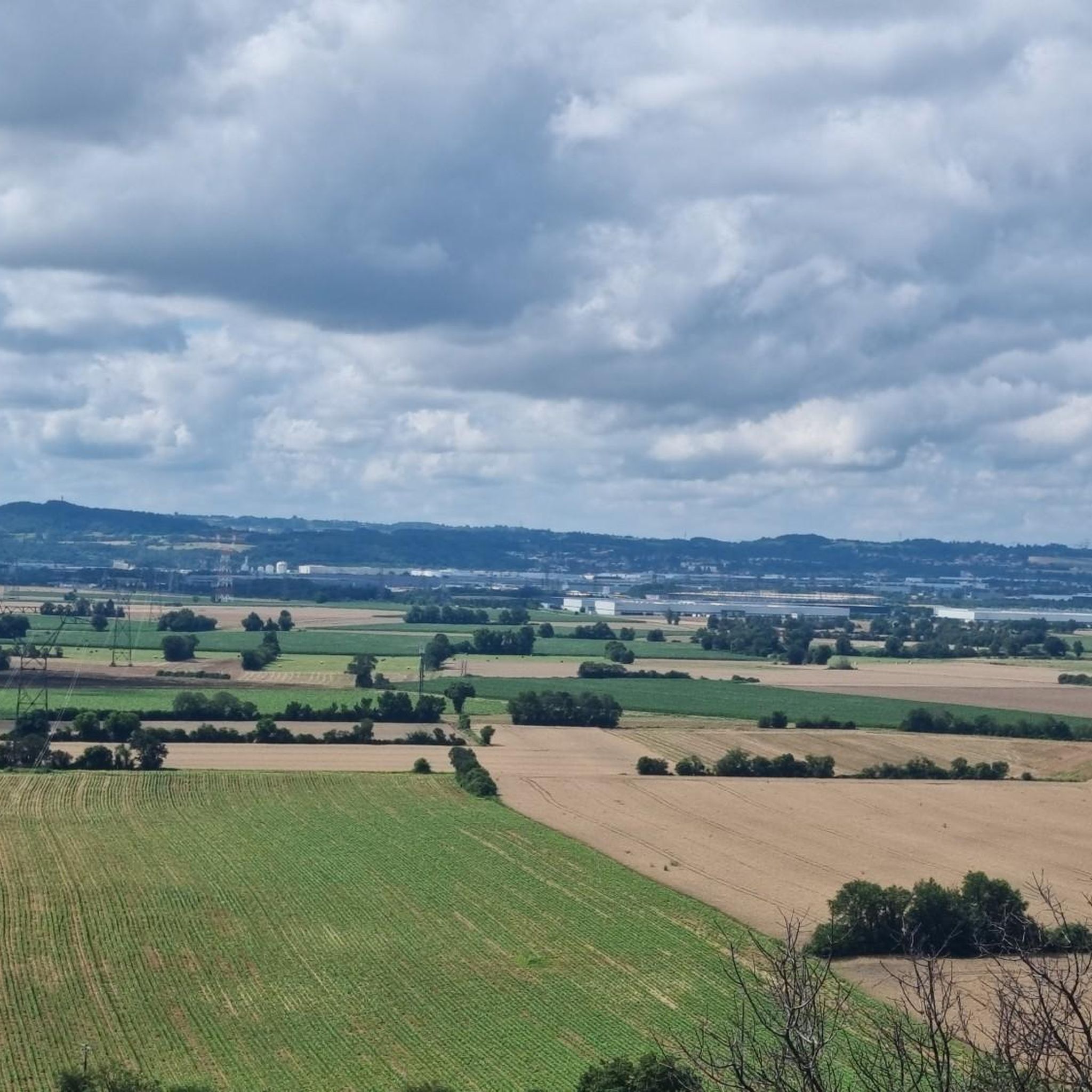
Beautiful view of the surrounding plain. The cross dates from 1860...
0
0

Nice walk as soon as you cross the first small bridge. The path towards Jameyzieu is pleasant and was passable (because it is well maintained). After crossing the departmental road (crossing the bridge) the path is a little less good but it is still possible to continue the walk to the next small bridge. Return on the other bank to Jameyzieu. But, there, you have to return on the same bank as on the way there. Apparently, the municipality or municipalities in charge of maintaining the path on the opposite bank do not take care of it. I had to turn around to take the same bank as on the way there. Too bad, but a nice walk when it's hot 😉
0
0


The Sensitive Natural Space of the pond and the dry lawns of Marsa is a place that is worth the detour. This environment offers a summary of the Isle of Crémieu: dry hillsides, marshy areas and meadows. Here live more than 450 animal and plant species.
2
0
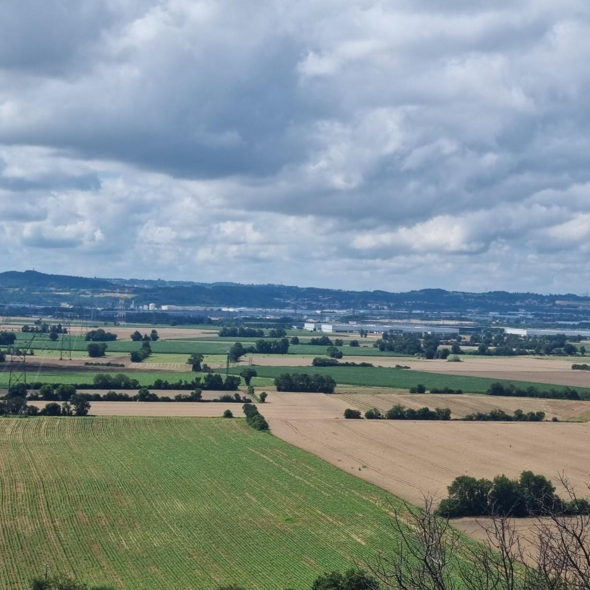
La Croix de l'Éperon offers a beautiful panorama of the landscapes of the cereal plain.
3
0
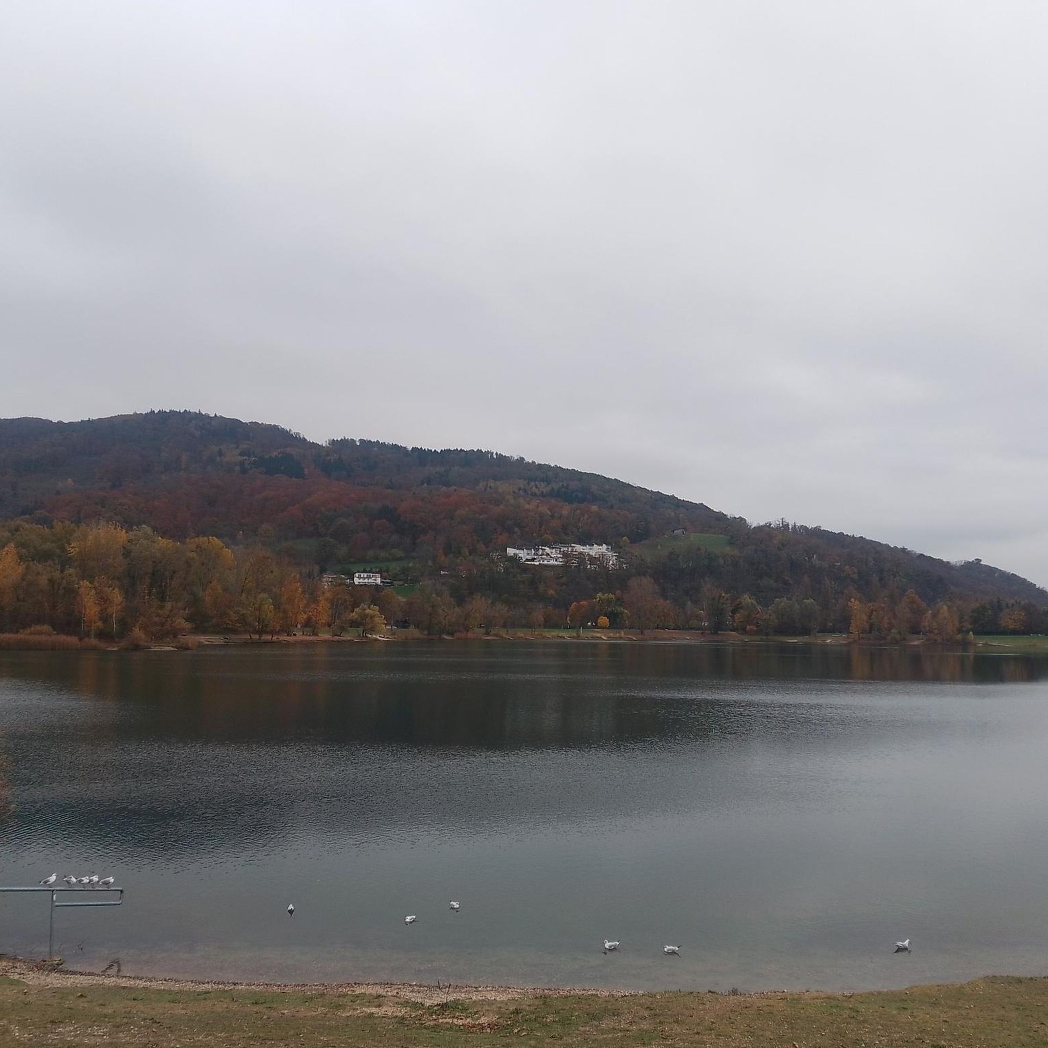
The pond of Chalignieu was recently classified ENS (Sensitive Natural Space). The site is home to many migrating passerines. At the confluence of many paths, it is also a place of walk appreciated by the inhabitants of the surroundings.
4
0
Frequently Asked Questions
How many touring cycling routes are available around Satolas-Et-Bonce?
There are over 300 touring cycling routes around Satolas-Et-Bonce, offering a wide variety of options for different skill levels and preferences. These routes are highly rated by the komoot community, with an average score of 4.6 stars.
What types of landscapes can I expect to see while touring cycling in Satolas-Et-Bonce?
Satolas-Et-Bonce is situated in the Isère department, characterized by expansive agricultural plains, gentle hills, and wooded areas. You'll encounter varied terrain, including natural features like the Étang de Chalignieu, providing a tranquil environment for exploring the countryside.
Are there any easy touring cycling routes suitable for beginners or families?
Yes, Satolas-Et-Bonce offers 93 easy touring cycling routes. An excellent option is the Château de Poisieu – Château de Bienassis loop from Chamagnieu, an 11-mile (17.7 km) trail that leads through the countryside near historic chateaus. Another easy route is the Bike loop from Chamagnieu, which is about 7.6 km long.
What historical landmarks or points of interest can I visit along the cycling routes?
The area around Satolas-Et-Bonce is rich in history. You can cycle past the historic Château de Bienassis or explore the medieval town of Crémieu, known for its extensive ramparts and the Château Delphinal of Crémieu. The Seuillière Washhouse – Étang de Chalignieu loop from Chamagnieu also passes by the historic Seuillière Washhouse.
Are there any routes that feature lakes or natural water bodies?
Yes, several routes incorporate natural water features. The Seuillière Washhouse – Étang de Chalignieu loop from Chamagnieu takes you past the scenic Étang de Chalignieu. Other nearby lakes include Lake Saint-Quentin-Fallavier and the Étang de Moras, offering pleasant views and resting spots.
What is the best time of year for touring cycling in Satolas-Et-Bonce?
The Auvergne-Rhône-Alpes region, including Satolas-Et-Bonce, generally offers pleasant cycling conditions from spring through autumn. Spring brings blooming landscapes, while autumn provides cooler temperatures and vibrant foliage. Summer is also suitable, though it can be warmer, especially in the plains.
Can I find challenging routes for experienced touring cyclists?
Absolutely. Satolas-Et-Bonce offers 112 difficult touring cycling routes. For a challenging ride, consider the DH loop from Chamagnieu, a 16-mile (25.8 km) path that traverses rural landscapes with significant elevation changes. The Seuillière Washhouse – Étang de Chalignieu loop from Chamagnieu is another difficult option, spanning over 42 km.
Are there any circular touring cycling routes available?
Yes, many of the touring cycling routes around Satolas-Et-Bonce are designed as loops, allowing you to start and end in the same location. Examples include the Château de Poisieu – Château de Bienassis loop from Chamagnieu and the View of the Col de l'Éperon – Cross of the Spur loop from Colombier.
What do other touring cyclists say about the routes in Satolas-Et-Bonce?
The touring cycling routes in Satolas-Et-Bonce are highly regarded by the komoot community, with an average rating of 4.6 stars from over 360 reviews. Cyclists often praise the tranquil rural setting, the varied terrain, and the opportunity to explore both natural features and historical sites.
Is Satolas-Et-Bonce connected to any major long-distance cycling routes?
While Satolas-Et-Bonce is not directly on a major long-distance route, its location within the Auvergne-Rhône-Alpes region provides accessibility to the ViaRhôna. This monumental cycle route spans 815 kilometers from Lake Geneva to the Mediterranean Sea, offering opportunities for extended touring adventures along the Rhône River, encountering vineyards and historic towns.
Are there any viewpoints along the touring cycling routes?
Yes, the varied terrain around Satolas-Et-Bonce offers several spots with good views. For instance, the View of the Col de l'Éperon – Cross of the Spur loop from Colombier suggests scenic vistas. You can also find viewpoints like the View of the Étang de Moras, providing picturesque breaks during your ride.
What is the elevation like on the touring cycling routes?
The region around Satolas-Et-Bonce features elevations ranging from 200m to 285m. This means routes generally present manageable inclines and descents, suitable for touring cyclists who appreciate a mix of gentle hills and flatter sections across agricultural plains.
Most popular routes around Satolas-Et-Bonce
Most popular attractions around Satolas-Et-Bonce

Get inspired with the komoot mobile app


Explore more
Browse the best Cycling routes in other regions.
