The best mountain hikes around Saint-Ismier
4.6
(20)
250
hikers
21
hikes
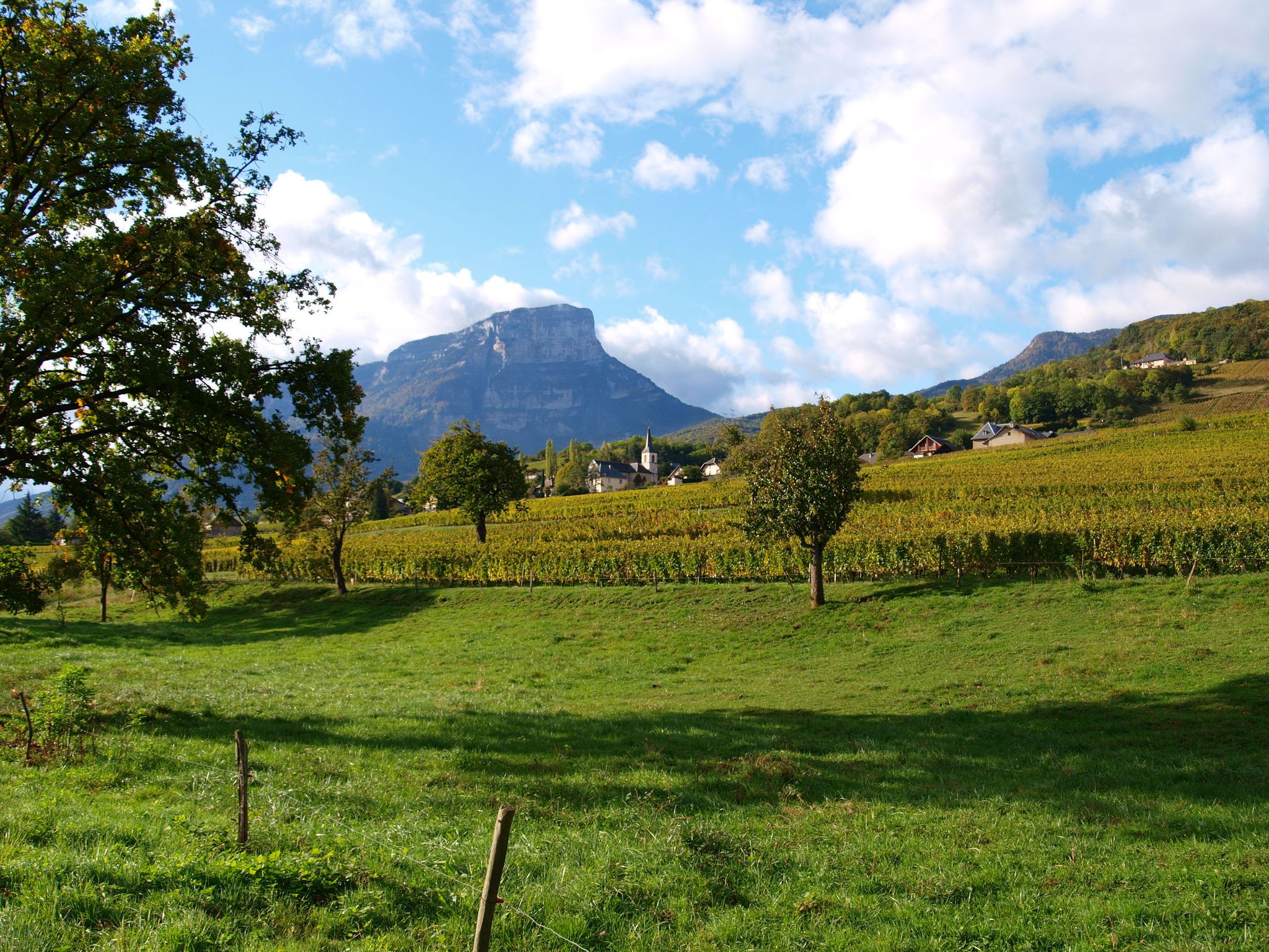
Mountaineering routes around Saint-Ismier offer access to the diverse and dramatic landscapes of the French Alps. The region is strategically located near the Chartreuse, Belledonne, Oisans, and Vercors massifs, providing a vast playground of towering peaks, alpine meadows, and limestone cliffs. The Grésivaudan Valley, where Saint-Ismier is situated, offers scenic beauty and views of the surrounding mountains, including prominent summits like Chamechaude and Dent de Crolles. This area provides varied terrain suitable for different levels of mountaineering experience.
Best mountaineering…
Last updated: October 18, 2026
5.0
(2)
18
hikers
Hard mountaineering route. Very good fitness required. Sure-footedness, sturdy shoes and alpine experience required.
18
hikers
3.74km
02:29
410m
410m
Hard mountaineering route. Good fitness required. Sure-footedness, sturdy shoes and alpine experience required.

5.0
(1)
14
hikers
11.6km
03:56
510m
510m
Moderate mountaineering route. Good fitness required. Mostly accessible paths. Sure-footedness required.
5.0
(1)
20
hikers
6.55km
03:47
630m
620m
Hard mountaineering route. Good fitness required. Sure-footedness, sturdy shoes and alpine experience required.
5.0
(2)
14
hikers
13.7km
04:54
610m
610m
Moderate mountaineering route. Good fitness required. Mostly accessible paths. Sure-footedness required.
Get access to more routes and recommendations from other explorers.
Already have an account?
Our route recommendations are based on thousands of hikes, rides, and runs completed by other people on komoot.
Start today with a free account
Your next adventure awaits.
Other adventures around Saint-Ismier

Tips from the Community

The Dent de Crolles, at 2,062 meters, is one of the best-known peaks in the Chartreuse. The striking limestone mountain towers high above the surrounding area and offers, on a clear day, a magnificent view of the Alps and the Grenoble valley. The hike there leads through varied mountain pastures, rocky terrain, and impressive limestone landscapes. A strenuous climb, but the views and the special atmosphere of the Chartreuse make it absolutely worthwhile.
0
0
The Dent de Crolles, at 2,062 meters, is one of the best-known peaks in the Chartreuse. This distinctive limestone mountain towers high above the surrounding area and offers, on a clear day, a magnificent view over the Alps and the Grenoble valley. The hike there leads through varied mountain meadows, rocky terrain, and impressive limestone landscapes. A strenuous climb, but the views and the special atmosphere of the Chartreuse make it absolutely worthwhile.
0
0

Very beautiful view when the sky is clear, remember to take a windbreaker at the summit, you will find ibexes. The area is really very simple and does not require strong hiking / trail experience (for the altitude 2930 I think)
1
0
Magnificent lake! Accessible to all! As a bonus, you'll find ibexes and a few marmots if you're lucky. For the more courageous, you can climb to an altitude of 2,900 m by continuing on the path with a magnificent view if the sky is clear!
0
0
Exceptional site at the foot of the Dent de Crolle with access via a wild forest road
2
0

The climb to the charming Som from the Col de Porte is always a treat. There are some very steep sections, but the view at the top is worth it. Be careful on the descent: uneven road, tight bends, cars.
0
0

Beautiful rock formation. Here is one of the steepest sections
0
0
There's still a lot to do if you want to climb the Dent de Crolles :)
0
0
Frequently Asked Questions
How many mountaineering routes are available around Saint-Ismier?
Saint-Ismier offers a wide array of mountaineering opportunities, with over 25 routes available. These routes cater to various skill levels, ranging from moderate ascents to more challenging high-altitude expeditions.
What are the difficulty levels of mountaineering routes in this region?
The routes around Saint-Ismier vary significantly in difficulty. You'll find 7 moderate routes, perfect for those with some experience, and 19 difficult routes that require very good fitness and alpine experience. The region's diverse terrain, from towering peaks to limestone cliffs, ensures there's a challenge for every mountaineer.
Are there any circular mountaineering routes near Saint-Ismier?
Yes, many of the mountaineering routes around Saint-Ismier are circular, allowing you to experience varied terrain without retracing your steps. For example, the Dent de Crolles – Le pas de l'œil loop from Saint-Pancrasse is a challenging 6.5 km circular route that offers stunning views.
What are some notable viewpoints or natural landmarks to see on these routes?
The region is rich with breathtaking viewpoints and natural landmarks. You can encounter iconic peaks like Dent de Crolles, known for its extensive underground network, or enjoy panoramic vistas from the Charmant Som summit. Mountain passes such as Col du Coq also offer spectacular views of the surrounding massifs.
What is the best time of year for mountaineering around Saint-Ismier?
The best time for mountaineering around Saint-Ismier generally spans from late spring to early autumn (May to October). During these months, the weather is more stable, and trails are typically free of snow, especially at lower to mid-altitudes. For higher, more technical ascents, summer offers the most favorable conditions. Winter mountaineering is possible but requires specialized equipment and experience due to snow and ice.
Are there any family-friendly mountaineering options?
While many mountaineering routes in Saint-Ismier are rated difficult, there are moderate options that can be suitable for families with older children who have some hiking experience and good fitness. These routes often feature less extreme elevation gains and shorter distances. Always check the specific route details for distance, elevation, and duration to ensure it matches your family's capabilities.
Can I bring my dog on the mountaineering trails?
Regulations regarding dogs on trails can vary, especially within protected areas like the Chartreuse Regional Nature Park. While many trails in France are dog-friendly, it's crucial to keep your dog on a leash to protect wildlife and ensure their safety on challenging terrain. Always check local signage or park regulations for specific rules before heading out with your canine companion.
What do other mountaineers enjoy most about the routes near Saint-Ismier?
The mountaineering routes around Saint-Ismier are highly regarded by the komoot community, boasting an average rating of 4.8 stars from over 40 reviews. Mountaineers frequently praise the dramatic landscapes, the challenging yet rewarding ascents, and the incredible panoramic views from peaks like Dent de Crolles and Chamechaude. The diversity of terrain across the Chartreuse, Belledonne, and Vercors massifs is also a highlight.
Are there any permits required for mountaineering in the Chartreuse Massif?
Generally, permits are not required for day hikes or standard mountaineering routes in the Chartreuse Massif. However, certain protected areas or specific activities might have regulations. It's always advisable to check with the Chartreuse Regional Nature Park authority for the most up-to-date information, especially if you plan multi-day expeditions or activities that might impact the natural environment.
Where can I find parking for trailheads in the Saint-Ismier area?
Many popular trailheads around Saint-Ismier, especially those leading into the Chartreuse Massif, offer designated parking areas. For instance, starting points near Saint-Pancrasse or Le Sappey-en-Chartreuse often have parking facilities. It's recommended to arrive early during peak season to secure a spot, as these areas can become busy.
Are there any routes that lead to the Charmant Som summit?
Yes, you can find routes that lead to the Charmant Som summit, offering exceptional views. A notable option is the Piénom (1615 m) – Charmant Som summit loop from Chamechaude. This moderate 13.75 km route provides a rewarding journey to one of the region's beloved peaks.
What kind of terrain can I expect on these mountaineering routes?
The terrain around Saint-Ismier is incredibly varied, reflecting its position near multiple massifs. You can expect everything from lush alpine meadows and dense forests to rugged limestone cliffs and rocky ascents. Routes often feature significant elevation changes, requiring good footing and stamina. Some paths may involve scree slopes or exposed sections, particularly on more difficult trails.
Most popular routes around Saint-Ismier
Most popular attractions around Saint-Ismier

Get inspired with the komoot mobile app


Explore more
Browse the best Mountain Hikes & Routes in other regions.
